oceanography Maps
7 geographic visualizations tagged with "oceanography"
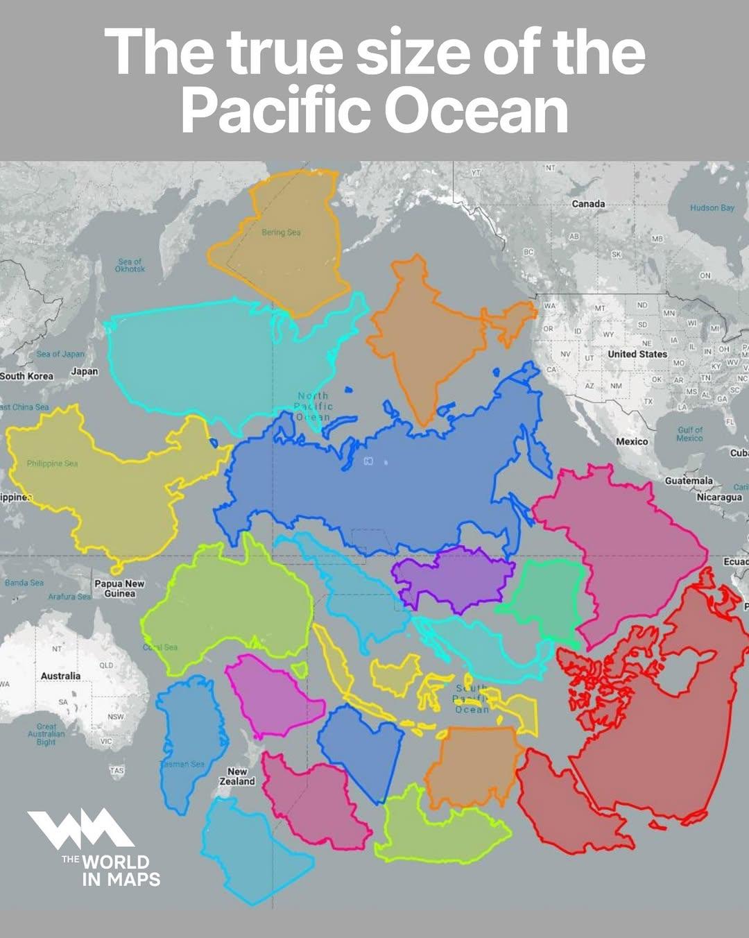
Map of the True Size of the Pacific Ocean
The visualization titled "The True Size of the Pacific Ocean" illustrates the vastness of the Pacific Ocean by accuratel...
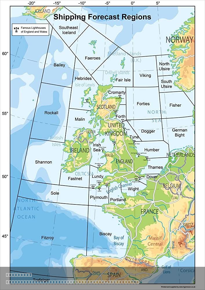
Shipping Forecast Regions in the British Isles Map
...
Ocean Currents Map of Earth
The "Ocean Currents Map of Earth" provides a detailed visualization of the major ocean currents that circulate through o...
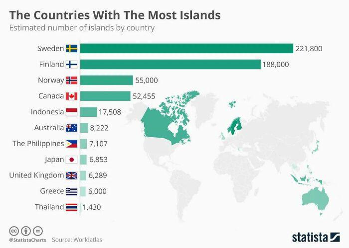
Countries with Most Islands Map
This map highlights the countries that boast the highest number of islands, providing a visual representation of these l...
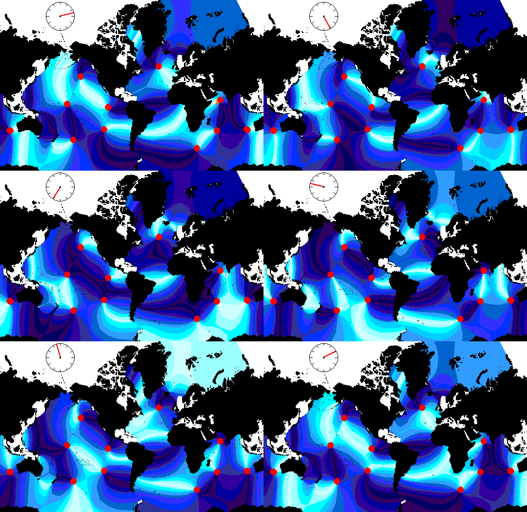
Global Tides Map with Animated Visualization
The "Animated Global Tides Map" provides a dynamic visualization of the world's tidal patterns, illustrating how ocean t...
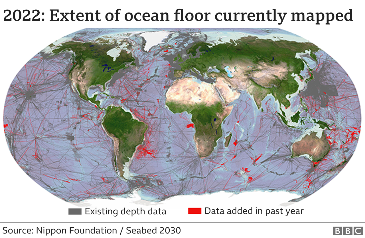
Seabed Mapping Coverage Map 2022
The Nipon Foundation / Seabed 2030 map from 2022 visually represents the total area of the seabed that has been accurate...
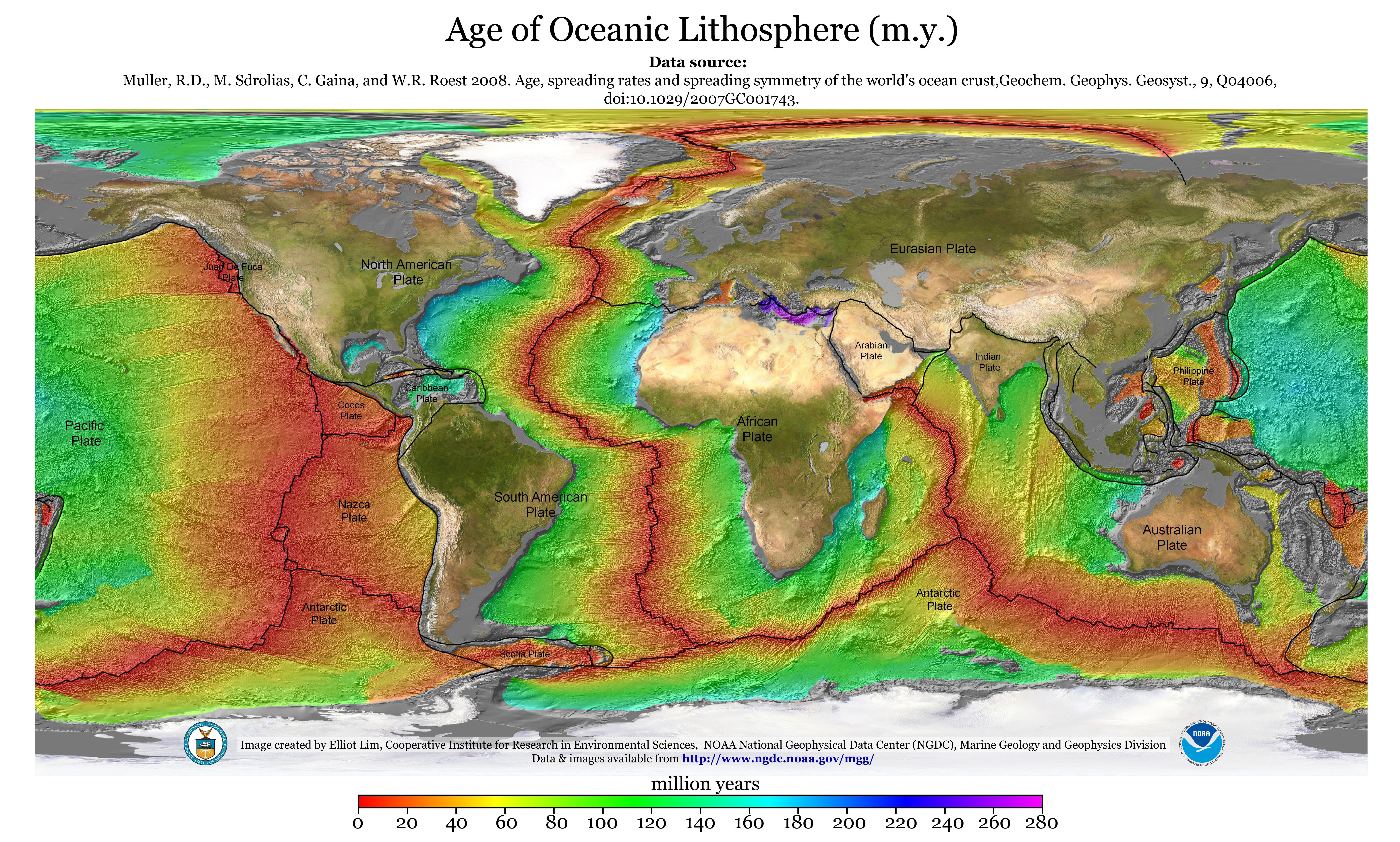
Age of Oceanic Lithosphere Map
The "Age of Oceanic Lithosphere Map" displays the distribution and ages of the oceanic lithosphere across the world's oc...