nordic countries Maps
4 geographic visualizations tagged with "nordic countries"

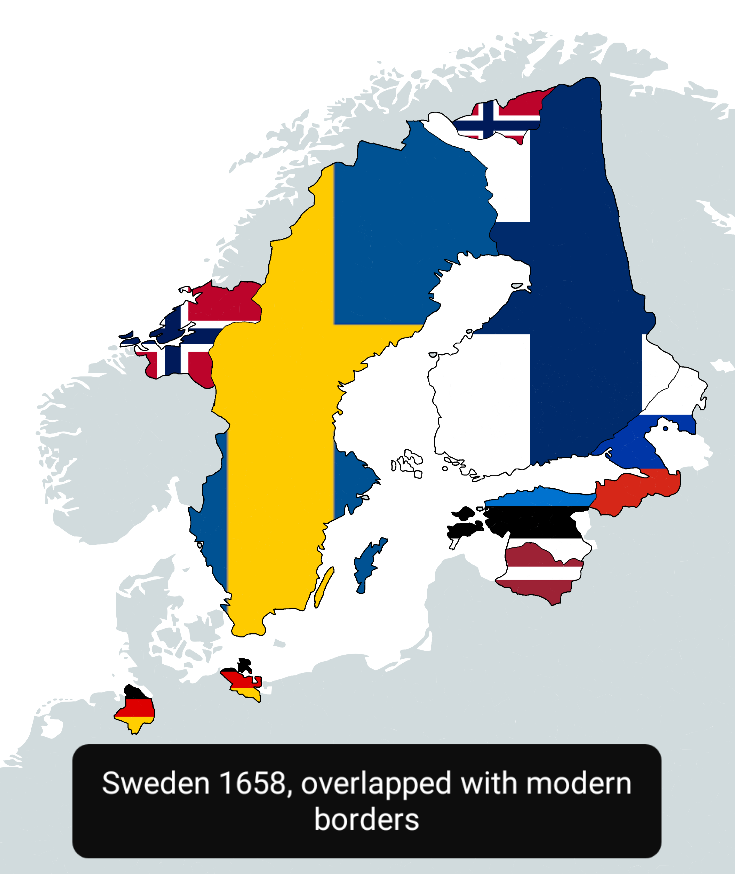
Sweden in 1658 Map Overlapped with Modern Countries
This map visually represents Sweden as it was in 1658, overlapped with the boundaries of modern countries. It allows us ...
👁 52📅 10/1/2025

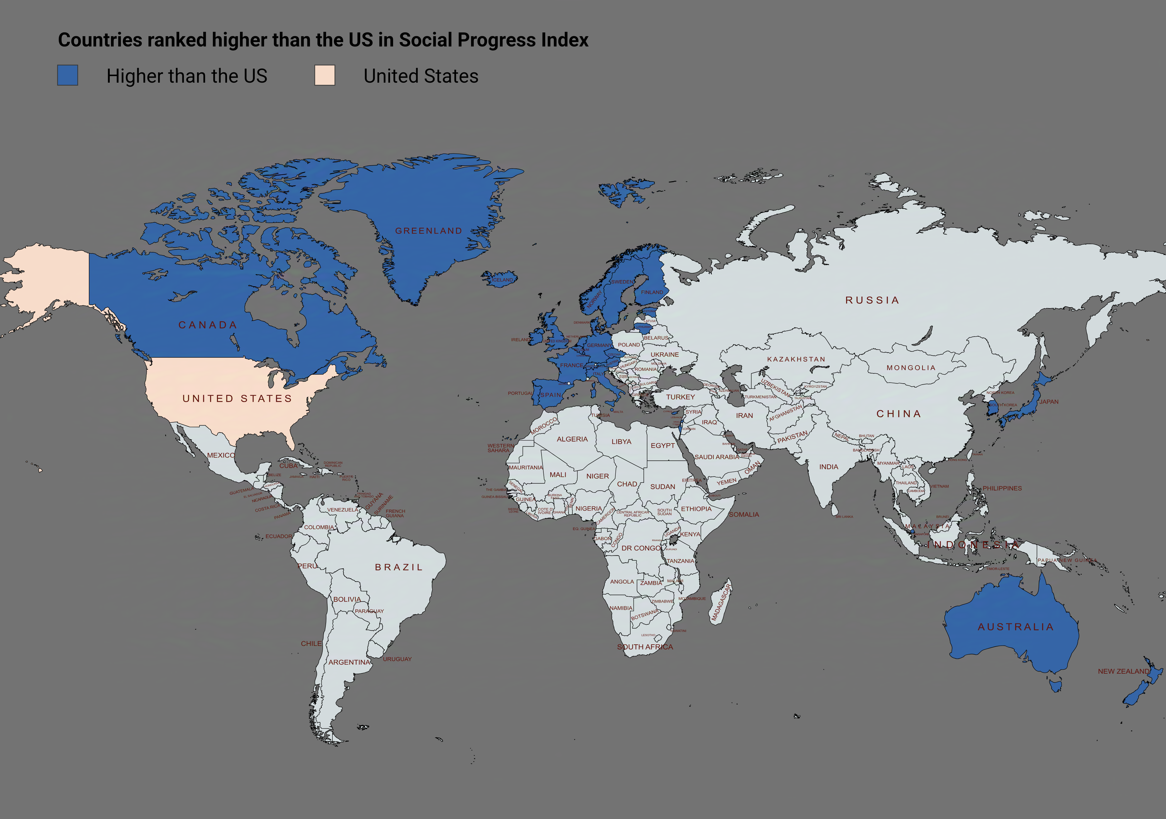
Social Progress Index Rankings Map by Country
The visualization titled "Countries Ranked Higher Than the US in Social Progress Index" provides a compelling overview o...
👁 240📅 8/18/2025

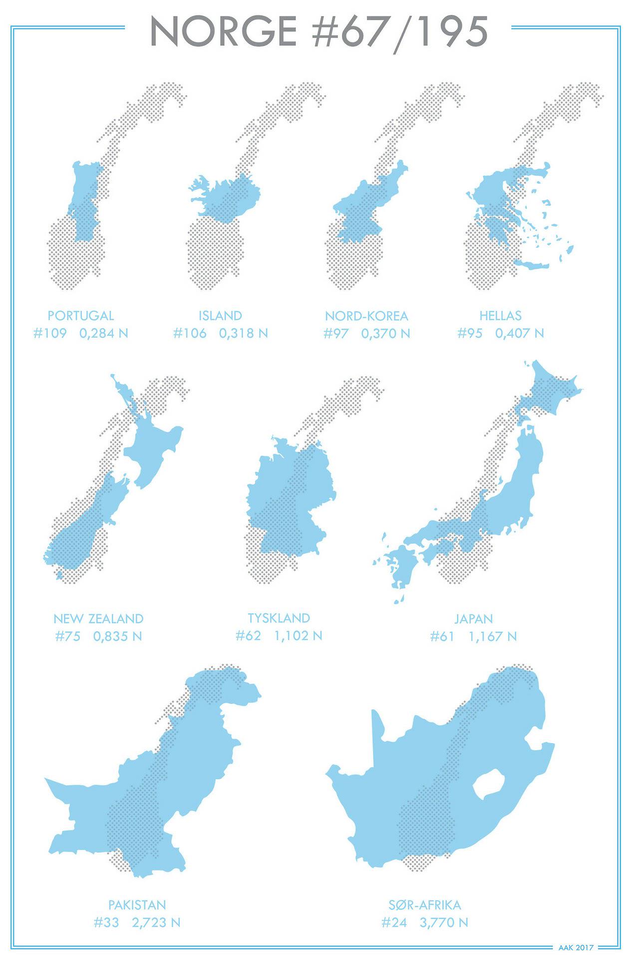
Norway Compared to Other Countries Map
The "Norway Compared to Other Countries Map" provides a visual representation of various attributes that define Norway i...
👁 16📅 10/28/2025

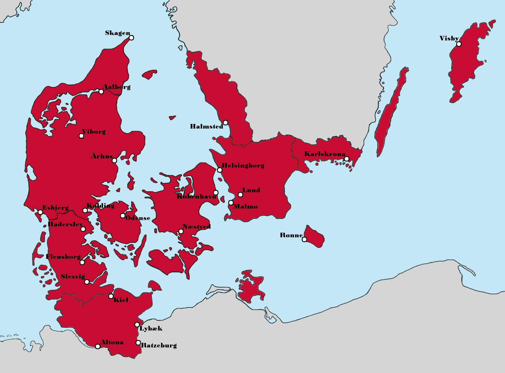
Greater Denmark Alternate History Map
The 'Greater Denmark (Alternate History)' map presents a fascinating reimagining of the Nordic region, highlighting a sc...
👁 74📅 9/5/2025