municipalities Maps
8 geographic visualizations tagged with "municipalities"
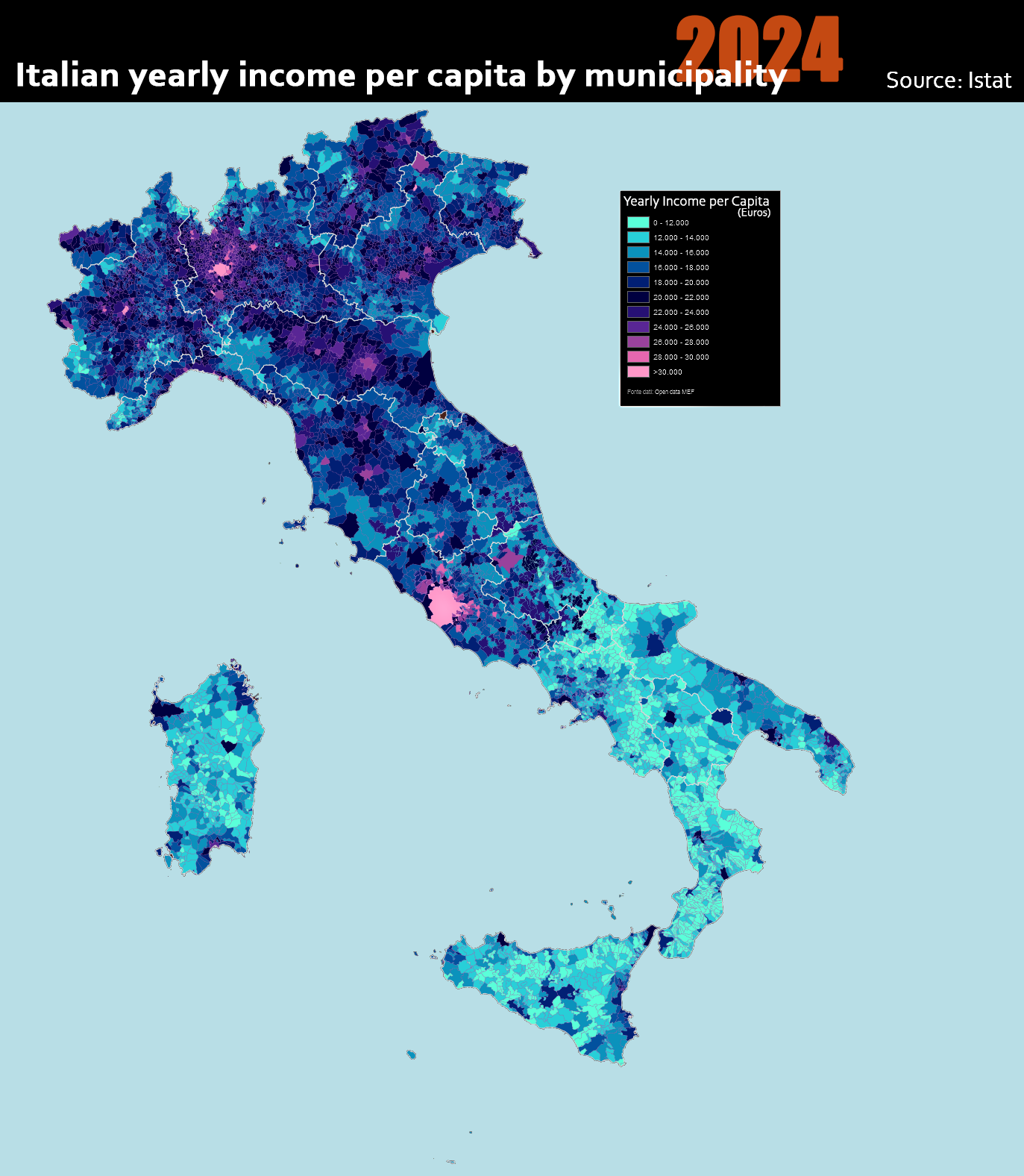
Italian Yearly Income Per Capita by Municipality Map
The "Italian Yearly Income per Capita by Municipality 2024" map provides an insightful look into the economic landscape ...
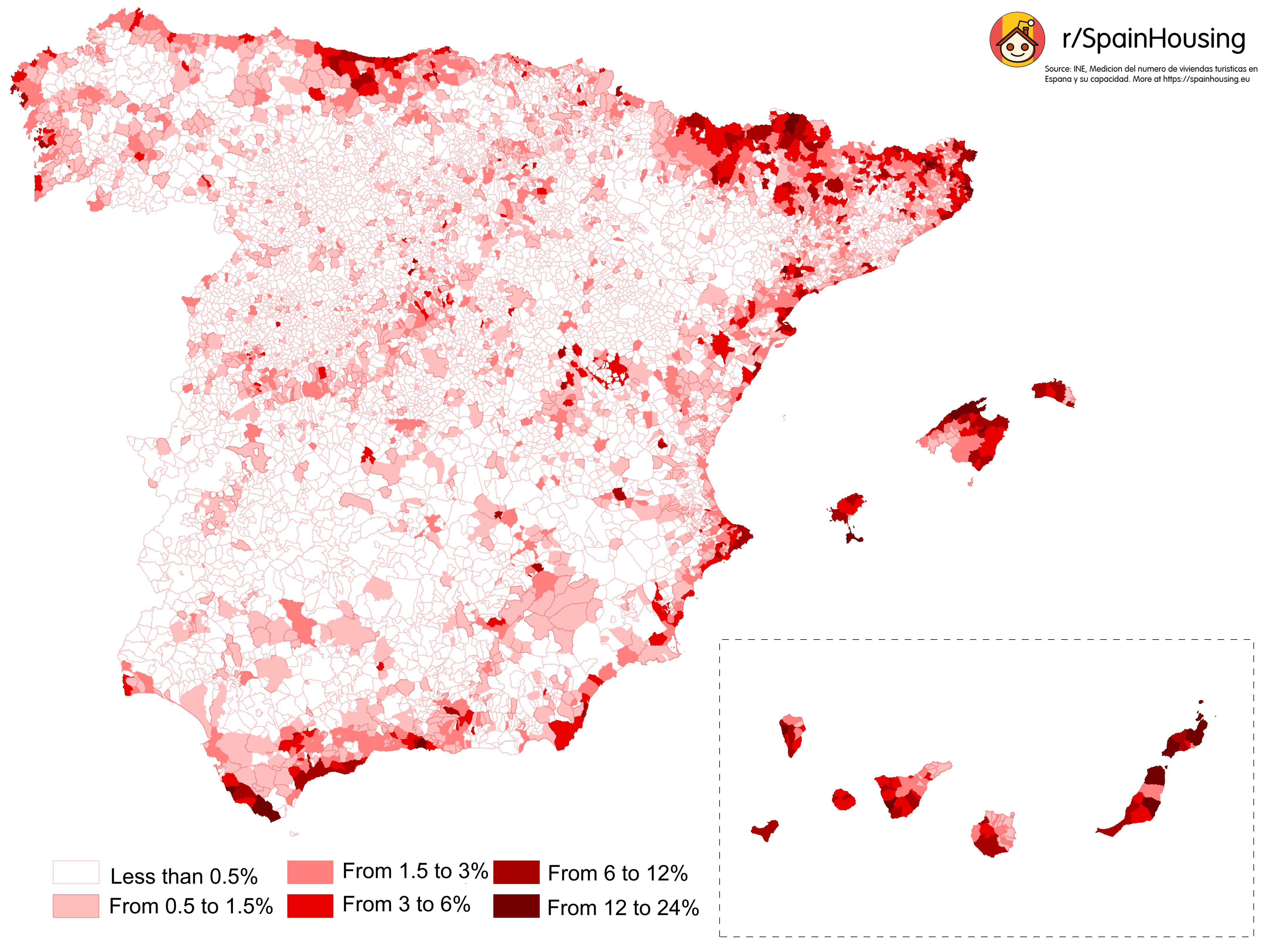
Map of Homes Used for Tourist Rentals in Spain
The map titled "Percentage of Homes Used for Tourist Rentals in Spain" provides a compelling visualization of how many r...
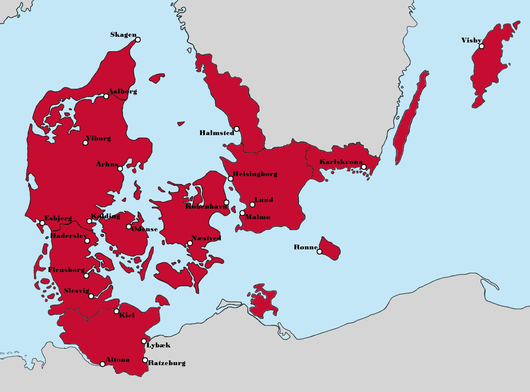
Aesthetic Map of Denmark's Political Landscape
The map titled "Politics aside, this version of Denmark looks really nice aesthetically" presents a unique visualization...
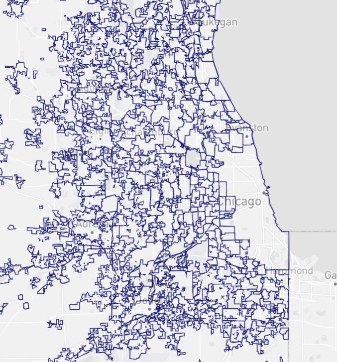
Chicago Metro City Boundaries Map
The "Chicago Metro City Boundaries Map" provides a striking visual representation of the various city boundaries within ...
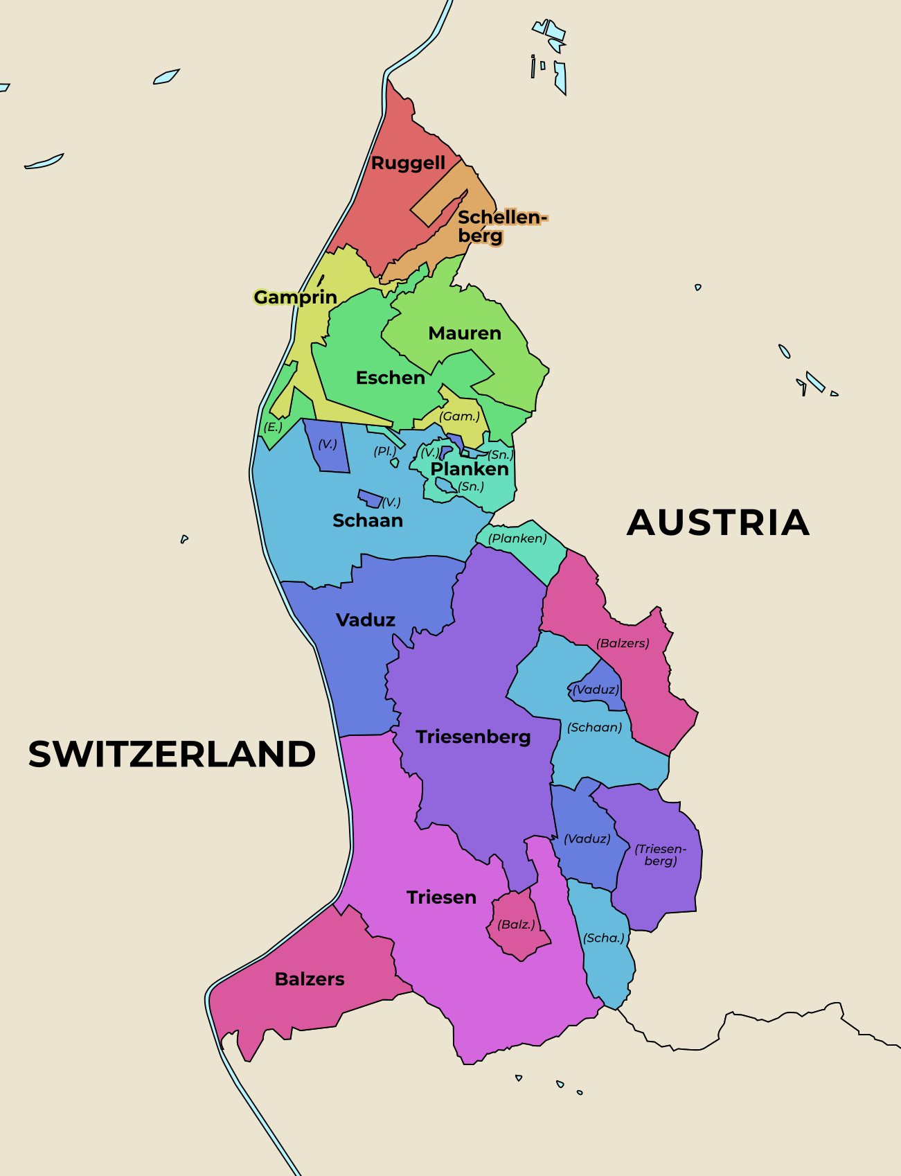
Administrative Map of Liechtenstein
The administrative map of Liechtenstein presents a clear and detailed visualization of the country's municipalities, whi...
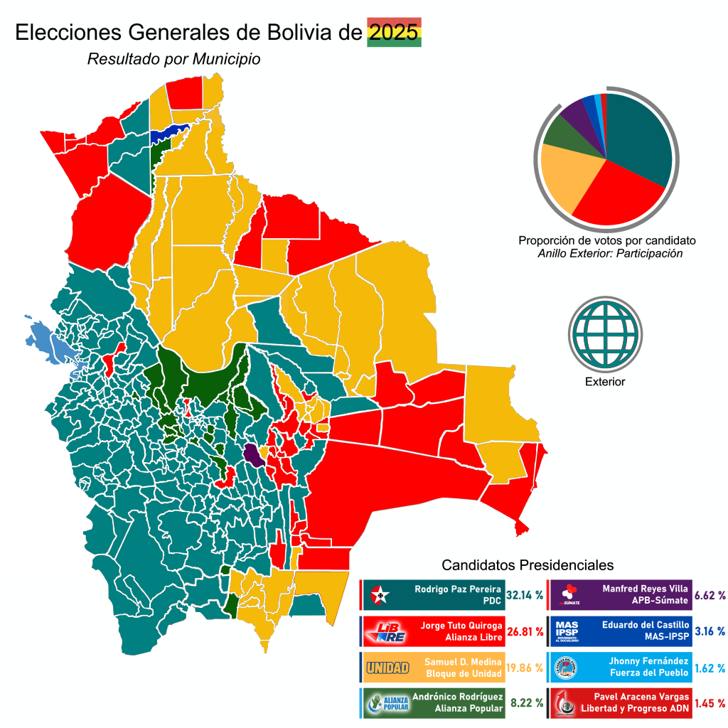
2025 Bolivian General Election Results by Municipality Map
The "Results of the 2025 Bolivian General Election by Municipalities" map provides a detailed visualization of how vario...
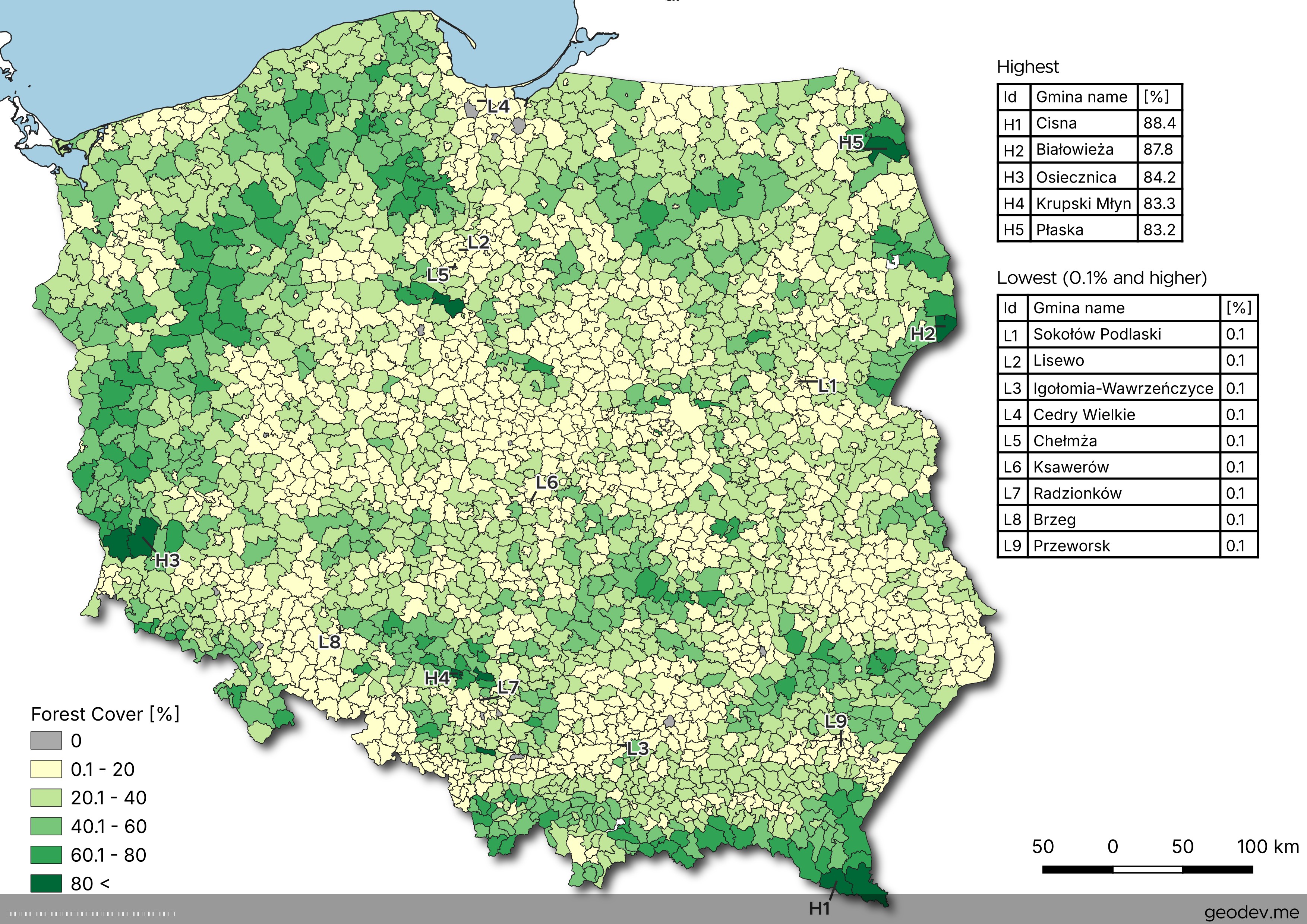
Forest Cover by Municipality Map of Poland
The map titled "Forest Cover by Municipality Map of Poland" presents a detailed visualization of forest coverage across ...
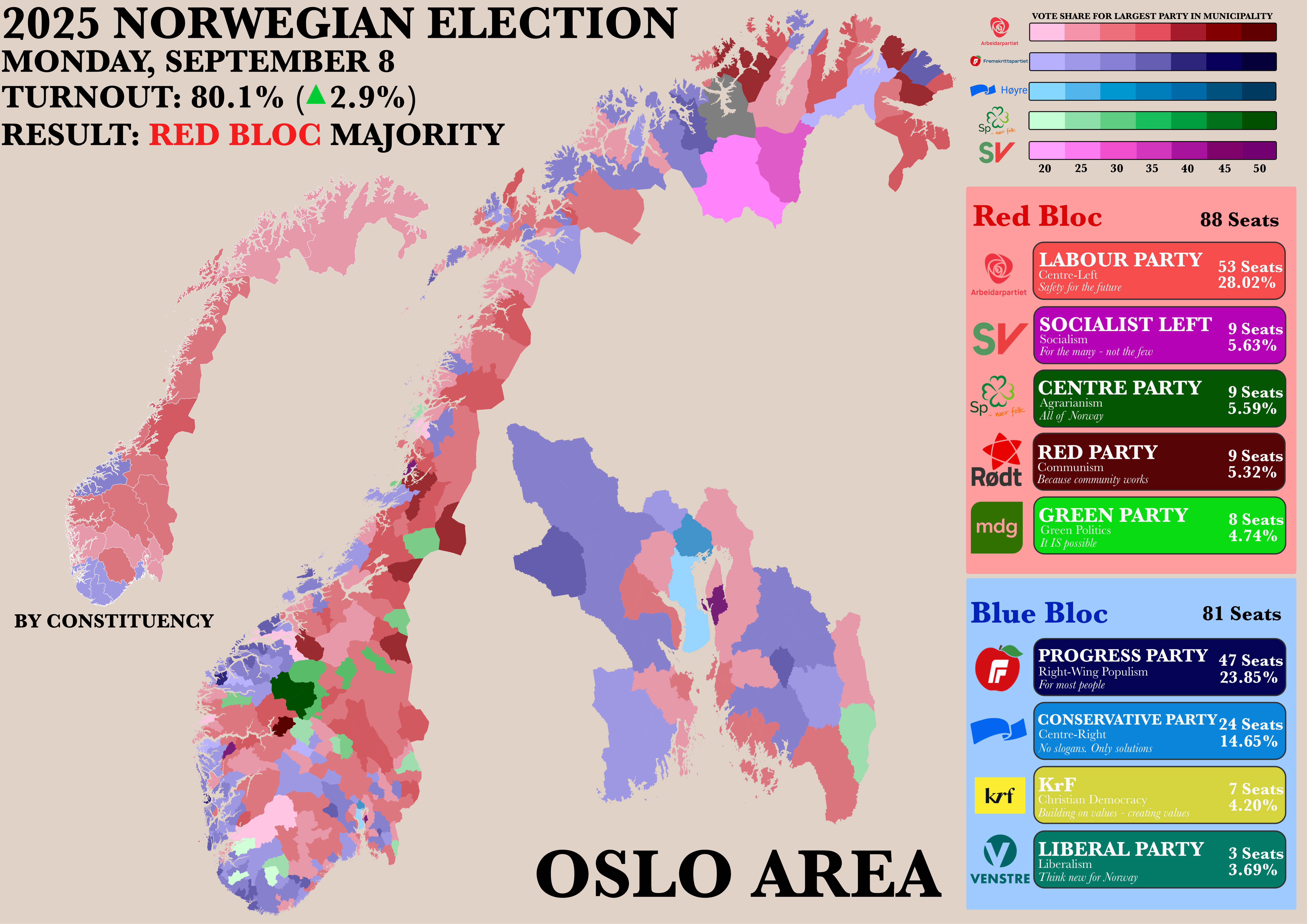
Norwegian Parliamentary Election Results by Municipality Map
The "Poster of the Recent Norwegian Parliamentary Election by Municipality" map provides a detailed visualization of the...