medieval europe Maps
4 geographic visualizations tagged with "medieval europe"

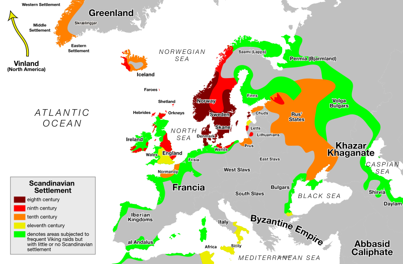
Viking Expansion Routes Map
The "Viking Expansion Routes Map" visually represents the vast territories explored and settled by the Norsemen, commonl...
👁 88📅 9/1/2025

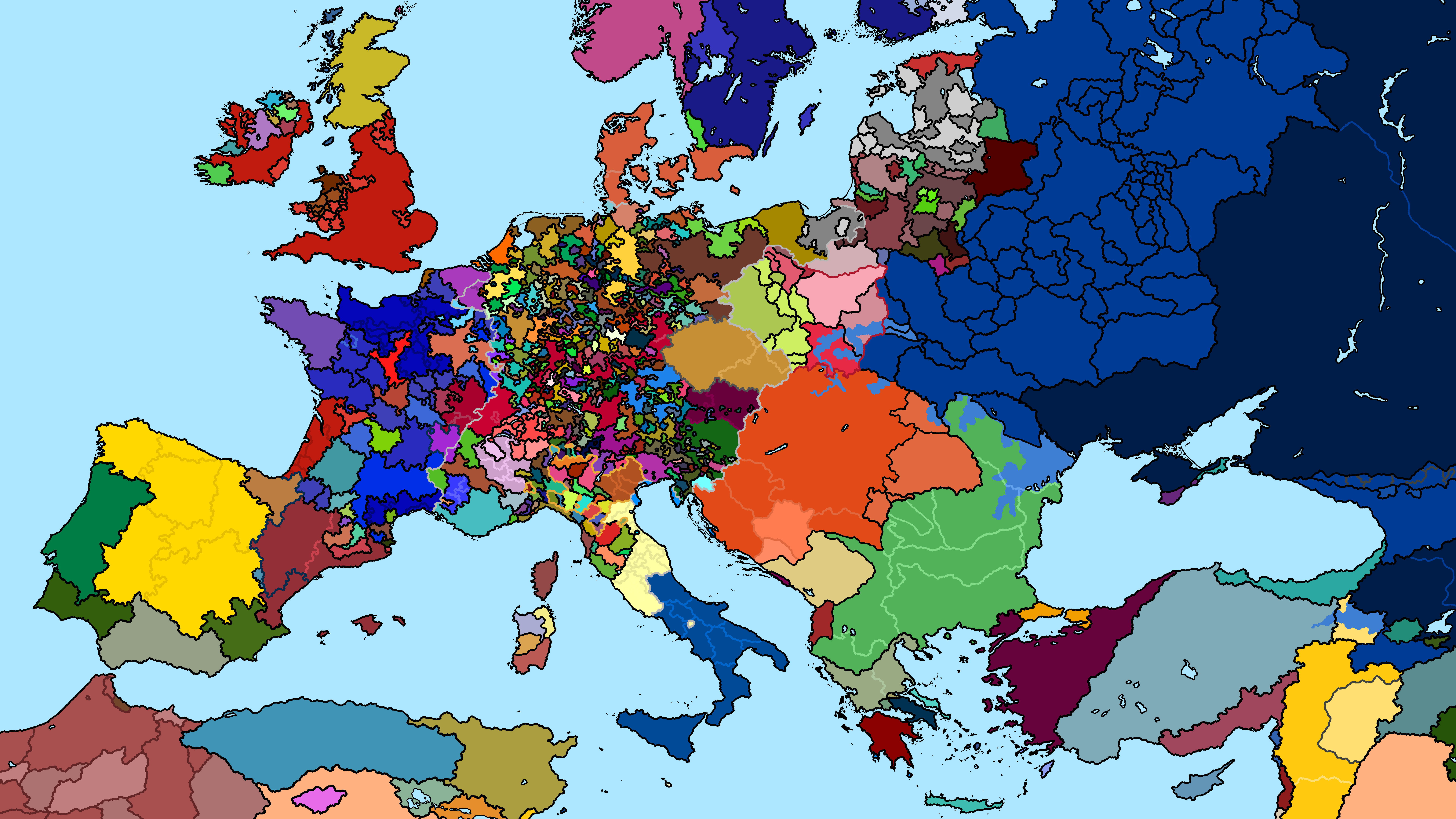
Political Map of Europe 1240 AD
The "Map of Europe 1240 AD" presents a snapshot of the political landscape in medieval Europe. During this time, the con...
👁 132📅 8/7/2025

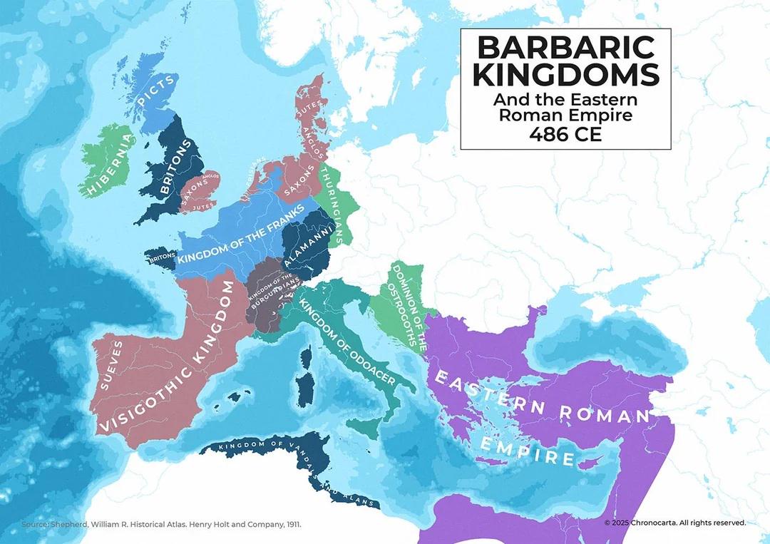
Map of Europe in 486 CE After Western Roman Empire
The map titled \...
👁 50📅 9/21/2025

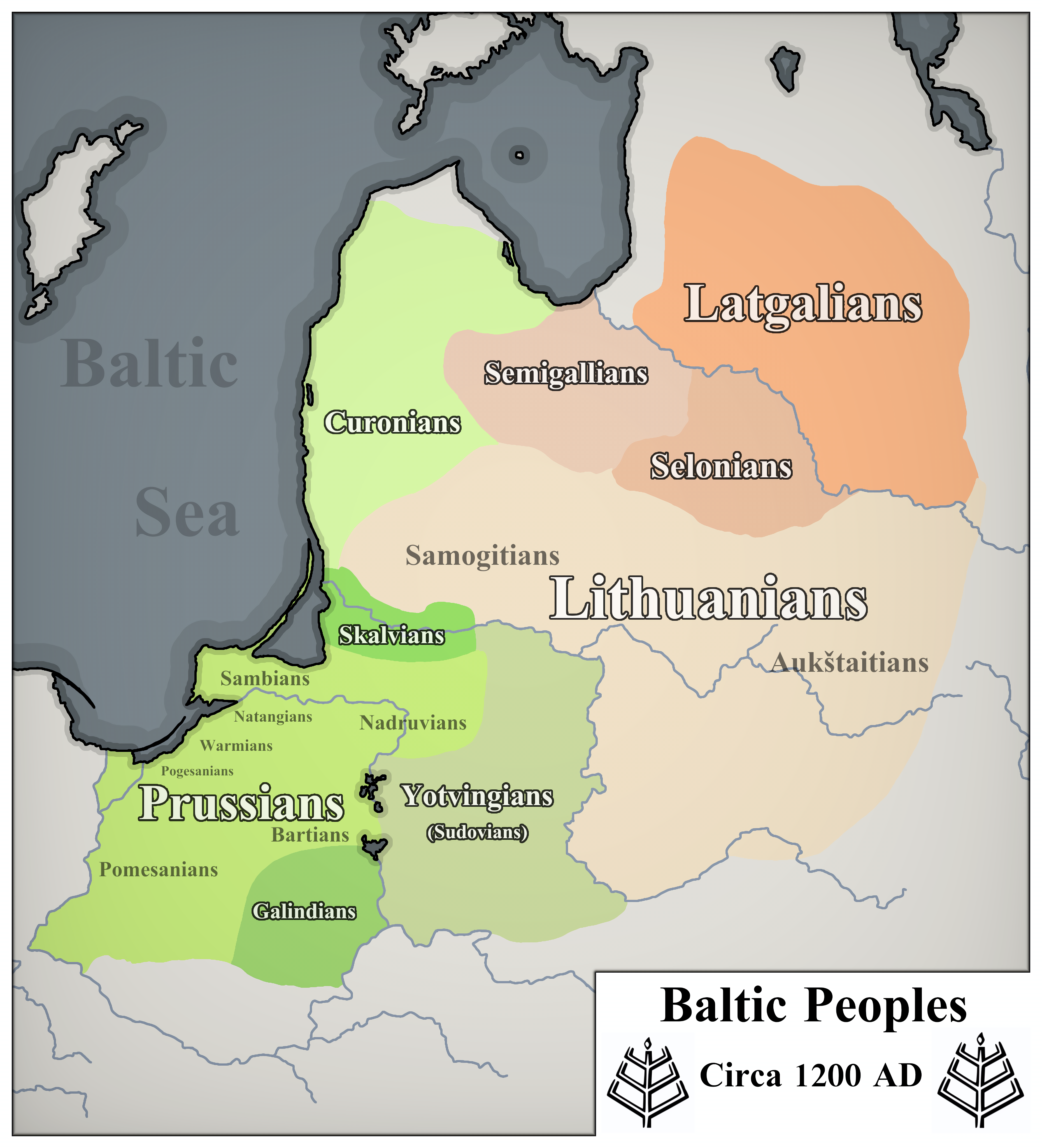
Map of Baltic Peoples Circa 1200 AD
The visualization titled 'Baltic Peoples Circa 1200 AD' intricately details the distribution of various ethnic groups in...
👁 40📅 10/10/2025