lithuania Maps
7 geographic visualizations tagged with "lithuania"
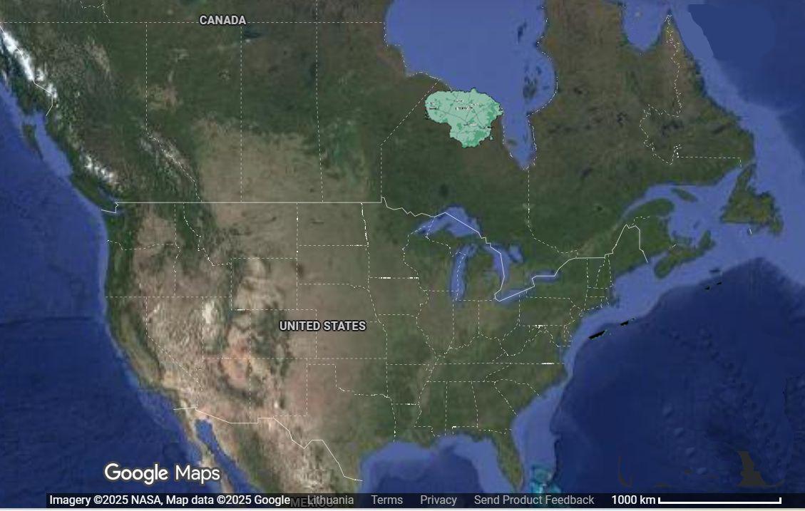
Lithuania Relocation 6000km West Map
This visualization intriguingly displays the geographical consequences of relocating Lithuania approximately 6,000 kilom...
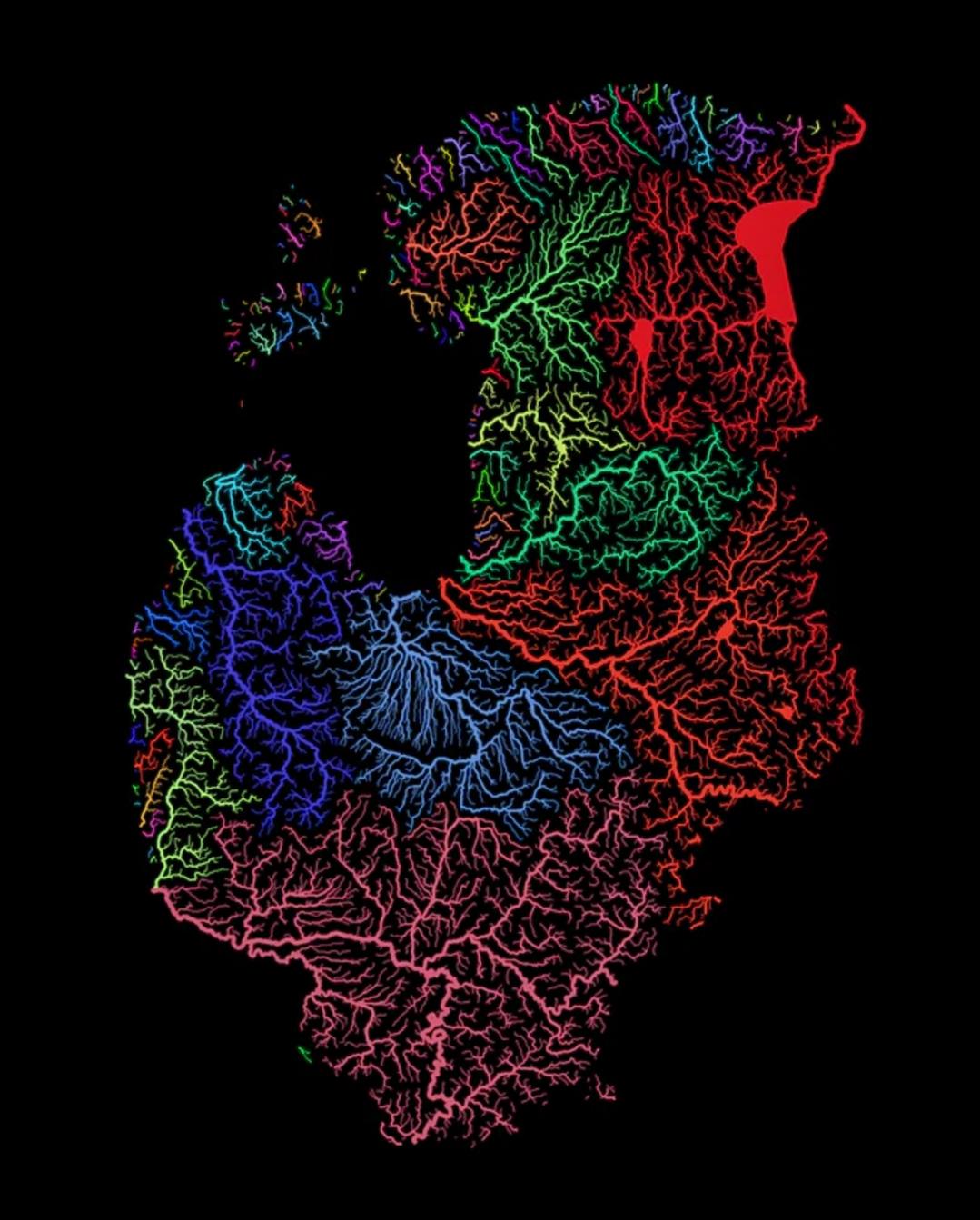
Rivers of the Baltic Nations Map
This map highlights the intricate network of rivers that flow through the Baltic nations of Estonia, Latvia, and Lithuan...
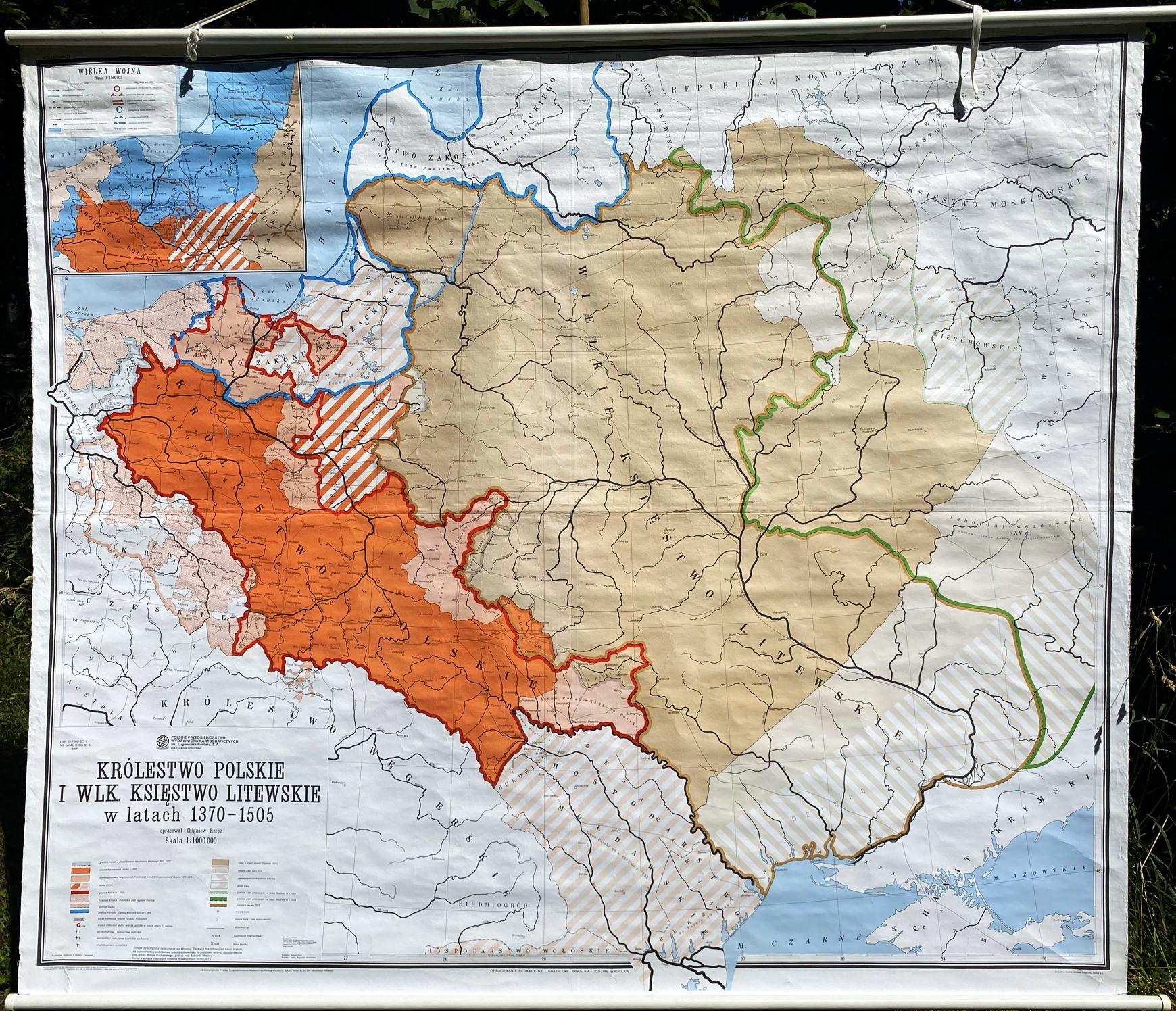
Poland and Lithuania Historical Map 1370-1505
This vintage school map illustrates the territorial expanse of Poland and Lithuania during the years 1370 to 1505, a tim...
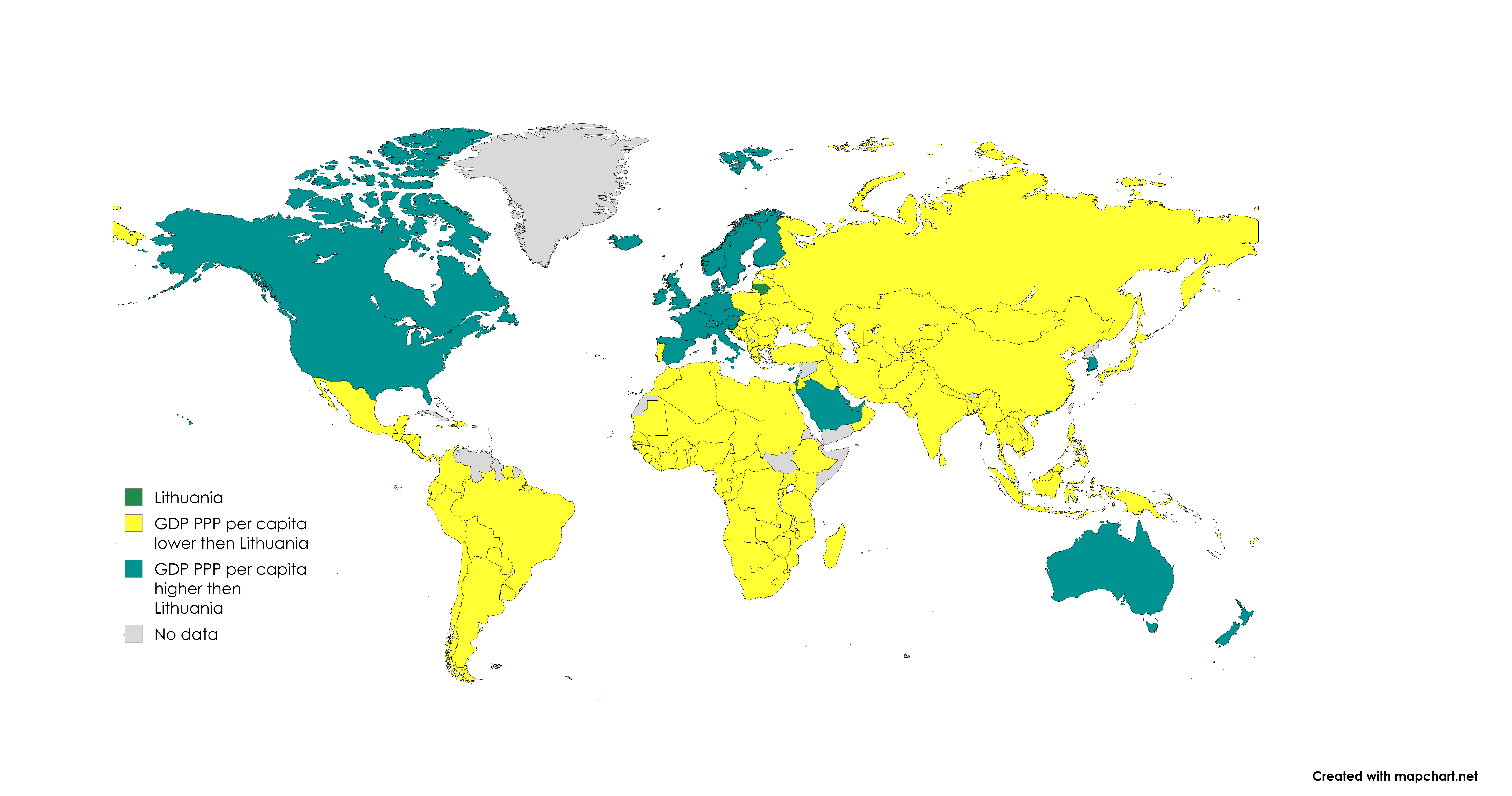
GDP (PPP) Per Capita Lithuania Map
The GDP (PPP) per capita Lithuania map provides a visual representation of the economic performance of Lithuania, expres...
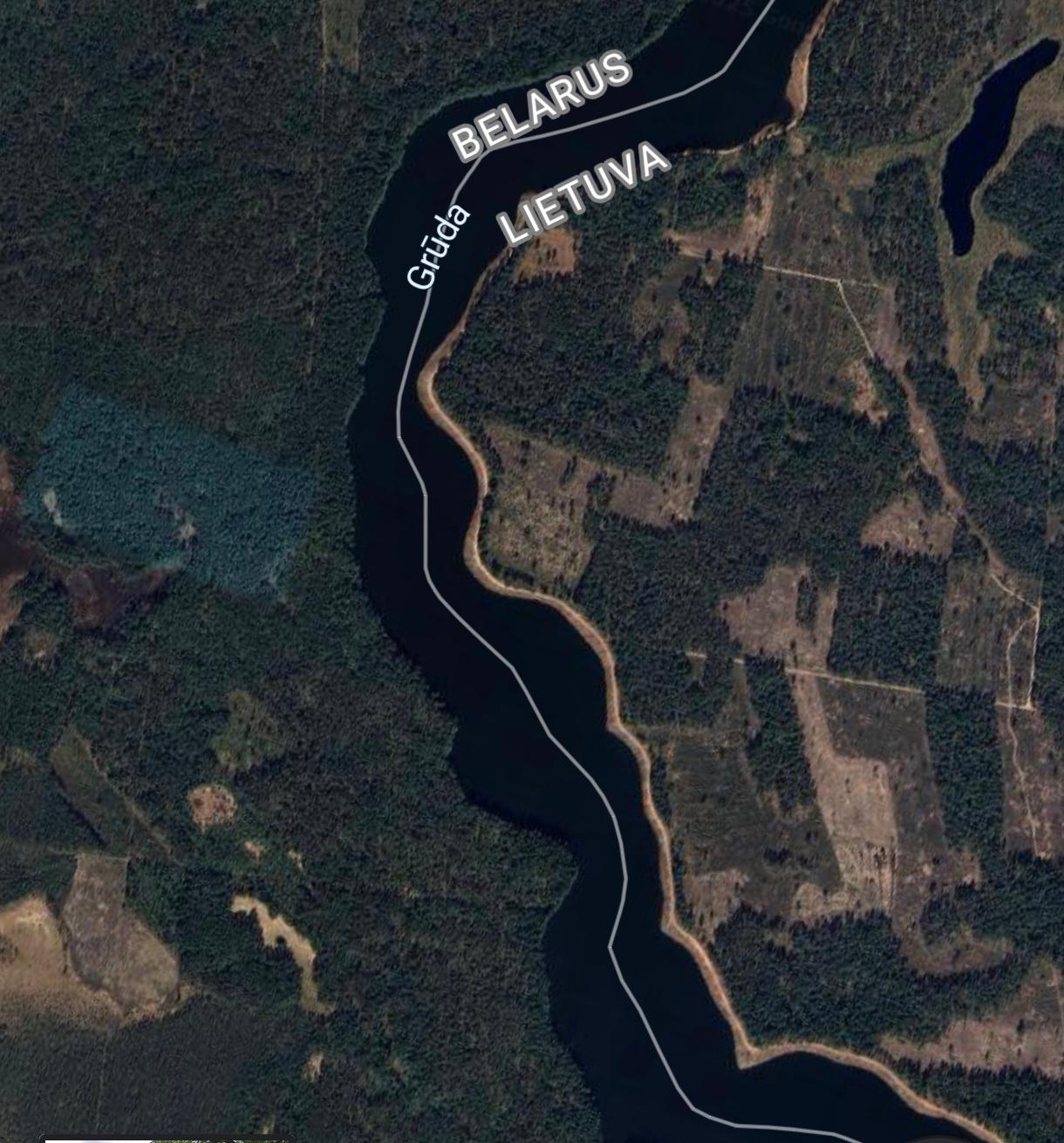
Belarus and Lithuania Forest Ownership Map
The visualization titled "Belarus and Lithuania Border: Forest Ownership" provides a clear depiction of the contrasting ...
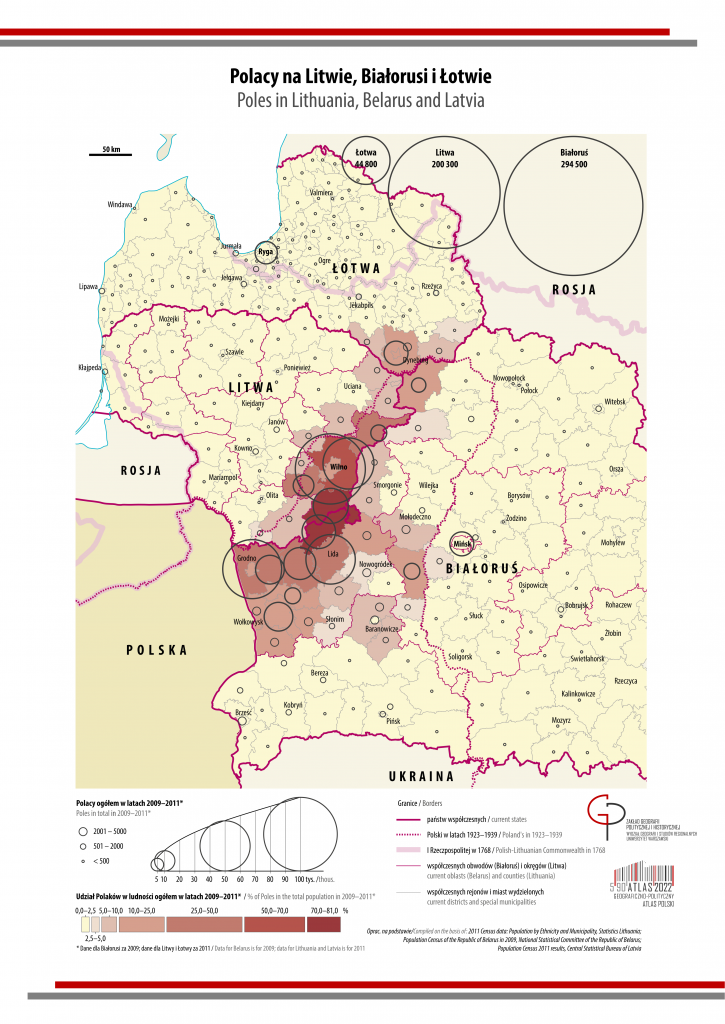
Map of Polish Population in Lithuania, Belarus, and Latvia
The map titled 'Polish Population in Lithuania, Belarus, and Latvia' provides a visual representation of the distributio...
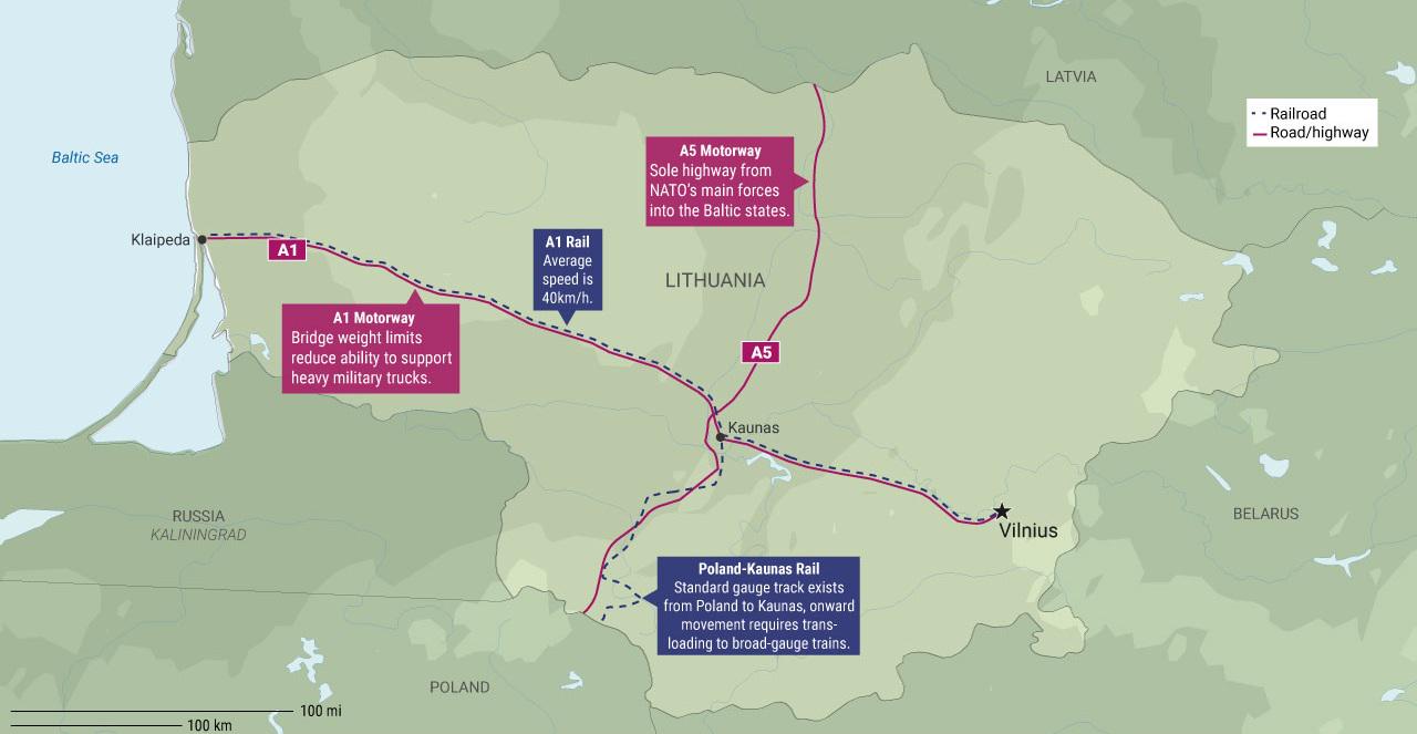
Lithuania's Infrastructure Pain Points for NATO Map
The "Lithuania's Infrastructure Pain Points for NATO Map" provides a detailed visualization of Lithuania's critical infr...