latitude Maps
5 geographic visualizations tagged with "latitude"
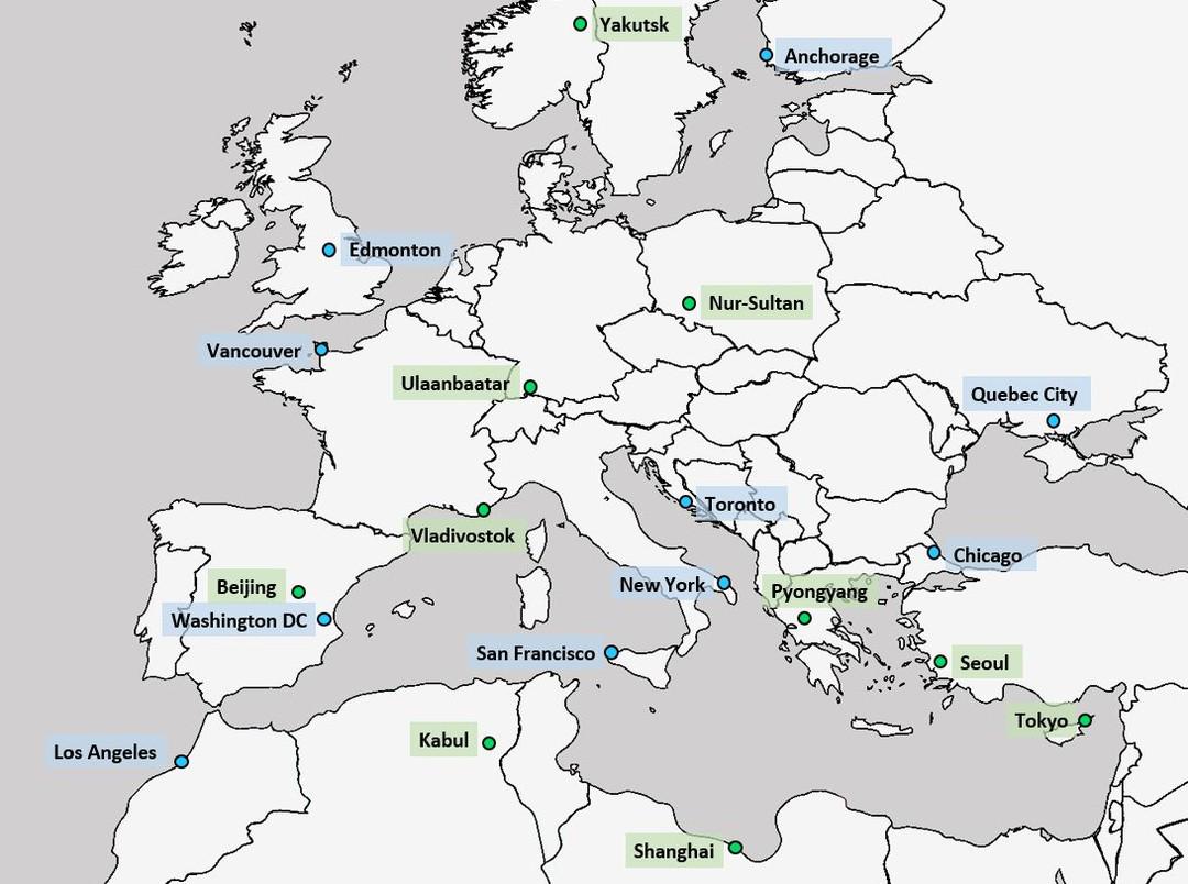
Latitude Comparison Map of Major World Cities
The latitude comparison map of major world cities with Europe illustrates the geographical positioning of various promin...
👁 90📅 10/10/2025
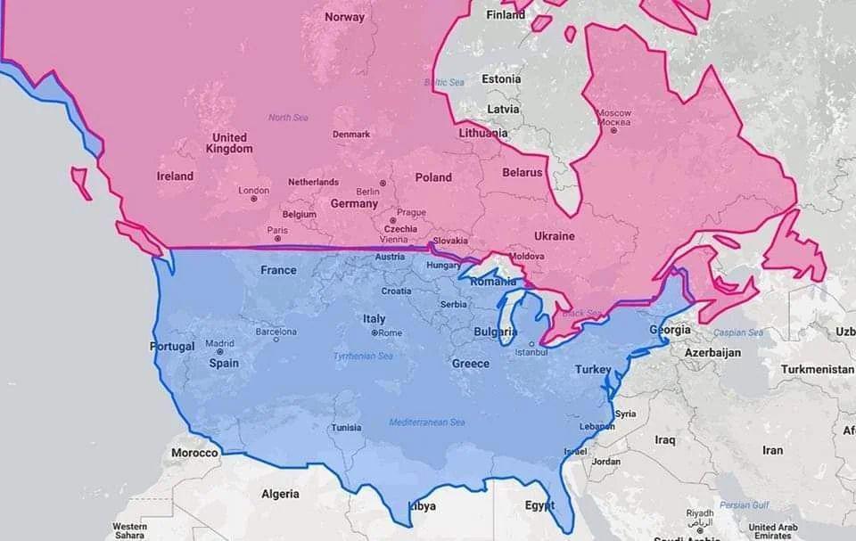
Latitude Map of United States, Canada, and Europe
The visualization titled "United States & Canada in same latitude w/ Europe" highlights the parallels of latitude that c...
👁 64📅 9/18/2025
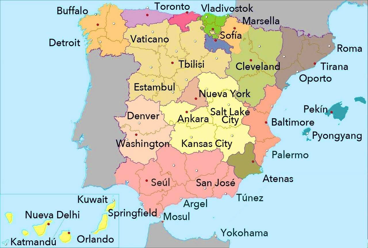
World Cities with Similar Latitude to Spanish Cities Map
This map presents a fascinating comparison of various world cities that share similar latitudes with cities in Spain. Ea...
👁 74📅 9/11/2025
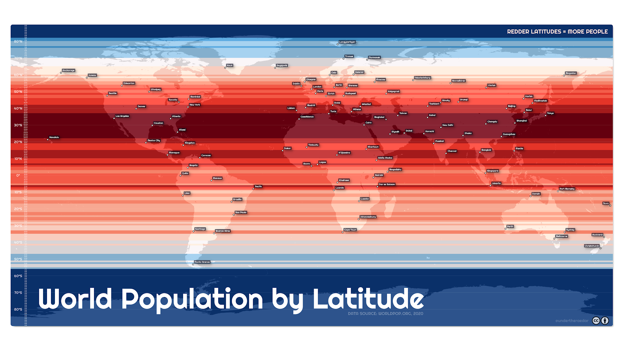
Population by Latitude Map
This visualization illustrates the global population distribution by latitude, employing a color gradient where red sign...
👁 8📅 10/16/2025
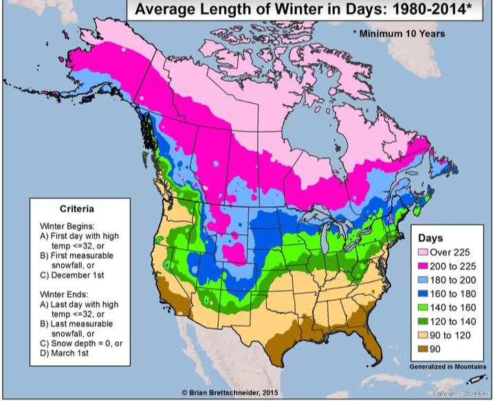
Average Length of Winter Days Map by Region
The map titled "Average Length of Winter Days between 1980-2014 by Region" provides a visual representation of the durat...
👁 24📅 10/4/2025