iraq Maps
8 geographic visualizations tagged with "iraq"
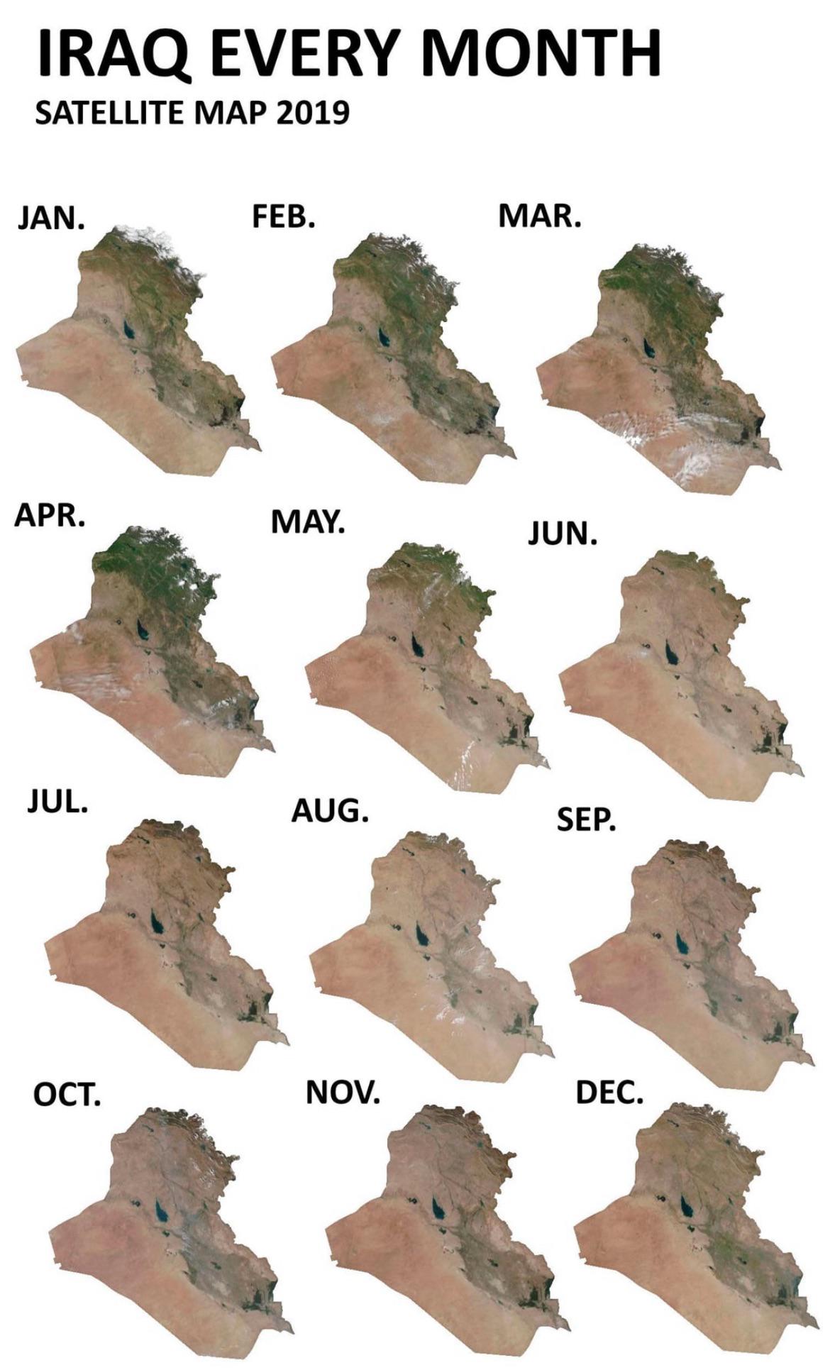
Iraq Seasonal Greenery Changes Map
This map visualizes how Iraq’s greenery fluctuates throughout the seasons, particularly focusing on satellite imagery ca...
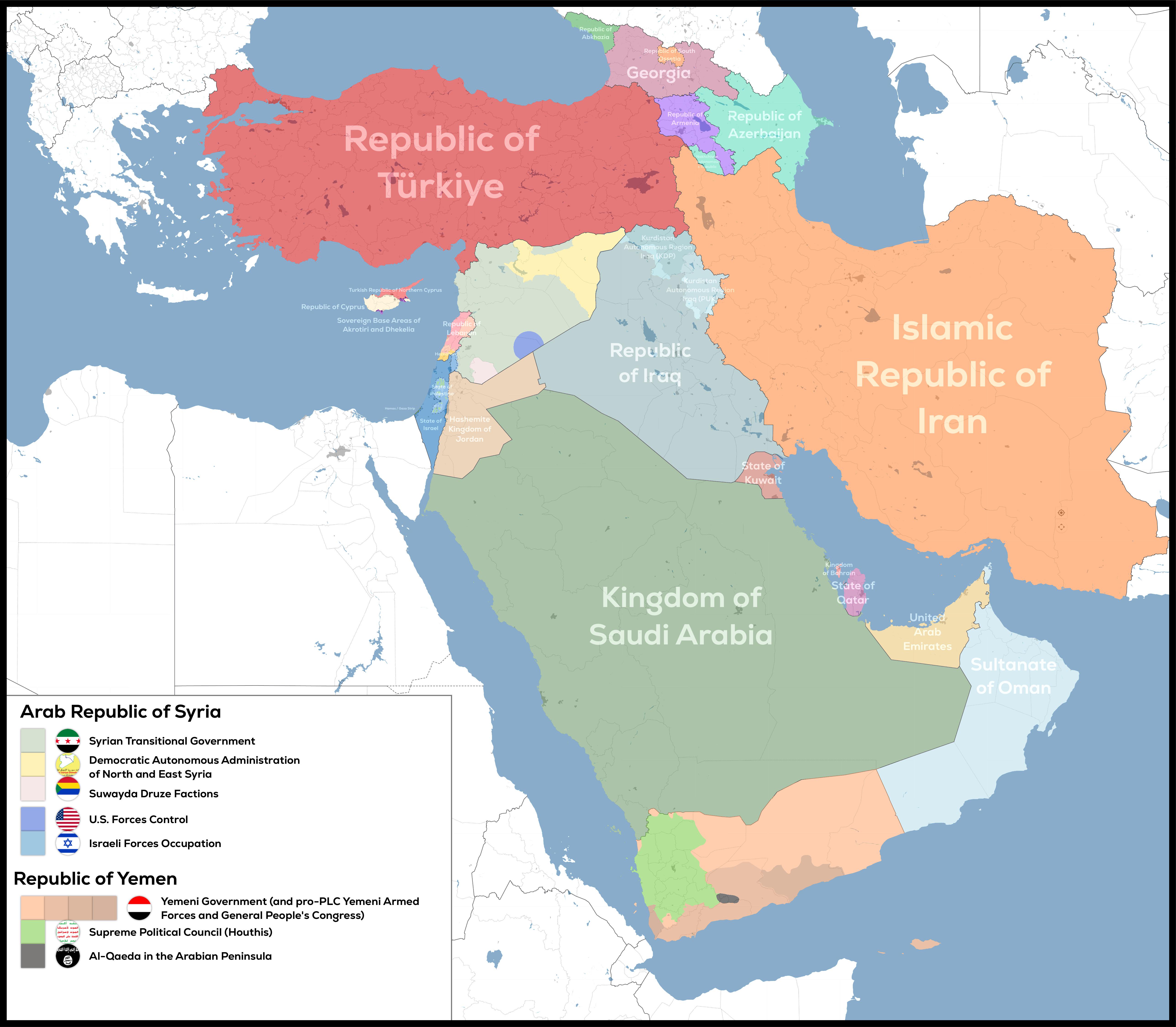
De Facto Geopolitical Map of West Asia
The "De-Facto Geopolitical Map of West Asia" provides a striking illustration of the current territorial control in this...
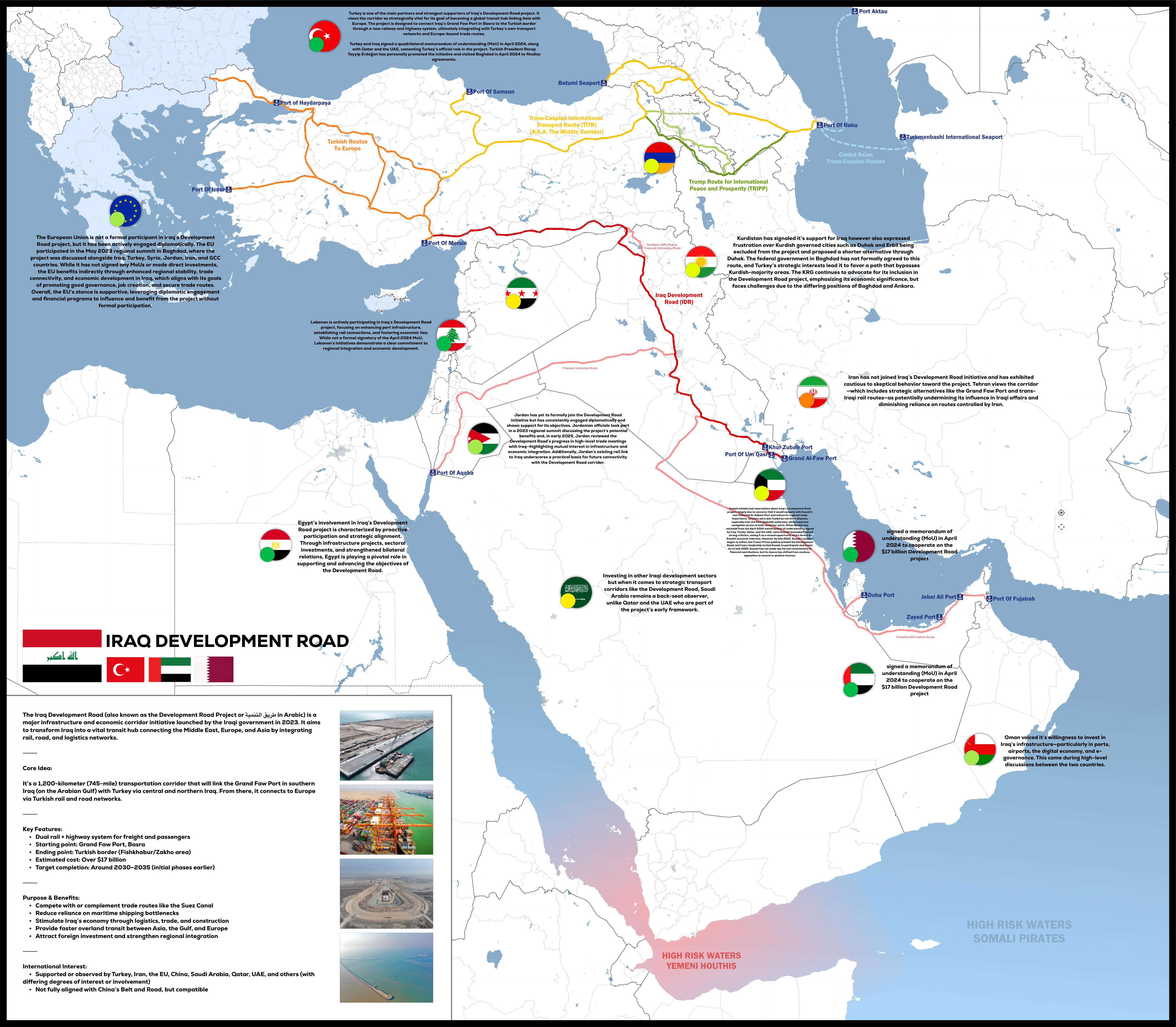
Iraq Development Road Project Map 2025
The "Iraq Development Road Project 2025" map provides a detailed visualization of the planned infrastructure development...
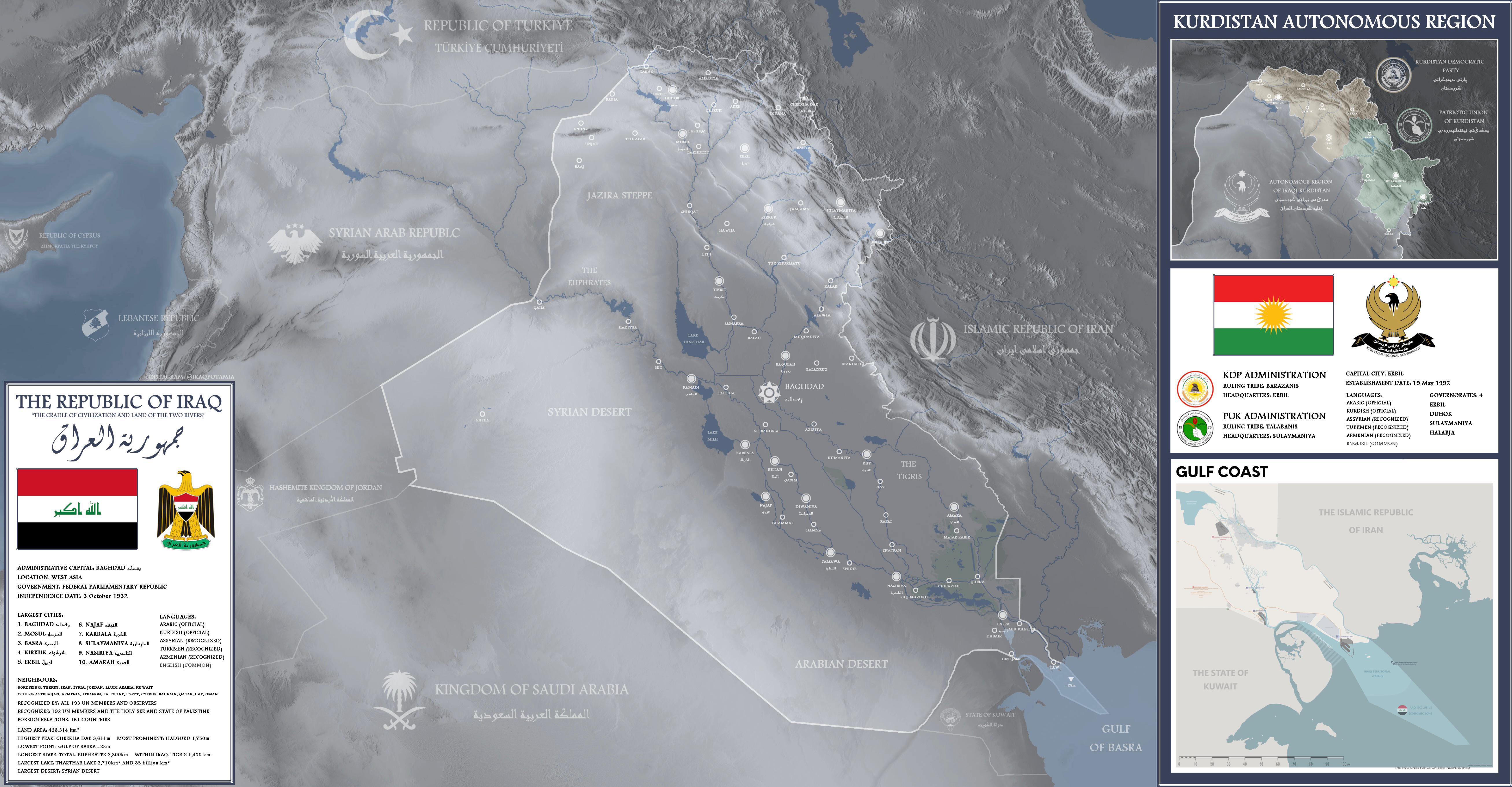
Detailed Map of Iraq
This detailed map of Iraq provides a comprehensive overview of the country's geographical features, including major citi...
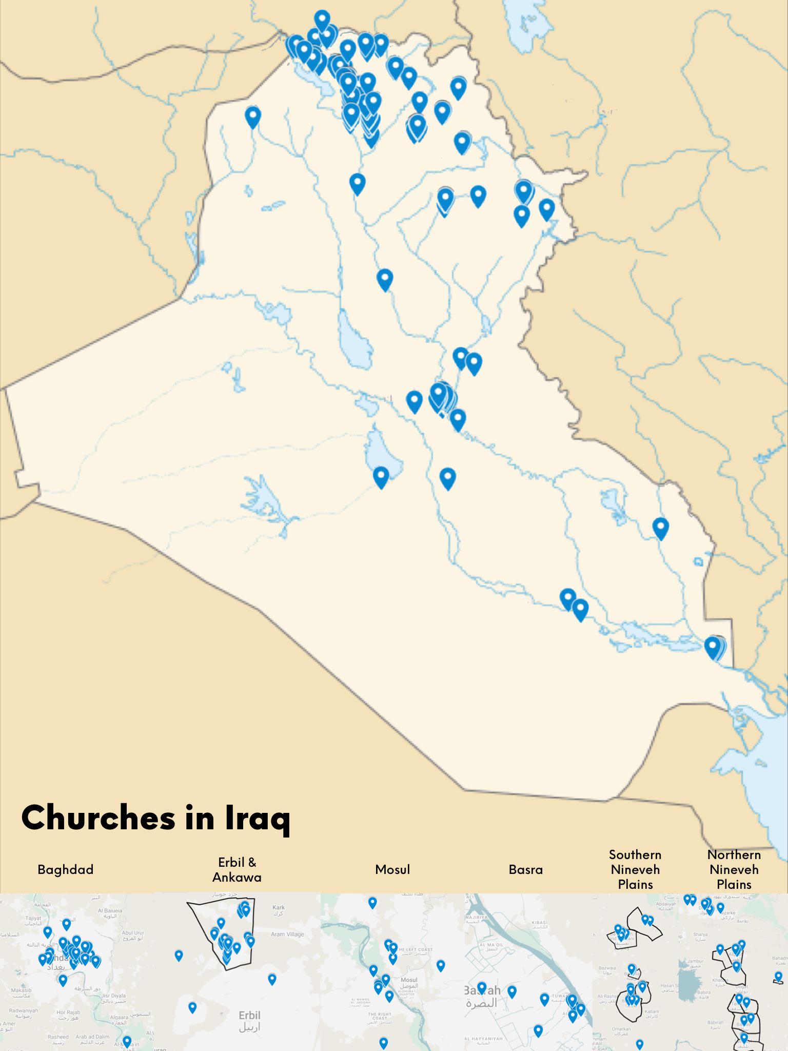
Map of Churches in Iraq
The "Map of Churches in Iraq" provides a detailed visualization of the locations and distribution of churches across the...
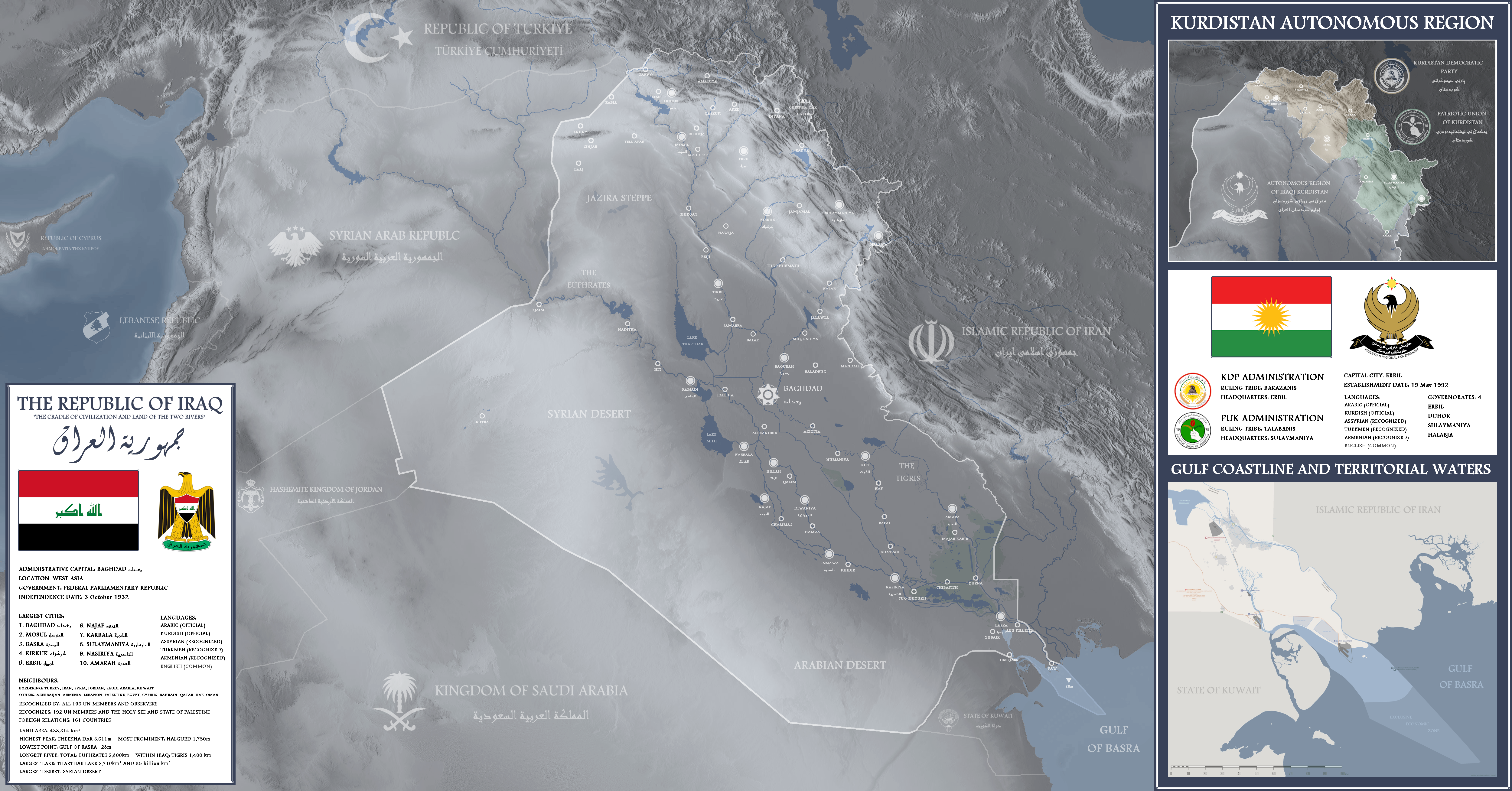
Detailed Map of Iraq by Me
The Tigris River, approximately 1,850 kilometers long, runs through Baghdad and plays a crucial role in the economy and ...
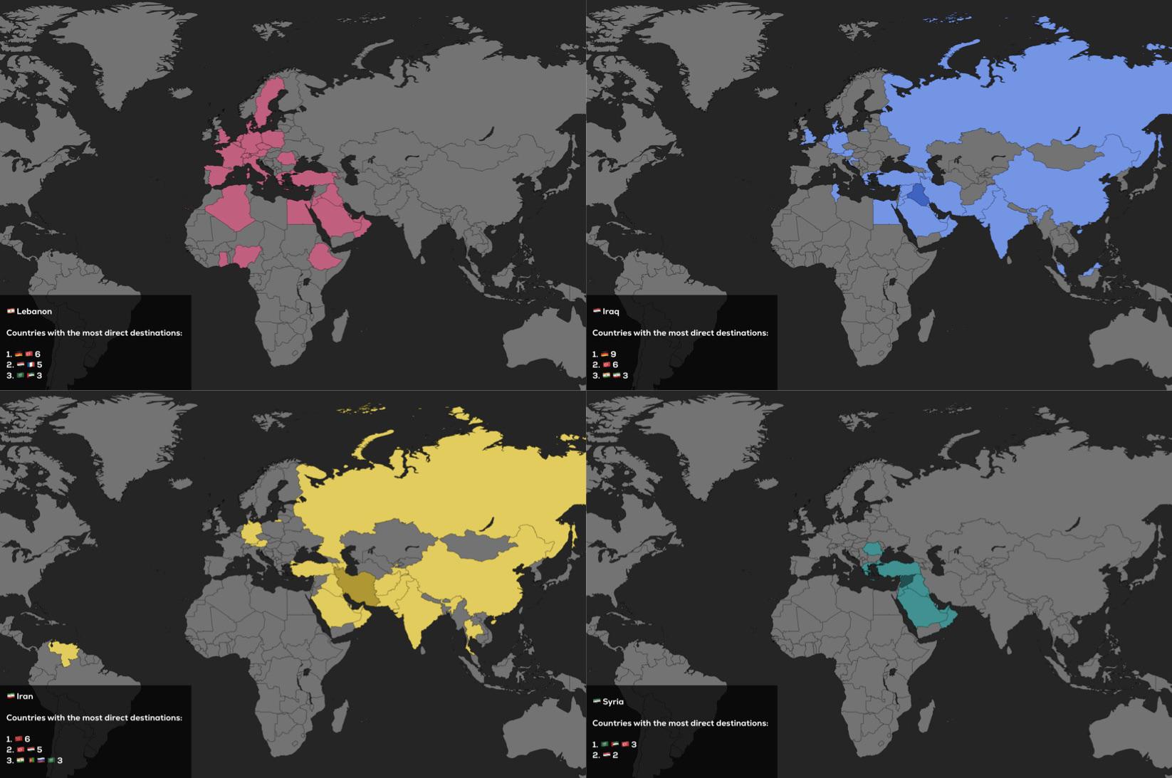
Direct Flights Map of Lebanon, Iraq, Iran and Syria
The visualization titled "Direct Flights of Lebanon, Iraq, Iran and Syria as of 2025" presents a comprehensive overview ...
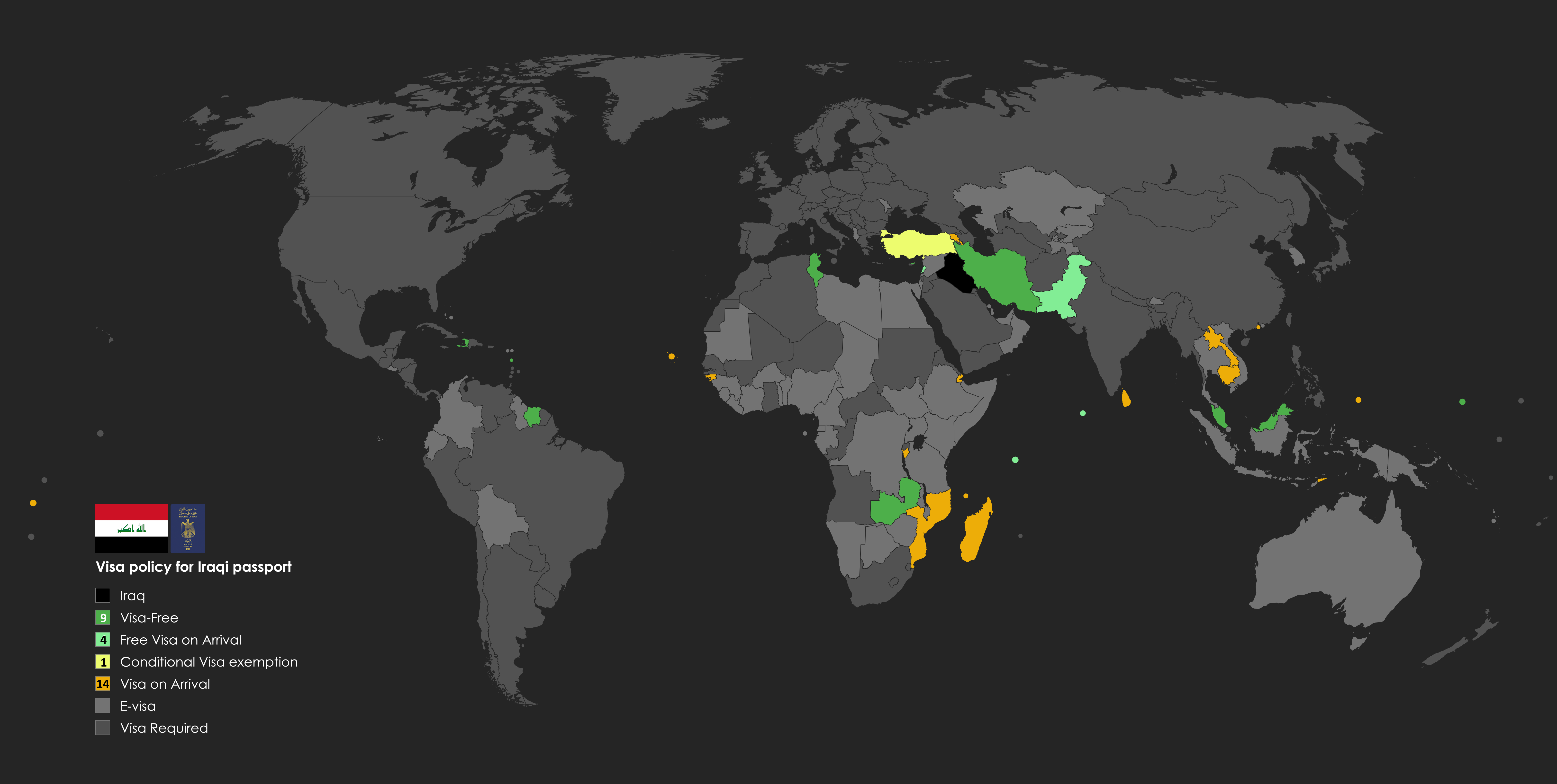
Iraq Passport Power Map
The "Iraq Passport Power Map" vividly illustrates the global mobility afforded by Iraqi passports, highlighting its posi...