immigration patterns Maps
7 geographic visualizations tagged with "immigration patterns"
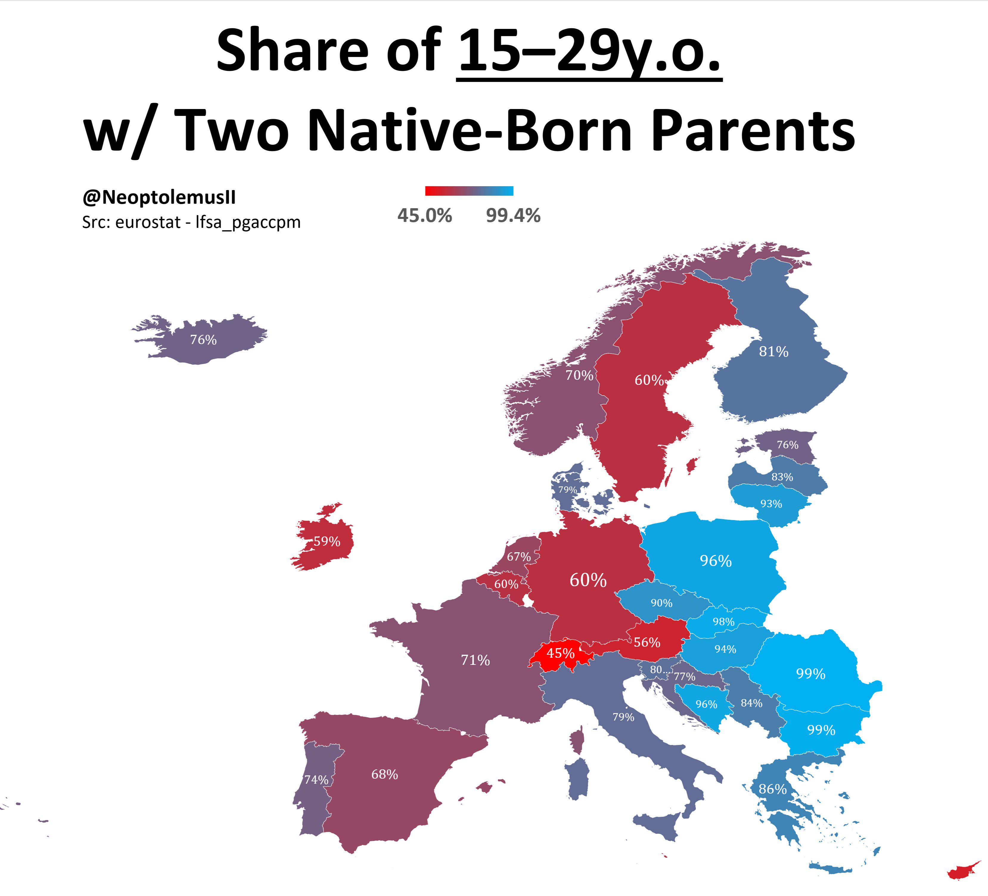
Map of Share of 15-19 Year Olds with Two Native Born Parents
The visualization titled \...
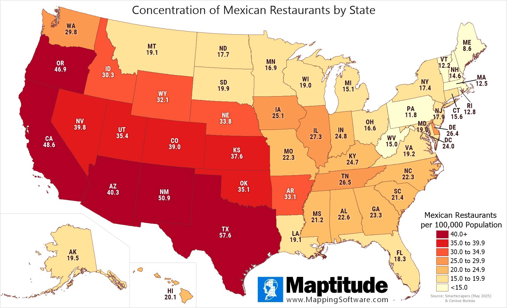
Mexican Restaurants by State Map
This geographical visualization titled "Mexican Restaurants by State Map" provides a detailed look at the distribution o...
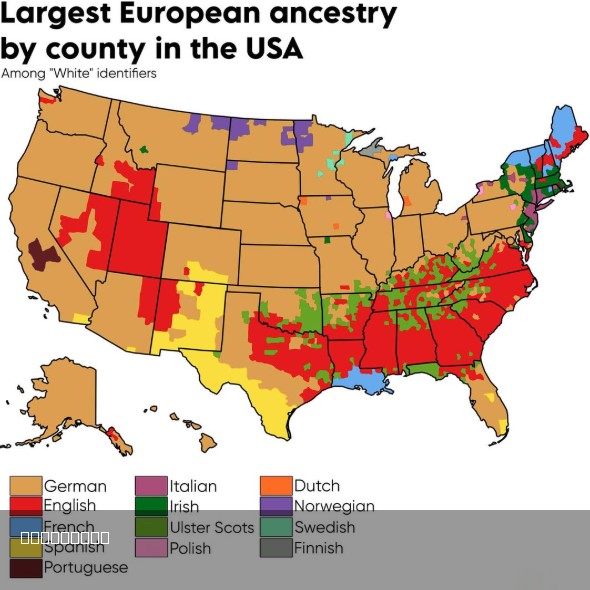
Largest European Ancestry in the US Map
The "Largest European Ancestry in the US Map" provides a detailed visualization of the distribution of European ancestry...
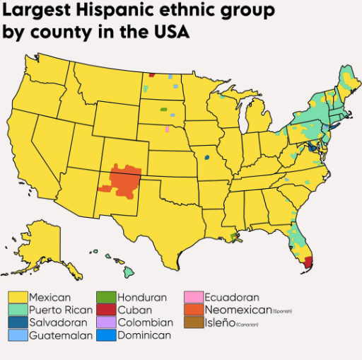
Largest Hispanic Ethnic Groups in the USA Map
Puerto Ricans form the second-largest group, primarily found in the Northeast, particularly in New York and New Jersey, ...
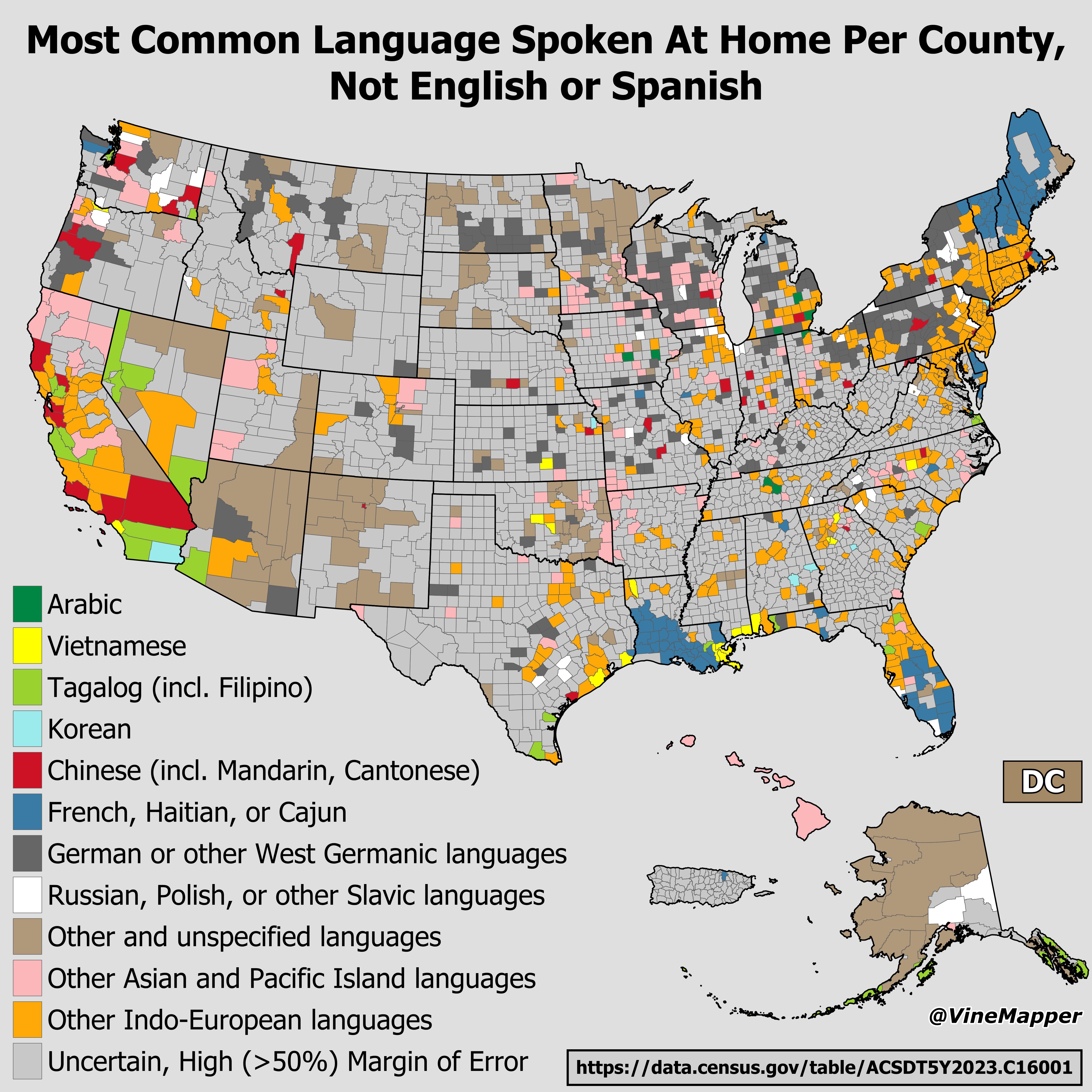
Map of Most Common Language Spoken at Home by County
This map visualizes the most common languages spoken at home across U.S. counties, excluding English and Spanish. It hig...
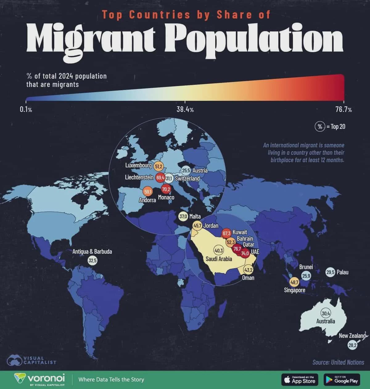
Map of Countries with Highest Proportion of International Migrants
The infographic titled "Countries with the Highest Proportion of International Migrants" presents a striking visualizati...
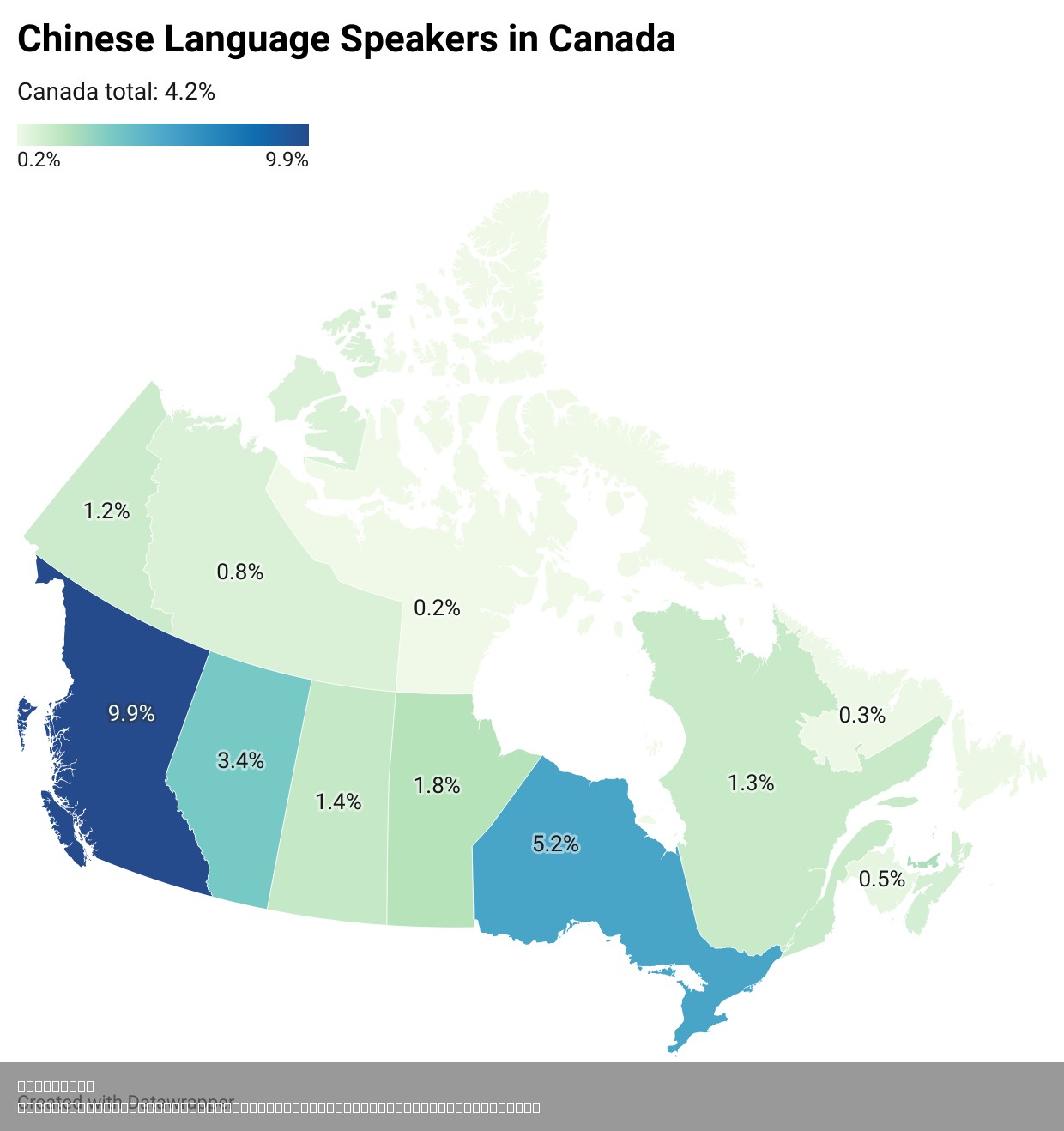
Chinese Language Speakers per Canadian Province and Territory Map
Interestingly, the Chinese language’s prominence is not just a reflection of population numbers but also of cultural int...