food assistance Maps
3 geographic visualizations tagged with "food assistance"

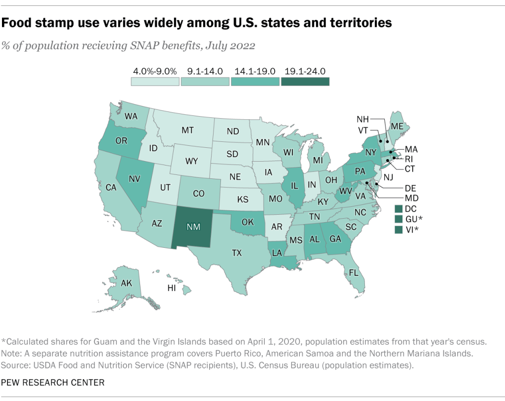
SNAP Dependency by State Map
The "SNAP Dependency by State Map" visually illustrates the percentage of the population in each U.S. state that relies ...
👁 6📅 10/28/2025

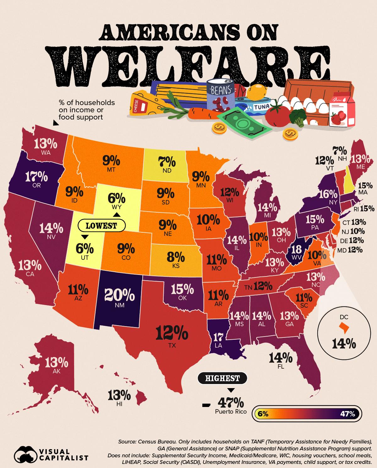
Map of American Households on Income or Food Support
The map titled "Percentage of American Households on Income or Food Support" provides a clear visual representation of t...
👁 66📅 8/30/2025

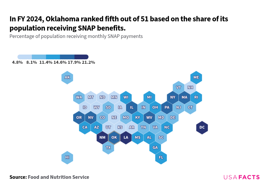
SNAP Benefits Distribution Map in the USA
The SNAP interactive map from USAFacts provides a unique visualization of the distribution of Supplemental Nutrition Ass...
👁 78📅 10/29/2025