england Maps
6 geographic visualizations tagged with "england"
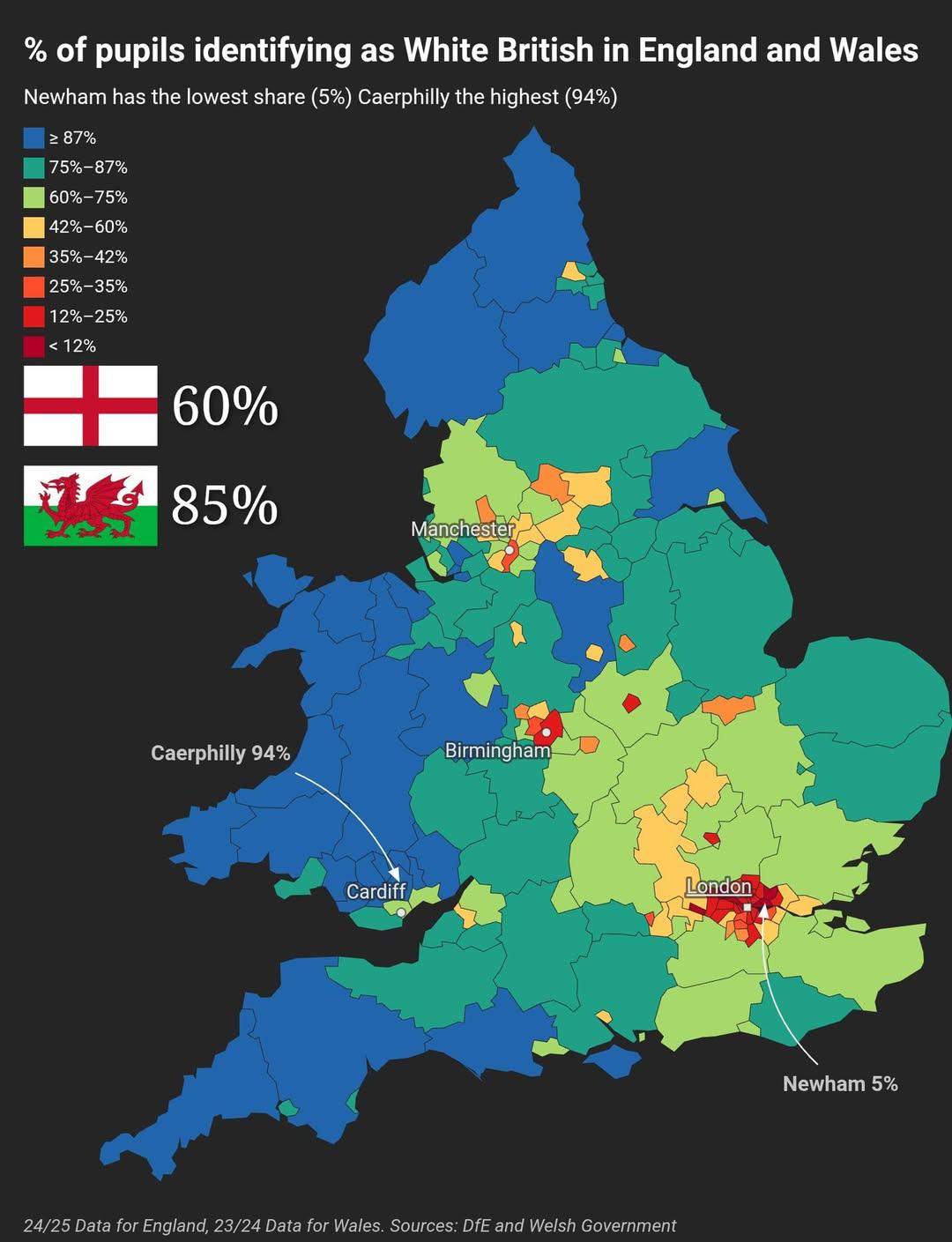
% of Pupils Identifying as White British in England and Wales Map
This map illustrates the percentage of pupils identifying as White British in England and Wales, providing a visual repr...
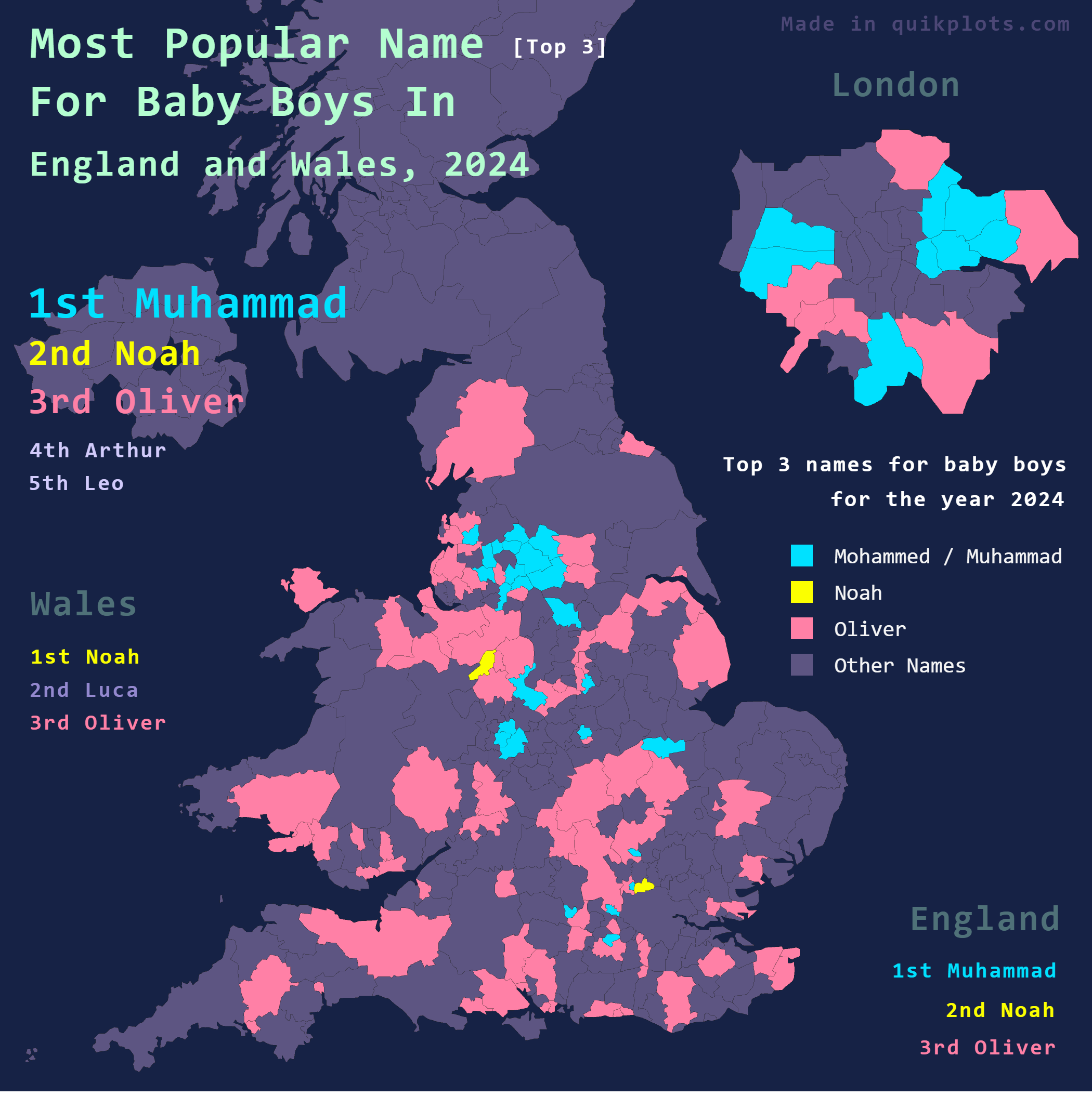
Map of Most Popular Baby Boy Names in England & Wales
Interestingly, the rise in popularity of this name over the past few years can be attributed to several factors, includi...
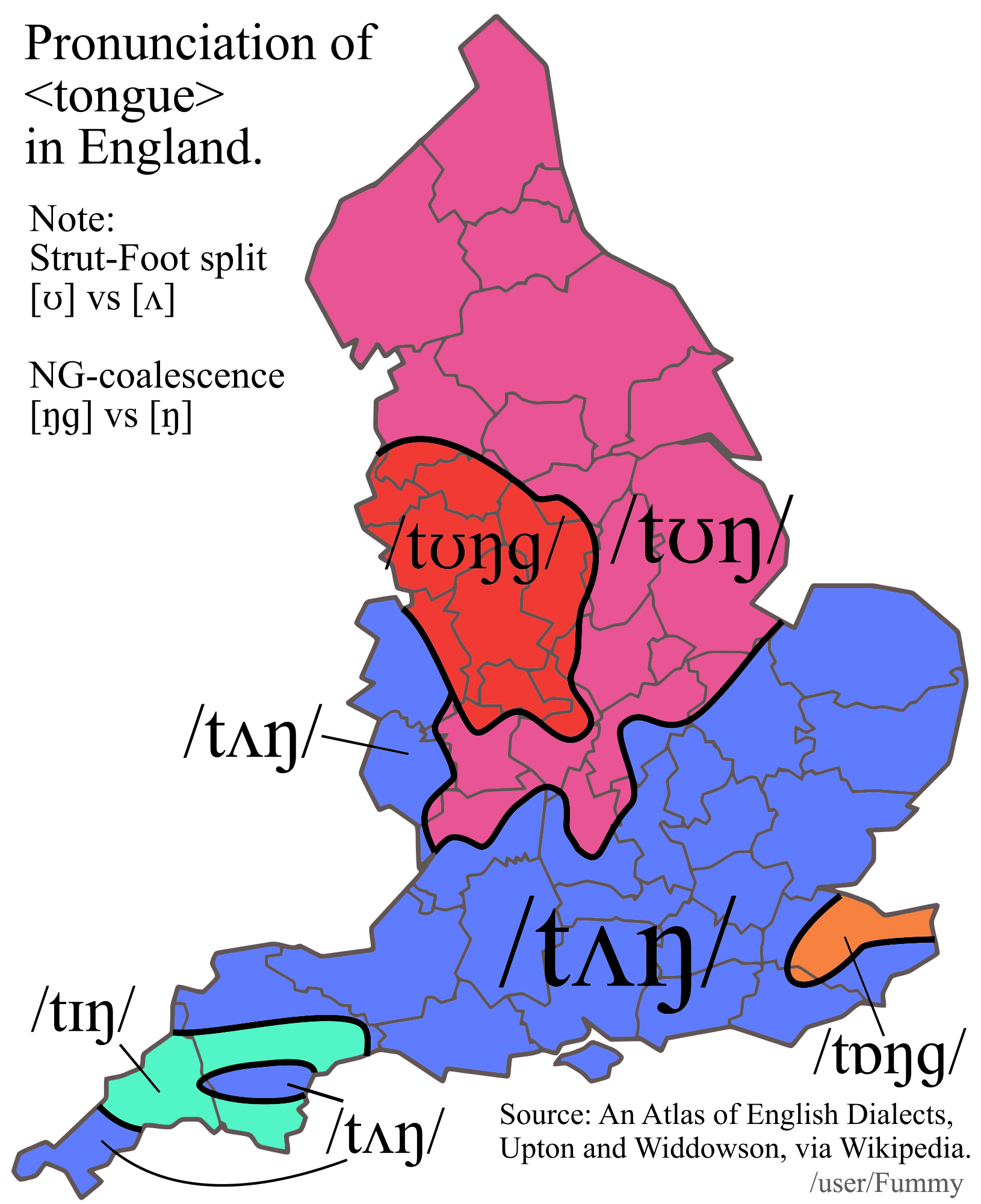
Map of Pronunciation Differences of 'Tongue' in England
This map illustrates the regional variations in the pronunciation of the word "tongue" across different areas of England...
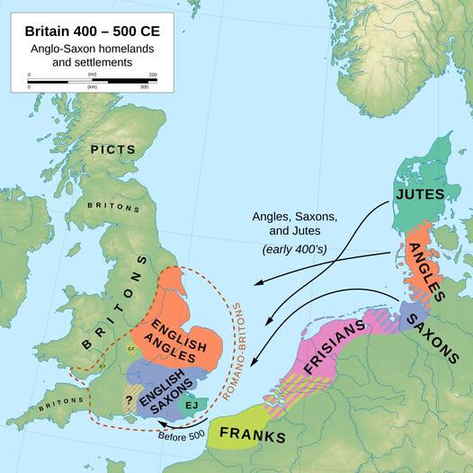
Anglo-Saxon Migration and Settlement Map
Interestingly, the Anglo-Saxons did not migrate as a single wave; instead, they arrived in several groups and settled in...
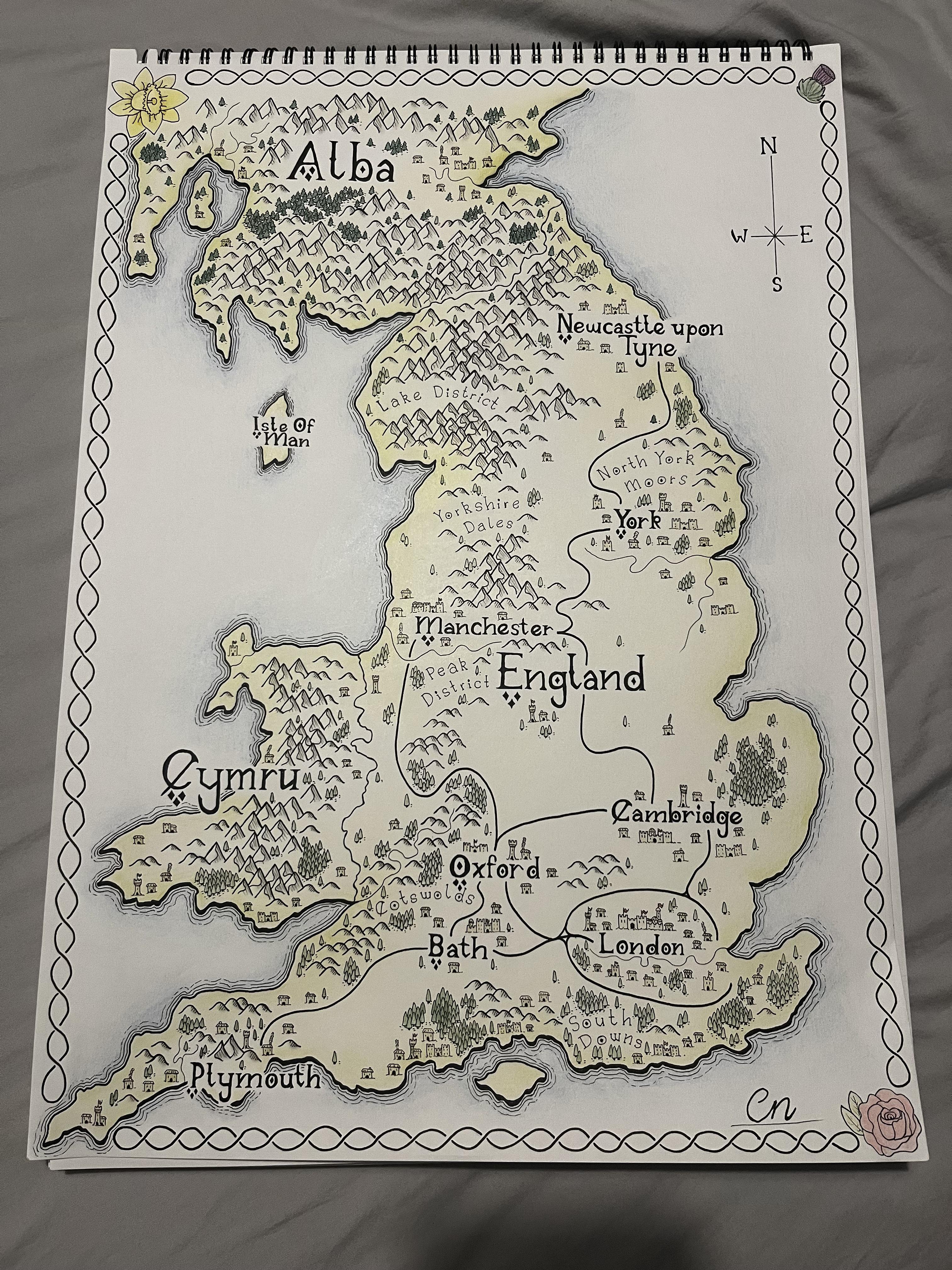
Fantasy Map of England Overview
This fantasy map of the British Isles, with a specific focus on England, presents a whimsical yet informative portrayal ...
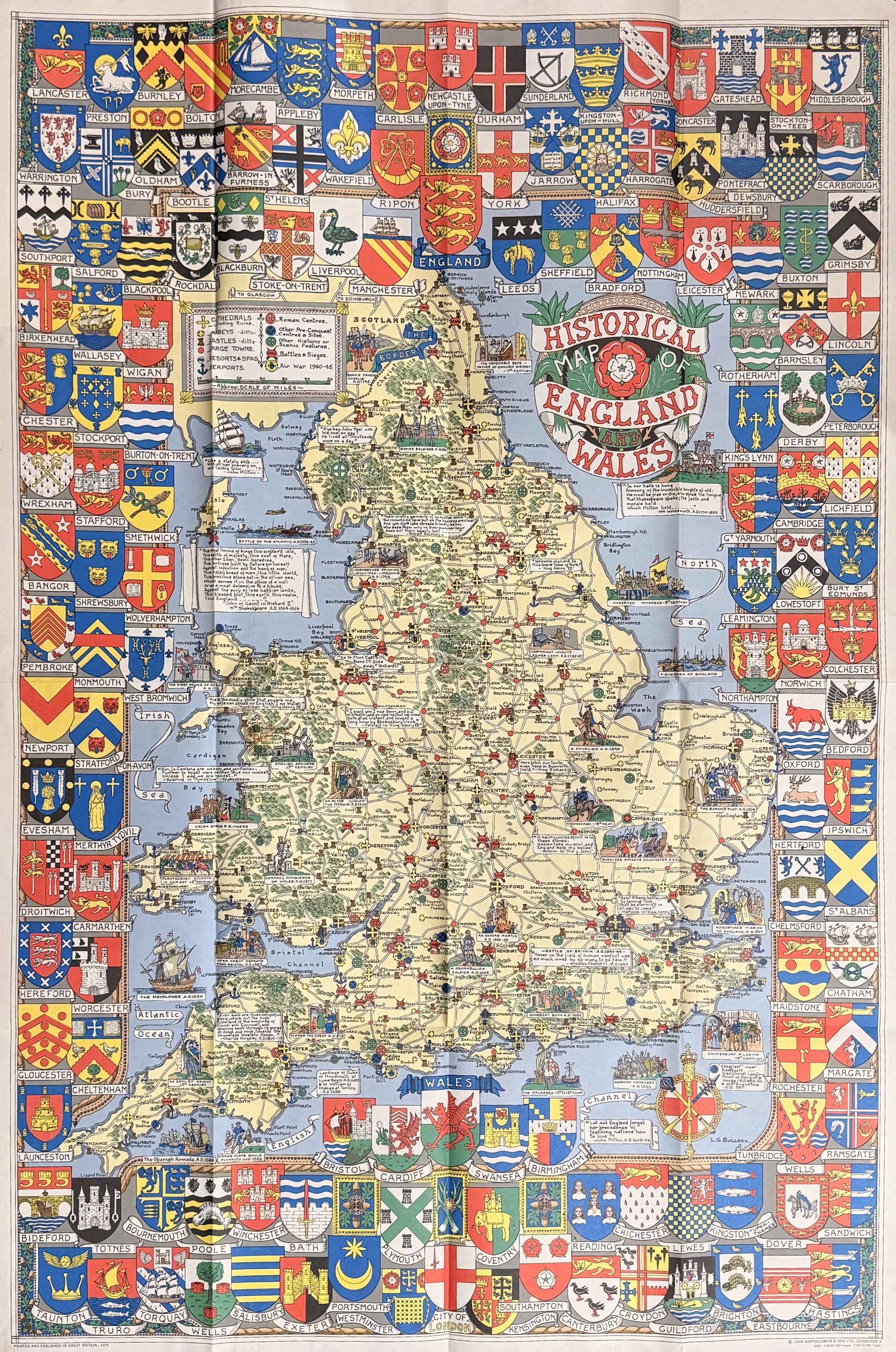
Historical Map of England & Wales from the 1970s
The Historical Map of England & Wales printed in the 1970s offers a fascinating glimpse into the geographical and cultur...