economic history Maps
8 geographic visualizations tagged with "economic history"
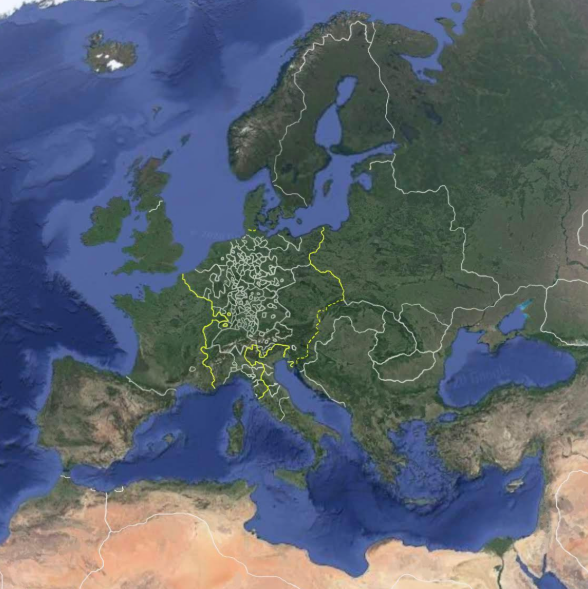
World Map of Trade Routes in 1600
This visualization, titled "Google Earth in 1600," provides an intriguing snapshot of the global trade routes that were ...
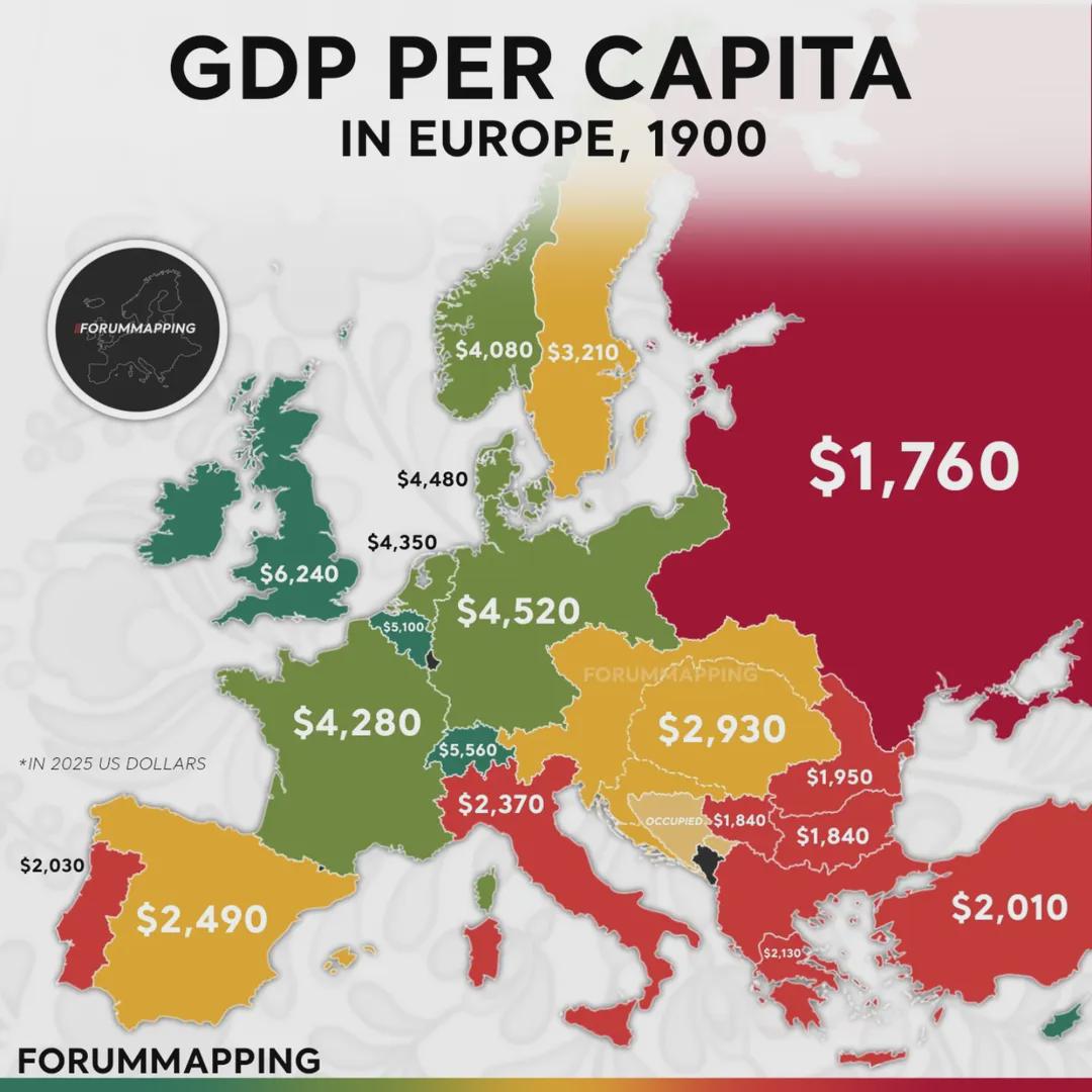
GDP Per Capita (PPP) in Europe Map
The map titled "GDP per Capita (PPP) in Europe (1900)" provides a compelling snapshot of economic disparities across the...
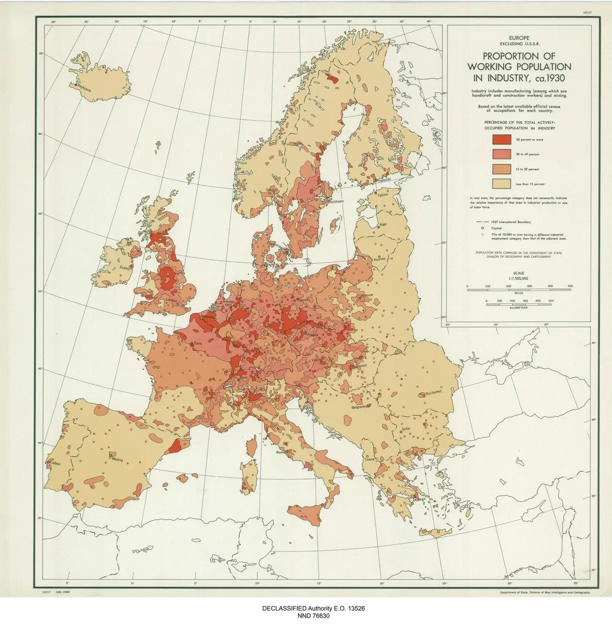
Map of Working Population in Industry in 1930s Europe
The map titled "Proportion of the Working Population Working in Industry in Europe in the 1930s" offers a fascinating gl...
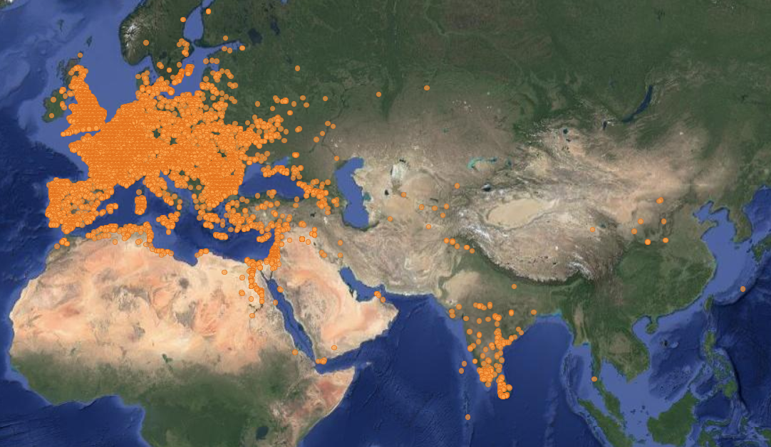
Map of Locations of Unearthed Roman Coins
This map illustrates the locations where Roman coins have been unearthed across various regions of Europe and the Medite...
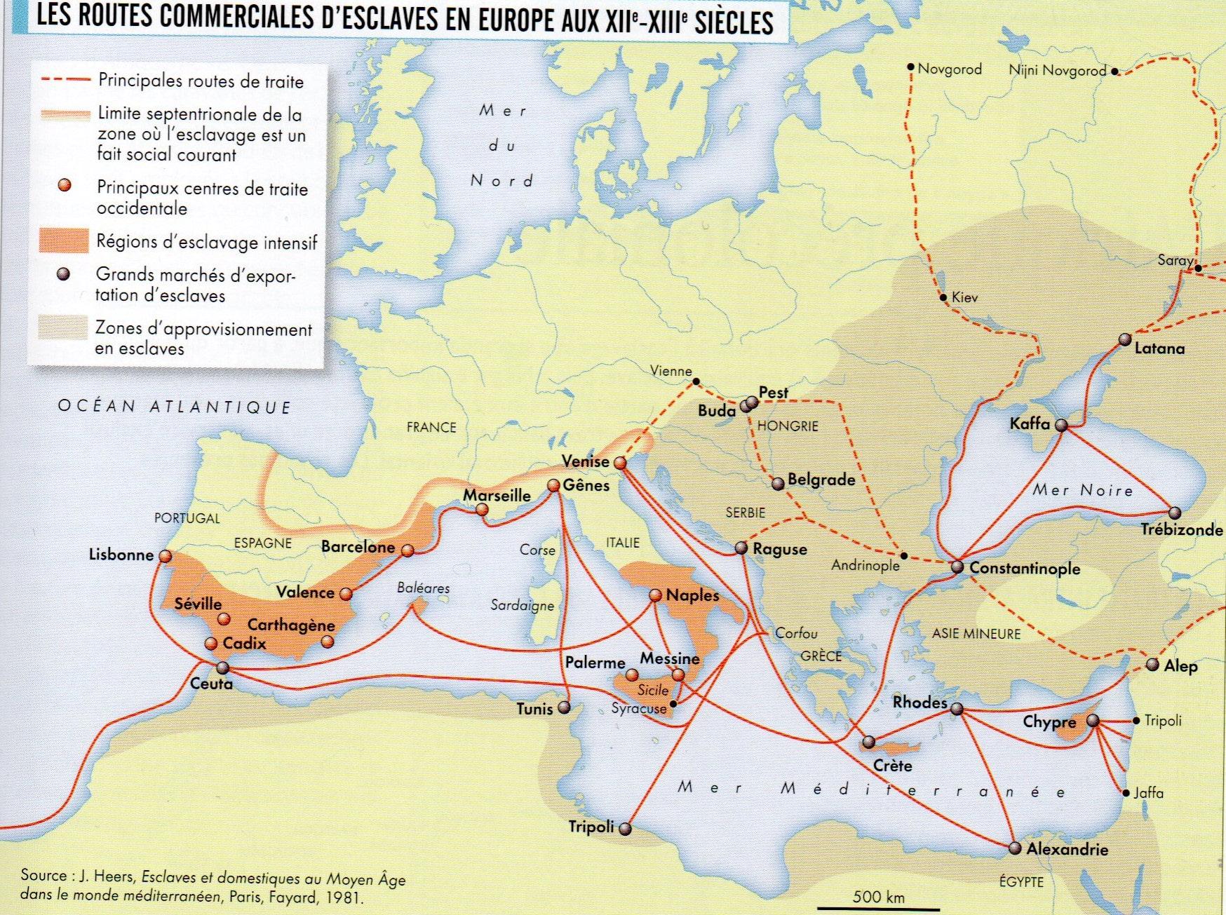
Map of the Slavic Slave Trade in Europe
This map presents a detailed overview of the Slavic slave trade that took place in Europe during the 12th and 13th centu...
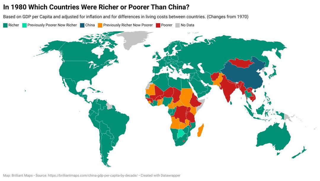
1980 GDP Comparison Map: Countries Richer or Poorer Than China
This visualization displays the GDP per capita of various countries in 1980, allowing us to see which nations were riche...
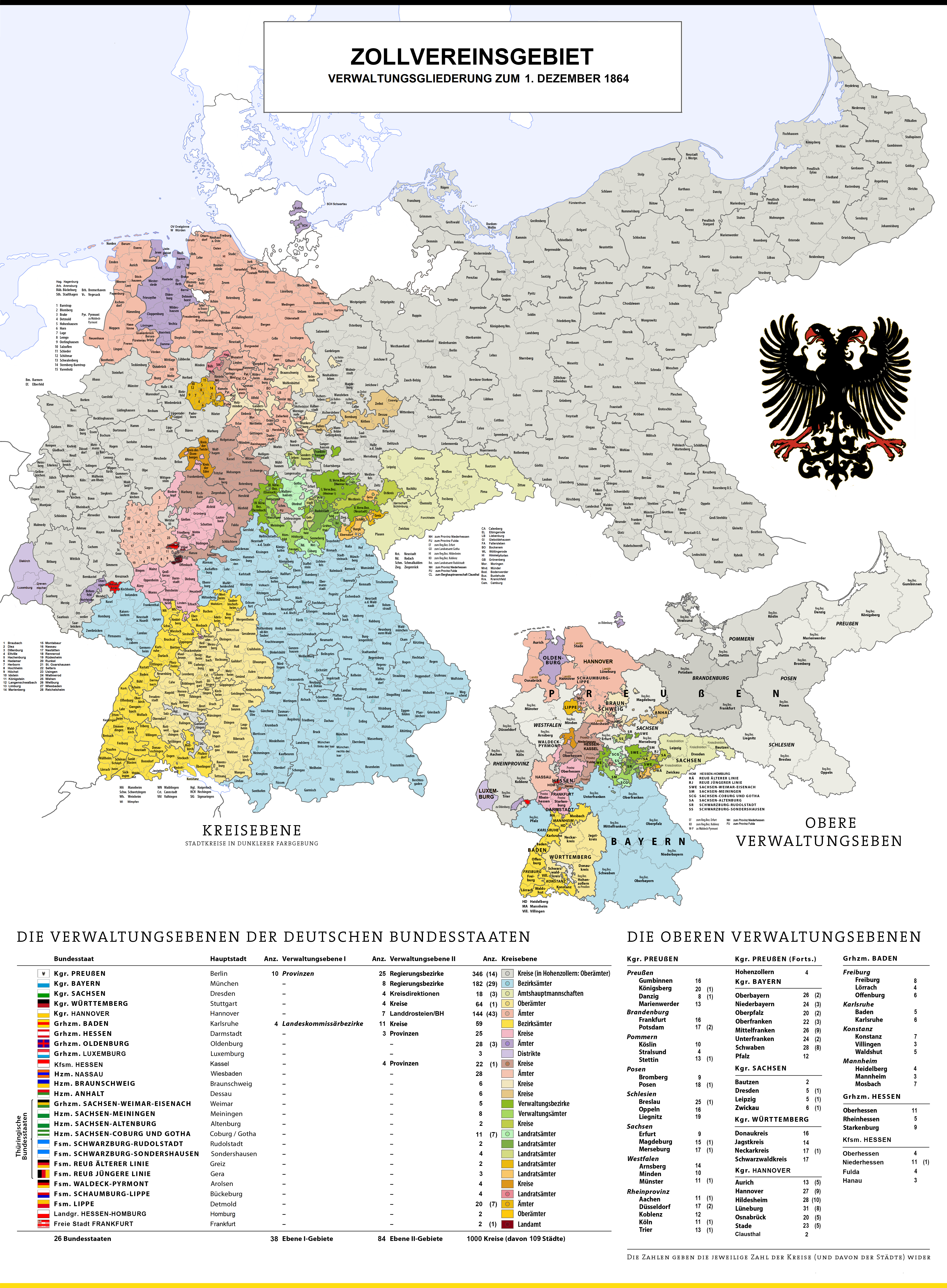
Map of Administrative Divisions of German Customs Union 1864
This visualization presents the administrative divisions of the German Customs Union as they were on December 1, 1864. T...
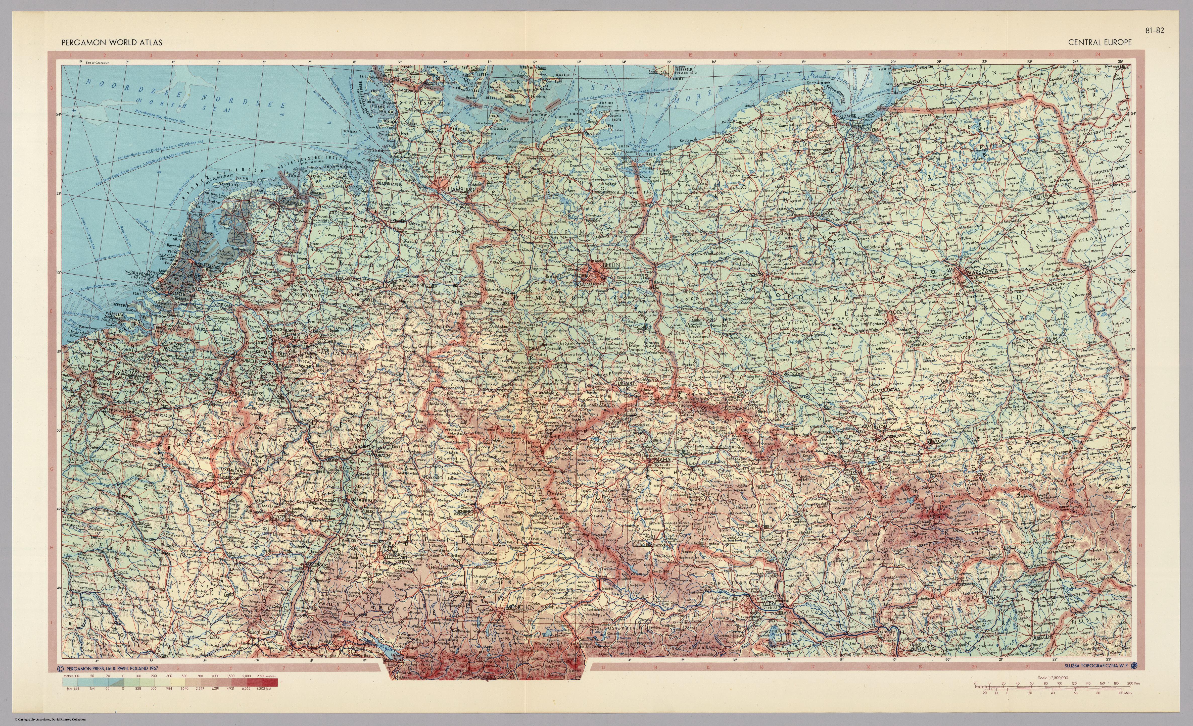
Central Europe Map of 1967
...