denmark Maps
7 geographic visualizations tagged with "denmark"
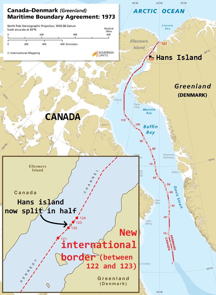
Hans Island Border Map Between Canada and Denmark
This map visually represents the unique land border established between Canada and Denmark in 2022, specifically splitti...
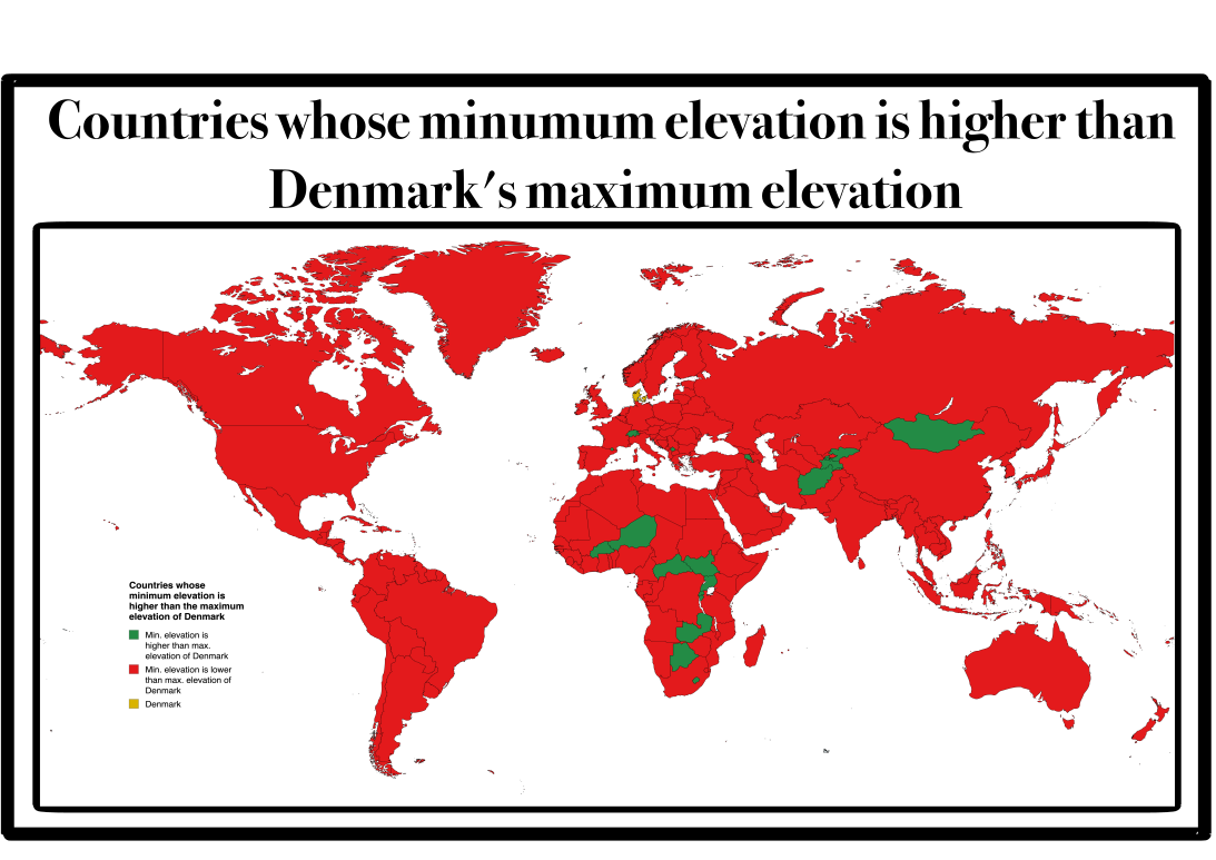
Map of Countries with Higher Lowest Points than Denmark
This map presents a unique geographical insight: it highlights countries whose lowest point is situated at a higher elev...
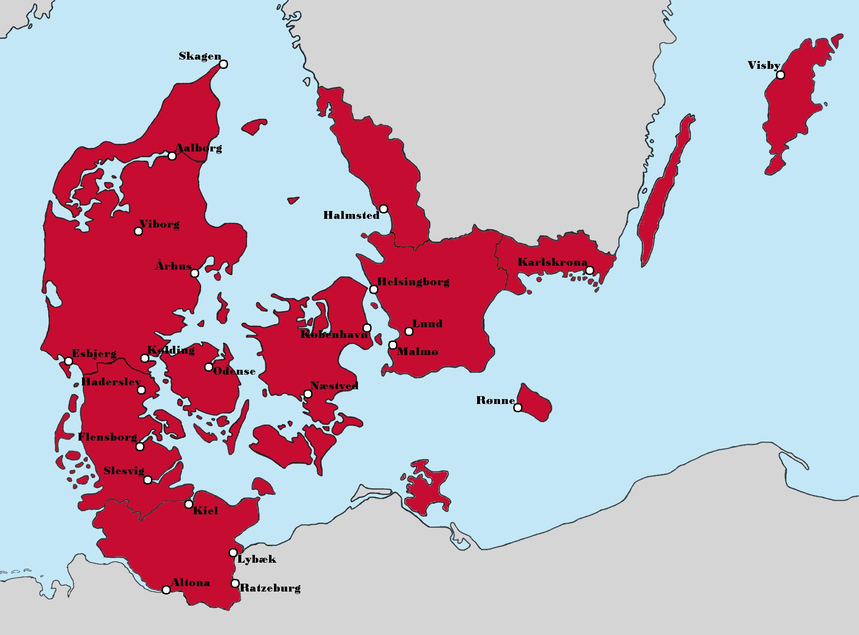
Aesthetic Map of Denmark's Political Landscape
The map titled "Politics aside, this version of Denmark looks really nice aesthetically" presents a unique visualization...
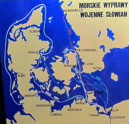
Map of Slavic Raids on Denmark Norway and Sweden
Interestingly, the motivations behind these Slavic incursions varied. While many were driven by the desire for plunder a...
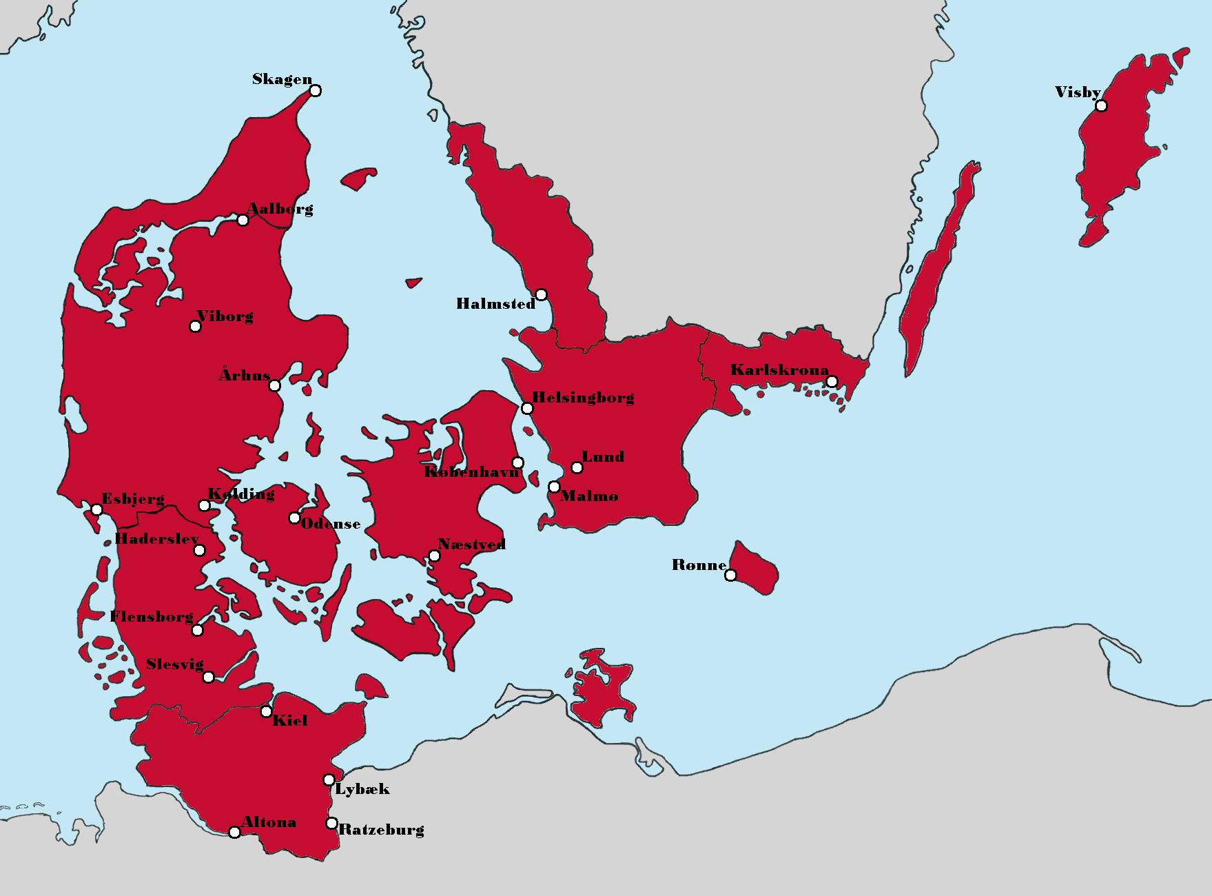
Greater Denmark Alternate History Map
The 'Greater Denmark (Alternate History)' map presents a fascinating reimagining of the Nordic region, highlighting a sc...
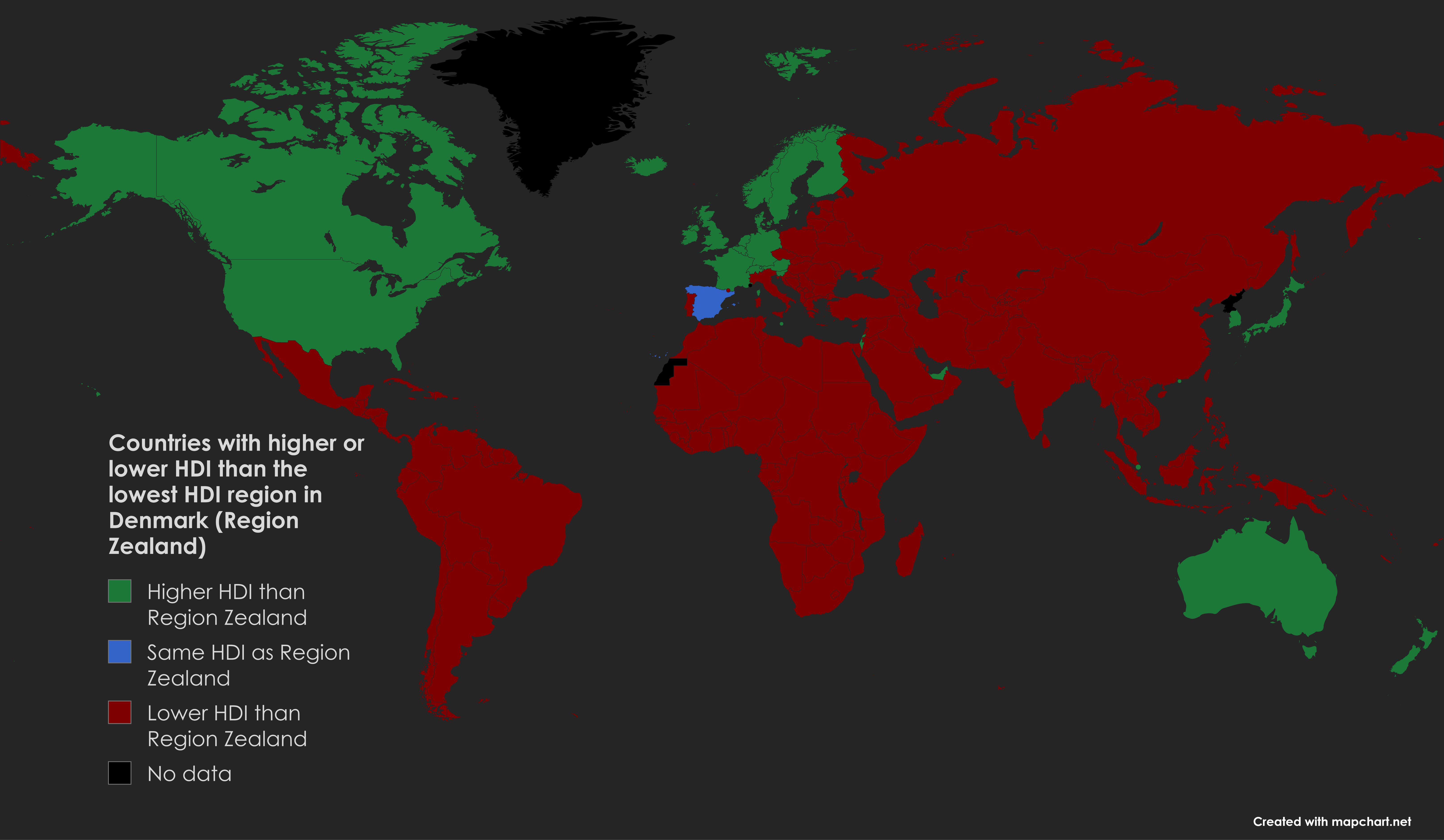
HDI Comparison Map of Zealand and Other Countries
The visualization titled "Countries with higher or lower HDI than Denmark's lowest HDI region (Region Zealand)" offers a...
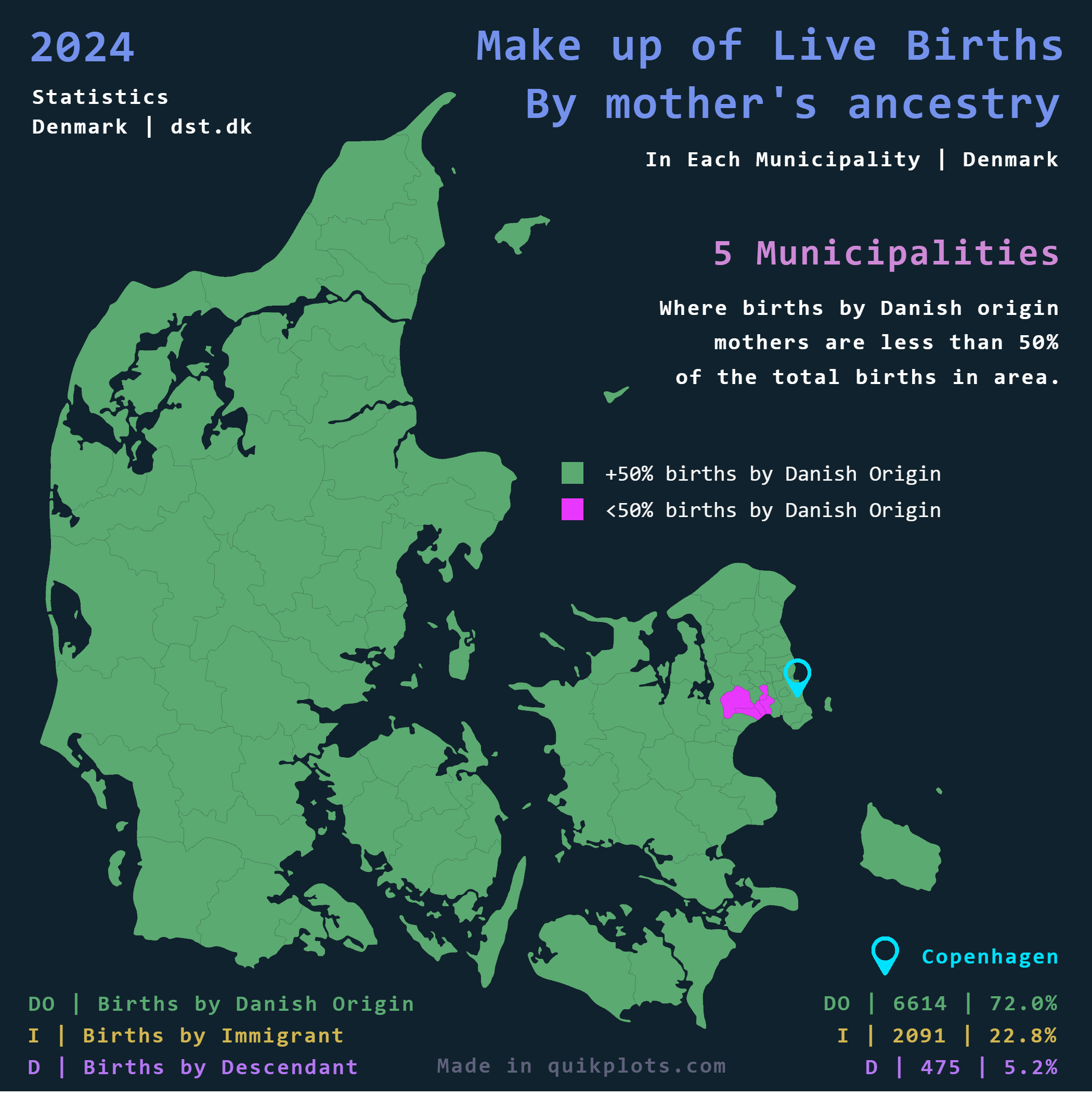
Births by Mother's Ancestry in Denmark Map
The \...