crusader states Maps
2 geographic visualizations tagged with "crusader states"

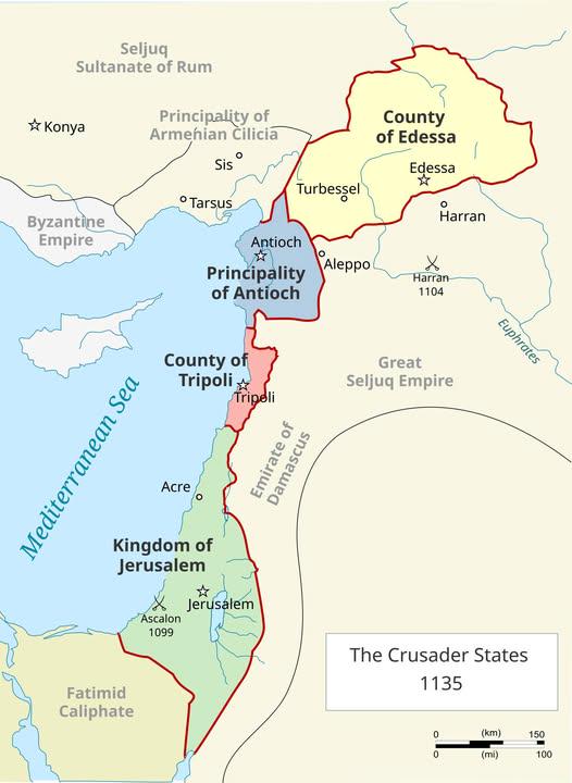
Map of the 4 Catholic Crusader States in 1135
The "Map of the 4 Catholic Crusader States in 1135" provides a snapshot of a pivotal period in medieval history, highlig...
👁 38📅 10/7/2025

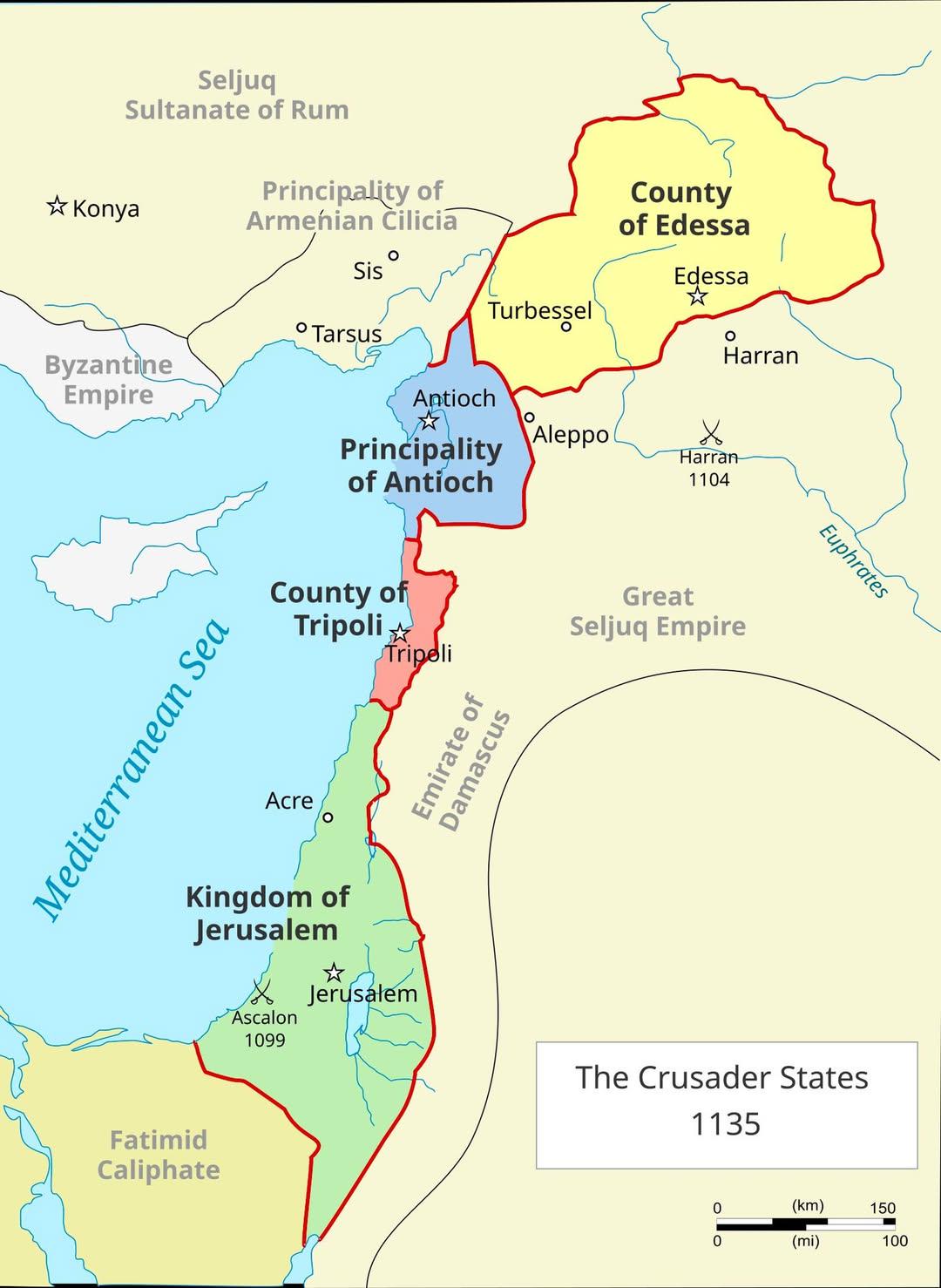
Crusader States in 1135 Map
The visualization titled "The Crusader States in 1135 Map" displays the territorial boundaries of the Crusader states es...
👁 10📅 10/26/2025