countries Maps
10 geographic visualizations tagged with "countries"
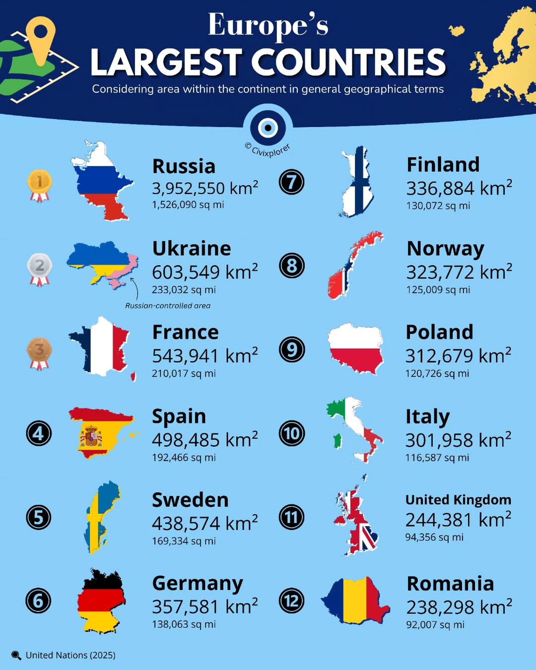
Largest Countries in Europe by Land Area Map
This map presents a clear visualization of the largest countries in Europe by land area, showcasing the vast differences...
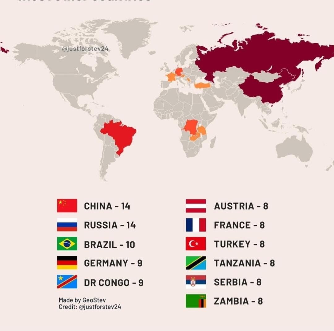
Countries That Border the Most Other Countries Map
This map illustrates the countries that share borders with the most other nations, highlighting the complex web of geopo...
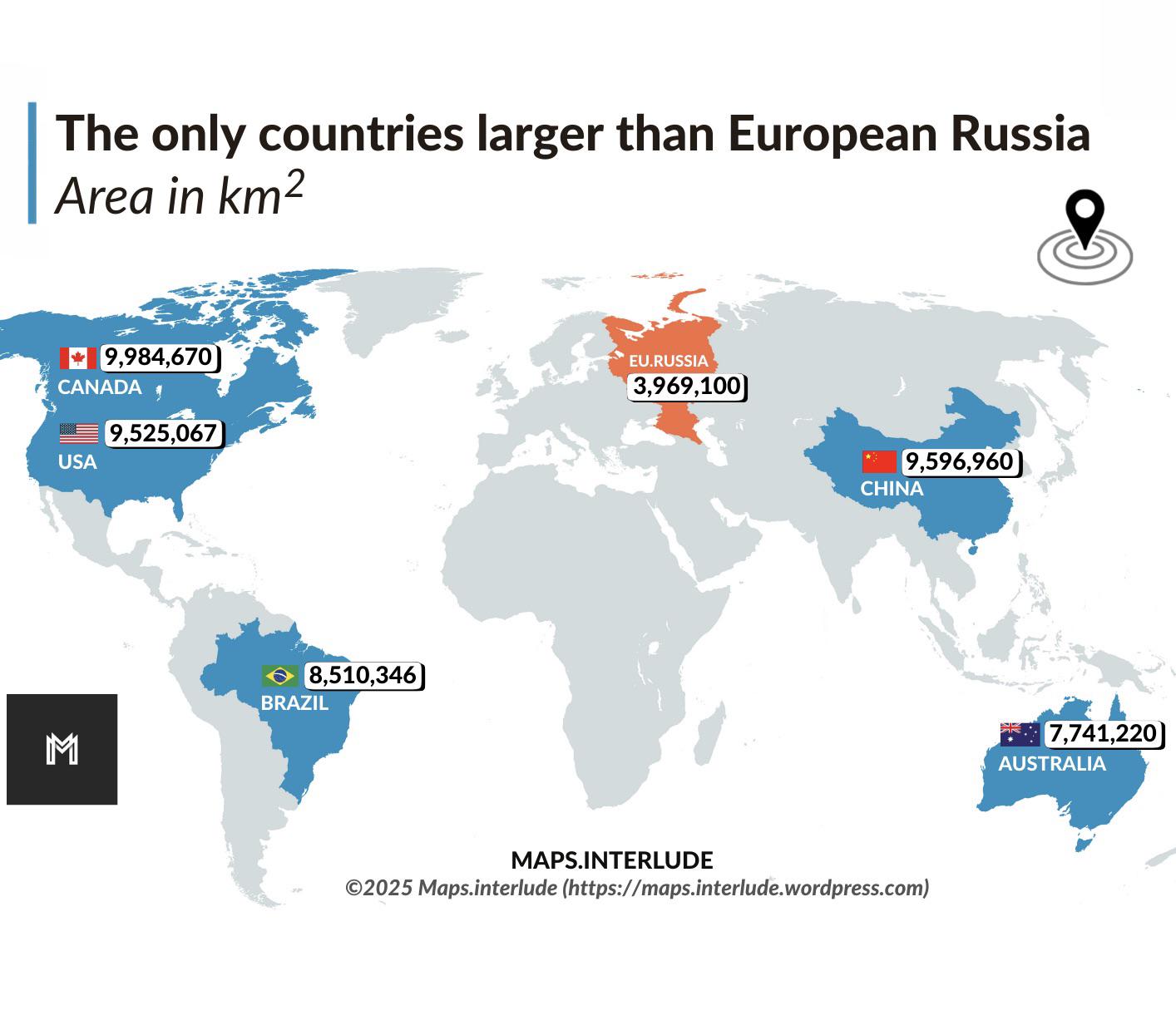
Map of Countries Larger than European Russia
This visualization highlights the countries that surpass European Russia in terms of land area. European Russia, which e...
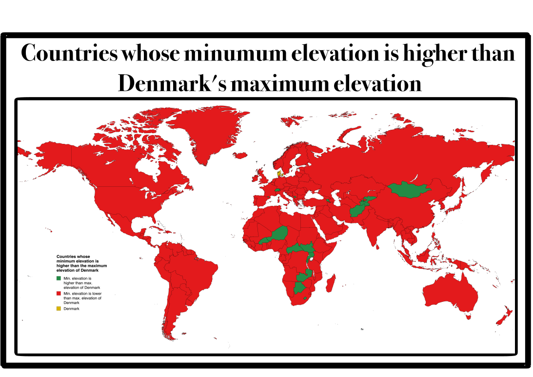
Map of Countries with Higher Lowest Points than Denmark
This map presents a unique geographical insight: it highlights countries whose lowest point is situated at a higher elev...
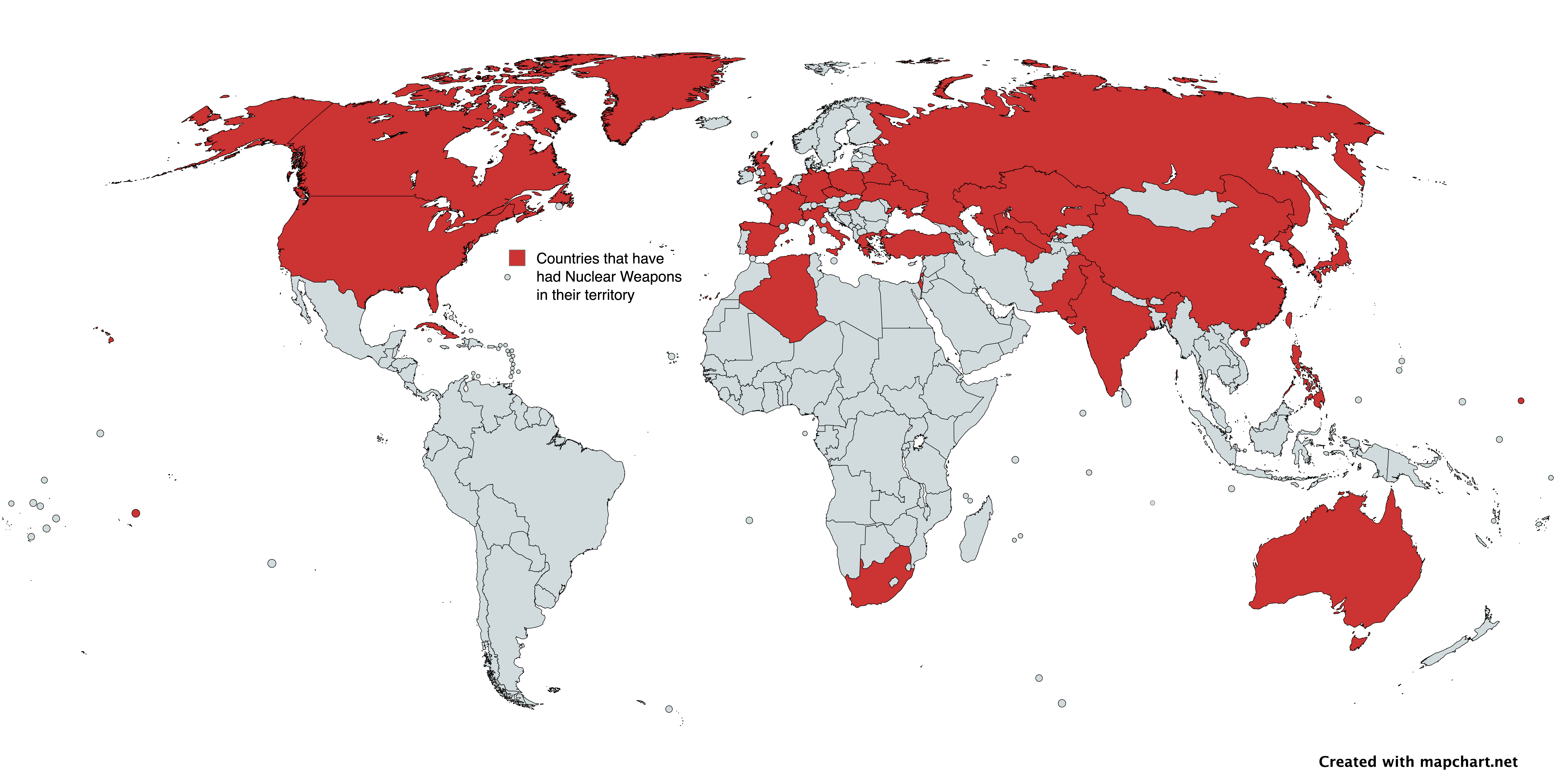
Countries with Nuclear Weapons Map
The map titled "Countries with Nuclear Weapons" provides a visual representation of nations that have had nuclear weapon...
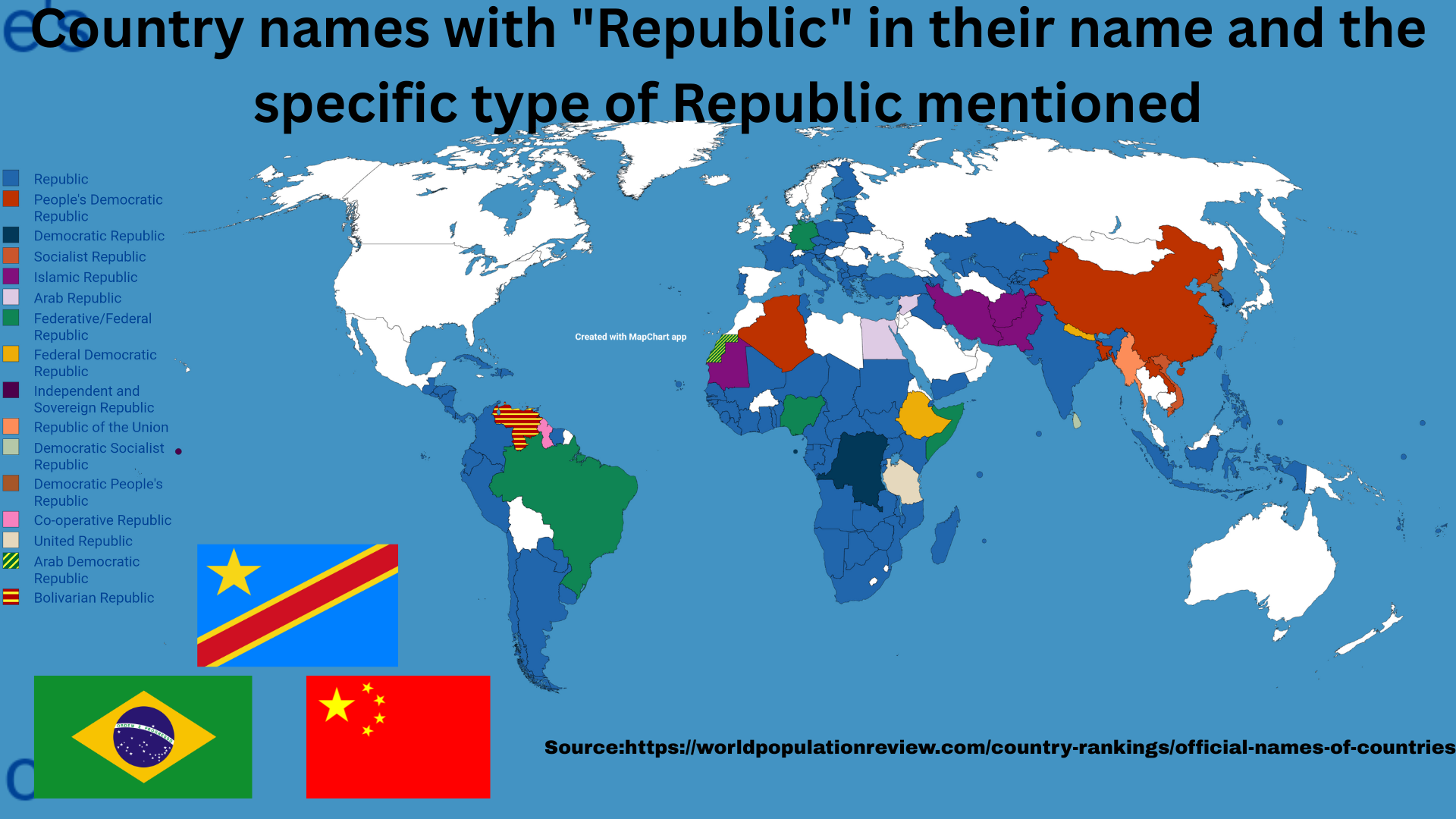
Countries with 'Republic' in Their Names Map
This map vividly illustrates the countries around the globe that incorporate the term 'Republic' in their official names...
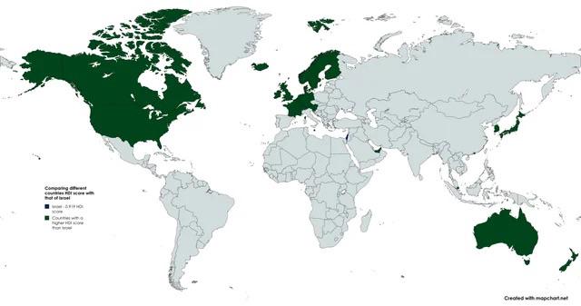
Countries with Higher HDI than Israel Map
The "Countries with Higher HDI than Israel Map" presents a visual representation of nations that boast a higher Human De...
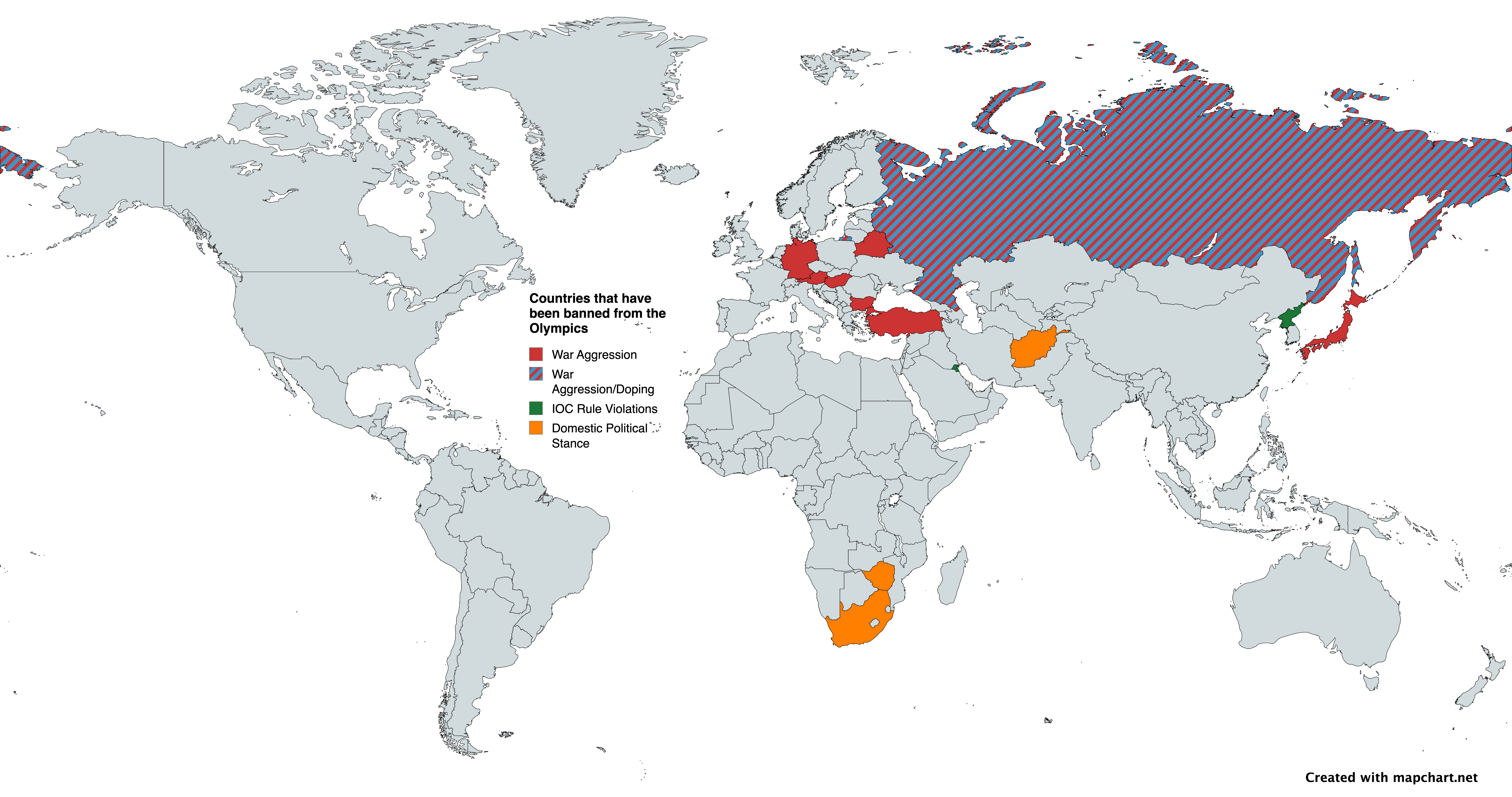
Countries Banned from the Modern Olympic Games Map
This map illustrates the countries that have faced bans from participating in the Modern Olympic Games, highlighting ins...
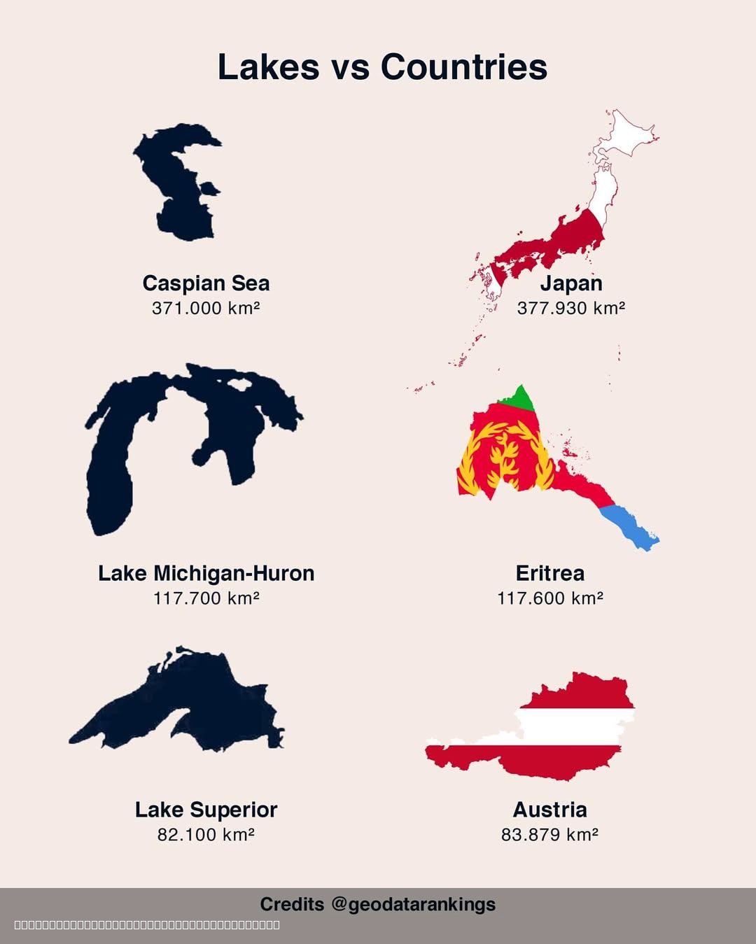
Lakes and Countries Size Comparison Map
The "3 Lakes vs 3 Countries Size Comparison Map" offers a compelling visual representation that juxtaposes the sizes of ...
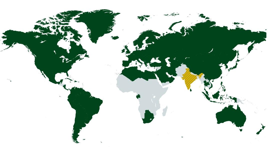
Map of Countries with Higher HDI than Maharashtra
This map visually represents countries that boast a higher Human Development Index (HDI) than Maharashtra, India’s wealt...