cost of living Maps
8 geographic visualizations tagged with "cost of living"
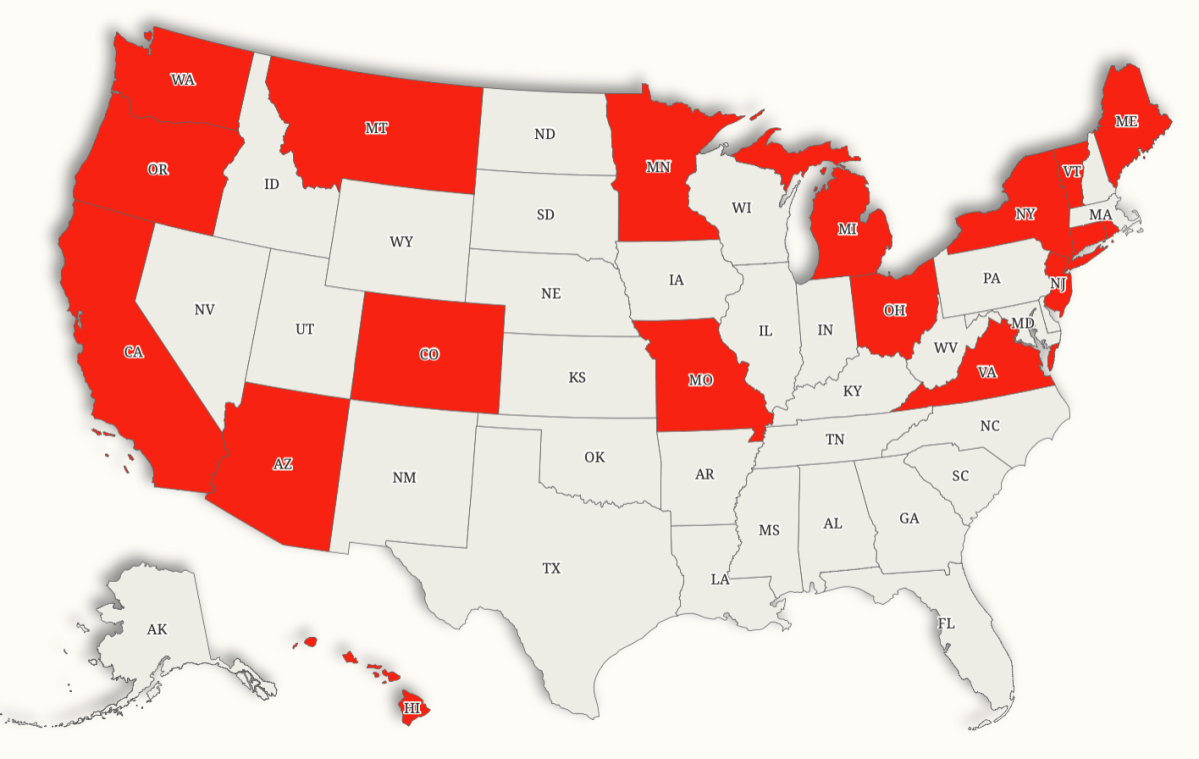
Minimum Wage Increases by State Map
This map illustrates the states in the U.S. that are scheduled to raise their minimum wage in 2026. It provides a clear ...
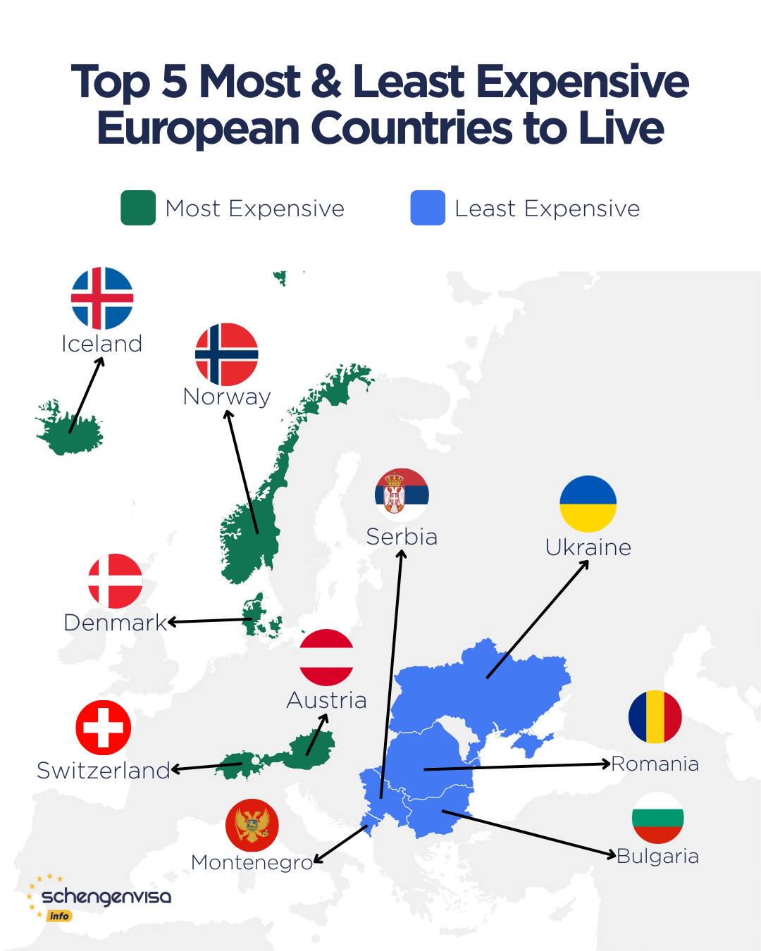
Most Expensive and Affordable Countries to Live in Europe Map
This map highlights the stark contrast between the most expensive and most affordable countries to live in Europe, prese...
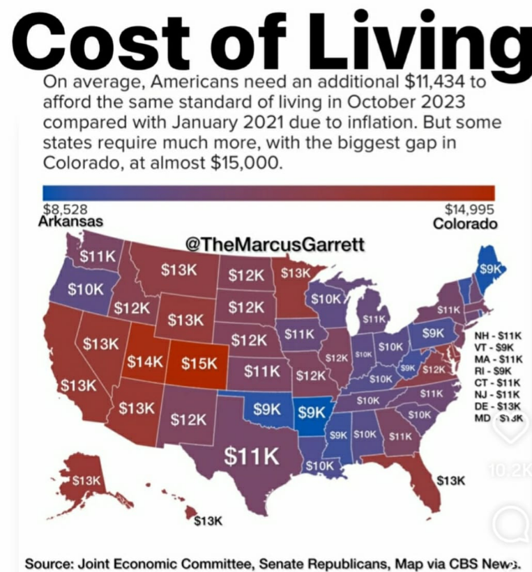
Cost of Living Increase by State Map
The visualization titled "The Shocking Difference in Cost of Living Increase Across U.S. States" effectively highlights ...
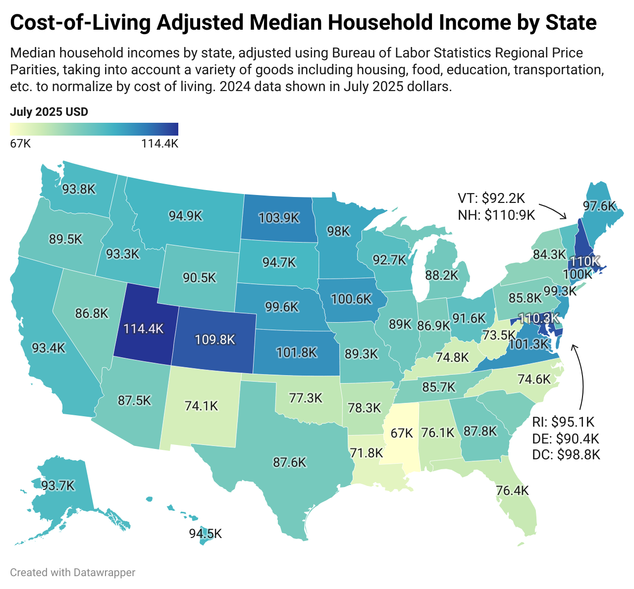
Cost-of-Living Adjusted Median Household Income by State Map
The "Cost-of-Living Adjusted Median Household Income by State Map" provides a comprehensive view of how median household...
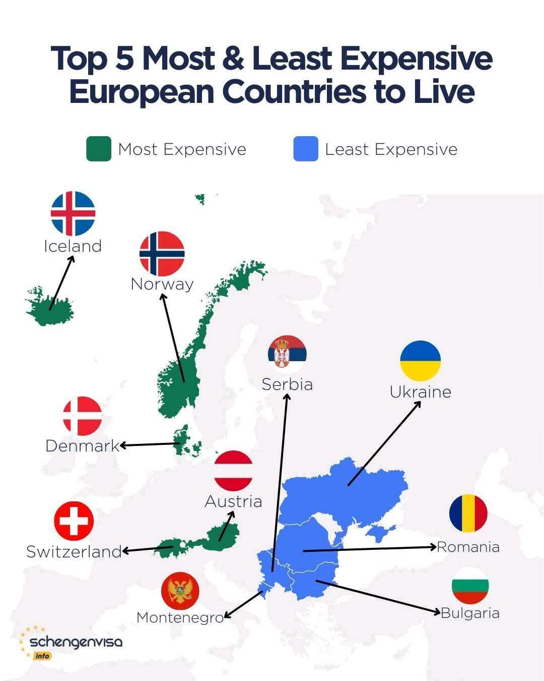
Affordable Living Map of Europe
The "Affordable Living Map of Europe" provides a comprehensive visualization of the varying costs of living across diffe...
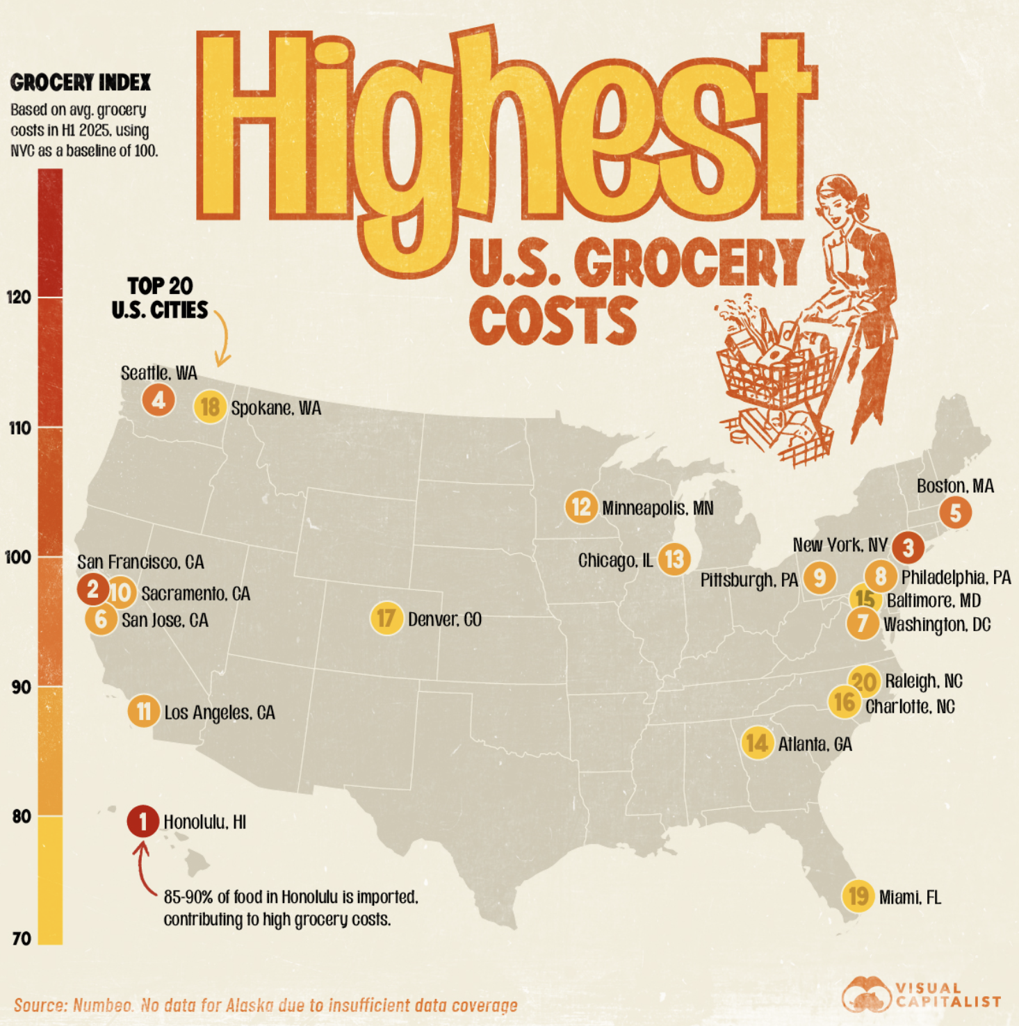
Grocery Cost Map of U.S. Cities
The "MapsRanked: U.S. Cities With the Highest Cost of Groceries" visualization provides a comprehensive snapshot of groc...
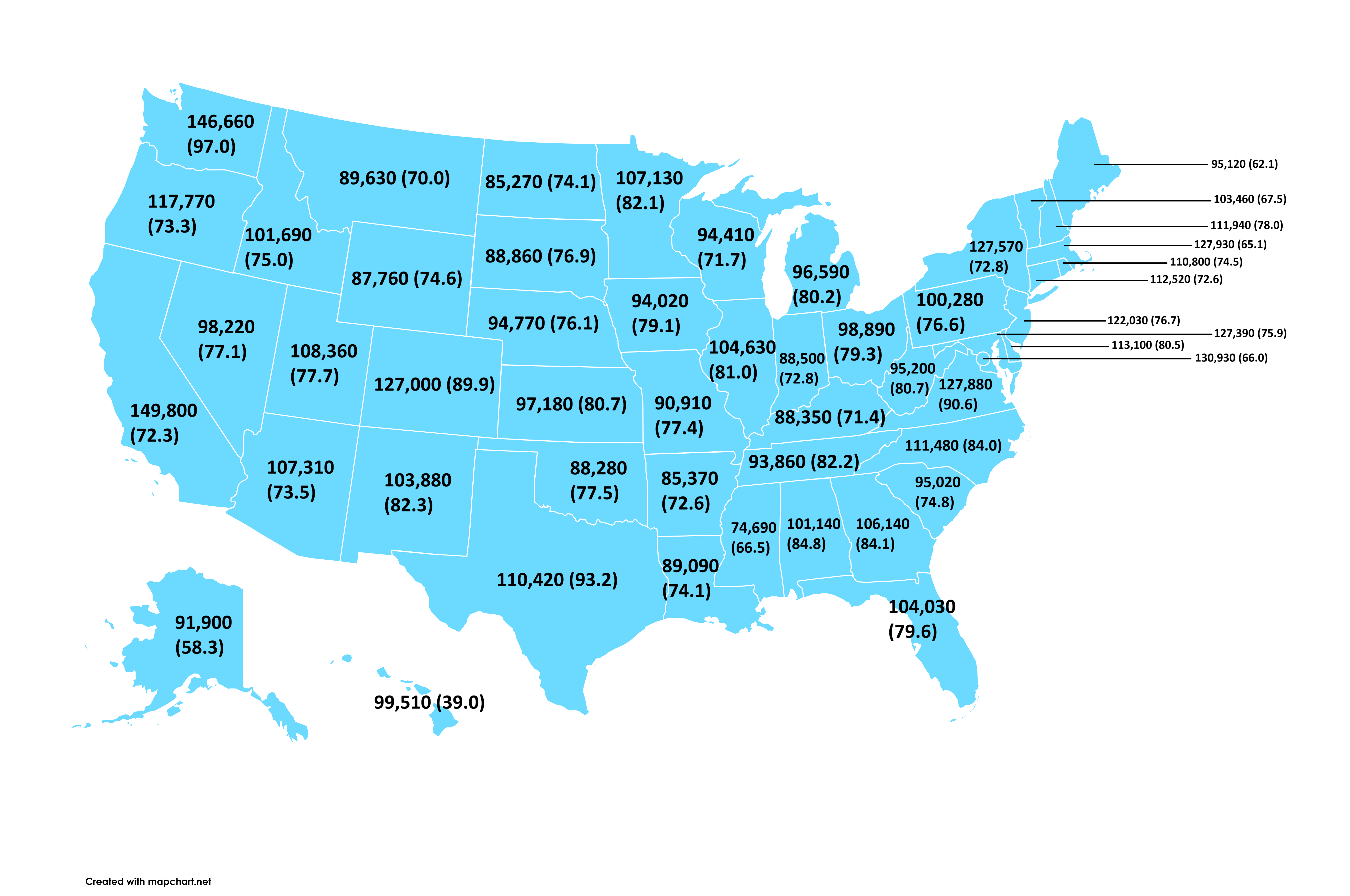
Computer and Mathematical Occupations Average Salary Map
This map provides a comprehensive overview of average salaries for computer and mathematical occupations across the Unit...
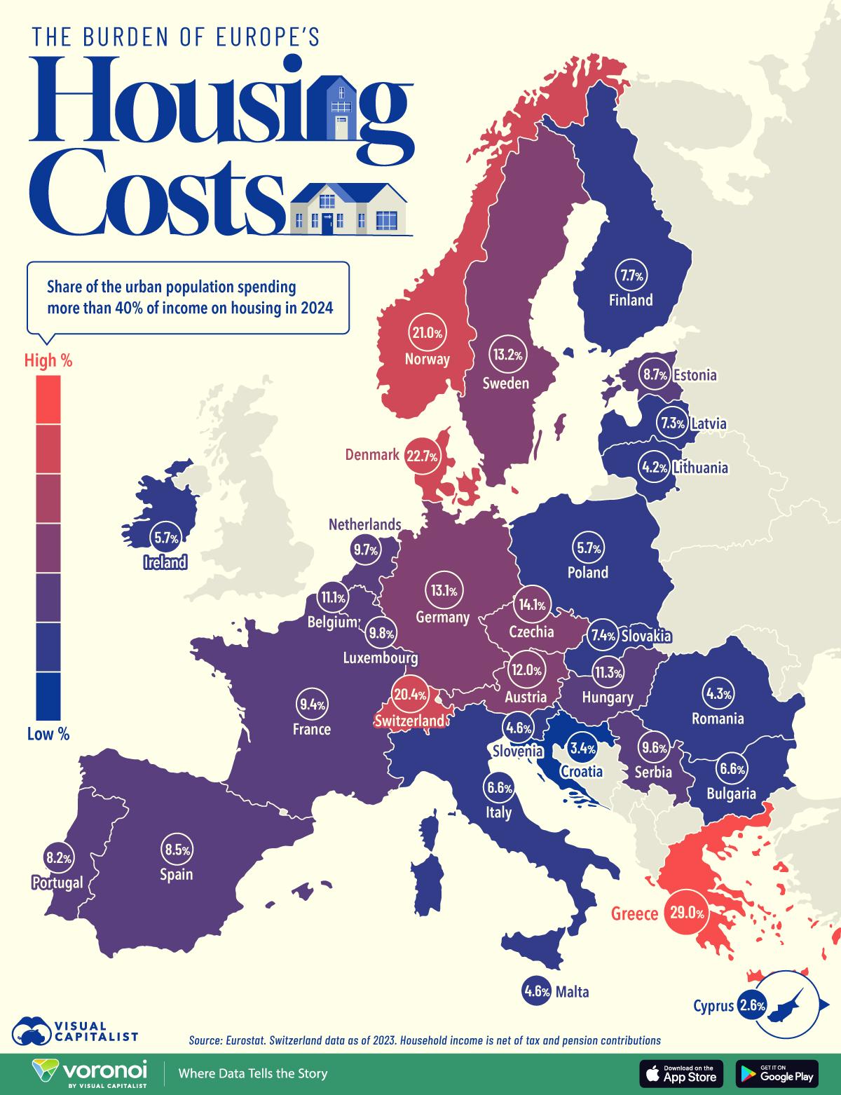
Europe’s Housing Cost Burden by Country Map
The "Europe’s Housing Cost Burden by Country" map provides a visual representation of how housing costs vary across Euro...