central europe Maps
8 geographic visualizations tagged with "central europe"
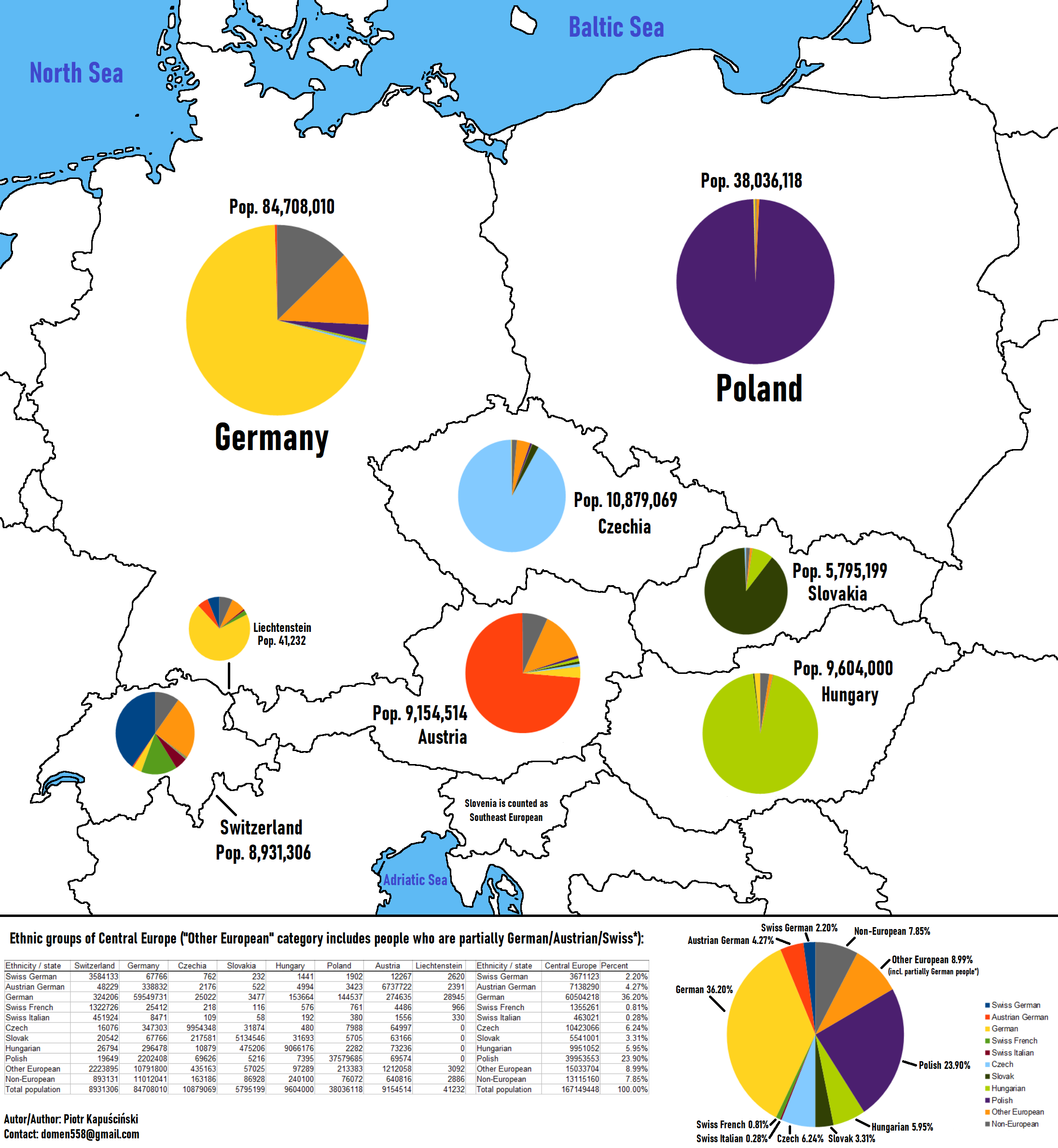
Ethnic Groups of Central Europe Map
This updated map of Central Europe provides a detailed visualization of the various ethnic groups within the region, sho...
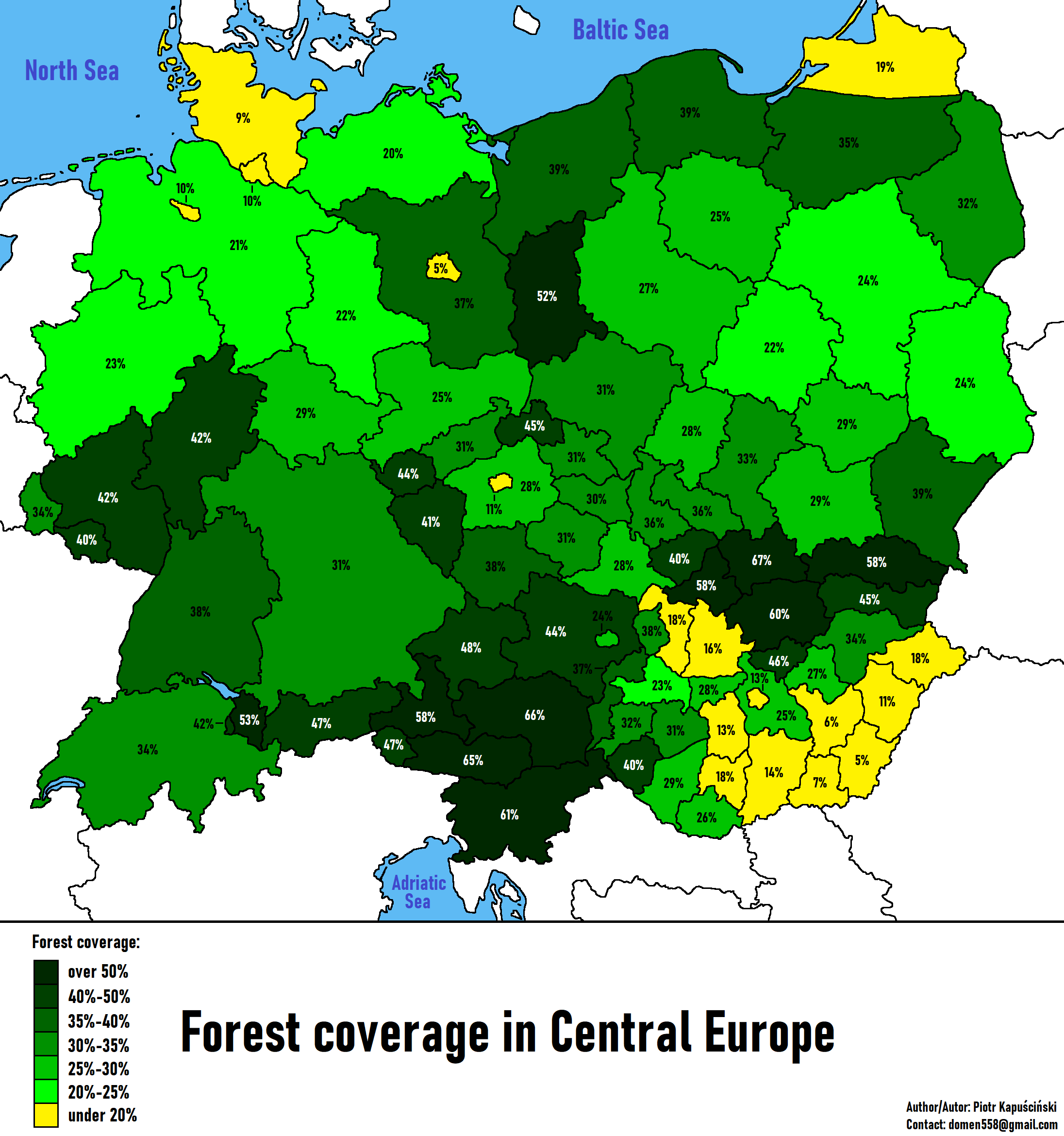
Forest Coverage in Central Europe Map
The "Forest Coverage in Central Europe Map" provides a comprehensive overview of the forested areas across several key c...
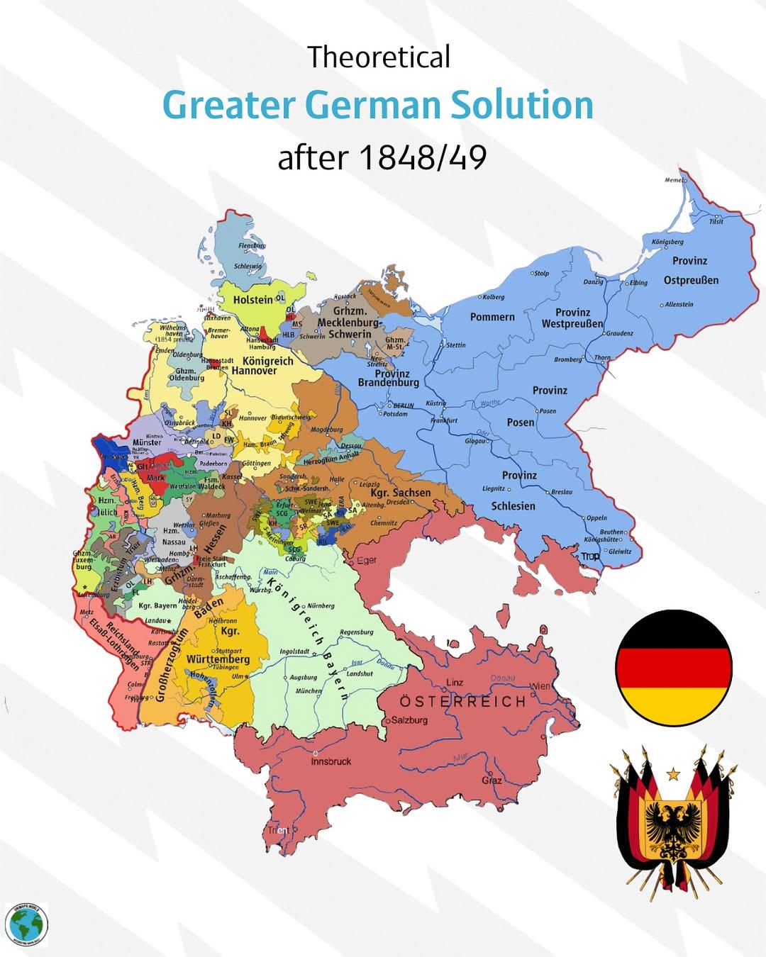
Greater German Solution Map 1848-1849
...
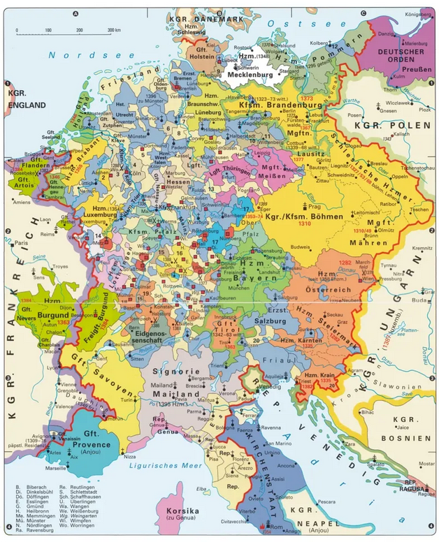
Map of the Holy Roman Empire in 1387
The "Map of the Holy Roman Empire in 1387" provides a detailed representation of the political landscape of Central Euro...
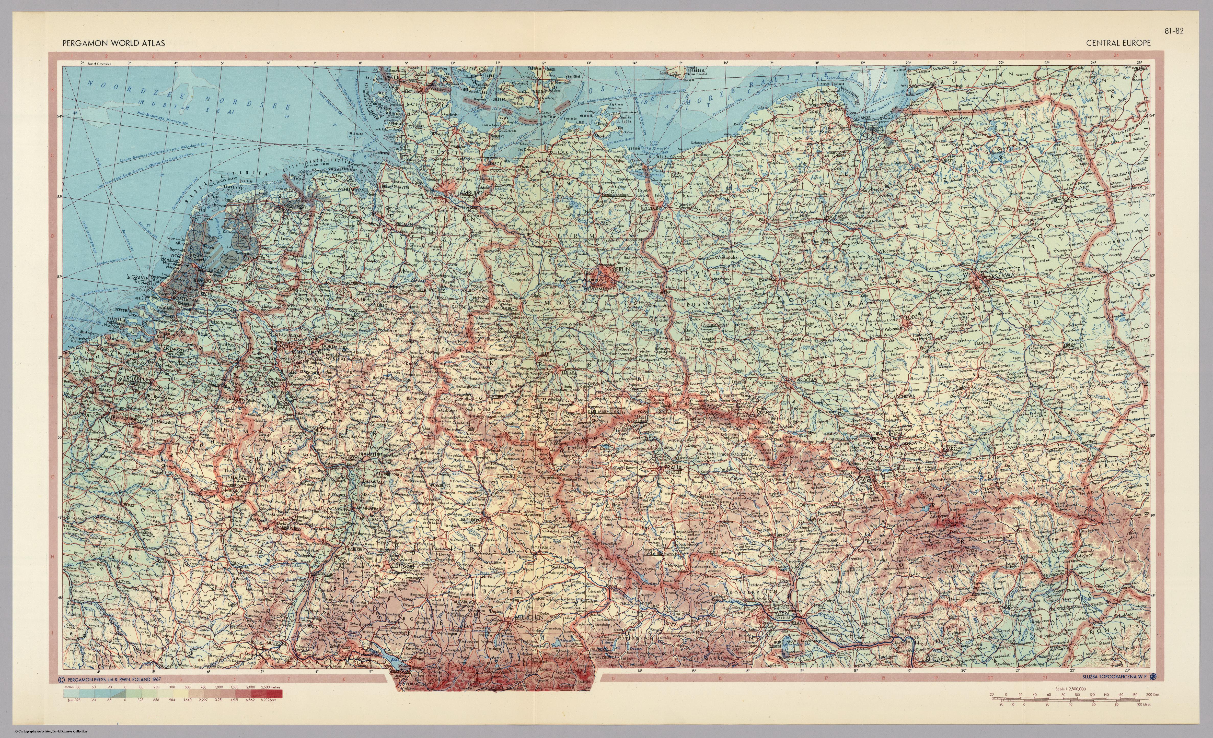
Central Europe Map of 1967
...
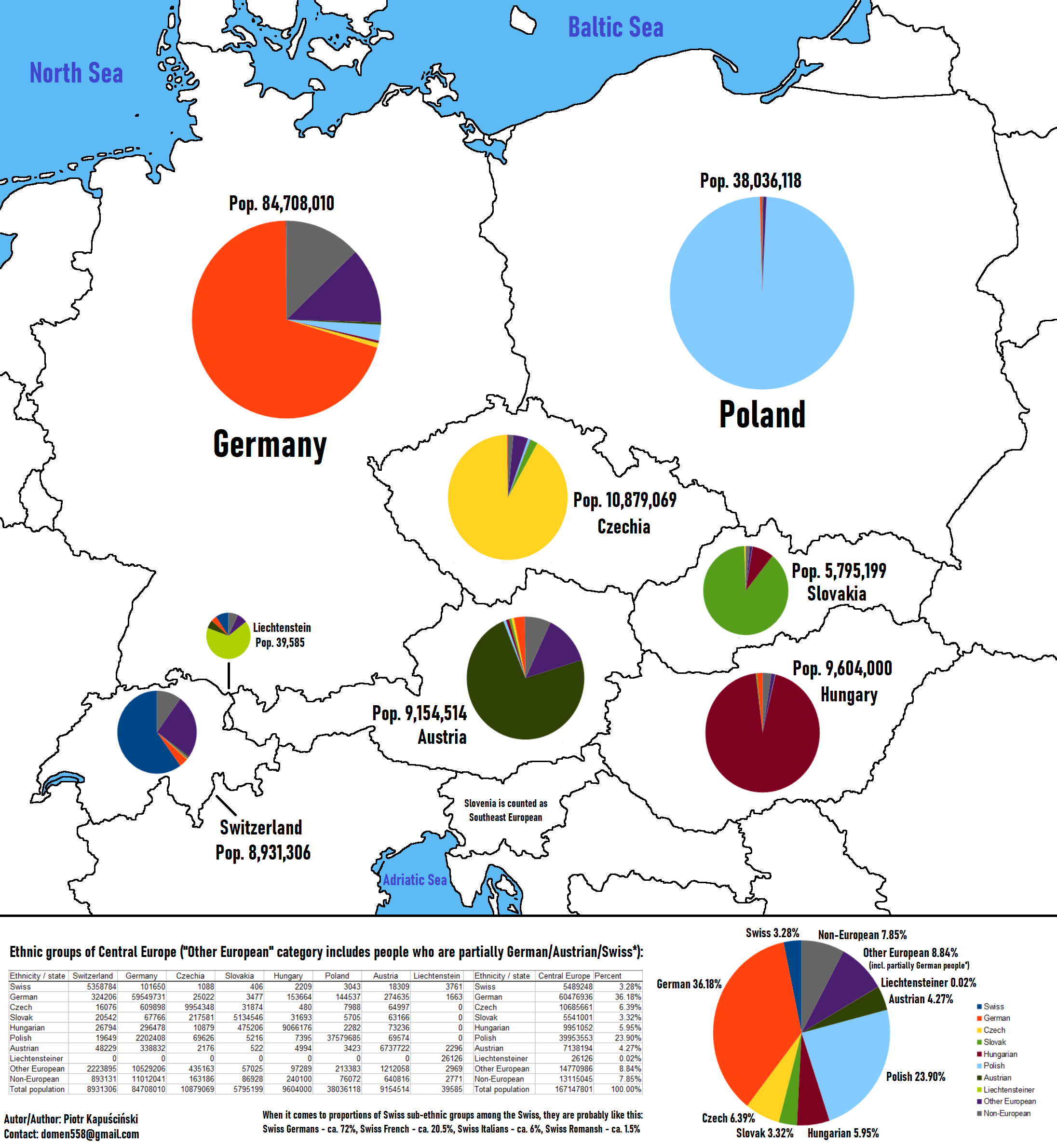
Ethnic Groups of Central Europe Map
This map provides a detailed visualization of the ethnic groups residing in Central Europe, highlighting the diverse cul...
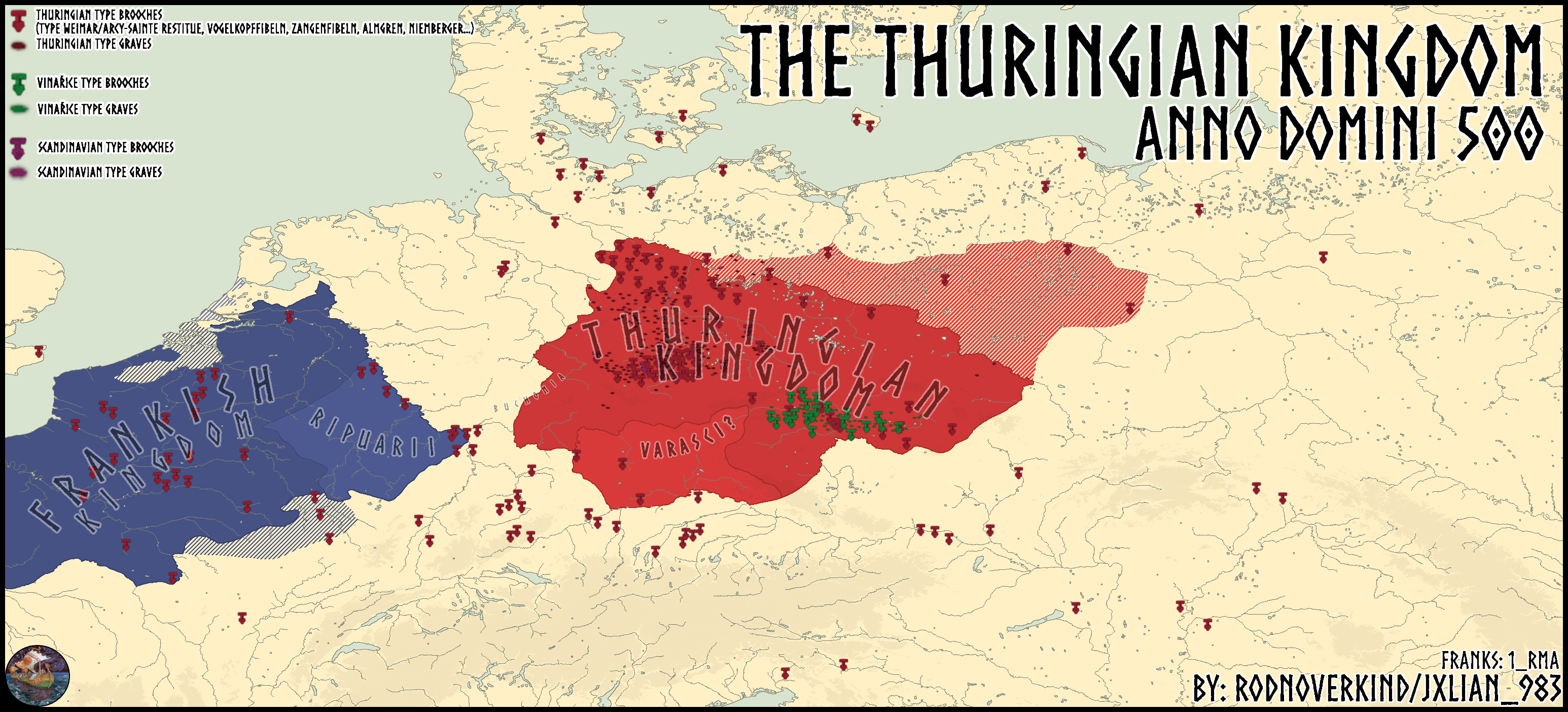
Thuringian Kingdom Map in 500 A.D.
The map titled "The Thuringian Kingdom in 500 A.D." provides a detailed geographical representation of the Thuringian Ki...
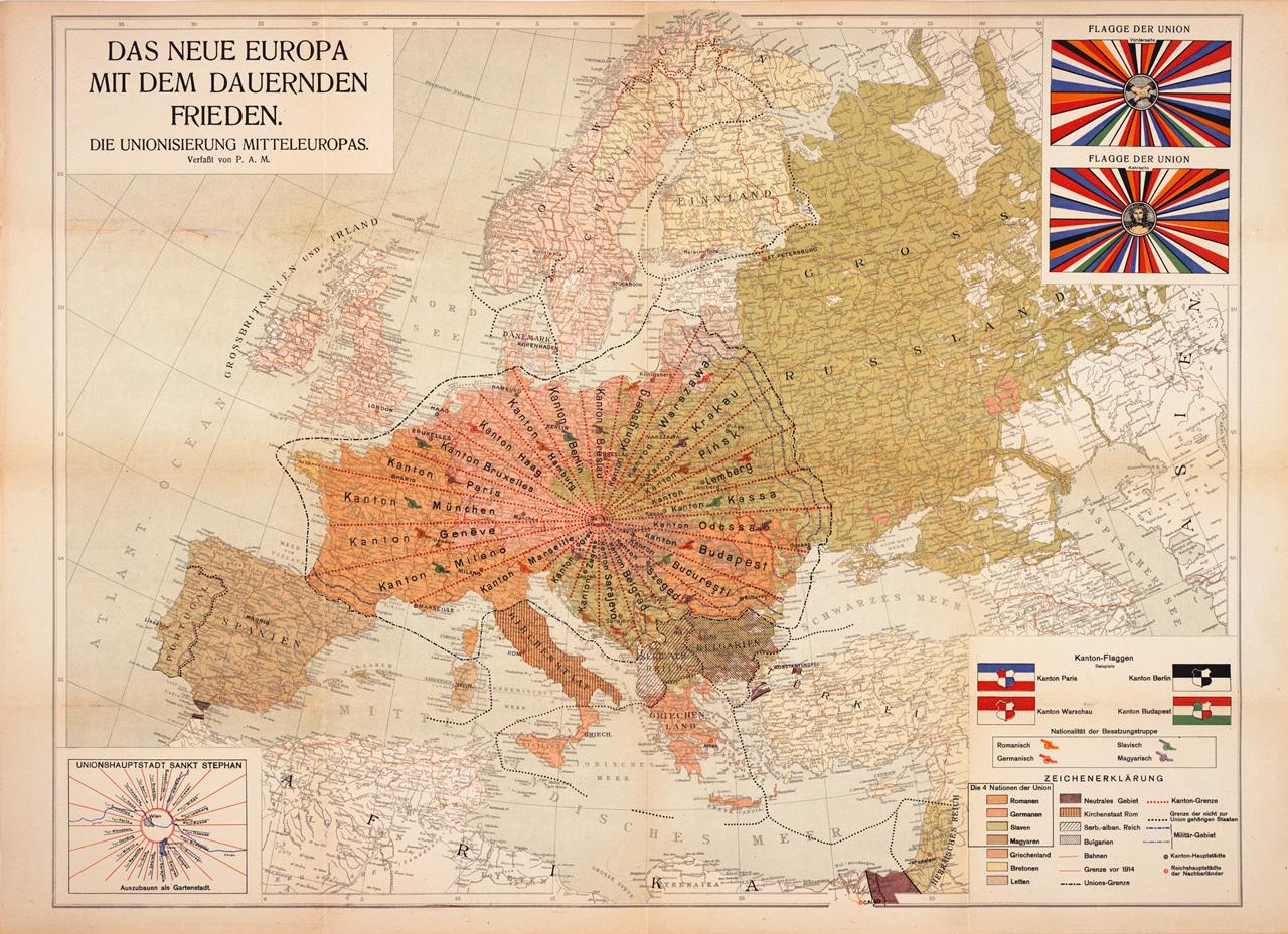
1920 Central Europe Utopian Cantons Map
The 1920 plan of United Central Europe, published in Vienna by Otto Maas’ Sons with P. A. Maas as the self-publisher, of...