census Maps
7 geographic visualizations tagged with "census"
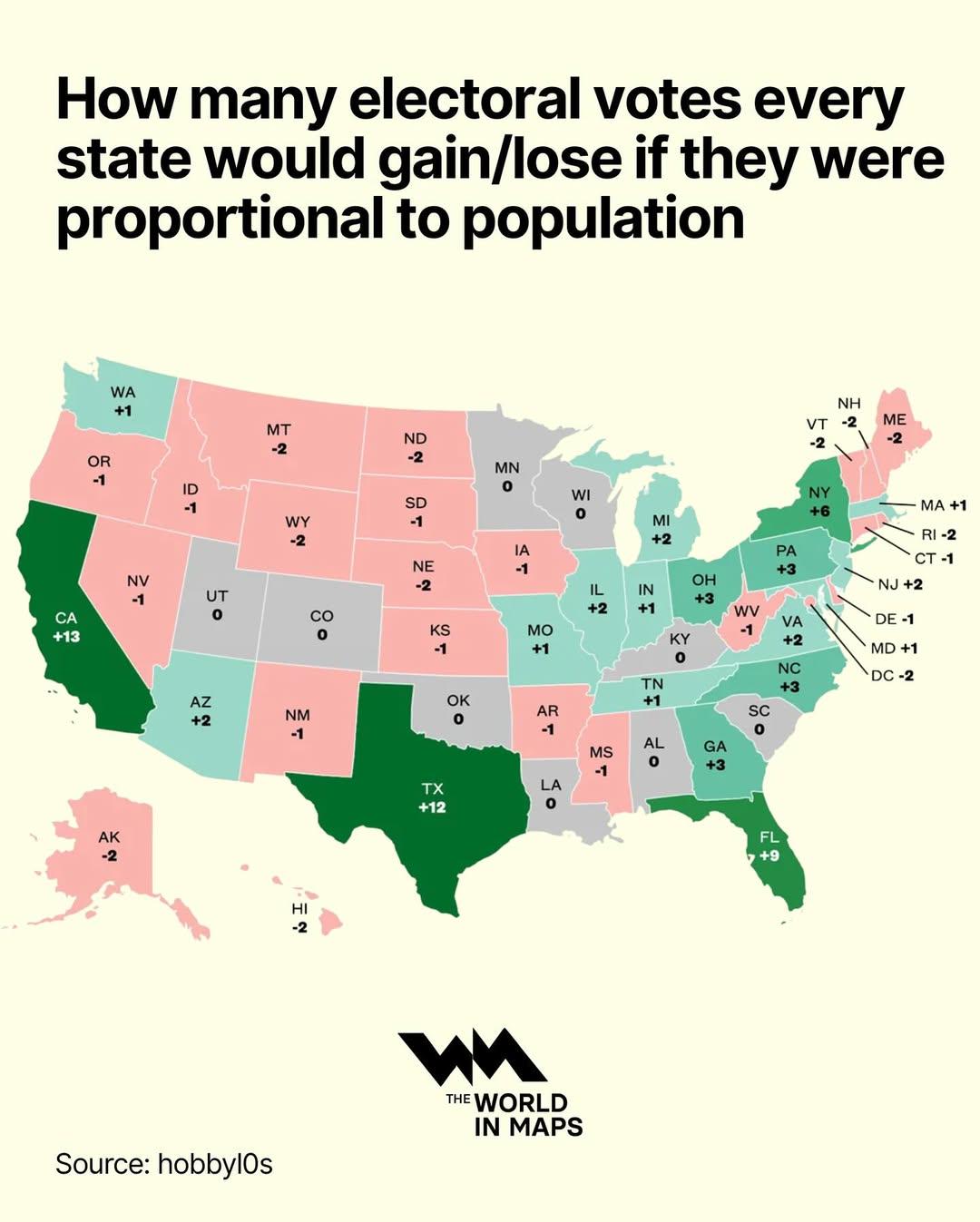
Electoral Votes by State Population Map
This map visualizes how the allocation of electoral votes would change if they were distributed proportionally to the po...
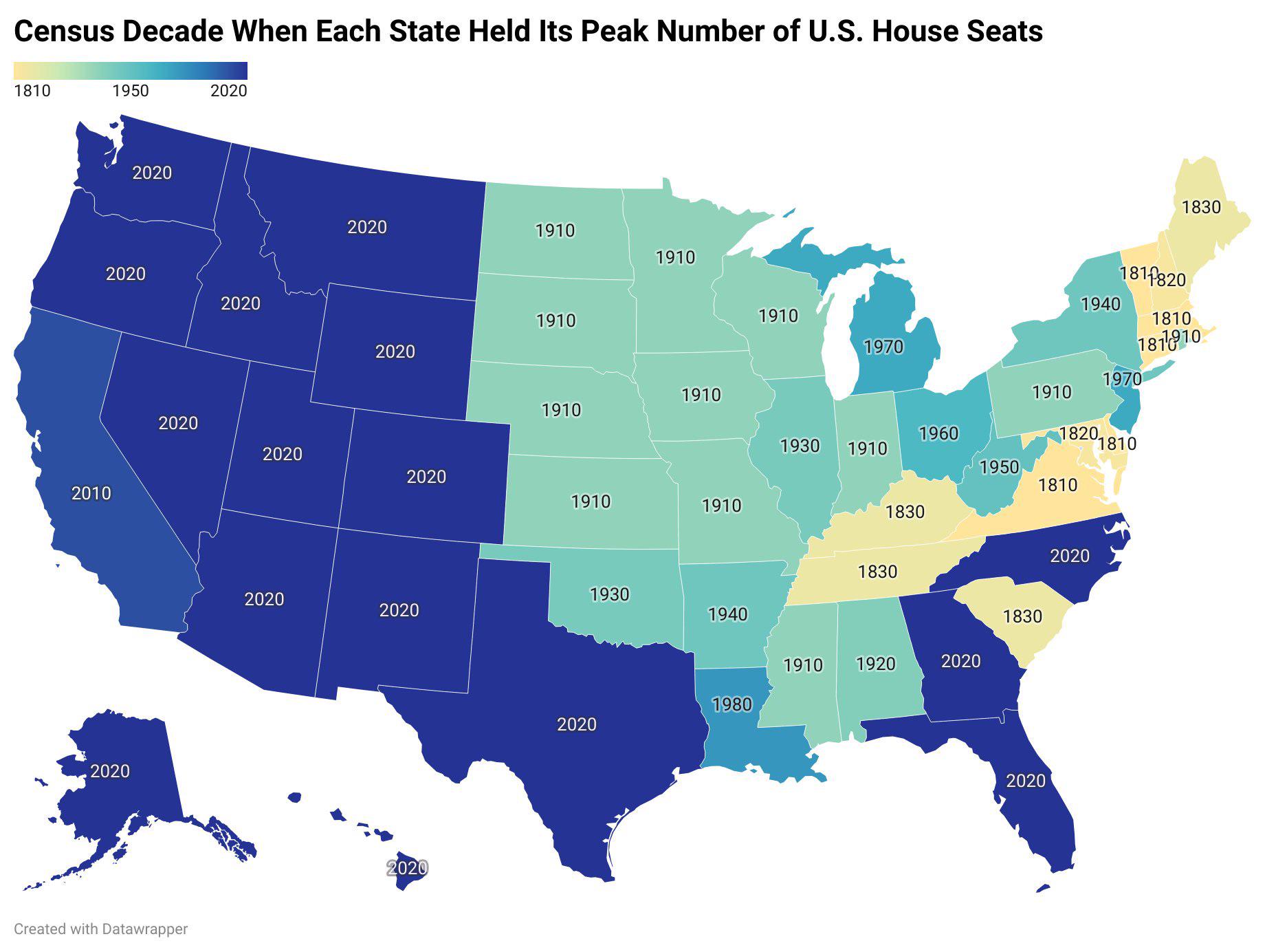
US States Peak House Seats Decade Map
This map visually represents the decade in which each U.S. state reached its maximum number of congressional House seats...
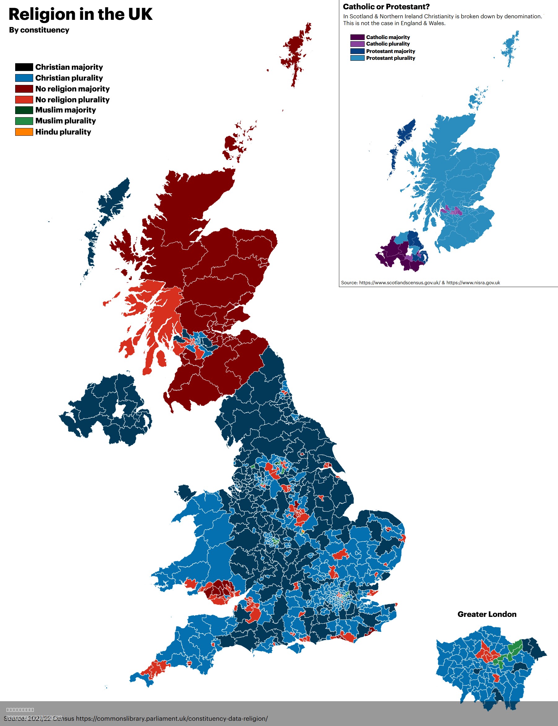
Religion in the UK Map
The "Religion in the UK Map" provides a visualization of the diverse religious affiliations present across the United Ki...
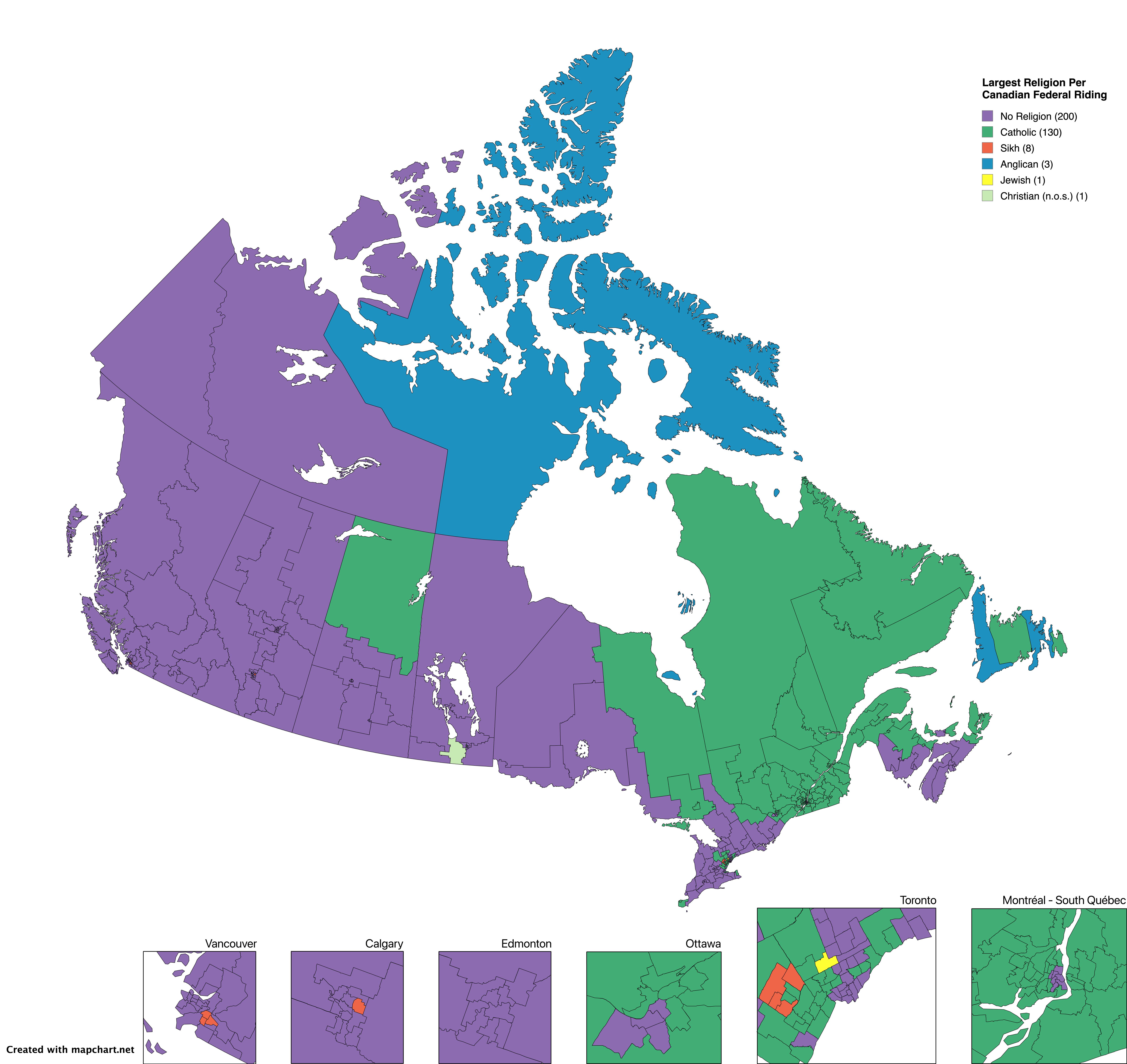
Largest Religion by Canadian Electoral Area Map
This visualization presents an intriguing look at the largest religion practiced in each Canadian electoral area, based ...
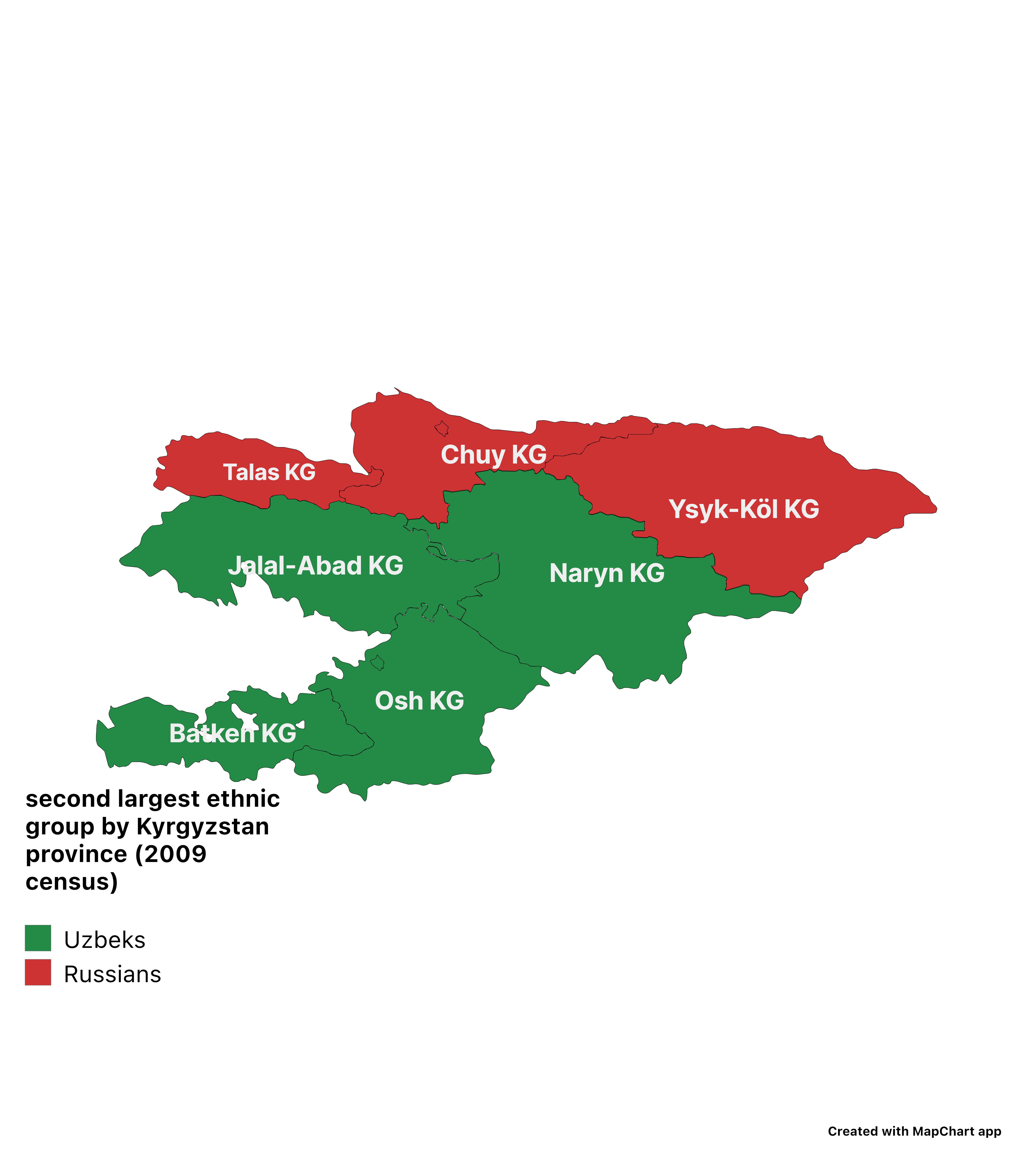
Second Largest Ethnic Group in Kyrgyzstan Map
This visualization provides a detailed overview of the second largest ethnic groups in various regions of Kyrgyzstan, ba...
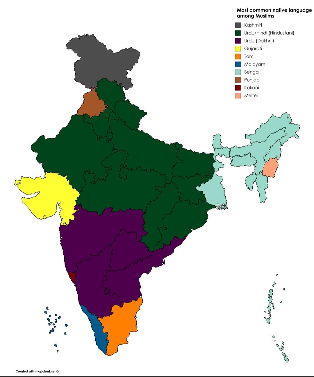
Common Language Among Muslims in India Map
The visualization titled "Most Common Language Among Muslims in India" offers a detailed representation of linguistic di...
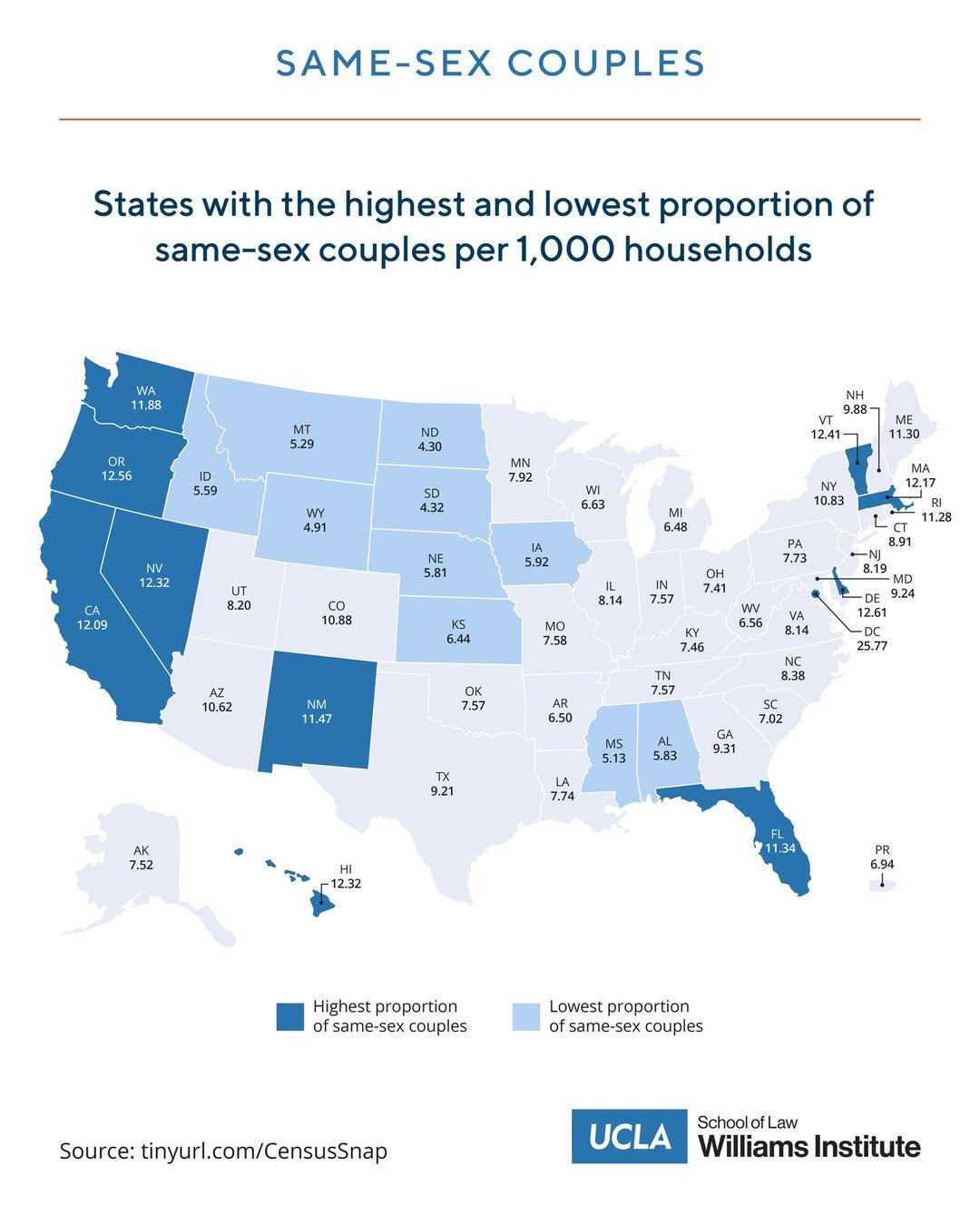
Map of Same-Sex Couples per 1000 Households by State
This map illustrates the proportion of same-sex couples per 1,000 households based on data from the 2020 Census. Underst...