baltic states Maps
3 geographic visualizations tagged with "baltic states"

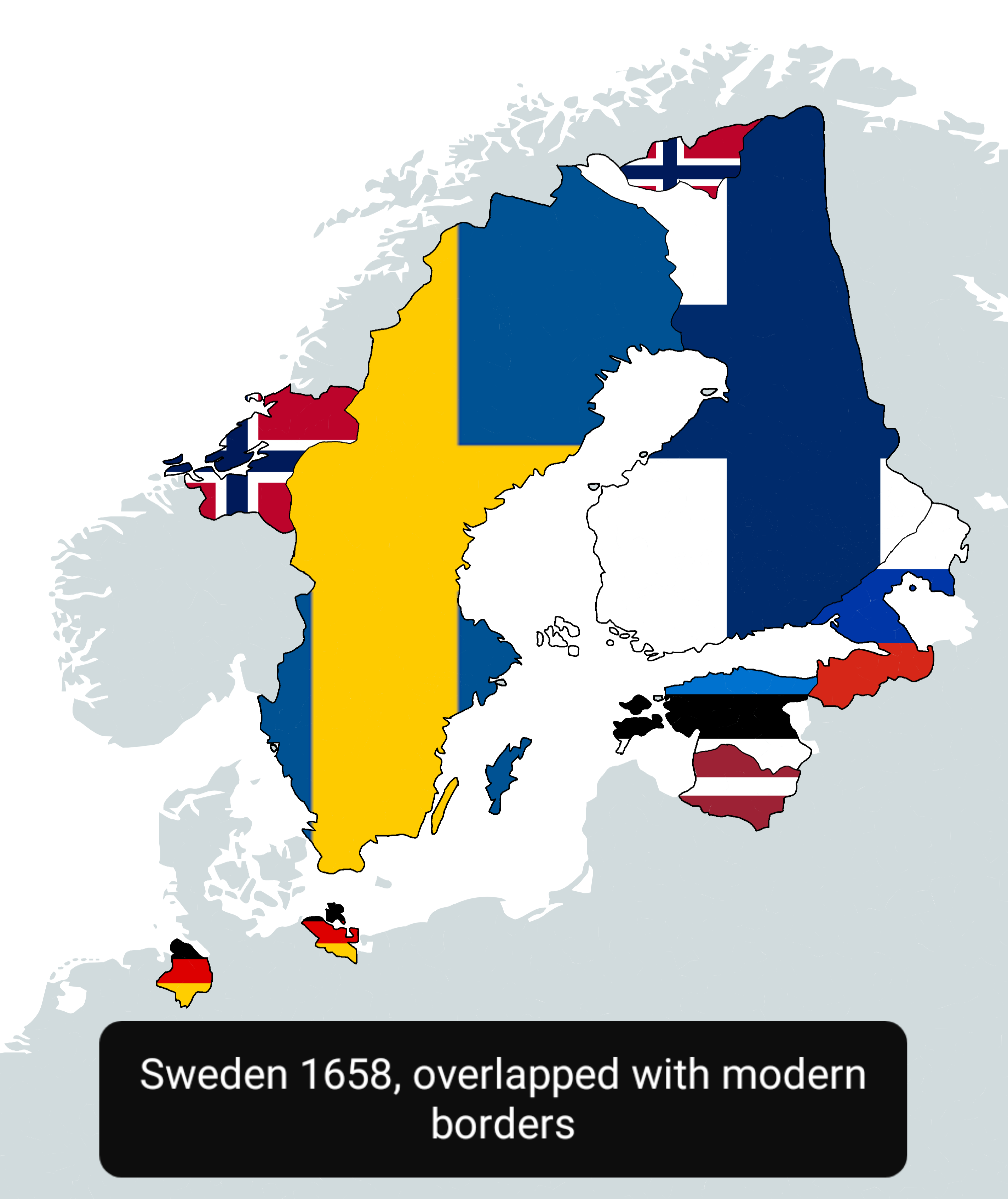
Sweden in 1658 Map Overlapped with Modern Countries
This map visually represents Sweden as it was in 1658, overlapped with the boundaries of modern countries. It allows us ...
👁 36📅 10/1/2025

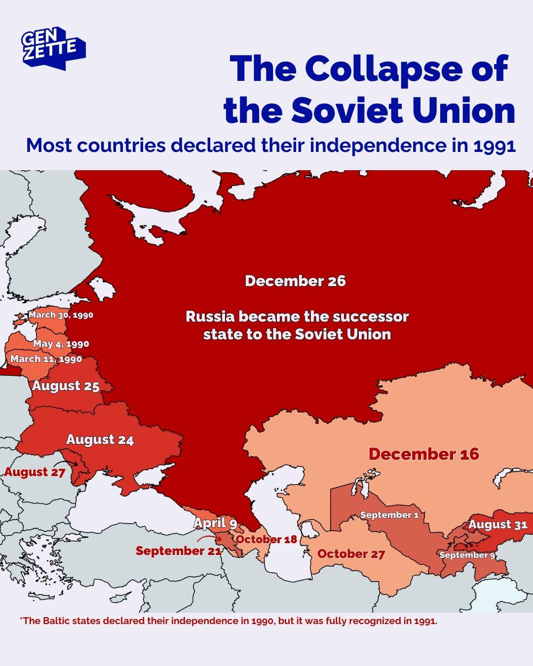
Countries Declaring Independence in 1991 Map
The map titled "Countries Declaring Independence in 1991" visualizes the significant geopolitical changes that occurred ...
👁 82📅 8/29/2025

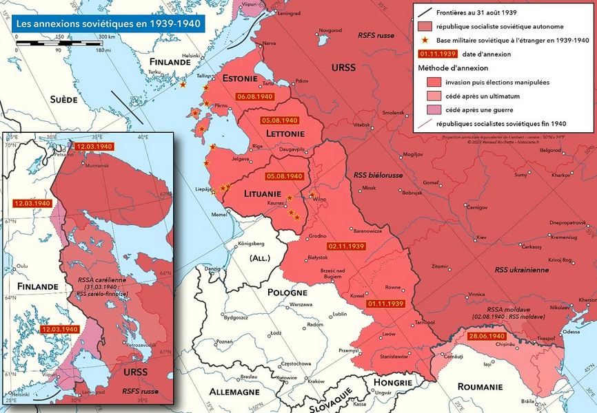
Soviet Annexations in 1939-1940 Map
One of the most significant events was the invasion of Poland in September 1939. The Soviet forces entered from the east...
👁 26📅 10/11/2025