aviation Maps
7 geographic visualizations tagged with "aviation"
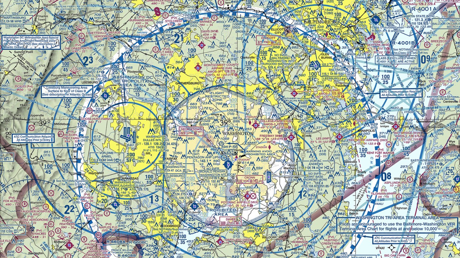
Air Traffic Routes Map of Washington DC and Baltimore
The map of Washington DC and Baltimore provides a detailed overview of air traffic routes in the region. It highlights t...
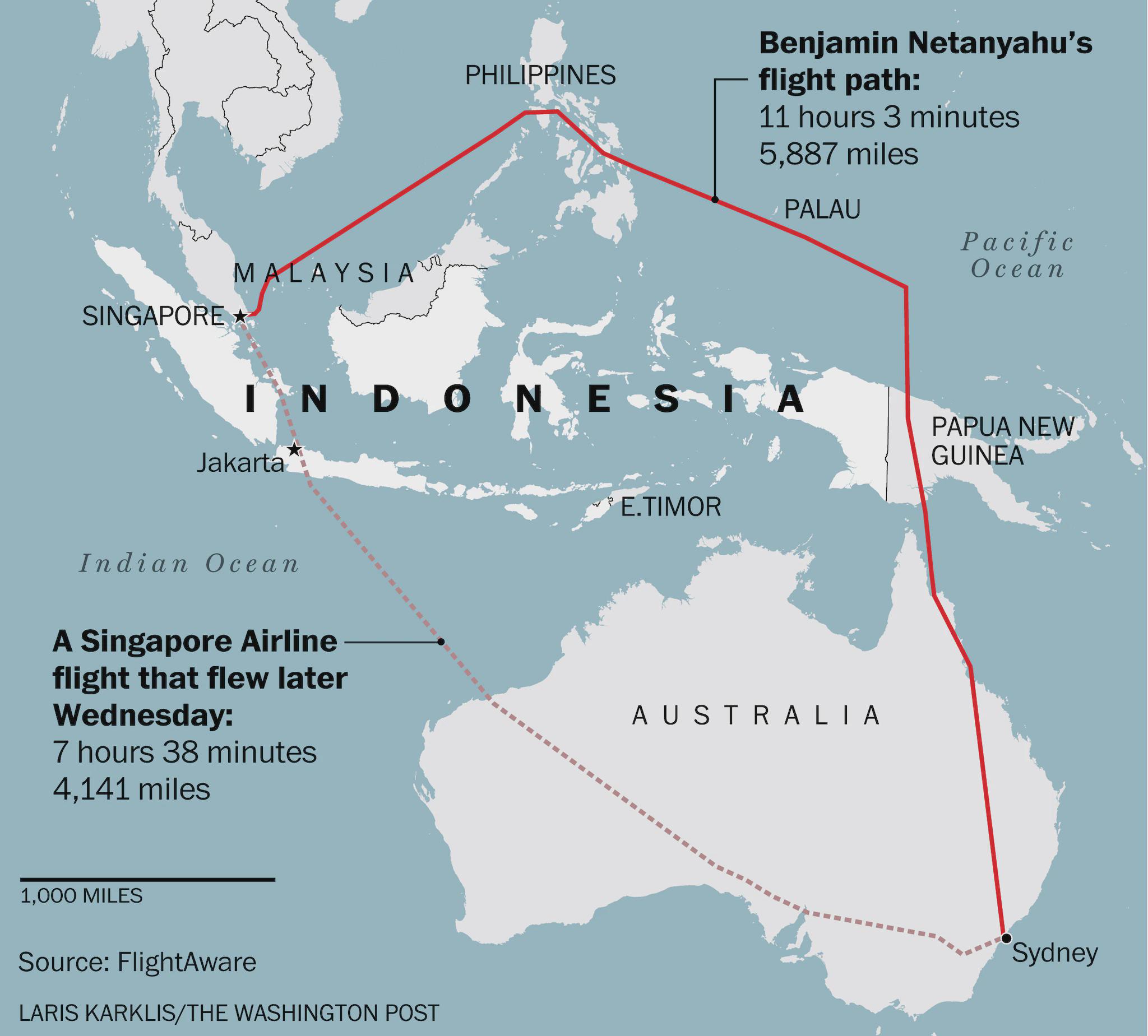
Flight Route Map of Israeli PM Avoiding Indonesia
This map visually represents the flight path taken by Israeli Prime Minister Benjamin Netanyahu during his journey from ...
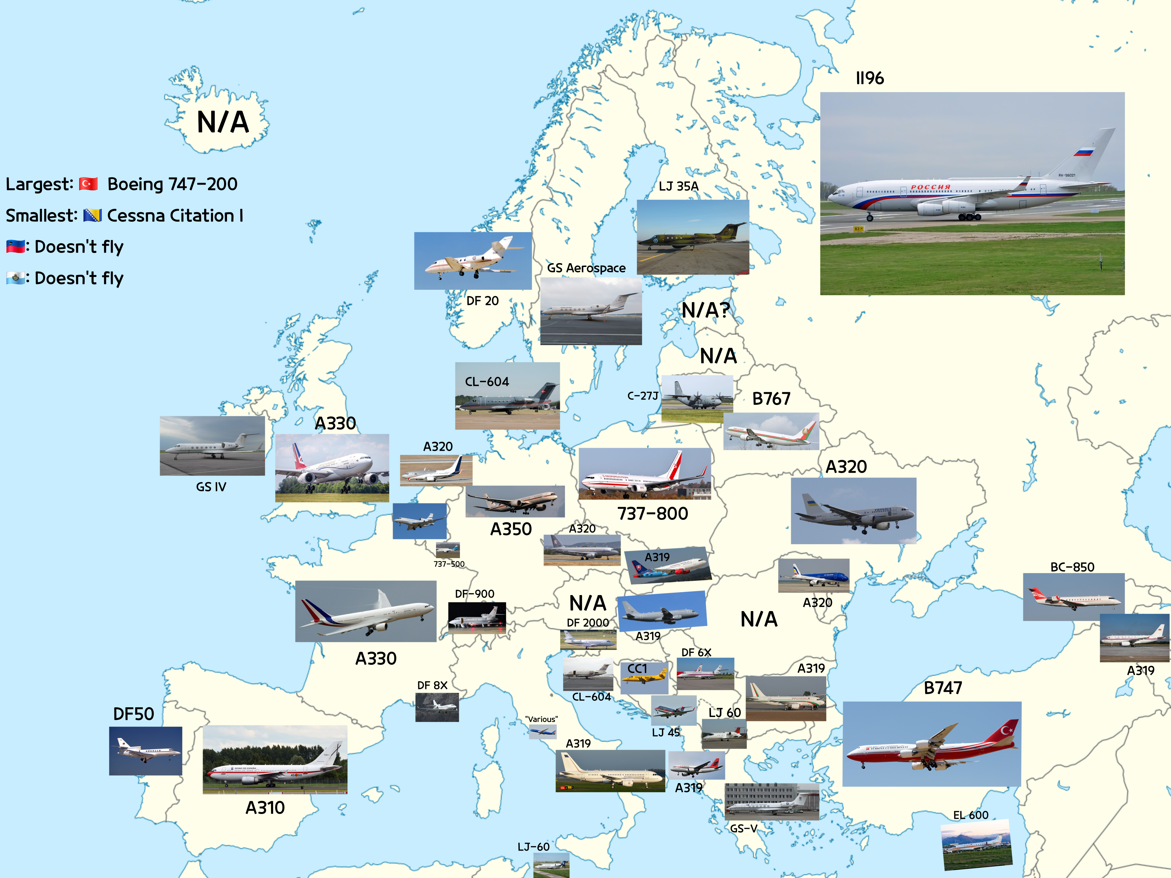
Map of Aircraft Types Heads of State Fly in Europe
The visualization titled "The Types of Aircraft Heads of State Fly in Europe" provides an intriguing look into the aviat...
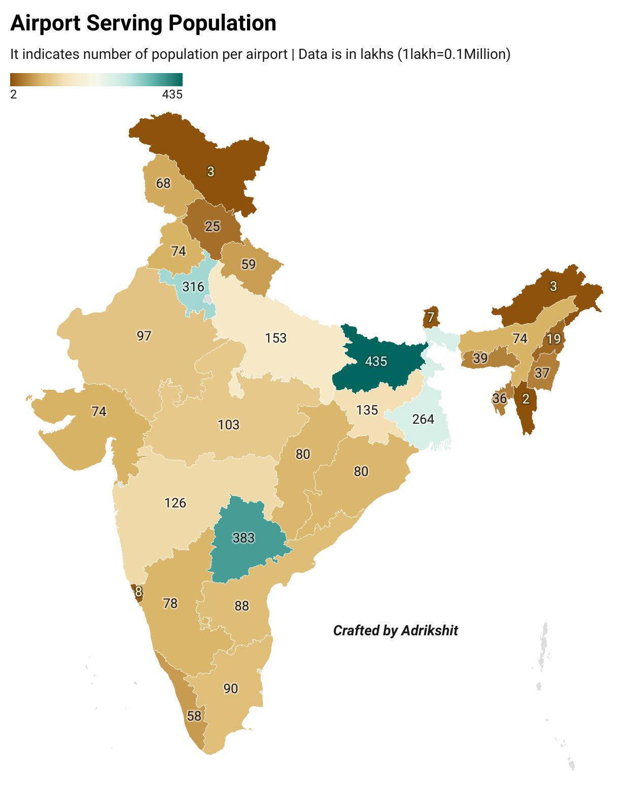
Airport Serving Population in India Map
This map displays the relationship between airports and the populations they serve across India. It highlights the acces...
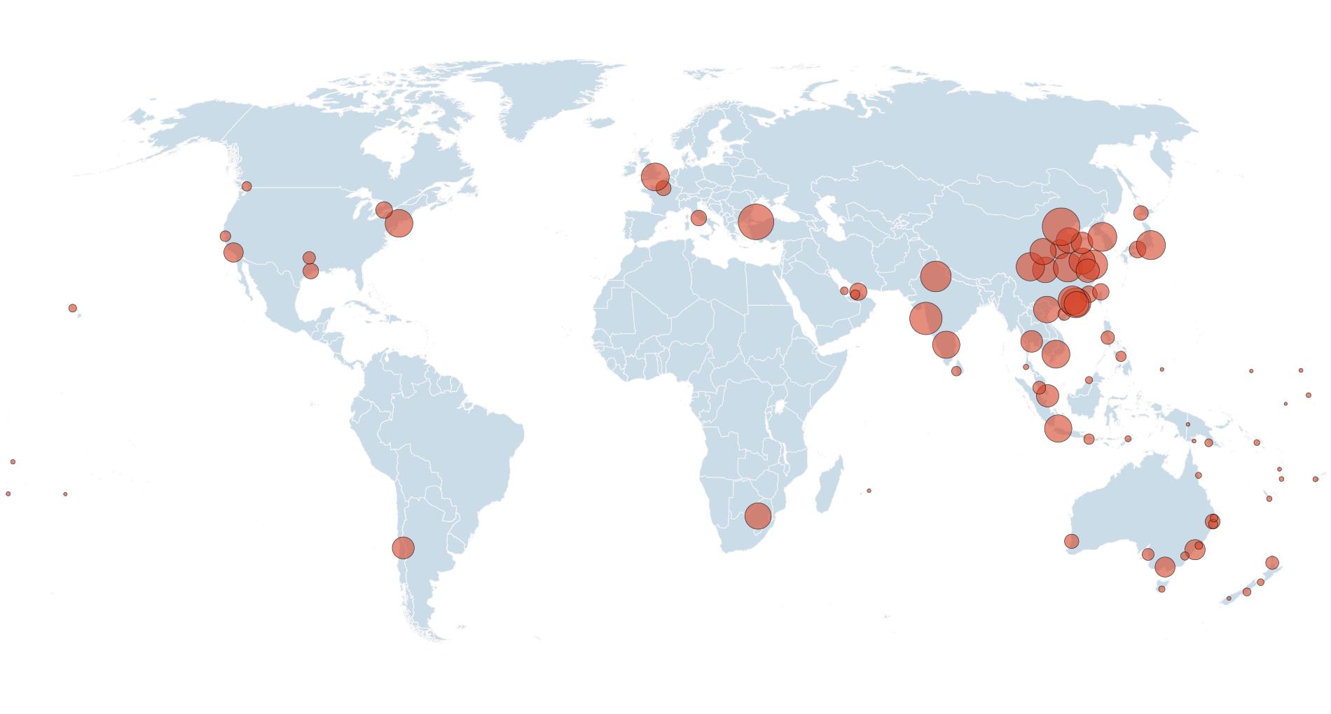
Direct Flights to/from Australia Map
This visualization presents a comprehensive overview of airports that offer direct flights to and from Australia. Each a...
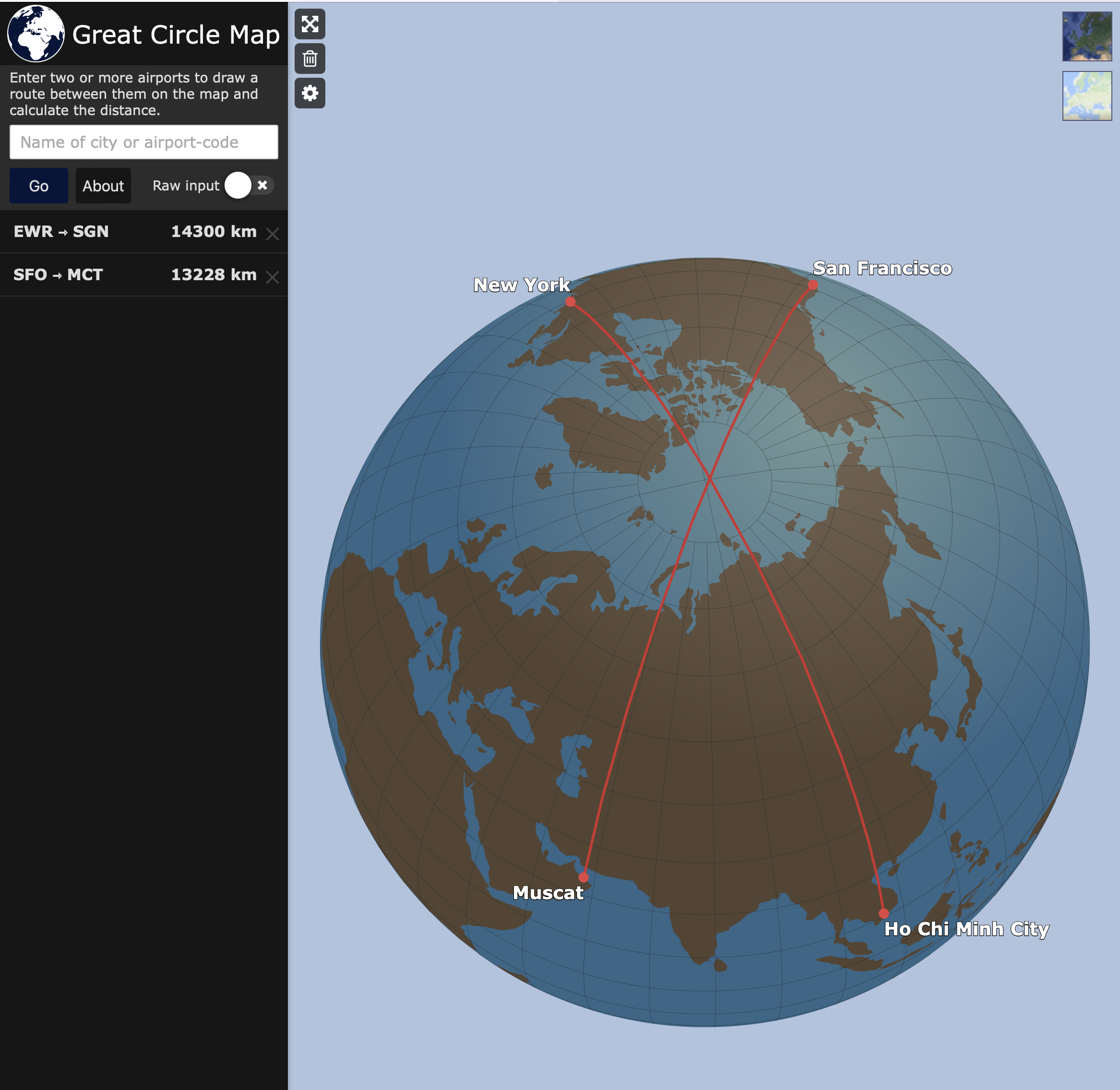
Map of City Pairs Flying Over North Pole
This map visualizes the city pairs that, for the shortest flying route, require aircraft to traverse the North Pole. It ...
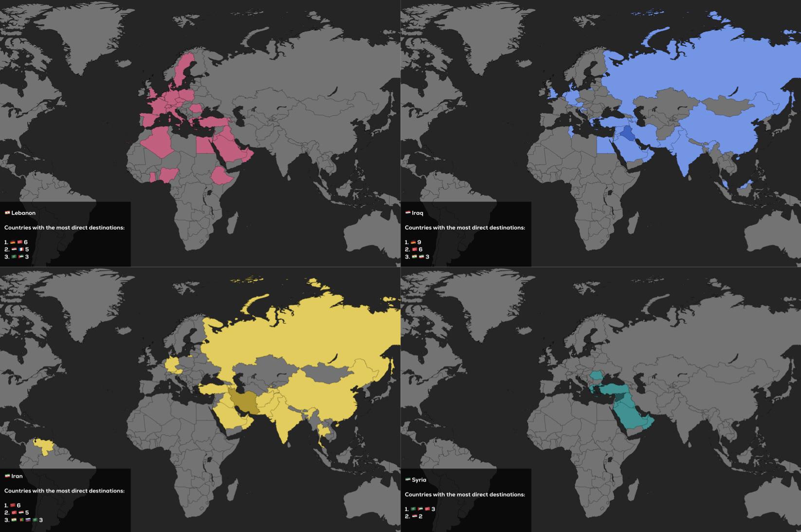
Direct Flights Map of Lebanon, Iraq, Iran and Syria
The visualization titled "Direct Flights of Lebanon, Iraq, Iran and Syria as of 2025" presents a comprehensive overview ...