18th century Maps
4 geographic visualizations tagged with "18th century"

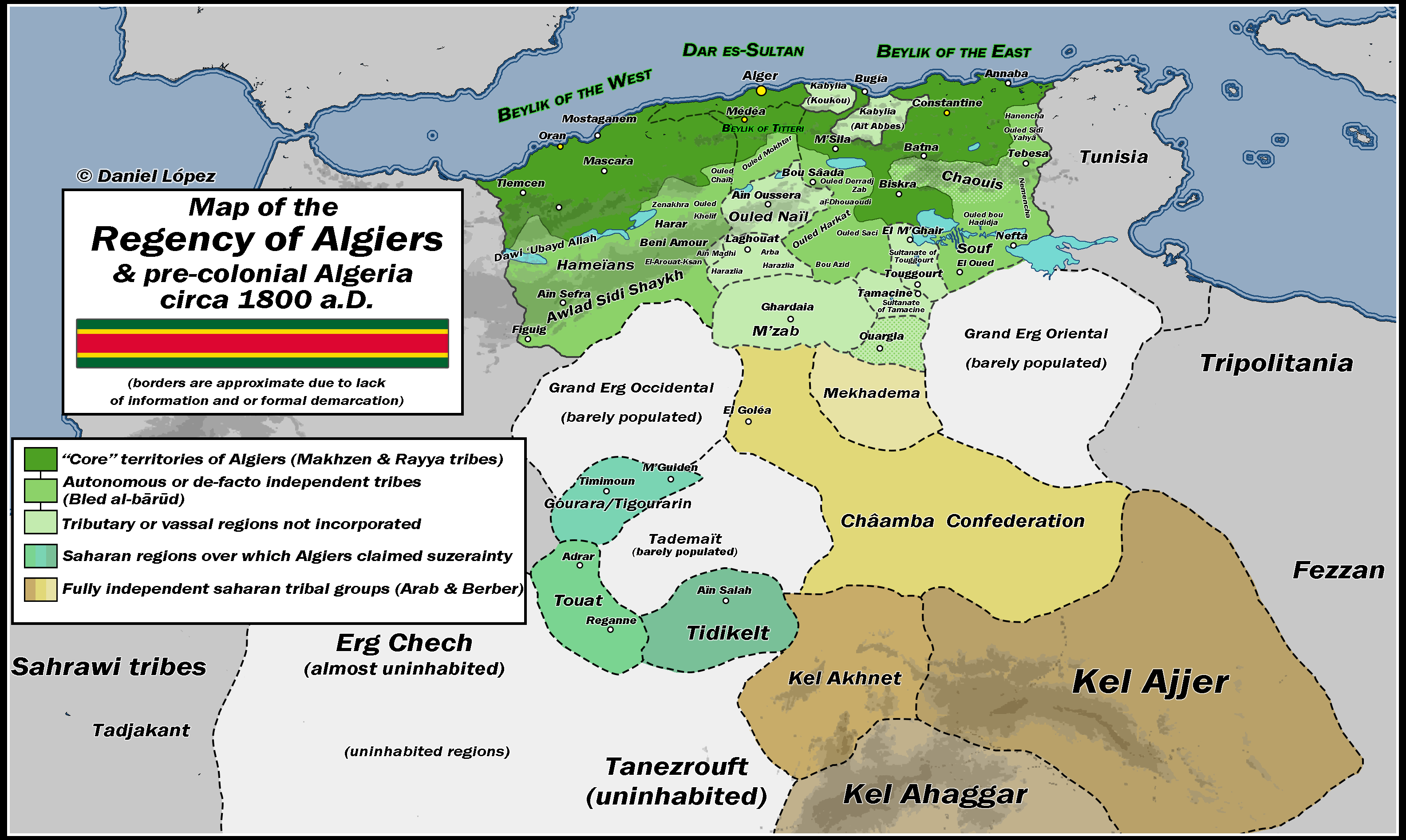
Map of the Regency of Algiers c.1800 A.D.
The "Map of the Regency of Algiers c.1800 A.D." provides a detailed depiction of the geographical and political landscap...
👁 118📅 8/31/2025

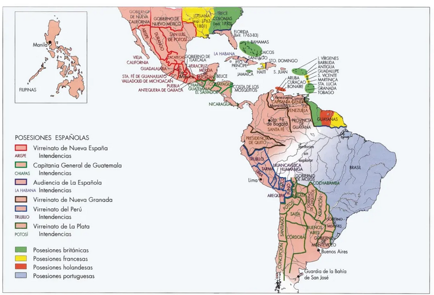
Spanish Colonies in the Americas Map
This map provides a detailed visualization of the Spanish colonies in the Americas during the 18th century, illustrating...
👁 122📅 8/13/2025

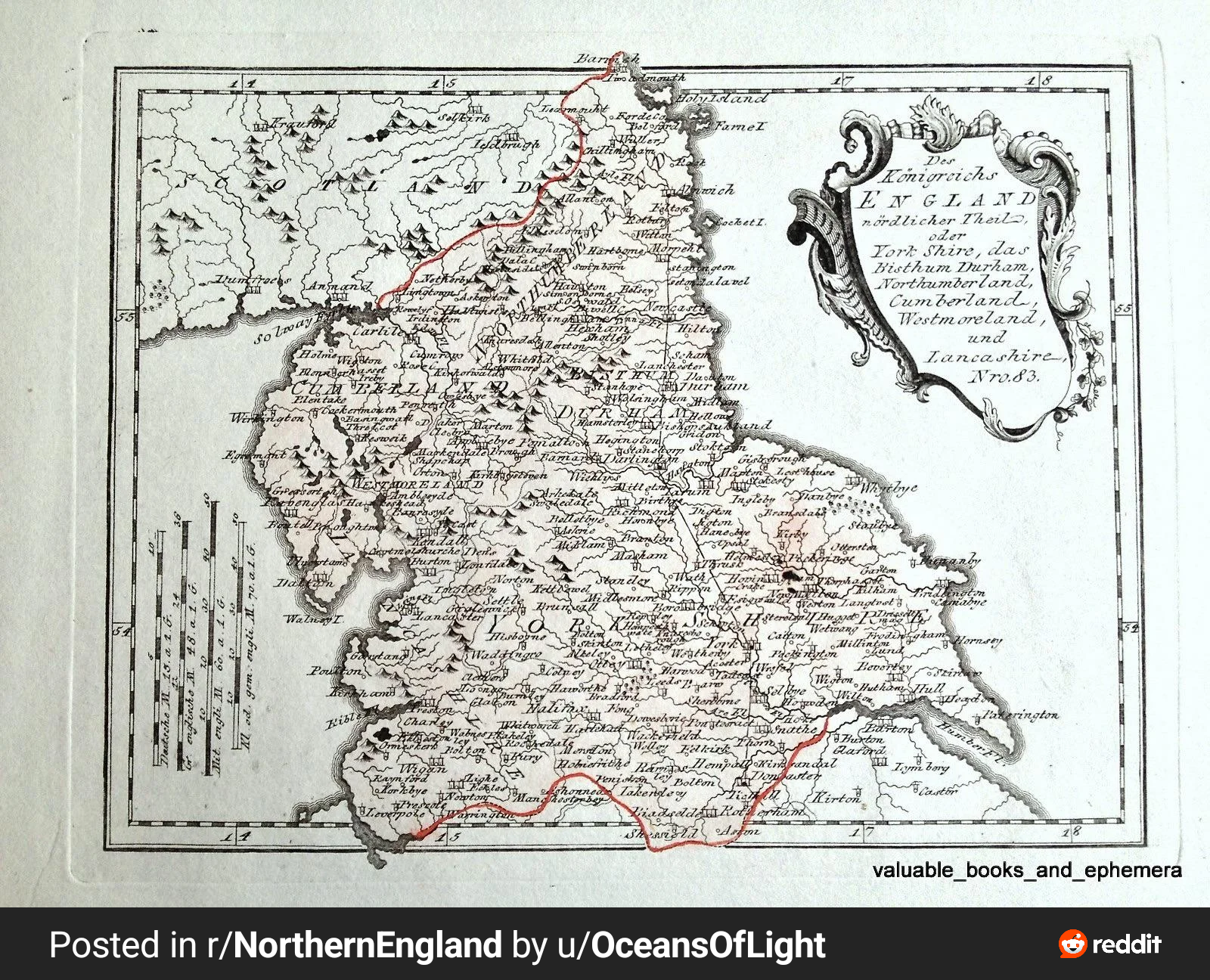
1789 Map of Northern England Map
The 1789 map of Northern England created by Austrian cartographer Franz Joseph Von Reily is a remarkable historical arti...
👁 86📅 8/27/2025

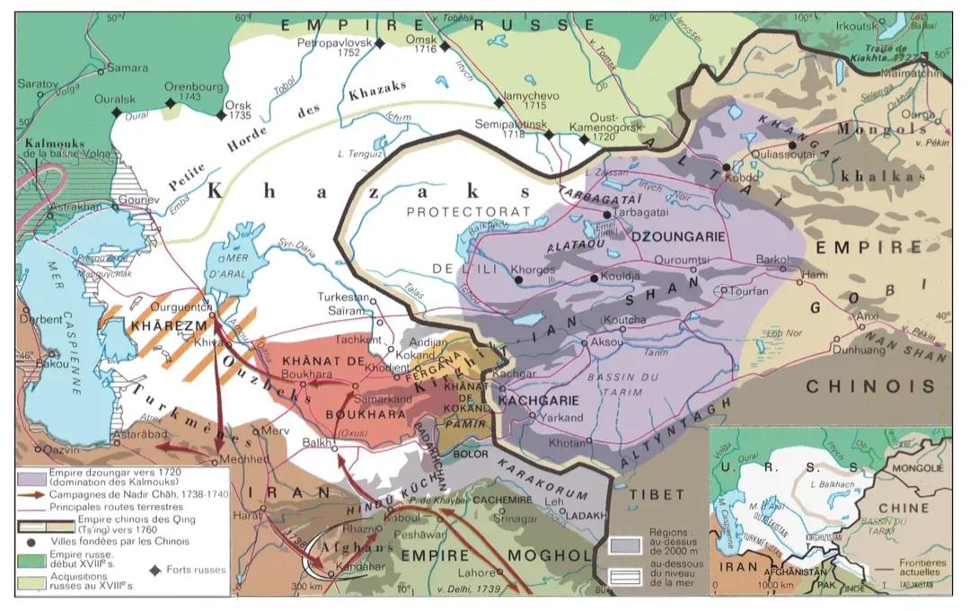
18th Century Central Asia Map
The \...
👁 26📅 10/9/2025