DRC Swamp or Mangroves Map

Alex Cartwright
Senior Cartographer & GIS Specialist
Alex Cartwright is a renowned cartographer and geographic information systems specialist with over 15 years of experience in spatial analysis and data...
Geographic Analysis
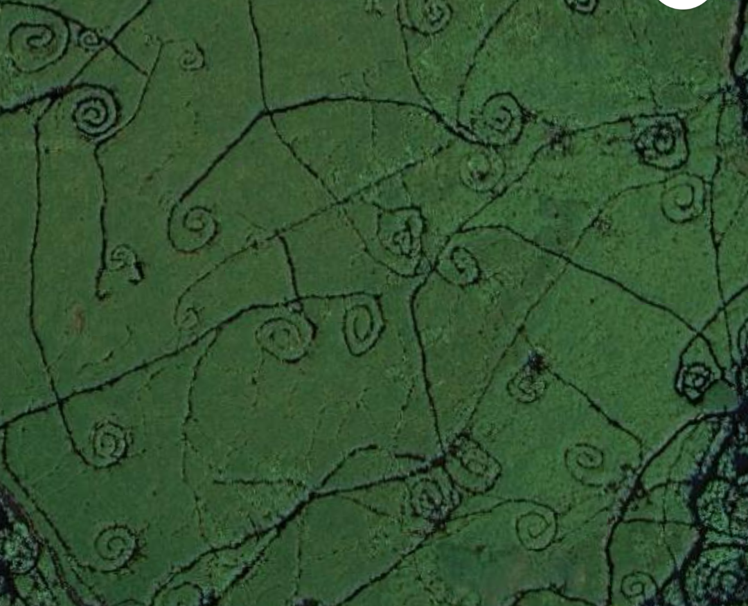
What This Map Shows\nThe map at the coordinates 8.040285, 26.895258 reveals intriguing swirls in the southern lakes of the Democratic Republic of the Congo (DRC). These patterns are visually striking and have sparked curiosity about their origin. Upon initial inspection, one might wonder if these swirls are remnants of fish traps, but they are more likely related to the natural formations and ecosystems found in the region. The DRC is home to extensive wetlands and swamp areas, raising questions about the ecological interactions and functions of these landscapes.
Deep Dive into Wetland Ecosystems\nWetlands, which include swamps and mangroves, are vital ecosystems that occur at the intersection of land and water. They are characterized by their unique hydrology, vegetation, and soil types. In the DRC, wetlands play a crucial role in maintaining biodiversity, providing habitat for countless species, and supporting the livelihoods of local communities.
Interestingly, the DRC boasts one of the largest swamp areas in Africa, known as the Congo Basin. This basin is not only significant for its size but also for its ecological importance. It serves as a sanctuary for a variety of wildlife, including endangered species such as the bonobo and forest elephants.
These wetlands also act as natural filters, improving water quality by trapping sediments and pollutants. Additionally, they provide essential resources, including fish, which are a primary food source for many communities. Ever wondered why the DRC is so rich in biodiversity? The wetlands contribute significantly to this wealth, as they serve as breeding grounds and nurseries for numerous aquatic species.
The vegetation in these wetland areas predominantly consists of various species of grasses, reeds, and trees adapted to saturated soil conditions. Mangroves, although more commonly associated with coastal regions, may also be present in some freshwater systems, providing additional ecological benefits such as shoreline stabilization and habitat for marine life. The interplay between land and water in these ecosystems creates unique microhabitats that are essential for sustaining diverse biological communities.
Regional Analysis\nThe swirls observed in the DRC map likely represent specific areas within the broader wetland ecosystem. For instance, the regions surrounding Lake Tanganyika and the Congo River are critical to understanding the hydrology and ecological diversity of the area.
Comparatively, the northern regions of the DRC, which are more forested, contrast sharply with the swamps and lakes found in the south. The interaction between freshwater and terrestrial ecosystems in these regions creates a mosaic of habitats, each supporting different forms of life. Moreover, variations in rainfall and topography across the DRC influence wetland formation and health.
In the southern lakes, local practices like fishing may be adapted to utilize these unique environmental features. Fish traps or other traditional fishing methods may indeed be employed by communities who have lived in harmony with these ecosystems for generations, showcasing the deep connection between the land and its inhabitants.
Significance and Impact\nUnderstanding the role of wetlands in the DRC is critical not only for conservation efforts but also for sustainable development. As climate change continues to impact weather patterns and water levels, the health of these ecosystems is increasingly at risk. Wetlands are highly sensitive to changes in climate and human activity, making their preservation essential for maintaining biodiversity and supporting local economies.
Moreover, the DRC's wetlands hold potential for carbon sequestration, helping to mitigate climate change impacts. Protecting these areas can contribute to global efforts to reduce greenhouse gases while supporting local livelihoods through sustainable fishing and tourism opportunities.
In conclusion, the swirls captured in the map are more than mere curiosities; they represent a complex web of ecological interactions and human reliance on these vital ecosystems. As we continue to explore and understand the DRC’s wetlands, it becomes increasingly clear that their protection is fundamental to the health of both the environment and the communities that depend on them.
Visualization Details
- Published
- October 26, 2025
- Views
- 10
Comments
Loading comments...