Official Map of the Republic of Chile

Marcus Rodriguez
Historical Geography Expert
Marcus Rodriguez specializes in historical cartography and geographic data analysis. With a background in both history and geography, he brings unique...
Geographic Analysis
What This Map Shows
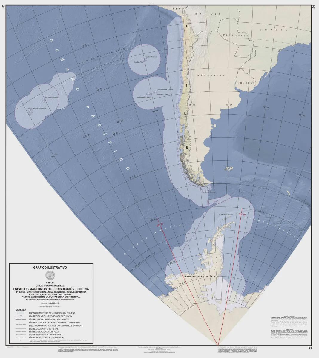
The official map of the Republic of Chile serves as a comprehensive representation of this long, narrow nation stretching along the western edge of South America. This visualization highlights key geographical features, including its extensive coastline, the Andes mountain range, and major urban centers. However, the map also provides insights into Chile's administrative divisions, such as regions and provinces, making it a valuable tool for understanding the country's political and geographical landscape.
Deep Dive into Chile's Geography
Chile's geography is as diverse as it is striking. The country is known for its remarkable physical features that range from the arid Atacama Desert in the north to the lush forests of Patagonia in the south. Covering roughly 756,102 square kilometers, Chile boasts a variety of climate zones and ecosystems.
One of the most interesting aspects of Chilean geography is its topography. The Andes mountain range runs the entire length of the country, forming a natural border with Argentina. This mountain range not only influences Chile's climate but also impacts its biodiversity. The eastern slopes are home to unique flora and fauna, with many species endemic to the region.
Chile's coastline stretches over 4,300 kilometers along the Pacific Ocean, making it one of the longest in the world. This extensive coastline is dotted with numerous ports and cities, such as Valparaíso and Antofagasta, which are vital for trade and tourism. Interestingly, the ocean currents off the coast significantly affect the weather patterns, contributing to the aridity of the north and the temperate climate experienced in the central region.
In terms of climate, Chile exhibits a wide range of conditions. The northern regions, especially around Iquique and Arica, experience a desert climate, characterized by extremely low precipitation. In contrast, the central regions, including Santiago, enjoy a Mediterranean climate with hot, dry summers and mild, wet winters. Meanwhile, the southern regions face a maritime climate, with cooler temperatures and more precipitation, particularly in areas like Puerto Montt and Punta Arenas.
Regional Analysis
Examining the administrative regions of Chile reveals fascinating geographical and cultural diversity. The country is divided into 16 regions, each with unique characteristics. For example, the Metropolitan Region, which includes Santiago, is the political and economic hub of the country, housing around 40% of Chile's total population. This region is well-developed, with a bustling urban landscape that contrasts sharply with the more rural and less populated regions to the south.
In contrast, the Araucanía Region is rich in indigenous Mapuche culture and offers stunning natural landscapes, including lakes and volcanoes. This region has faced challenges related to land rights and cultural preservation, highlighting the importance of understanding the socio-political context embedded in Chile’s geography.
Furthermore, the northern regions, such as Tarapacá and Antofagasta, are vital for mining, particularly copper production. Chile is the world’s largest copper producer, and the mining industry significantly contributes to the national economy. The stark landscapes of the Atacama Desert not only shape the physical geography but also influence the livelihoods of people living in these regions.
Significance and Impact
The geographical characteristics of Chile are not just fascinating; they hold significant implications for the country’s economy, culture, and environmental policies. Understanding the geography of Chile helps illuminate how natural resources, such as copper and lithium, are managed and exported, impacting global markets.
Additionally, Chile’s varied climate zones have made it a focus area for studying climate change impacts. The northern desert is facing water scarcity issues, while the southern regions are grappling with the consequences of melting glaciers and rising sea levels. As we consider future projections, it’s crucial to recognize that Chile’s geography will play a key role in shaping its responses to environmental challenges.
In summary, the official map of the Republic of Chile is more than just a visual guide; it encapsulates the country’s rich geographical diversity, cultural heritage, and the pressing environmental issues of our time. By diving into the specifics of this map, we gain a deeper appreciation for Chile and the intricate relationship between its geography and society.
Visualization Details
- Published
- September 10, 2025
- Views
- 82
Comments
Loading comments...