climate zones Maps
14 geographic visualizations tagged with "climate zones"
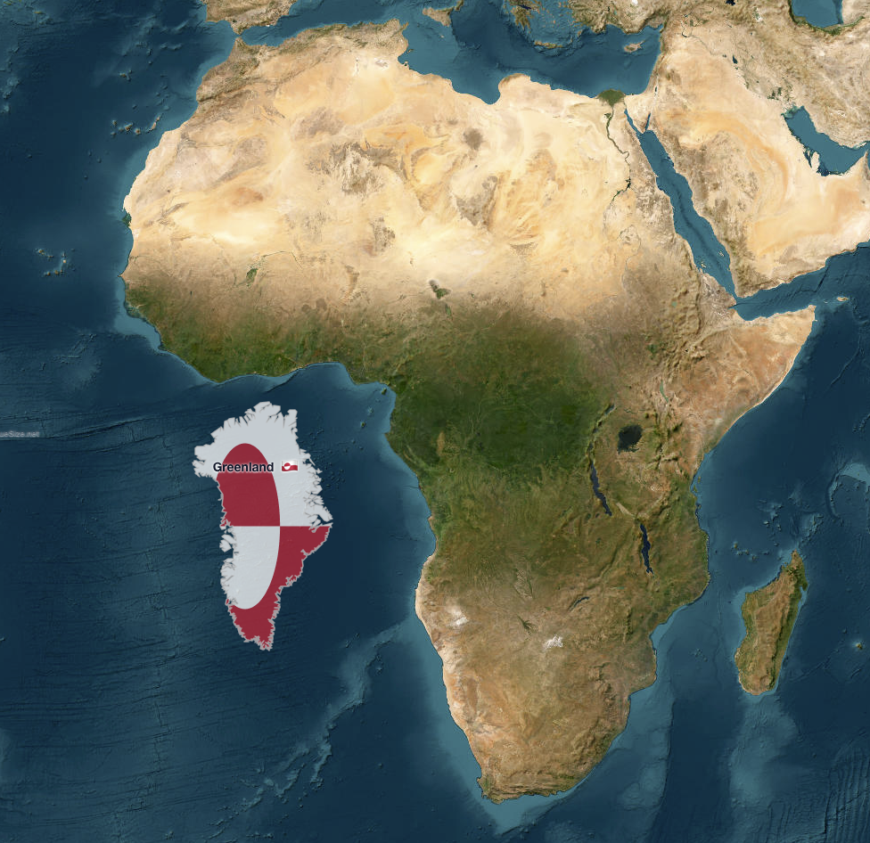
Greenland vs. Africa Size Comparison Map
The map titled "Greenland vs. Africa — the real scale" provides a striking visual comparison of the land areas of Greenl...
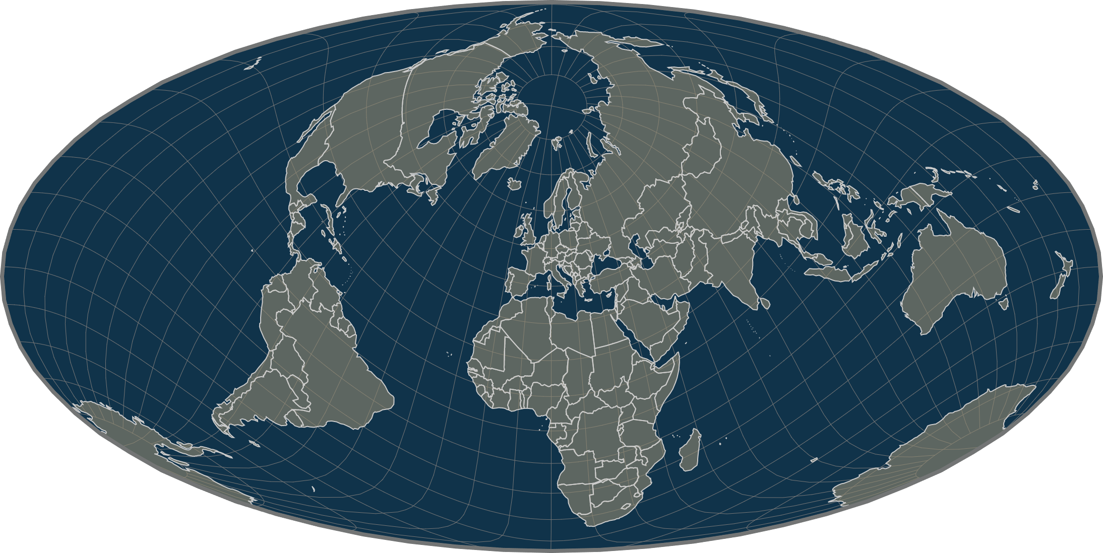
Mollweide Projection Equal-Area Map Centered on Europe
The "Mollweide Projection Equal-Area Map Centered on Europe" displays a distinctive view of Europe that emphasizes the r...
Africa Size Comparison Map
The "Africa is humongous" map offers a striking visual representation of Africa's vast land area compared to other conti...
Map of Australia's Climate Zones
The "Map of Australia's Climate Zones" provides a comprehensive overview of the diverse climatic regions across the cont...
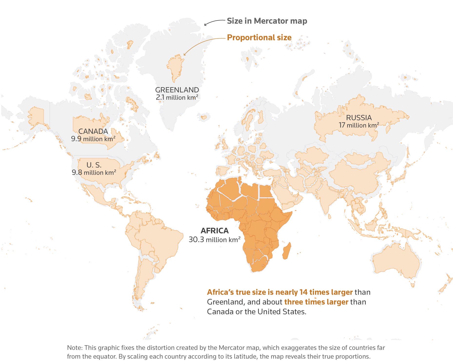
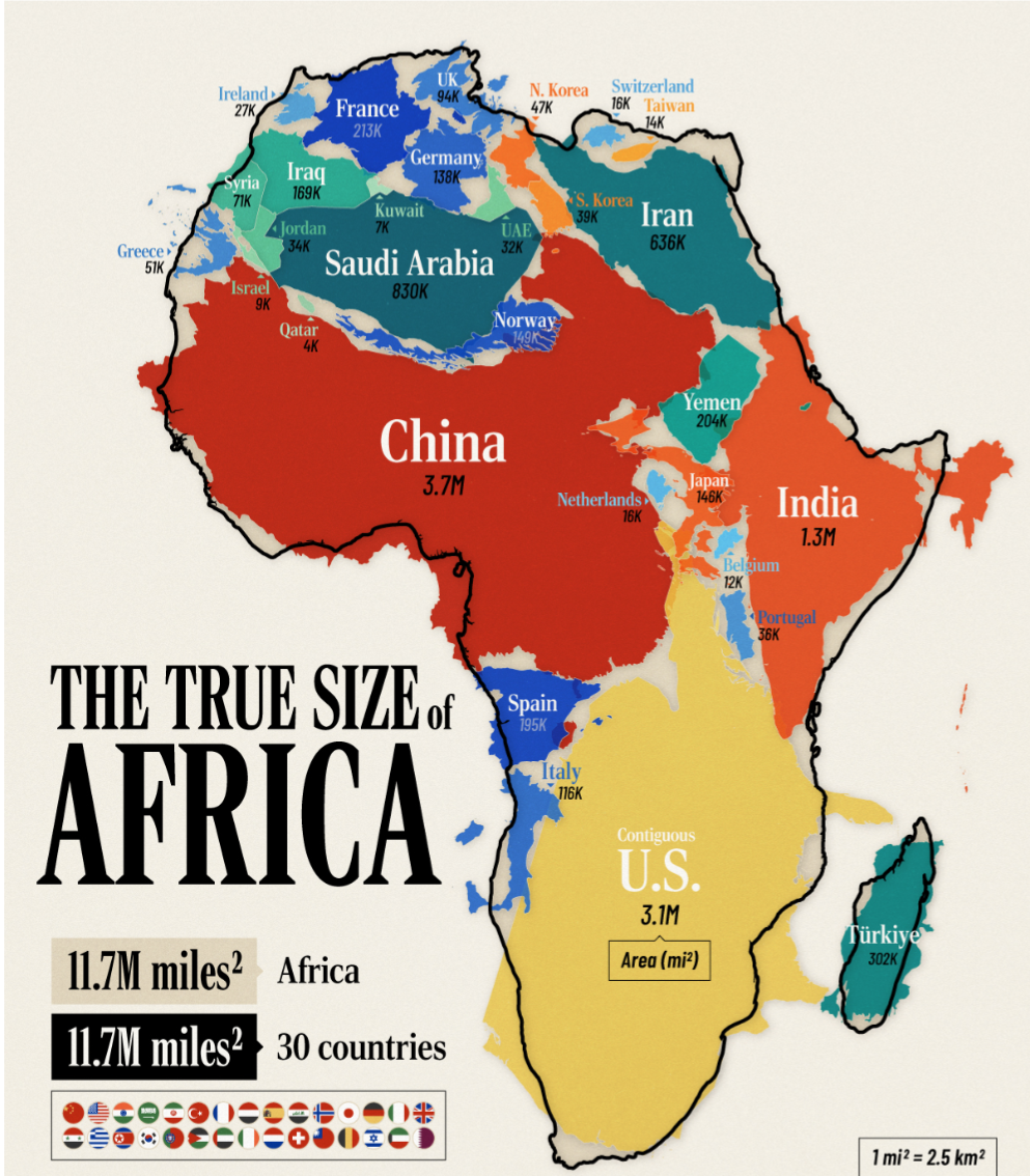
The True Size of Africa Map
The visualization titled "The True Size of Africa" challenges common misconceptions about the size of Africa relative to...
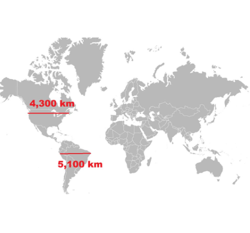
Length of North vs South America Map
The visualization titled "Length of North vs South America" presents a comparative analysis of the geographical extents ...
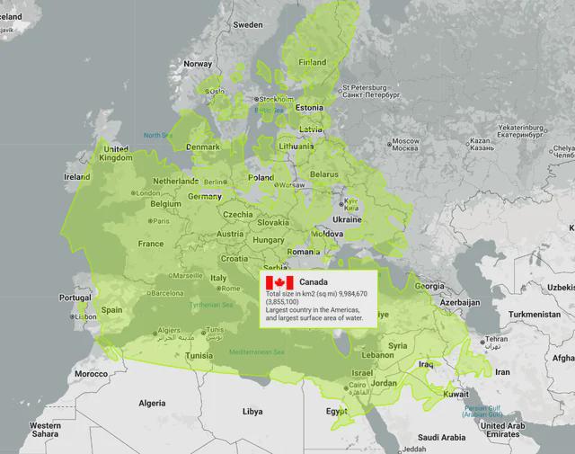
Canada vs Europe Map Comparison
Interestingly, Canada is home to the longest coastline in the world, measuring over 202,080 kilometers. This extensive c...
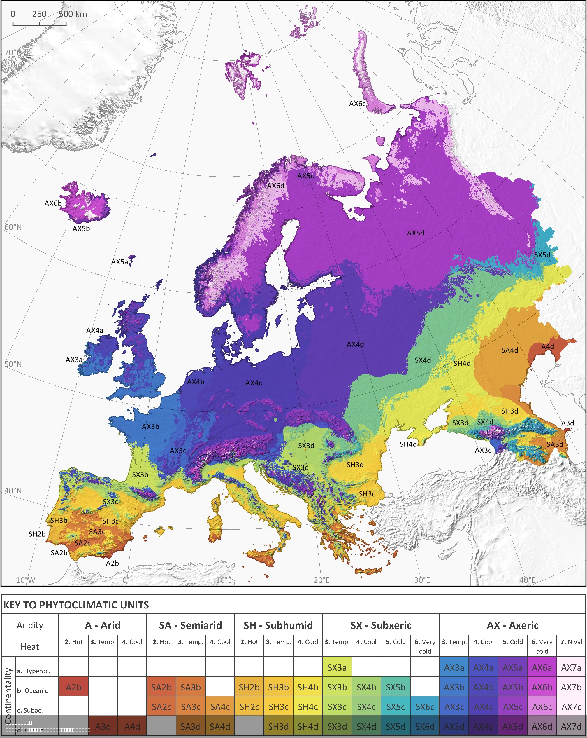
Phytoclimatic Map of Europe
The phytoclimatic map of Europe is a detailed visualization that illustrates the distribution of different plant communi...
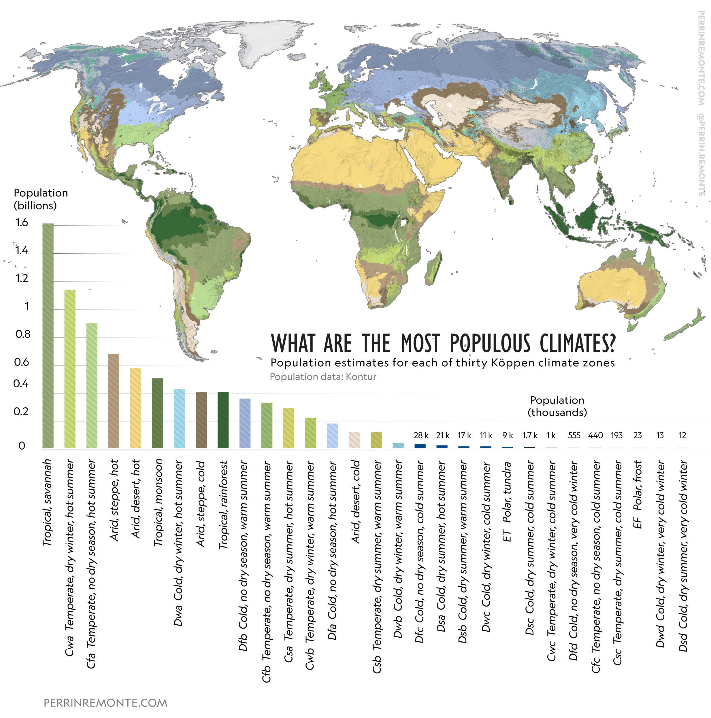
Map of Most Populous Climates
This visualization presents a fascinating overview of the world's most populous climates, illustrating how different cli...
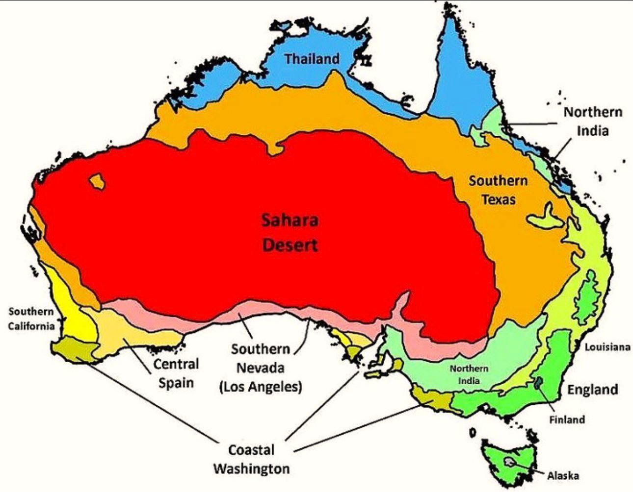
Australia’s Climate Compared to Other Countries Map
The map titled "Australia’s Climate Compared to Other Countries" provides a detailed look at how Australia's climate sta...
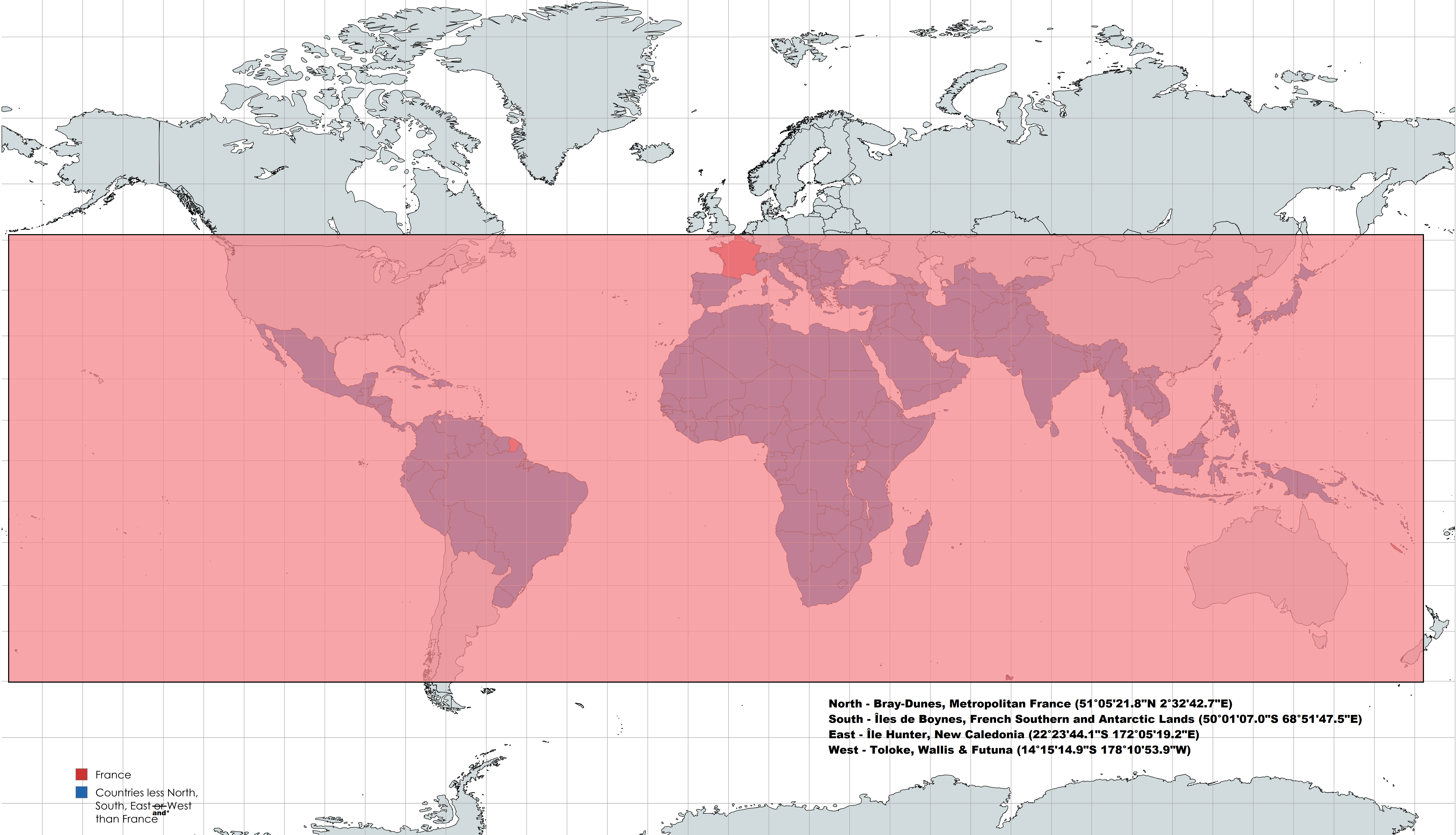
France's Geographical Extremes Map
This intriguing map highlights an interesting geographical fact: France is positioned further North, South, East, and We...
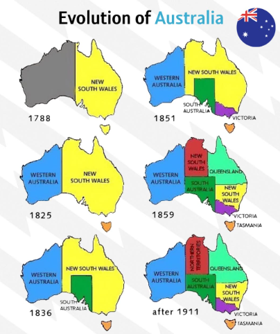
Evolution of Australia Map
...
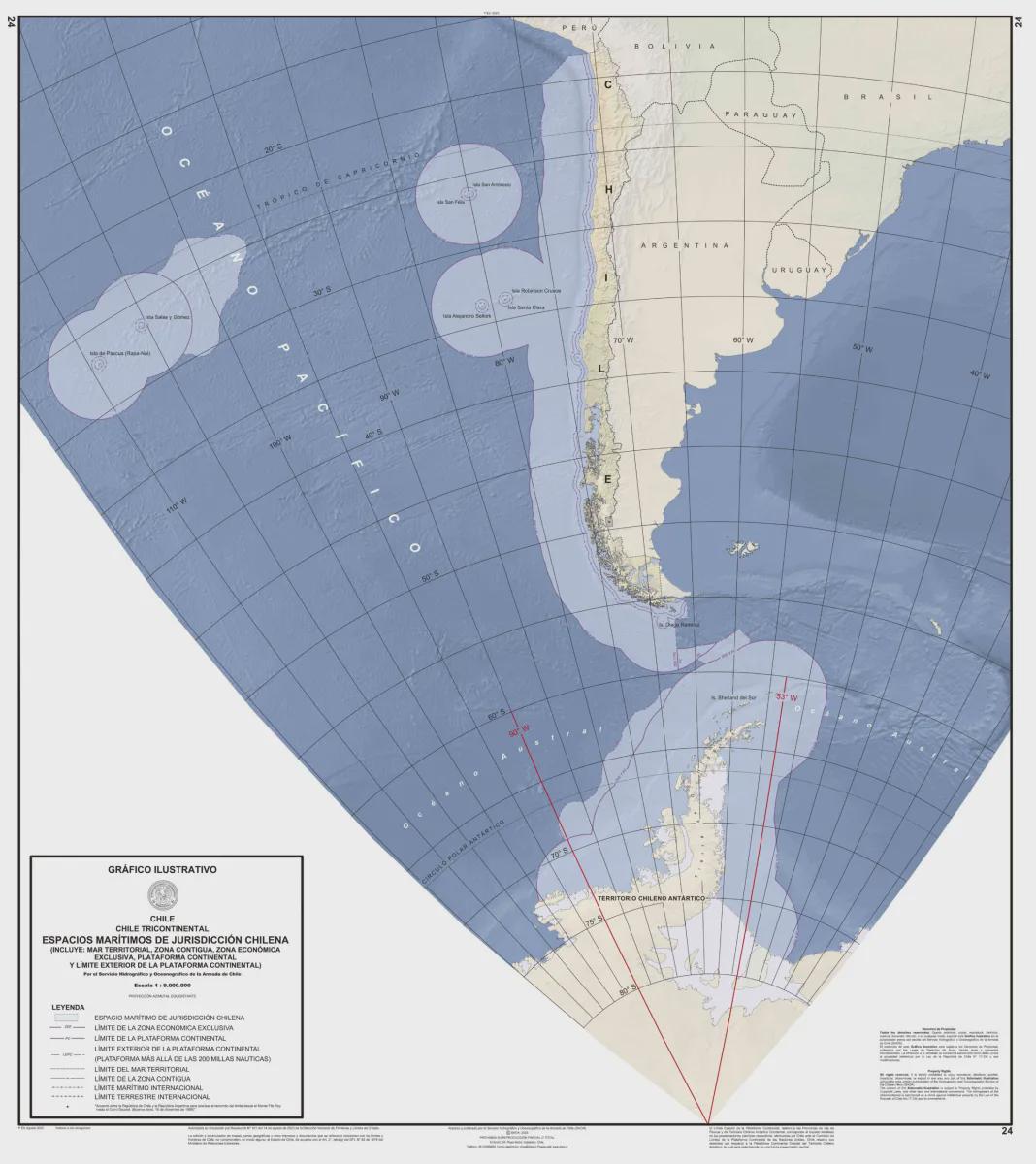
Official Map of the Republic of Chile
The official map of the Republic of Chile serves as a comprehensive representation of this long, narrow nation stretchin...
Climate Zones Map of the World
This climate zones map of the world provides a visual representation of the various climate classifications across diffe...