Putin Flight to Alaska According to Flat Earth Map

David Chen
Data Visualization Specialist
David Chen is an expert in transforming complex geographic datasets into compelling visual narratives. He combines his background in computer science ...
Geographic Analysis
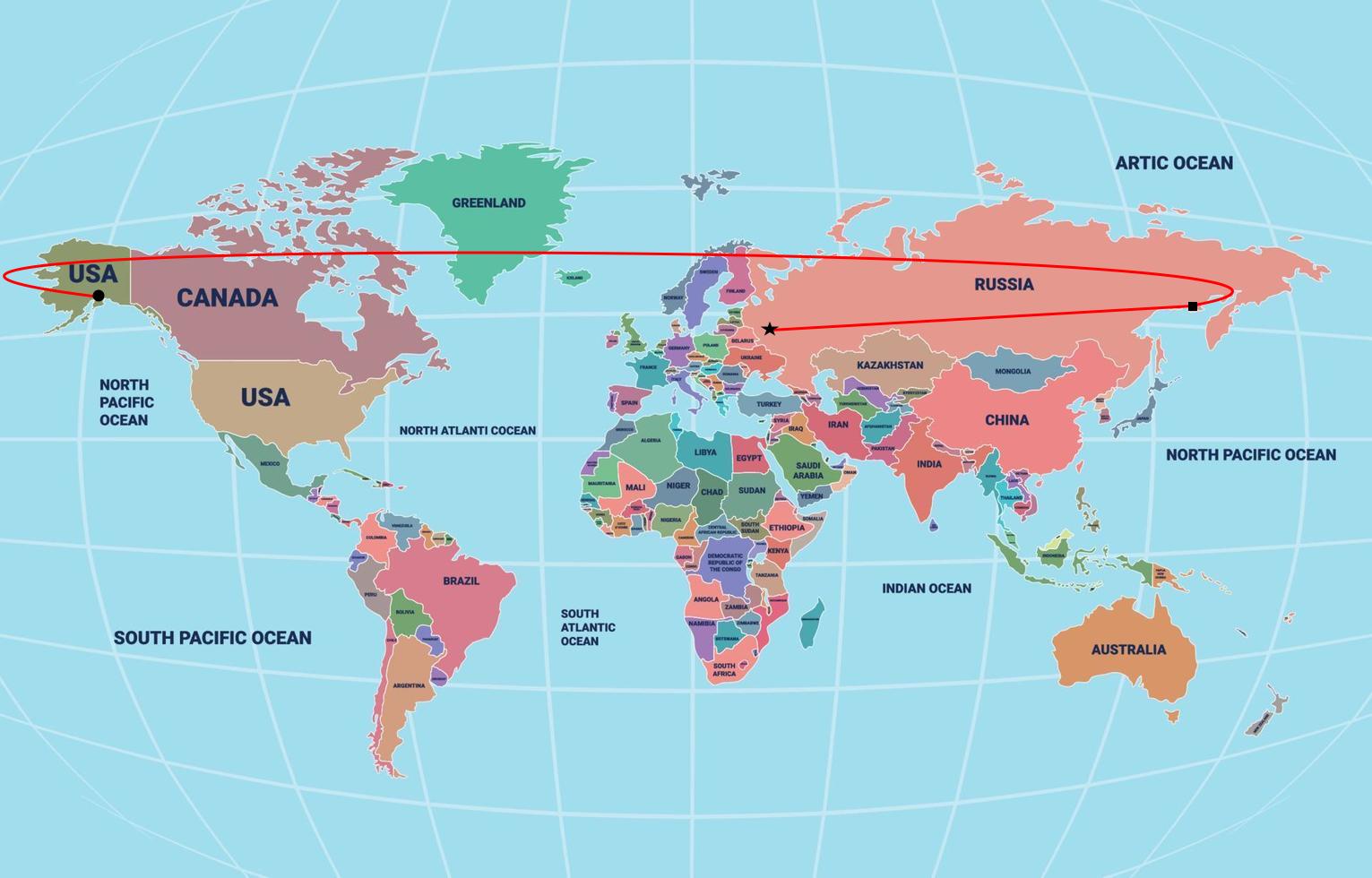
What This Map Shows
This intriguing map visualizes the hypothetical flight path of Russian President Vladimir Putin to Alaska, using a flat Earth perspective. The flat Earth model, while scientifically debunked, presents an alternative view of how distances and locations are perceived. In this visualization, we can see how the distance from Moscow to Alaska might be represented in a flat Earth framework, which contrasts sharply with conventional geospatial representations.
Deep Dive into Flight Paths and Geography
Flight paths are a fascinating subject in geography, especially when considering how different maps can reshape our understanding of distance and travel. When we think about air travel, several factors come into play: the curvature of the Earth, optimal flight routes, and the geography of the regions involved.
In a flat Earth map, the representation of distance can significantly distort our perception of how long a journey might take. For instance, the straight-line distance from Moscow to Anchorage appears much shorter than it is when viewed on a globe. This is mainly due to the way that latitudinal and longitudinal lines are flattened out in the flat Earth model, which does not account for the Earth's curvature. In reality, the flight from Moscow to Alaska typically covers a distance of around 4,000 miles, taking approximately 9 to 10 hours, depending on the flight path and weather conditions.
Interestingly, the flight routes taken by commercial airlines often follow what is known as a great circle route, which is the shortest path between two points on the globe. These routes might look curved on a flat map but are actually the most efficient way to traverse vast distances. This raises the question: why do some people still support flat Earth theories despite overwhelming scientific evidence?
The fascination with flat Earth maps often stems from a rejection of mainstream science, leading to alternative interpretations of geography and space. For many, it's not simply about the physical world but also a broader commentary on skepticism toward established knowledge.
Regional Analysis
Examining the regions involved in this hypothetical flight offers deeper insights into geopolitical relationships and the significance of air travel. Alaska, as part of the United States, has unique geographical characteristics that separate it from the contiguous states. It is situated closer to Russia than many realize; in fact, the Diomede Islands in the Bering Strait are only about 2.4 miles apart at their closest point.
In contrast, Moscow is a bustling metropolis with a population of over 12 million people, serving as the political, economic, and cultural center of Russia. The flight from Moscow to Anchorage can be seen as a bridge between two vastly different cultures and political landscapes. The Arctic region, which includes Alaska, is also experiencing rapid changes due to climate change, making the geopolitical significance of these areas increasingly relevant.
Moreover, comparing the infrastructure of Alaska and Russia reveals stark contrasts. While Alaska has developed air travel as a crucial means of transportation due to its vast wilderness, Russia maintains an extensive network of airlines that connect its remote regions, reflecting the country's size and diversity. This difference in infrastructure can greatly affect travel times and connectivity between these two regions.
Significance and Impact
Understanding the geographical implications of flight paths, especially in the context of contemporary geopolitics, is critical for several reasons. The relationship between the United States and Russia has been complex, and air travel plays a significant role in diplomacy and international relations. The ease or difficulty of travel can influence trade, tourism, and even military strategies.
Furthermore, the Arctic region, where Alaska is located, is becoming increasingly important due to melting ice caps and the potential for new shipping routes and resource extraction. As climate change continues to alter the landscape, the significance of air travel and the connections between these regions will only grow.
In conclusion, while the flat Earth map provides a unique lens through which to view the flight path from Putin to Alaska, it also invites us to consider the very real geographical, political, and environmental factors that shape our world today. The implications of such flights extend beyond mere travel; they represent the ties that bind nations and the challenges we face in an ever-changing global landscape.
Visualization Details
- Published
- August 16, 2025
- Views
- 382
Comments
Loading comments...