us elections Maps
6 geographic visualizations tagged with "us elections"
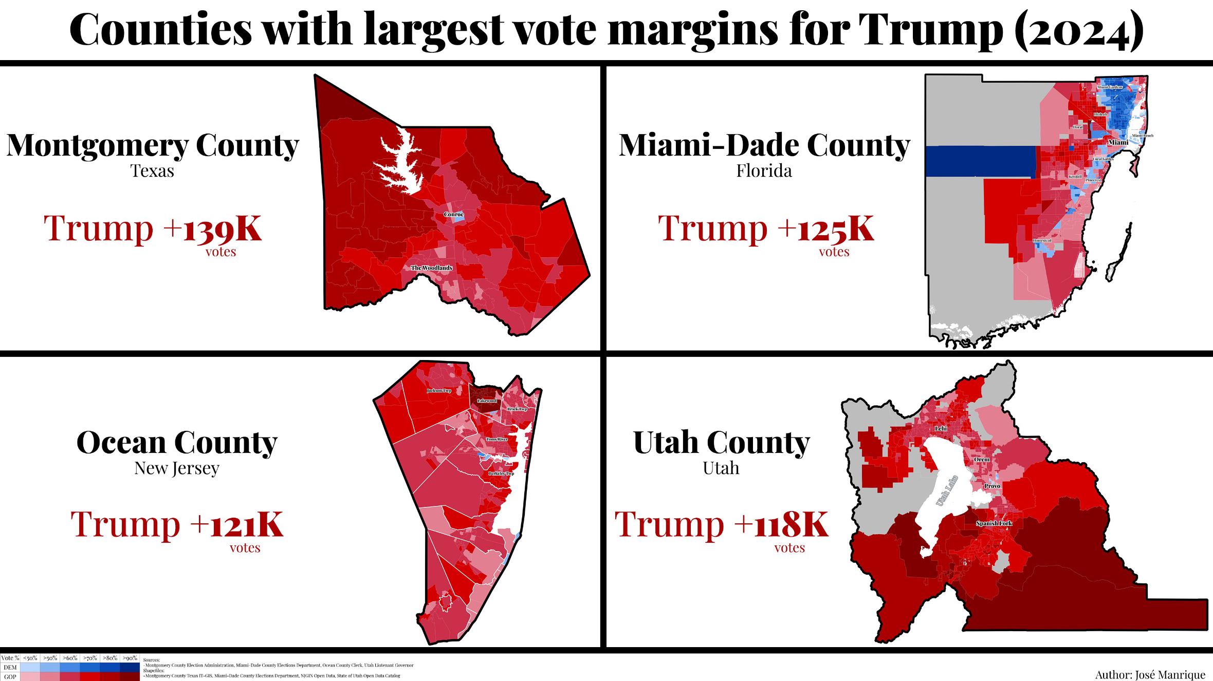
Trump's Largest Margin Counties in 2024 Election Map
The visualization titled "The 4 Counties That Gave Trump His Largest Margin in the 2024 Election" provides a detailed lo...
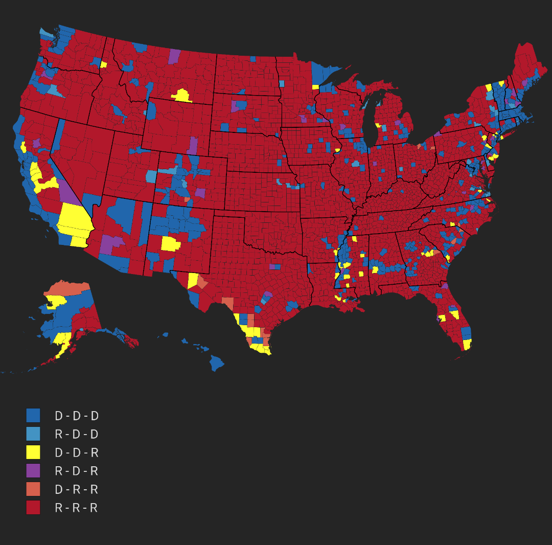
US Counties Voting Patterns Map
This visualization illustrates the voting patterns of US counties across the last three presidential elections. By color...
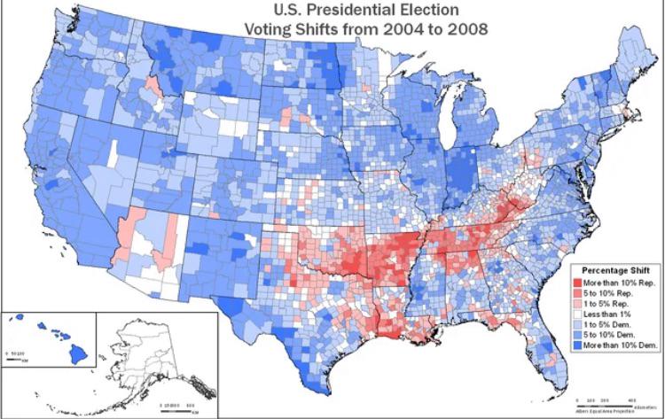
Voting Margin Shift Map from 2004 to 2008
The visualization titled "Shift in Voting Margins across Counties in the US from the 2004 election to the 2008 election"...
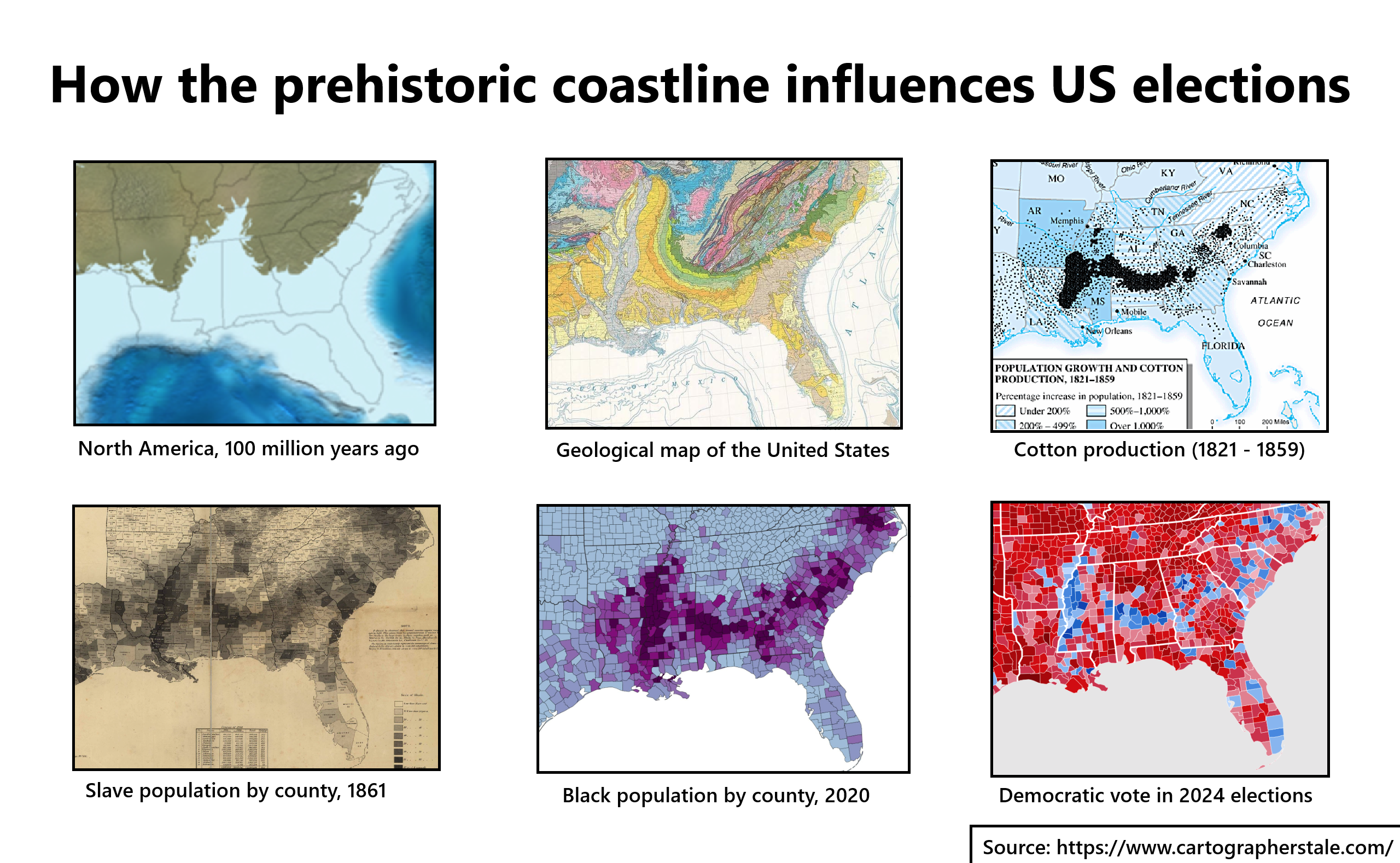
Prehistoric Coastline Influence on US Elections Map
The map titled "How the Prehistoric Coastline Influences US Elections" provides a fascinating visual representation of h...
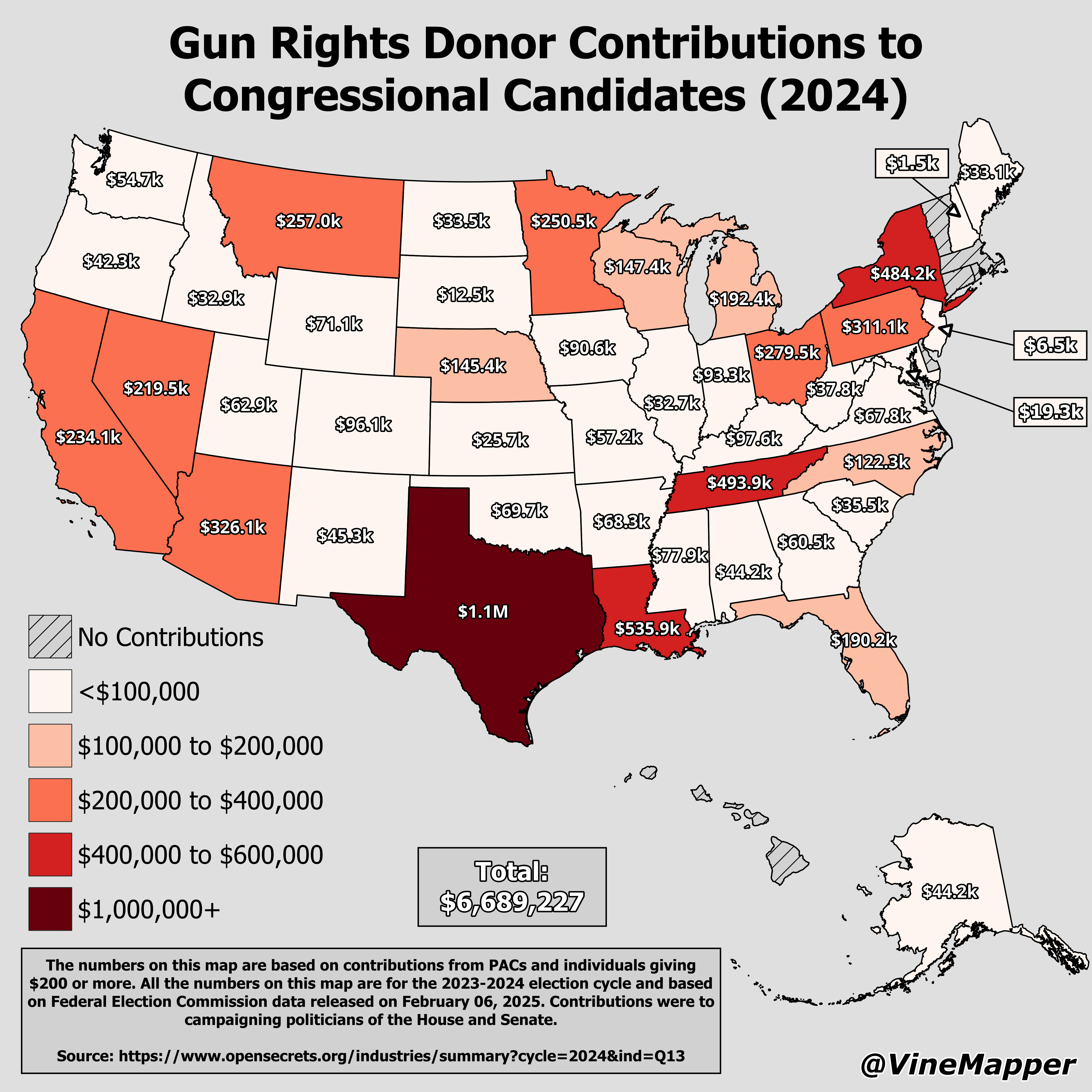
Gun Rights Donor Contributions to Congressional Candidates Map
The "Gun Rights Donor Contributions to Congressional Candidates (2024) Map" provides a detailed visualization of the fin...
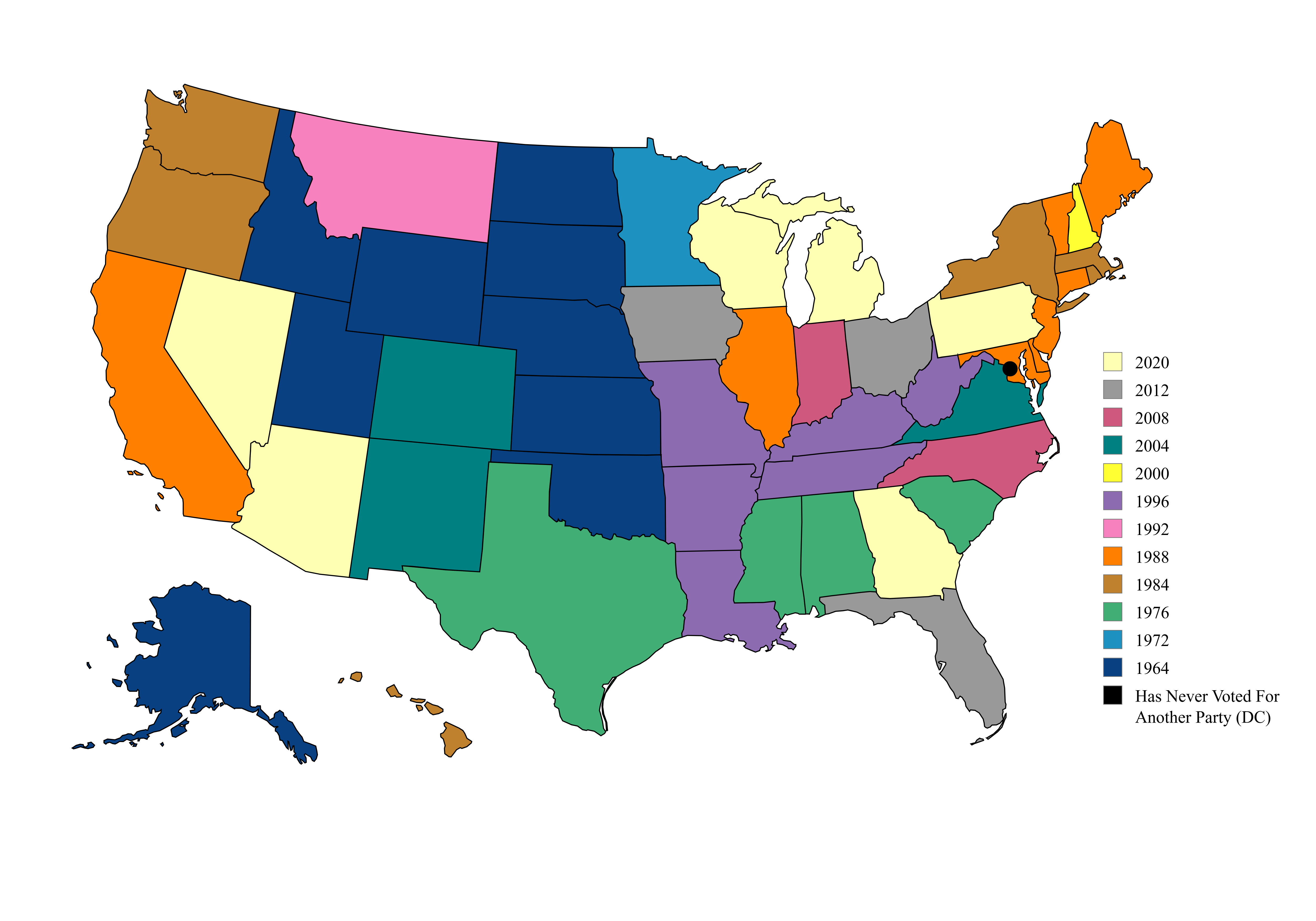
Map of US Presidential Election Party Switches
This map illustrates a fascinating political phenomenon in the United States: the last presidential election in which ea...