territorial expansion Maps
9 geographic visualizations tagged with "territorial expansion"
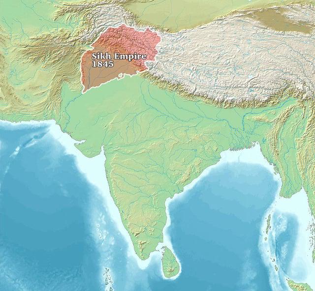
Sikh Empire 1845 Map
The "Sikh Empire 1845 Map" provides a detailed overview of the territorial expanse of the Sikh Empire at its zenith. Spa...
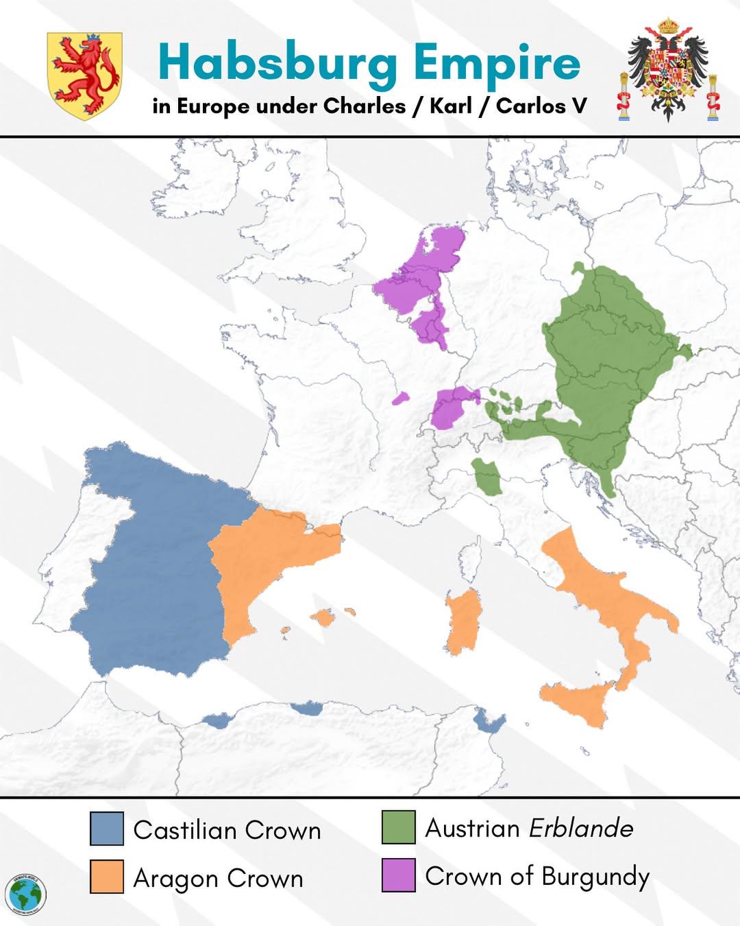
Habsburg Empire Map of Europe under Charles V
The map titled "The Habsburg Empire in Europe under Charles V" provides a detailed visualization of the vast territories...
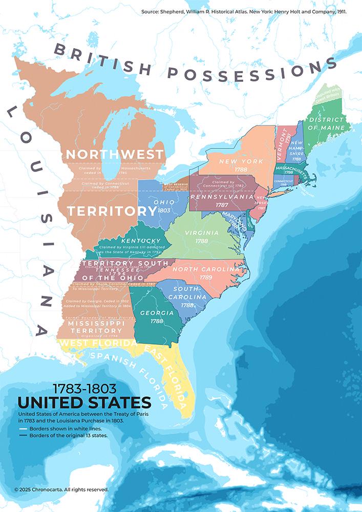
Map of the United States 1783 to 1803
This map illustrates the territorial expansion of the United States from 1783 to 1803, a transformative period in Americ...
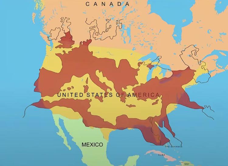
Map of the Roman Empire at its Peak Over the U.S.
This fascinating map overlays the boundaries of the Roman Empire at its zenith around 117 AD with the geographical layou...
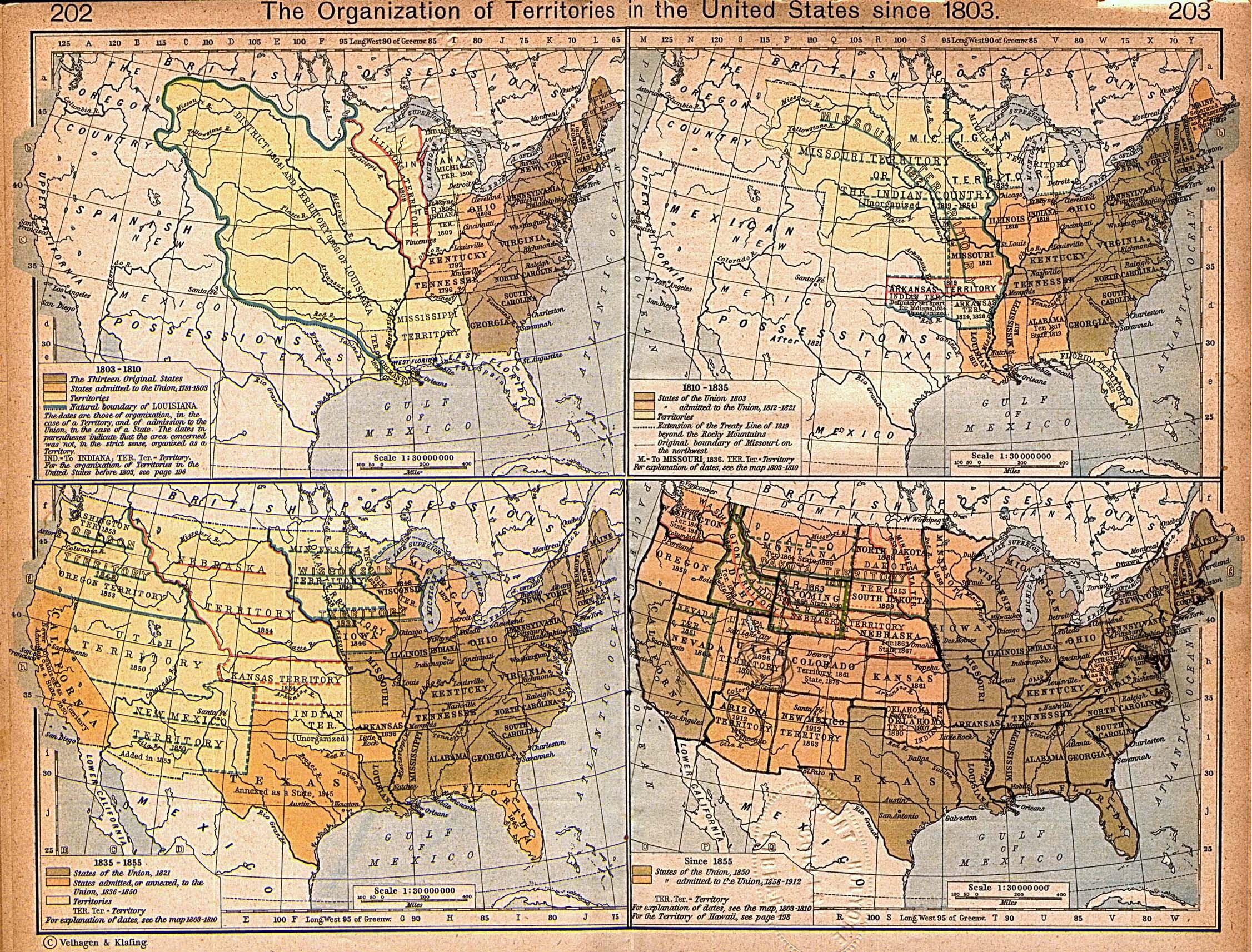
Map of U.S. Territorial Expansion Since 1803
This historical map details the territorial expansion of the United States following the ratification of the Louisiana P...
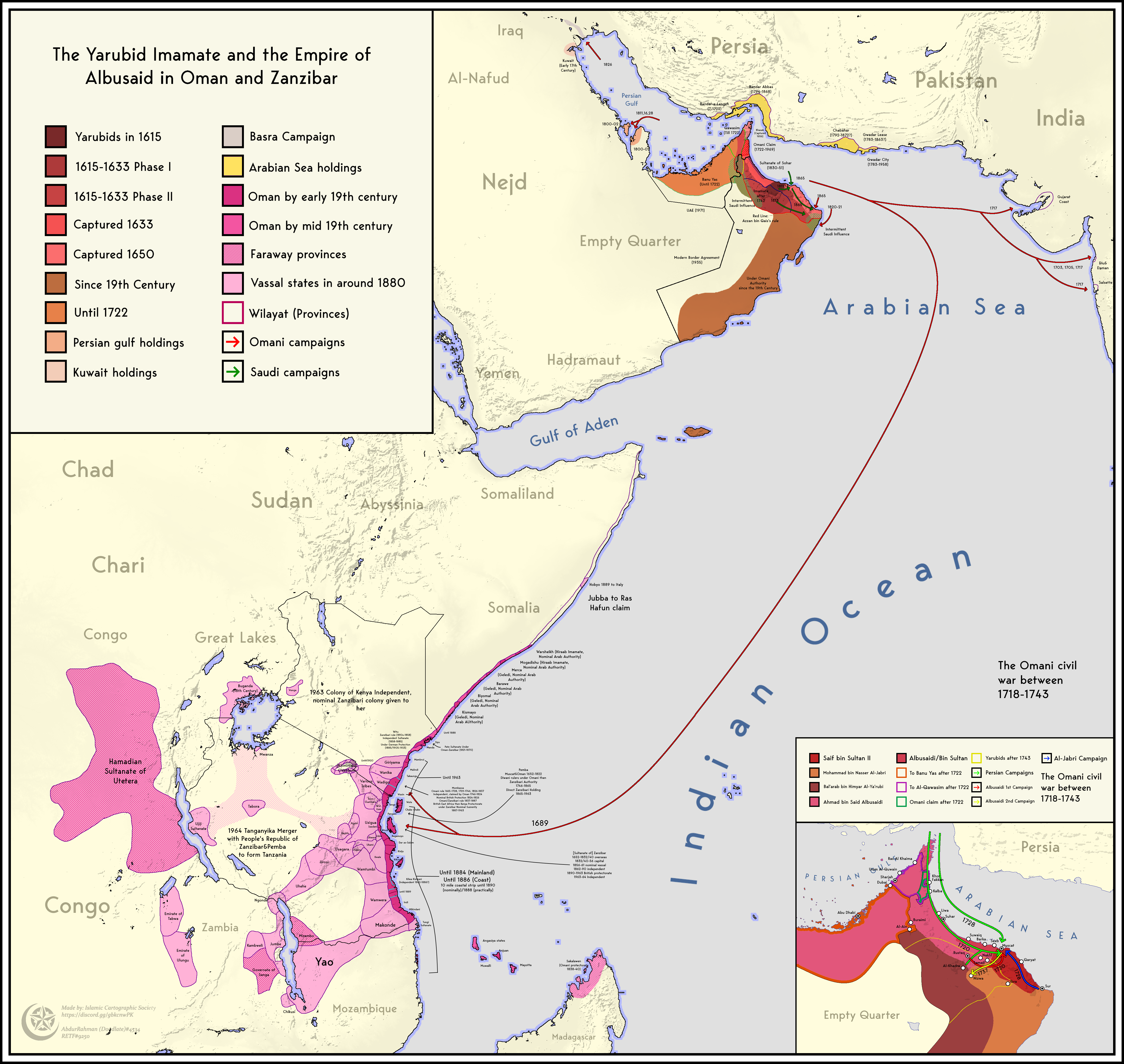
Territorial Expansion and Contraction Map of Oman and Zanzibar
The map titled "Territorial Expansion and Contraction of the Empire of Oman and Zanzibar (1615-1964)" visually represent...
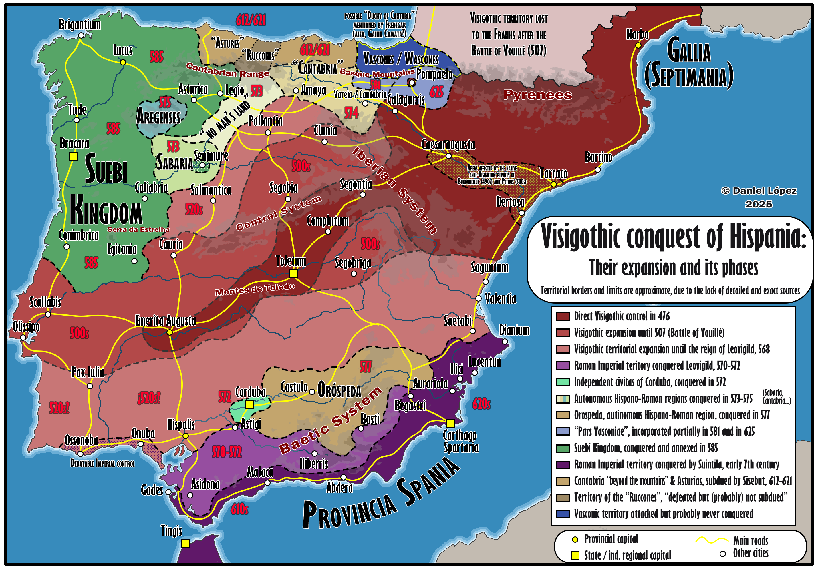
Visigothic Conquest of Hispania Map
This visualization illustrates the phases of the Visigothic conquest of Hispania, highlighting the territorial expansion...

Vietnam's Greatest Extent Map
...
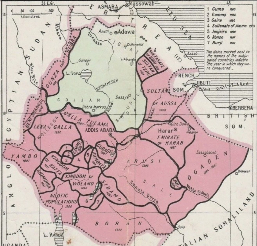
Map of Menelik II's Ethiopia Pre and Post Conquest
...