road networks Maps
4 geographic visualizations tagged with "road networks"

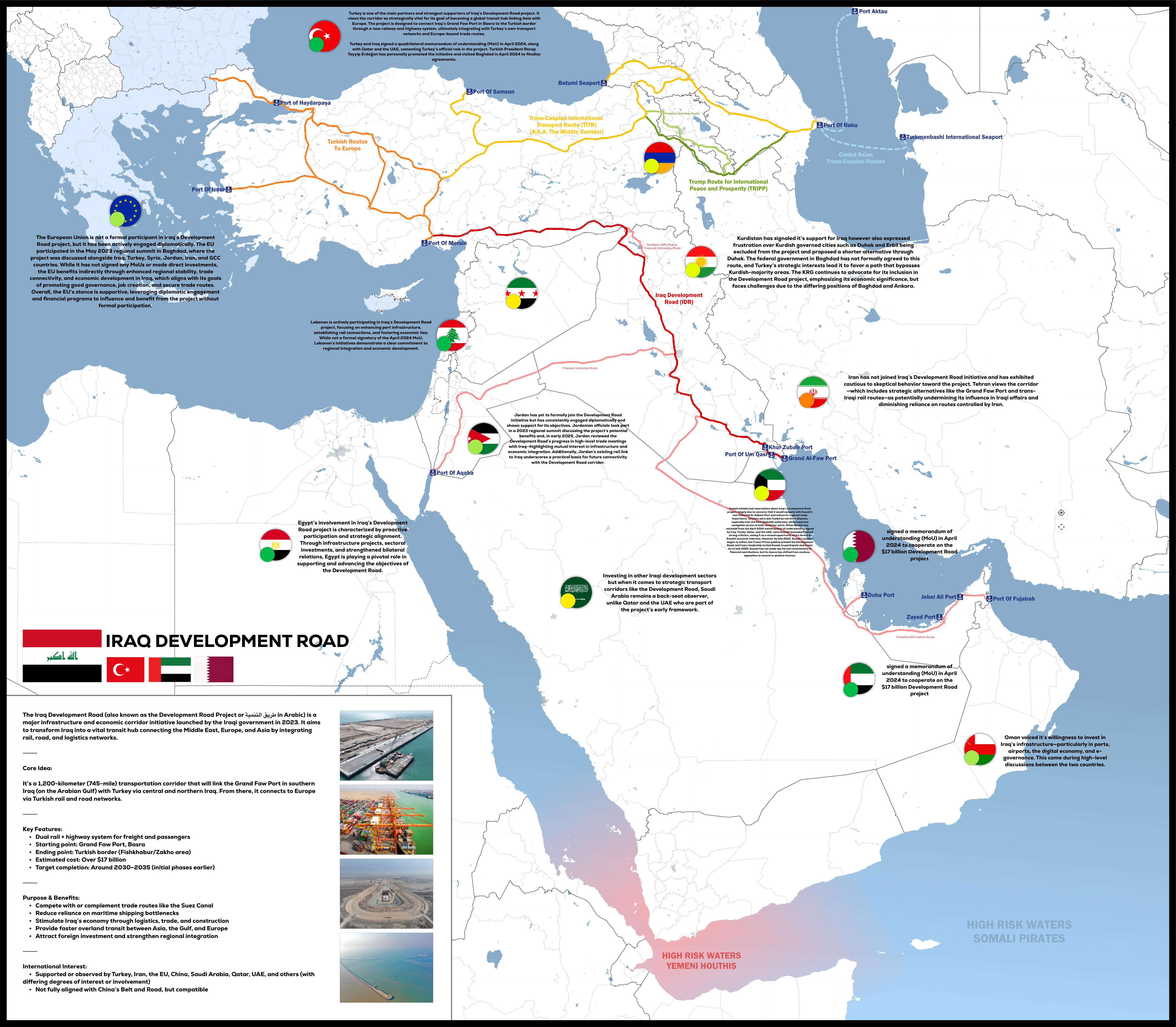
Iraq Development Road Project Map 2025
The "Iraq Development Road Project 2025" map provides a detailed visualization of the planned infrastructure development...
👁 136📅 8/15/2025

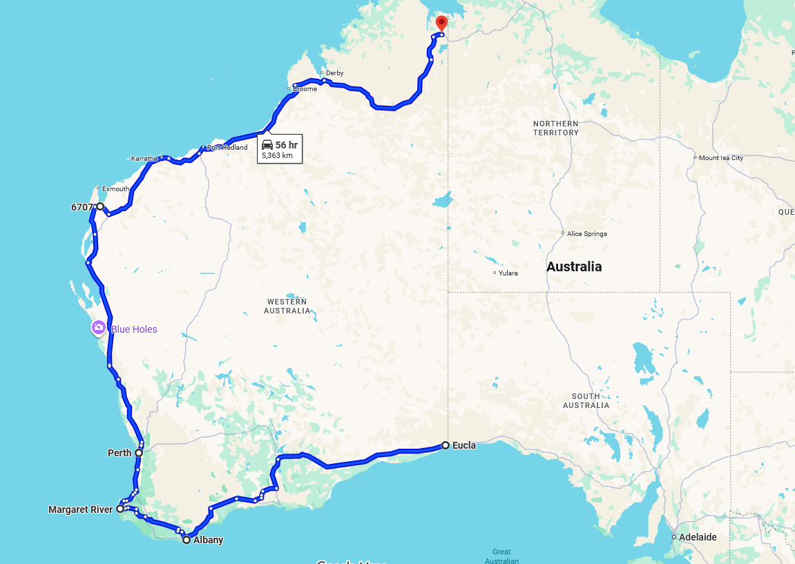
Longest One-Province Road Map
This map visualizes the longest one-province/state road in the world, stretching an impressive 5,363 kilometers and taki...
👁 68📅 9/19/2025

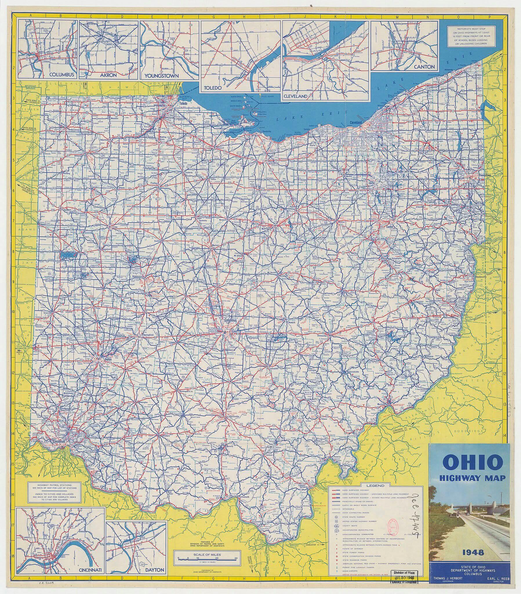
Ohio Highways Map Before the Interstate in 1948
The map titled "Ohio highways before the interstate, as they looked in 1948" provides an intriguing glimpse into the roa...
👁 88📅 9/5/2025

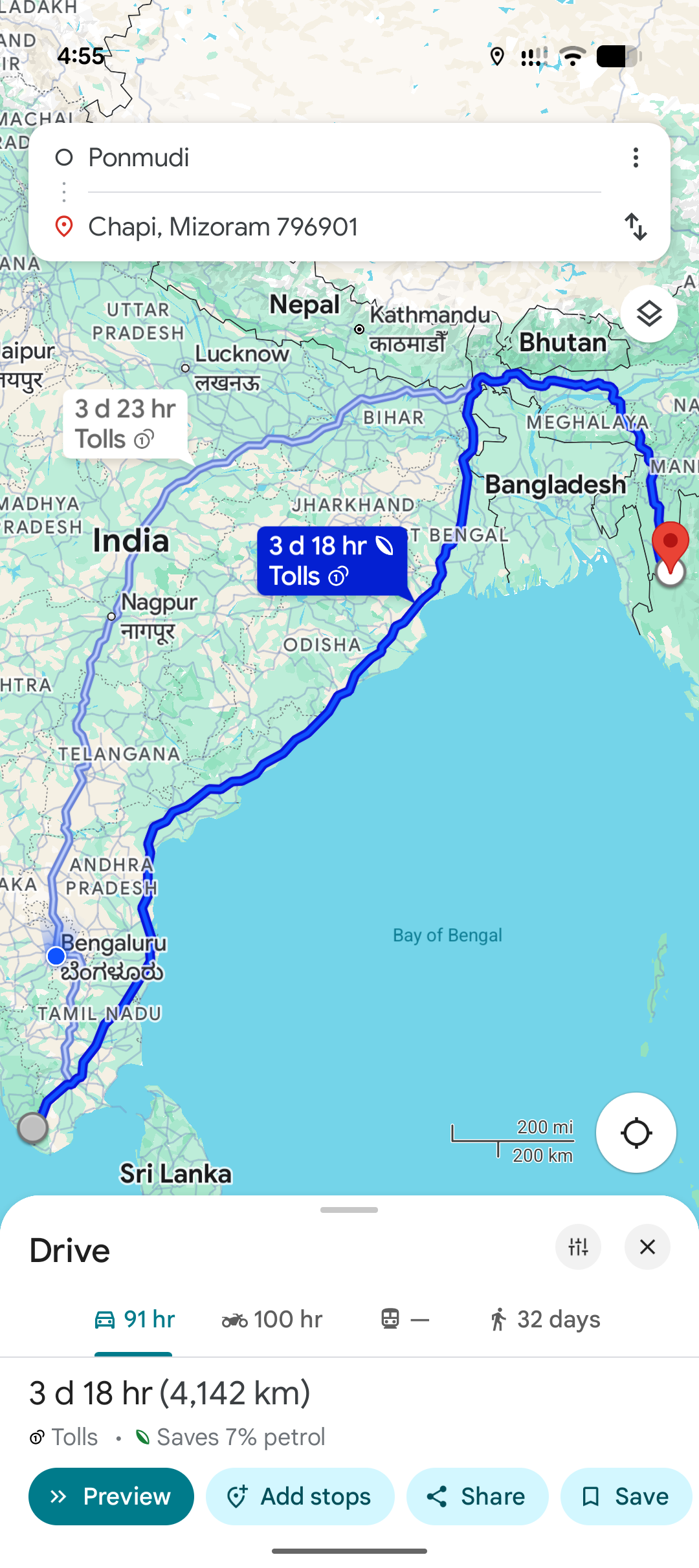
Farthest Points in Country Road Networks Map
This map visualizes the farthest two points within any country's road network, presenting a unique perspective on connec...
👁 42📅 10/10/2025