regional differences Maps
10 geographic visualizations tagged with "regional differences"
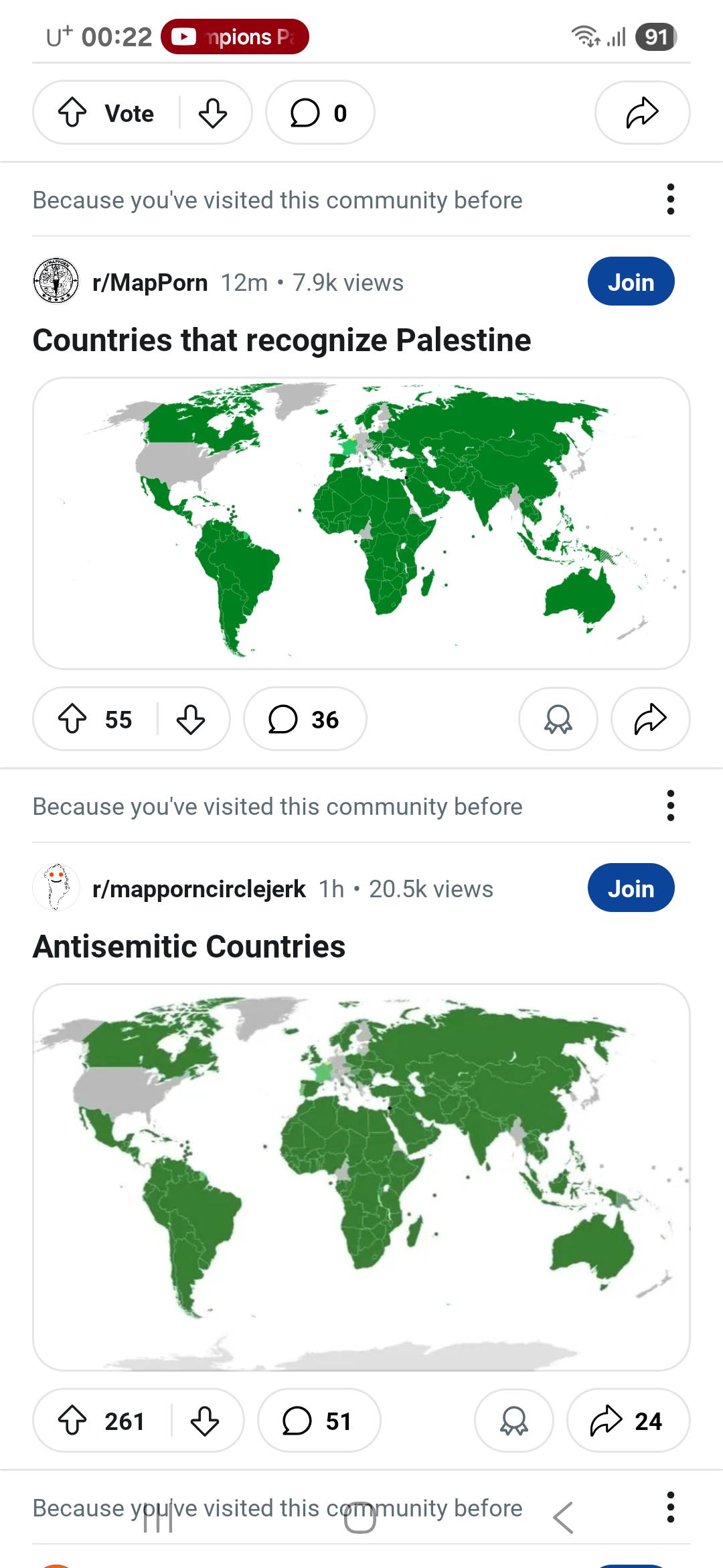
Humorous Regional Stereotypes Map
This visualization humorously depicts regional stereotypes across various parts of the world. The map highlights how dif...
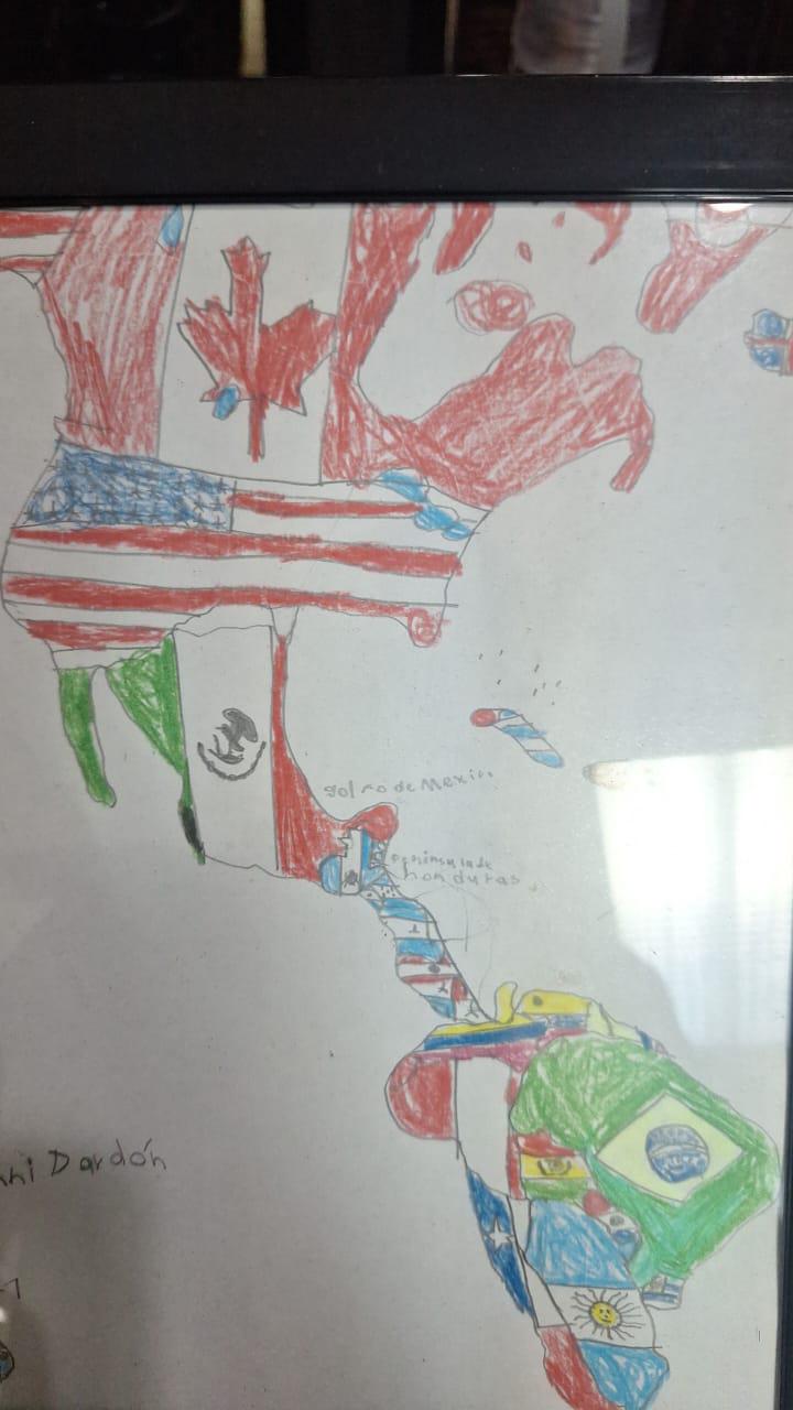
Childhood Drawing Map of America
This charming visualization, a drawing made by a six-year-old, represents a simplistic yet heartfelt interpretation of A...
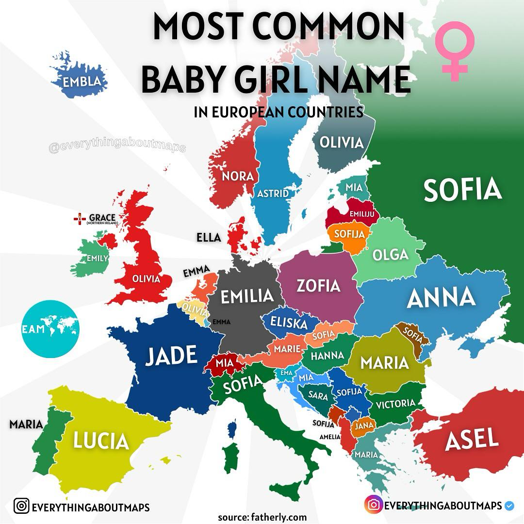
Most Common Baby Girl Names in Europe Map
The "Most Common Baby Girl Names in Europe" map presents an intriguing snapshot of naming trends across the continent. B...
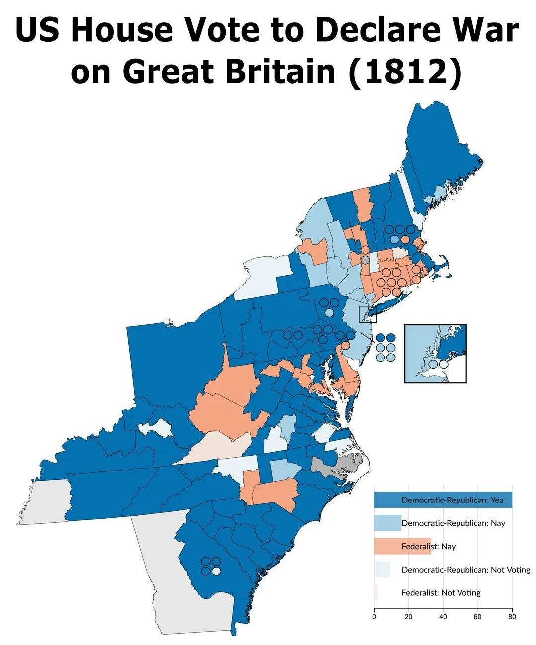
Congress Voting on Declaring War Map 1812
This map visualizes the congressional voting patterns regarding the declaration of war against Great Britain in 1812. It...
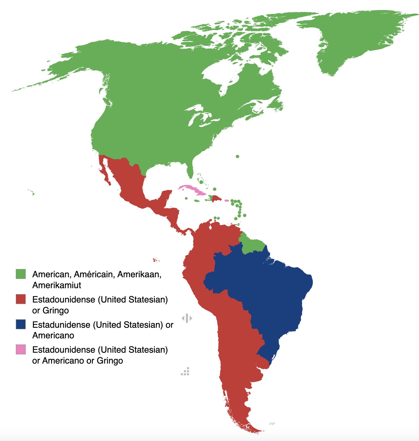
Map of How Americas Refer to USA People by Language
The map titled "Various countries in the Americas refer to people from the USA based on their language" provides a fasci...
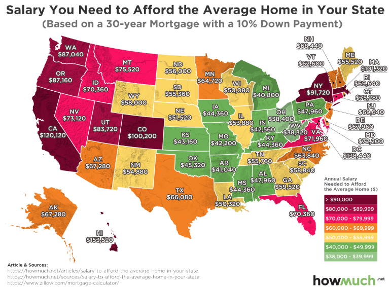
Salary Needed to Afford a Home Map
Interestingly, the map illustrates how salaries vary dramatically across different regions, affecting home affordability...
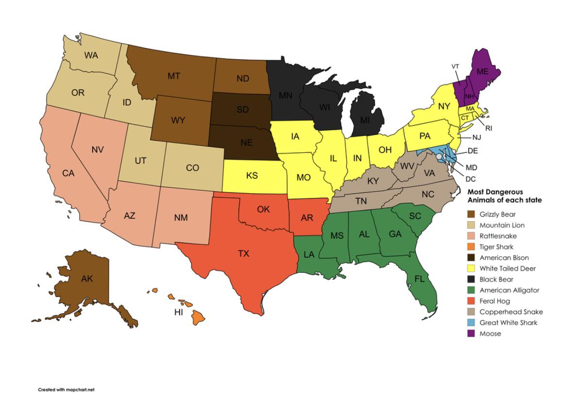
Most Dangerous Animal by State Map
This visualization titled "Most Dangerous Animal by State" provides an intriguing snapshot of the various dangerous anim...
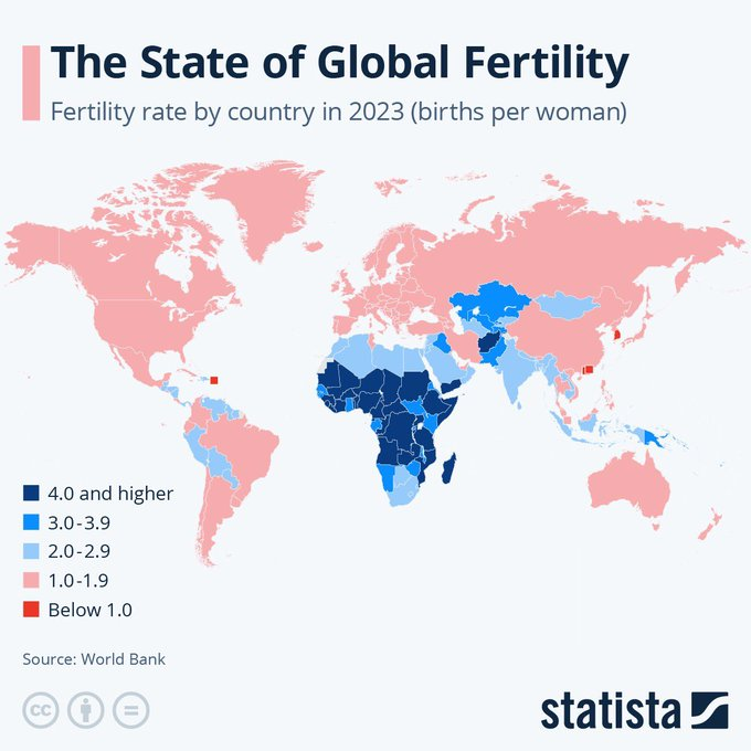
Global Fertility Rates Map
The "Global Fertility Rates Map" provides a comprehensive visualization of fertility rates across different countries an...

Mississippi Flag Vote 2001 Map
The "Mississippi Flag Vote 2001 Map" visually represents the outcome of a significant referendum on the state flag of Mi...
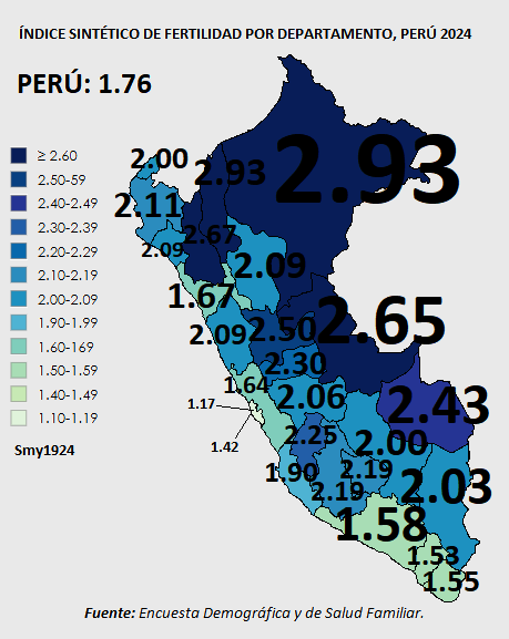
Total Fertility Rate Map of Peru 2024
The map titled "Total Fertility Rate (Children per Woman), Perú 2024" provides a visual representation of the average nu...