public transportation Maps
4 geographic visualizations tagged with "public transportation"

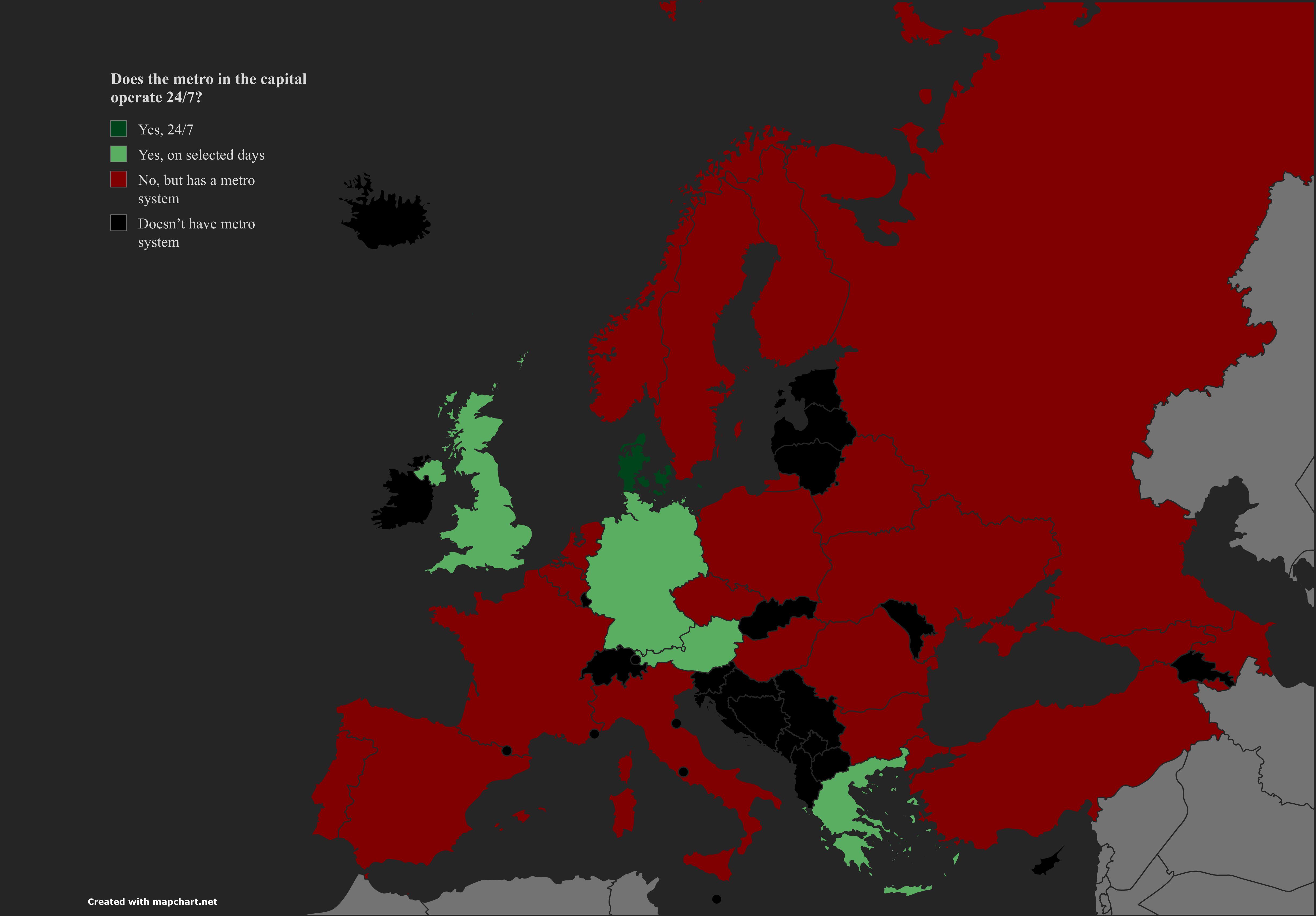
Metro Service in European Capitals Map
The "Metro Service in European Capitals" map presents a comprehensive overview of the metro systems operational in vario...
👁 102📅 9/10/2025

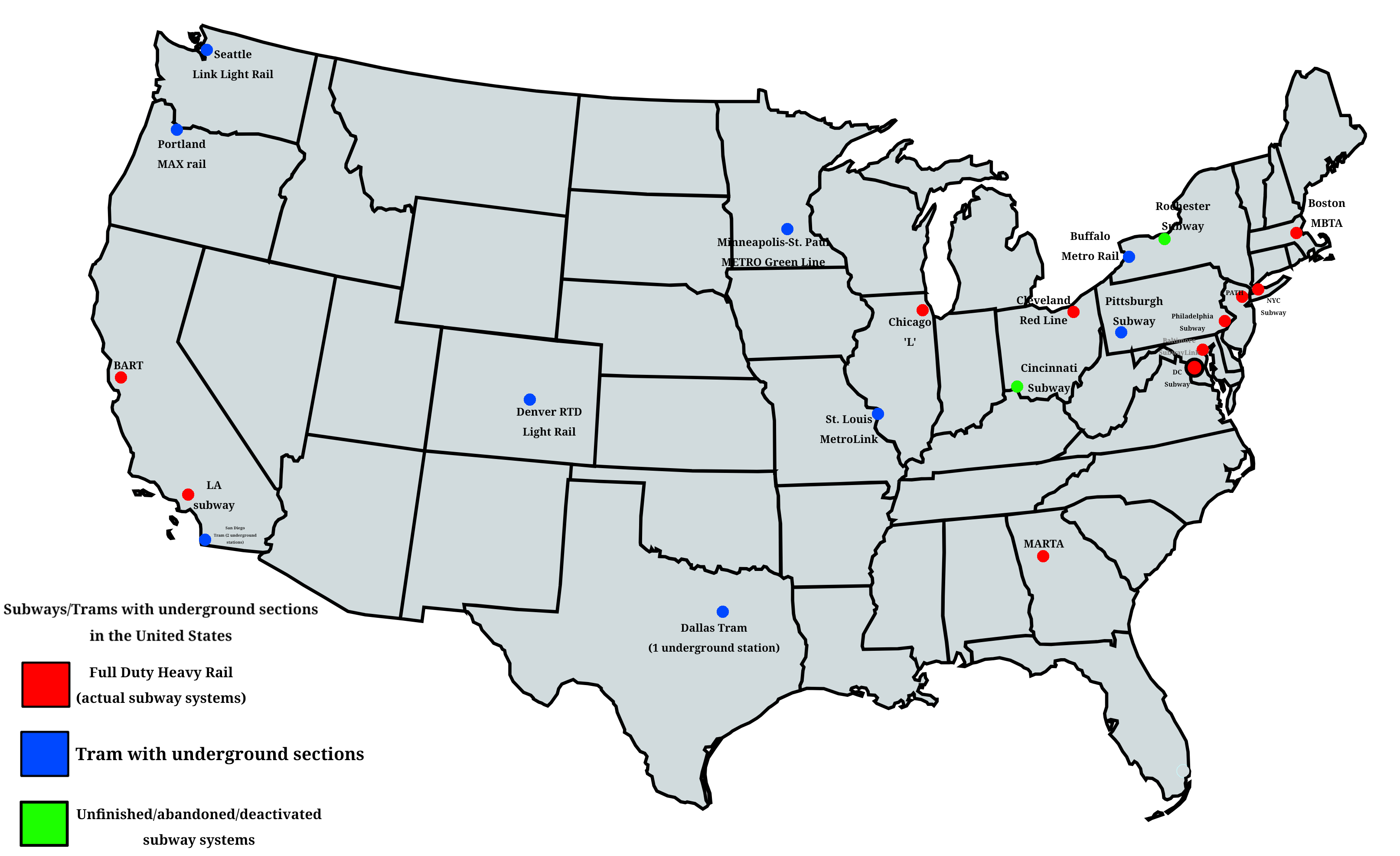
Subway and Tram Systems with Underground Sections Map
This comprehensive map provides a detailed overview of all subway and tram systems across the United States that feature...
👁 110📅 9/2/2025

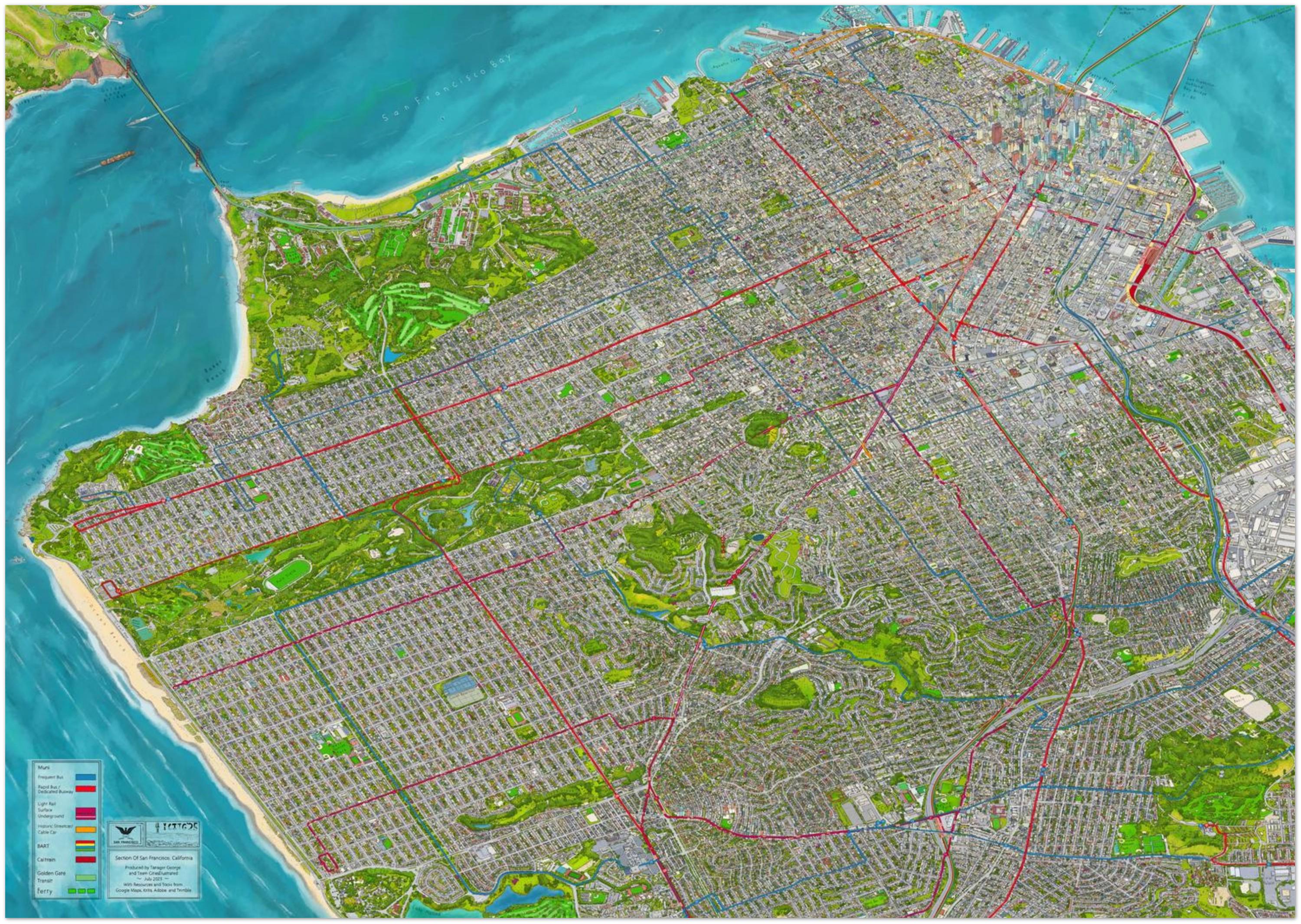
San Francisco Transit and Buildings Map
The map of San Francisco showcases a detailed view of the city's transit systems alongside notable buildings. This type ...
👁 94📅 9/9/2025

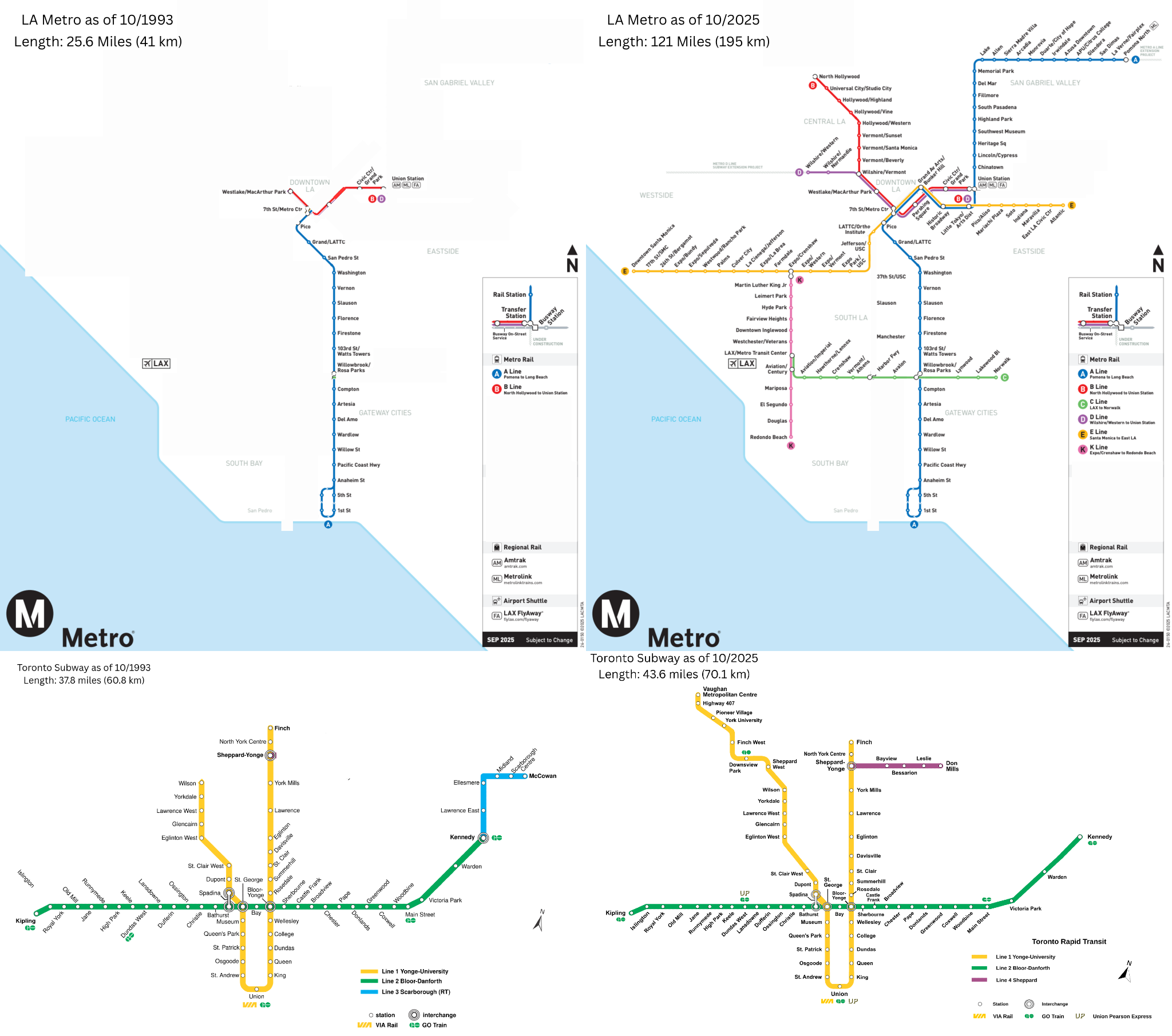
Toronto vs. Los Angeles Rail Transit Networks Map
The "World Series Transit Showoff: Toronto vs. Los Angeles Rail Transit Networks, 1993-2025" map provides a visual compa...
👁 18📅 10/27/2025