public transport Maps
11 geographic visualizations tagged with "public transport"
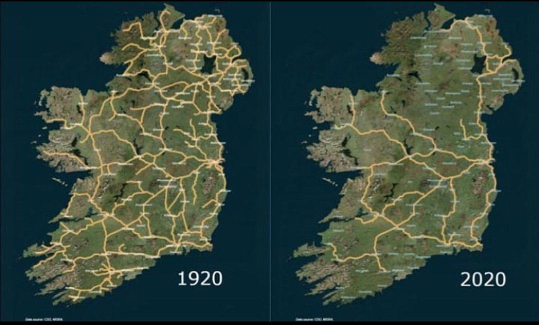
Irish Railway System Map 1920 to 2020
The map titled 'The Irish Railway System between 1920 and 2020' provides a comprehensive visualization of the railway in...
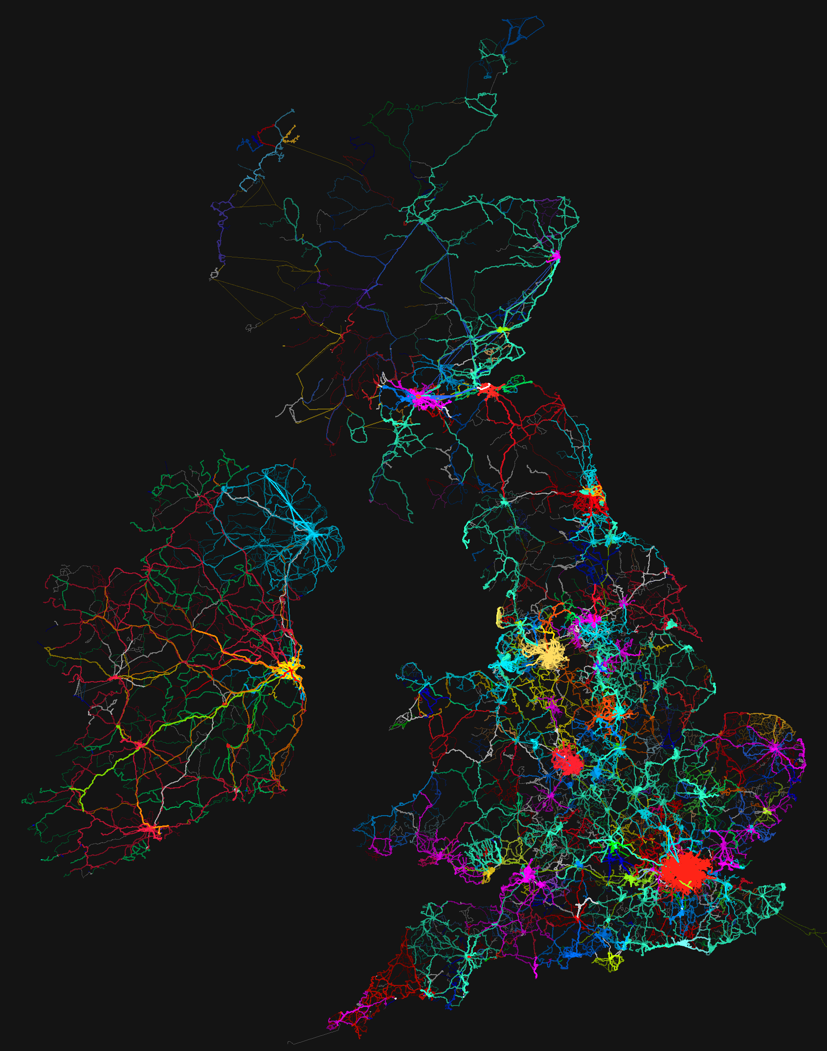
Bus Routes Map of the UK and Ireland
...
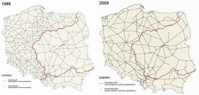
Downgrade of Polish Railway System Map
The "Downgrade of Polish Railway System Map" provides a stark visual representation of the decline in railway infrastruc...
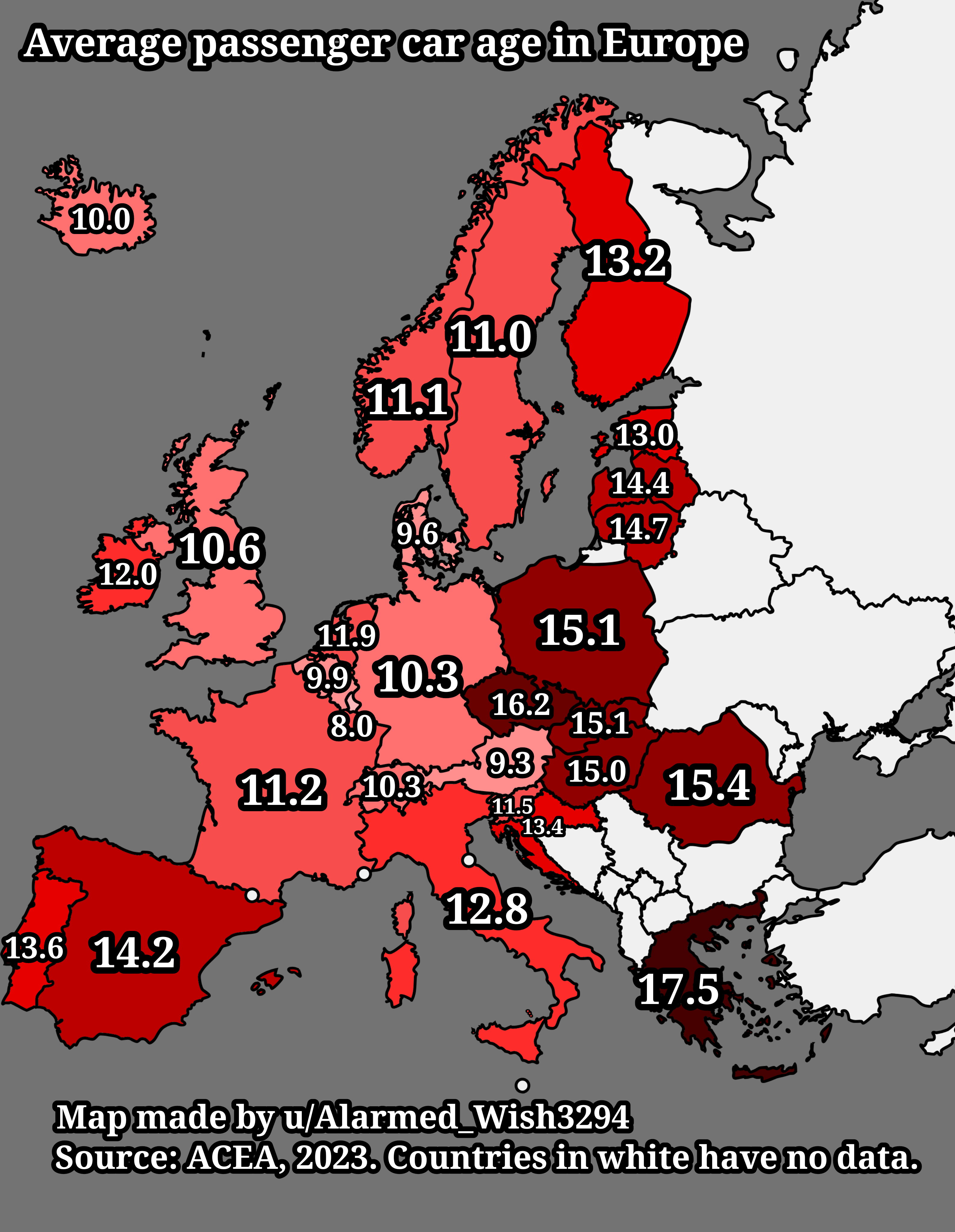
Average Passenger Car Age in Europe Map
The "Average Passenger Car Age in Europe Map" provides a visual representation of the average age of passenger vehicles ...
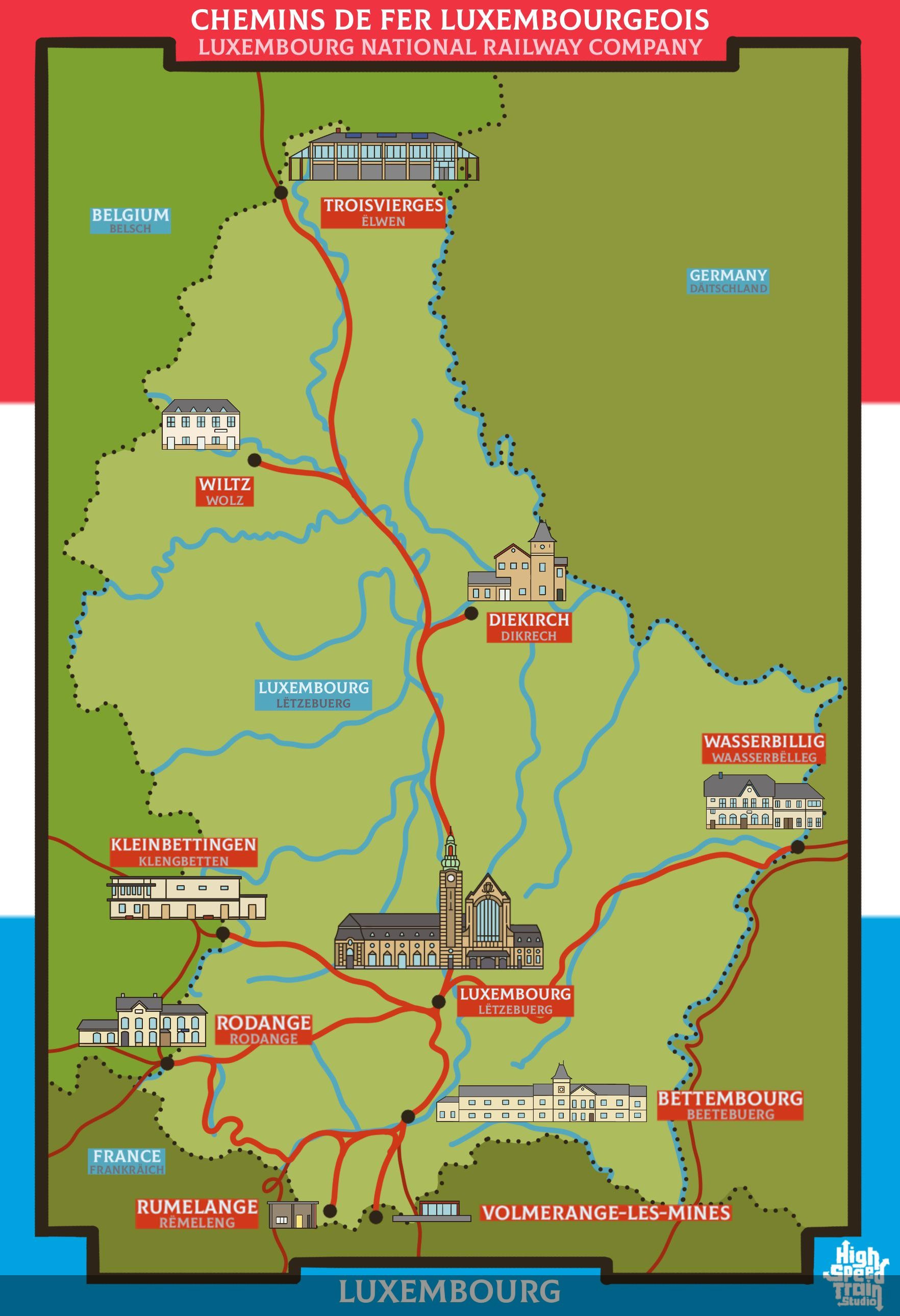
Rail Network Map of Luxembourg
The rail network map of Luxembourg provides a comprehensive view of the country's railway infrastructure, highlighting t...
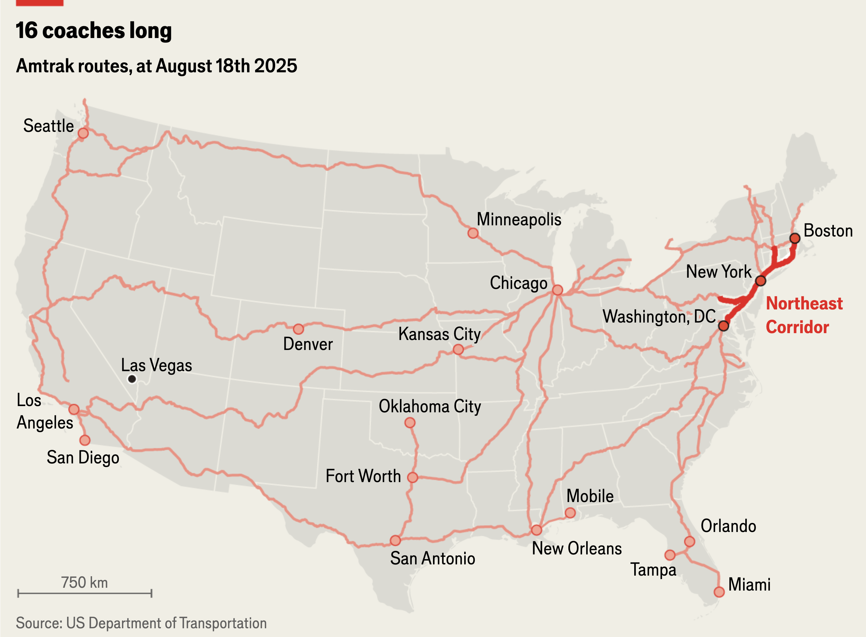
Amtrak Rail Routes Map August 2025
The "Amtrak Rail Routes Map (August 2025)" provides a comprehensive overview of the rail network operated by Amtrak acro...
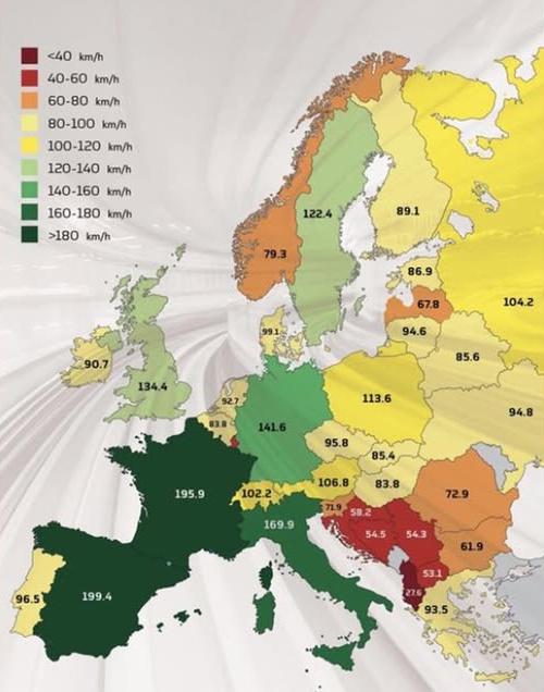
Average Train Speeds in Europe Map
This map visualizes the average train speeds in kilometers per hour (kph) across various countries in Europe, providing ...
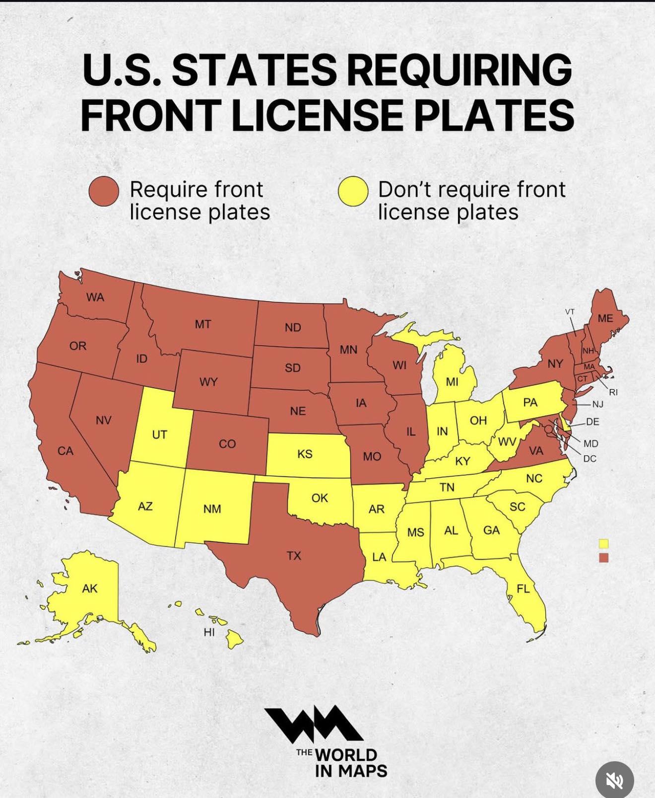
Car Ownership Distribution Map by Region
This map illustrates the distribution of car ownership across various regions, highlighting the number of vehicles per c...
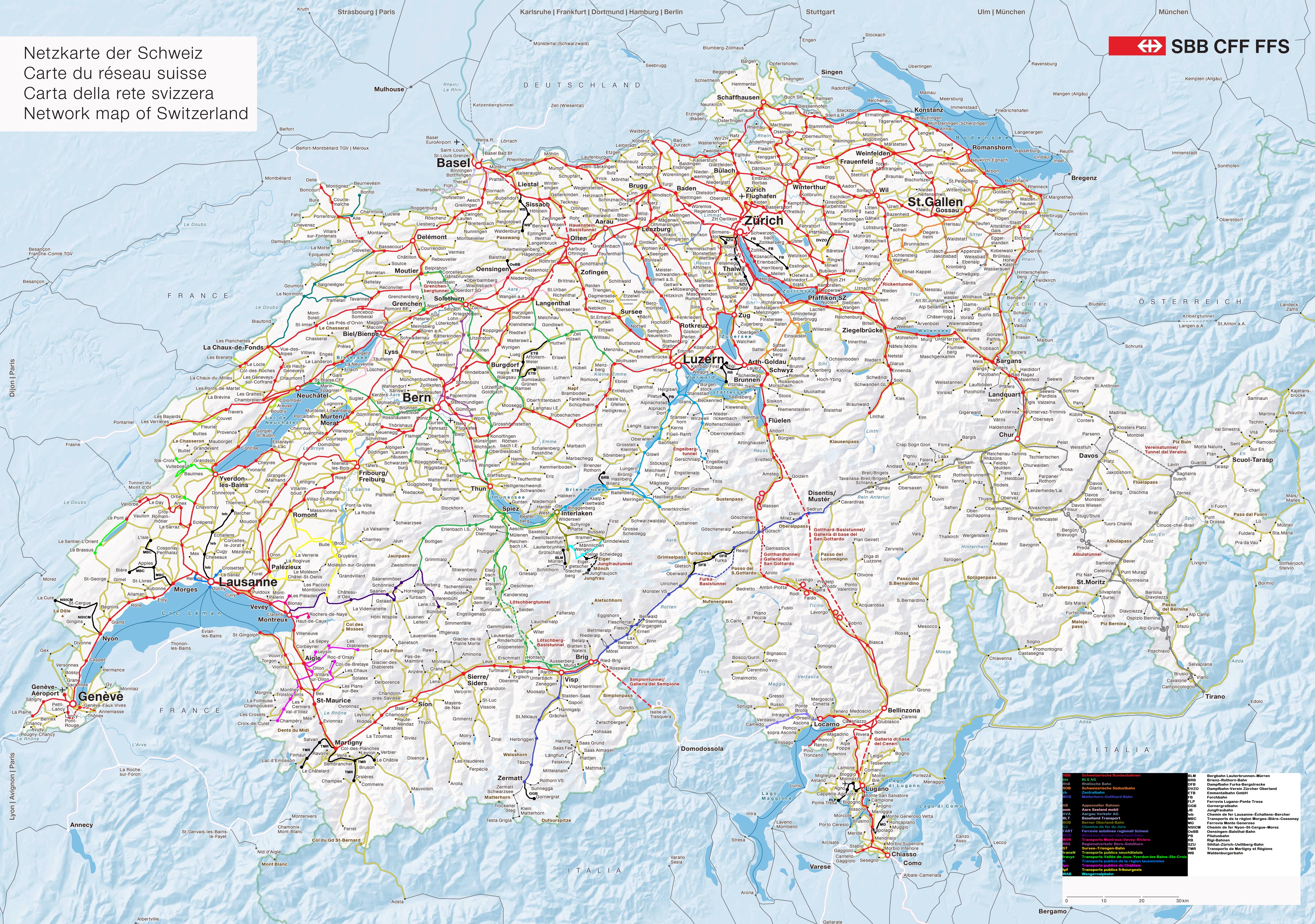
Railway Network of Switzerland by Company Map
The "Railway Network of Switzerland by Company Map" provides a detailed visualization of the various railway lines in Sw...
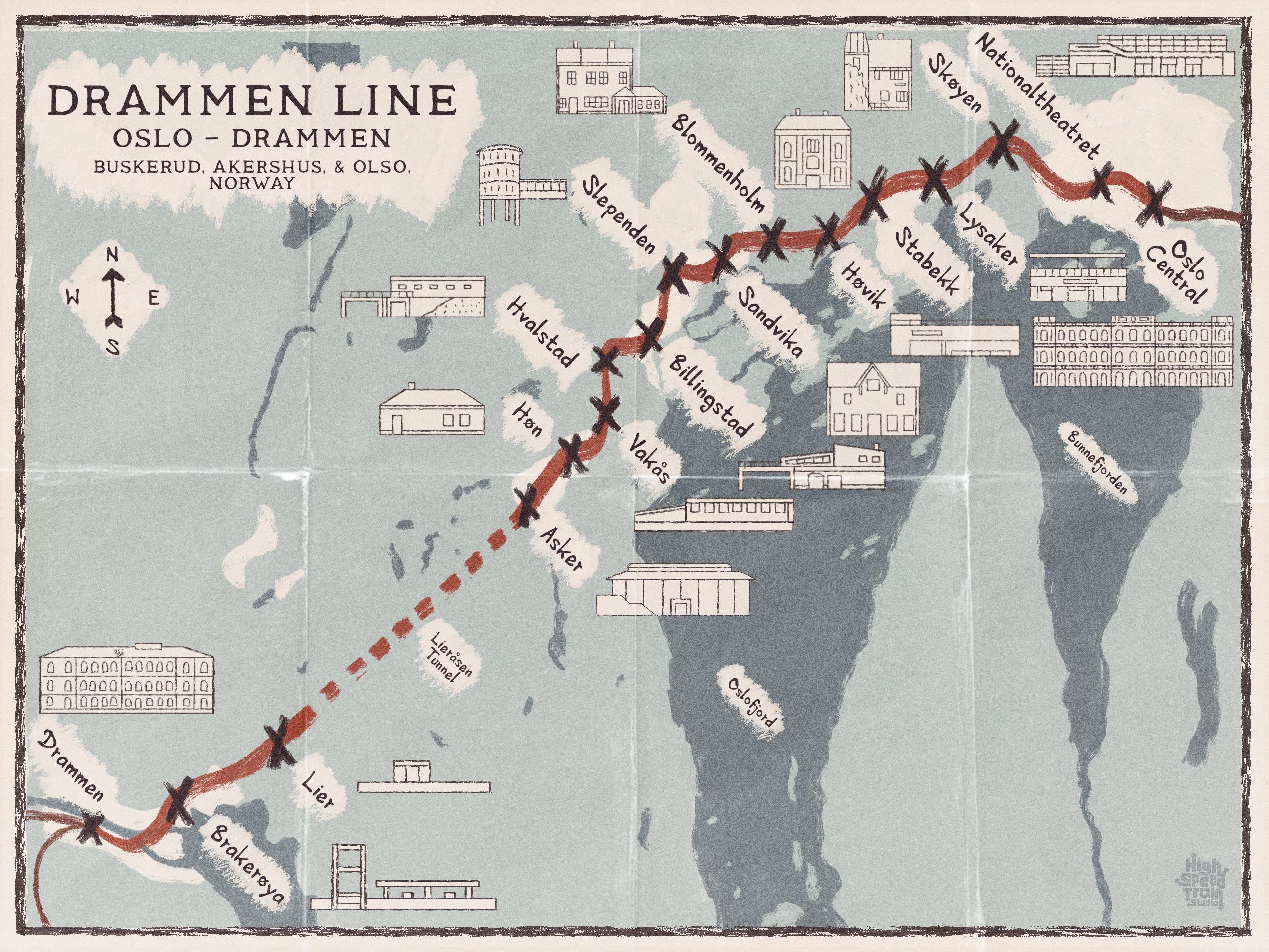
Drammen Line Map of Norway
The map titled "A Map of the Drammen Line, Norway" vividly illustrates the railway line that stretches from Oslo to Dram...
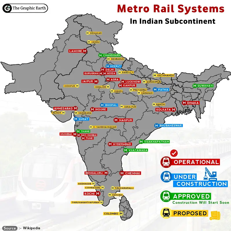
Metro Railway Systems in Indian Subcontinent Map
This visualization provides a comprehensive overview of the metro railway systems across the Indian subcontinent, highli...