postal system Maps
2 geographic visualizations tagged with "postal system"

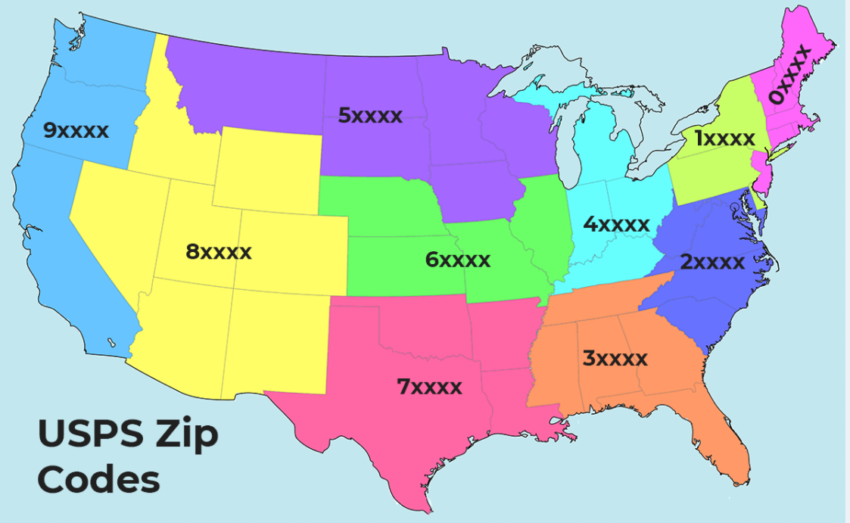
First Digit of ZIP Code Map
The "First Digit of ZIP Code Map" visually represents the first digit of ZIP codes across the United States, revealing r...
👁 138📅 8/11/2025

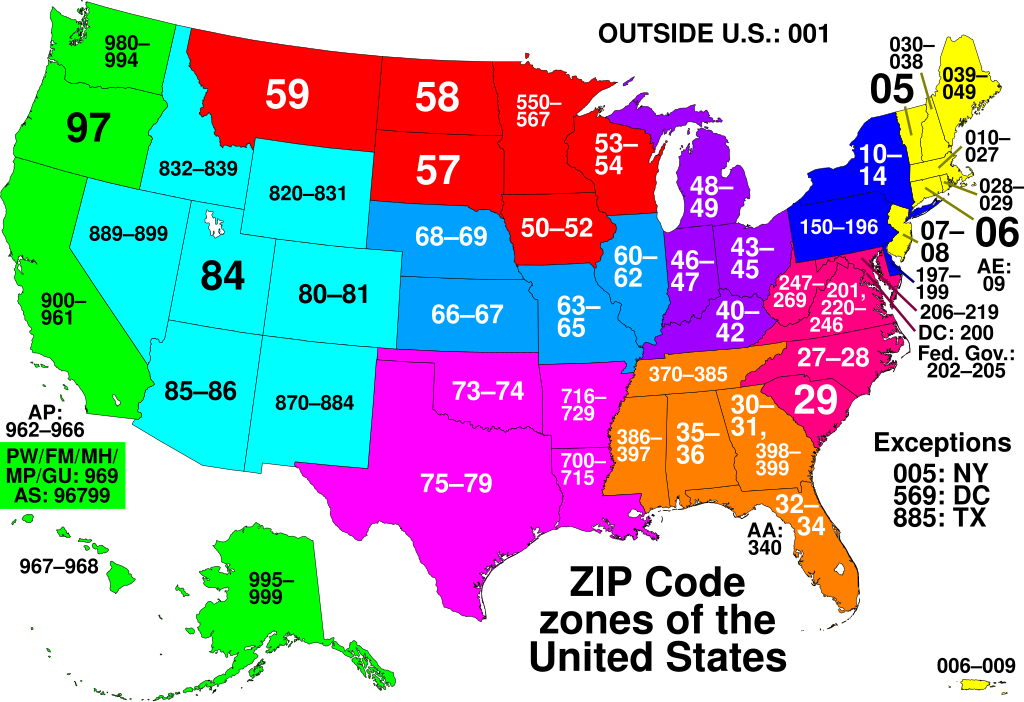
ZIP Code Zones of the United States Map
The "ZIP Code Zones of the United States" map visually represents the postal code system that divides the U.S. into spec...
👁 54📅 9/19/2025