interwar period Maps
2 geographic visualizations tagged with "interwar period"

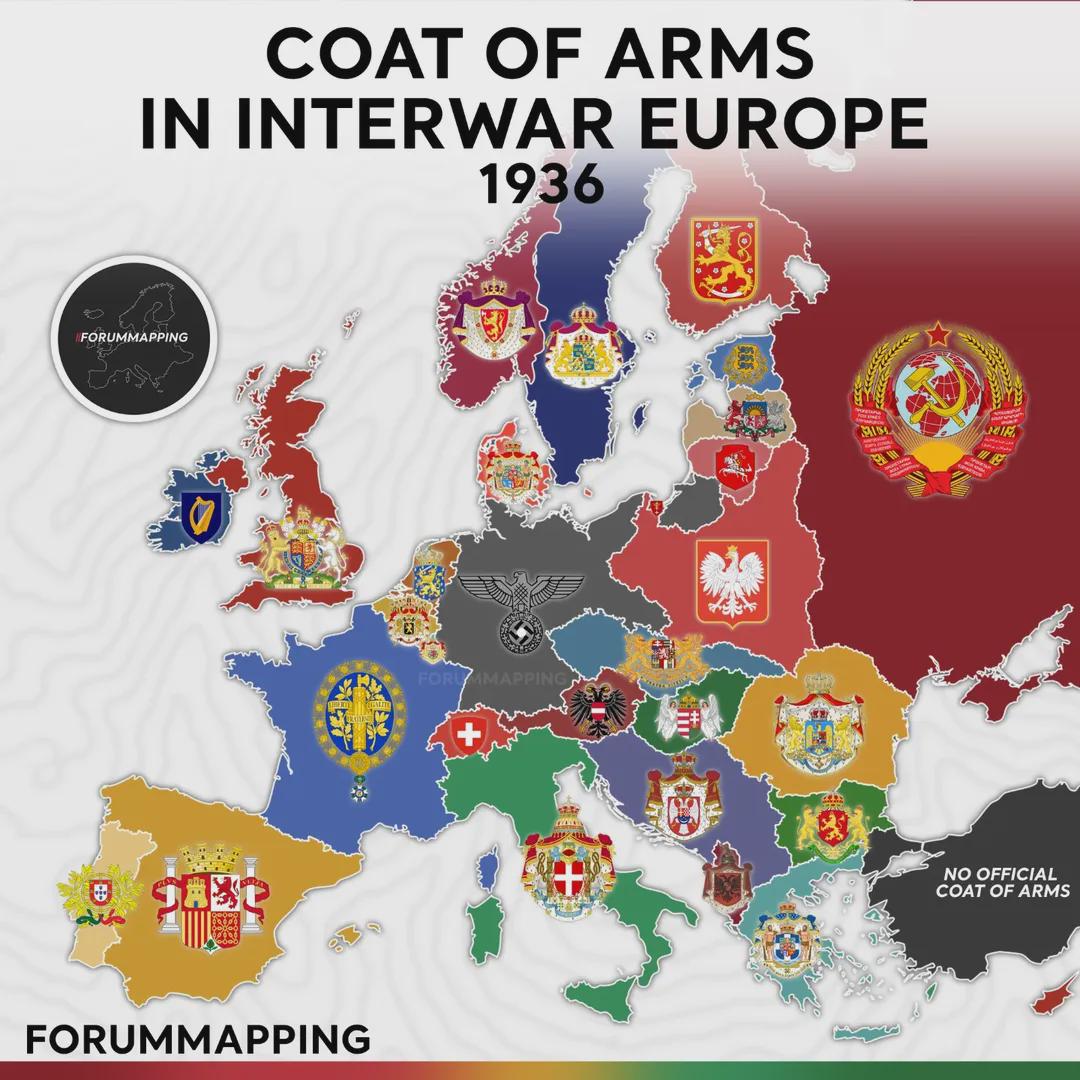
Coat of Arms in Interwar Europe Map
The visualization titled "Coat of Arms in Interwar Europe, 1936" presents a unique snapshot of European heraldry during ...
👁 180📅 8/21/2025

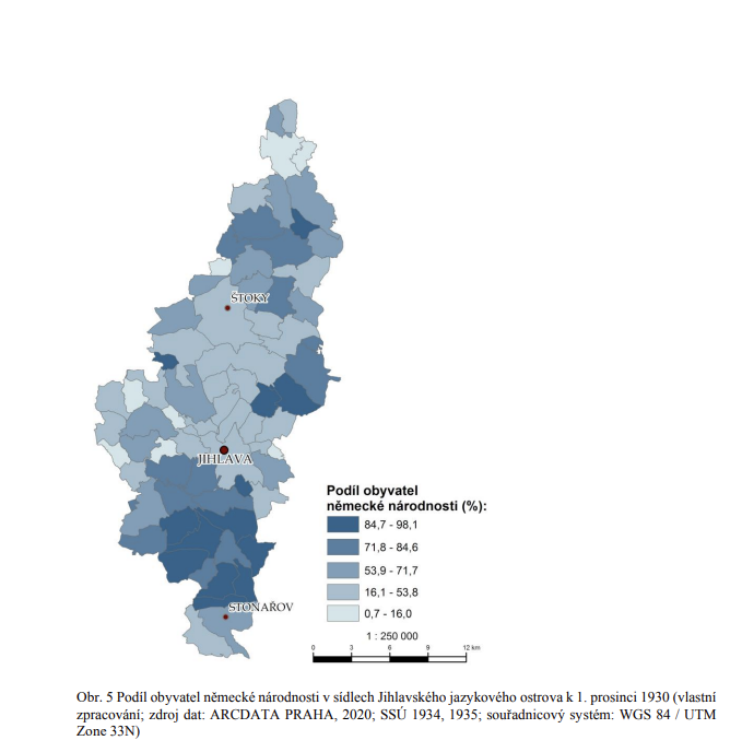
Jihlava Iglau German Language Island Map 1934
The map titled "Jihlava/Iglau German Language Island - Proportion of German Nationality in 1934/1935" presents a fascina...
👁 110📅 8/13/2025