indonesia Maps
7 geographic visualizations tagged with "indonesia"
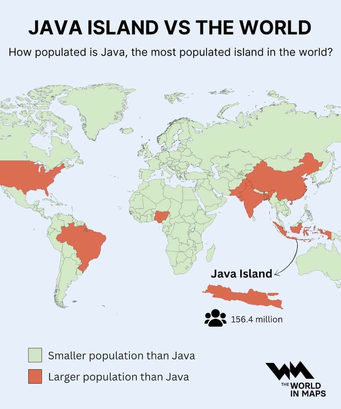
Population Density Map of Java Island
The visualization at hand provides a striking representation of Java Island, illustrating its status as the most populat...
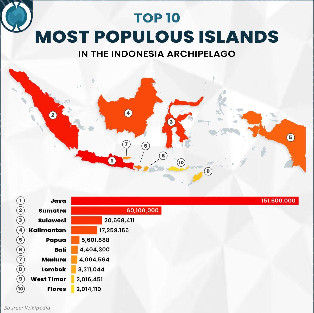
Population Map of Indonesia's Most Populous Islands
The visualization titled "Top 10 Most Populous Islands in the Indonesia Archipelago" provides a clear representation of ...
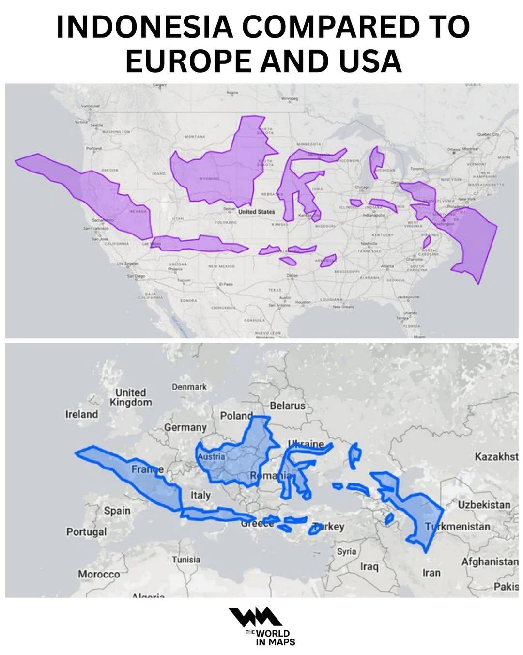
Indonesia Population Density Map Compared to Europe and USA
This map provides a comparative visualization of population density in Indonesia relative to Europe and the USA. By illu...
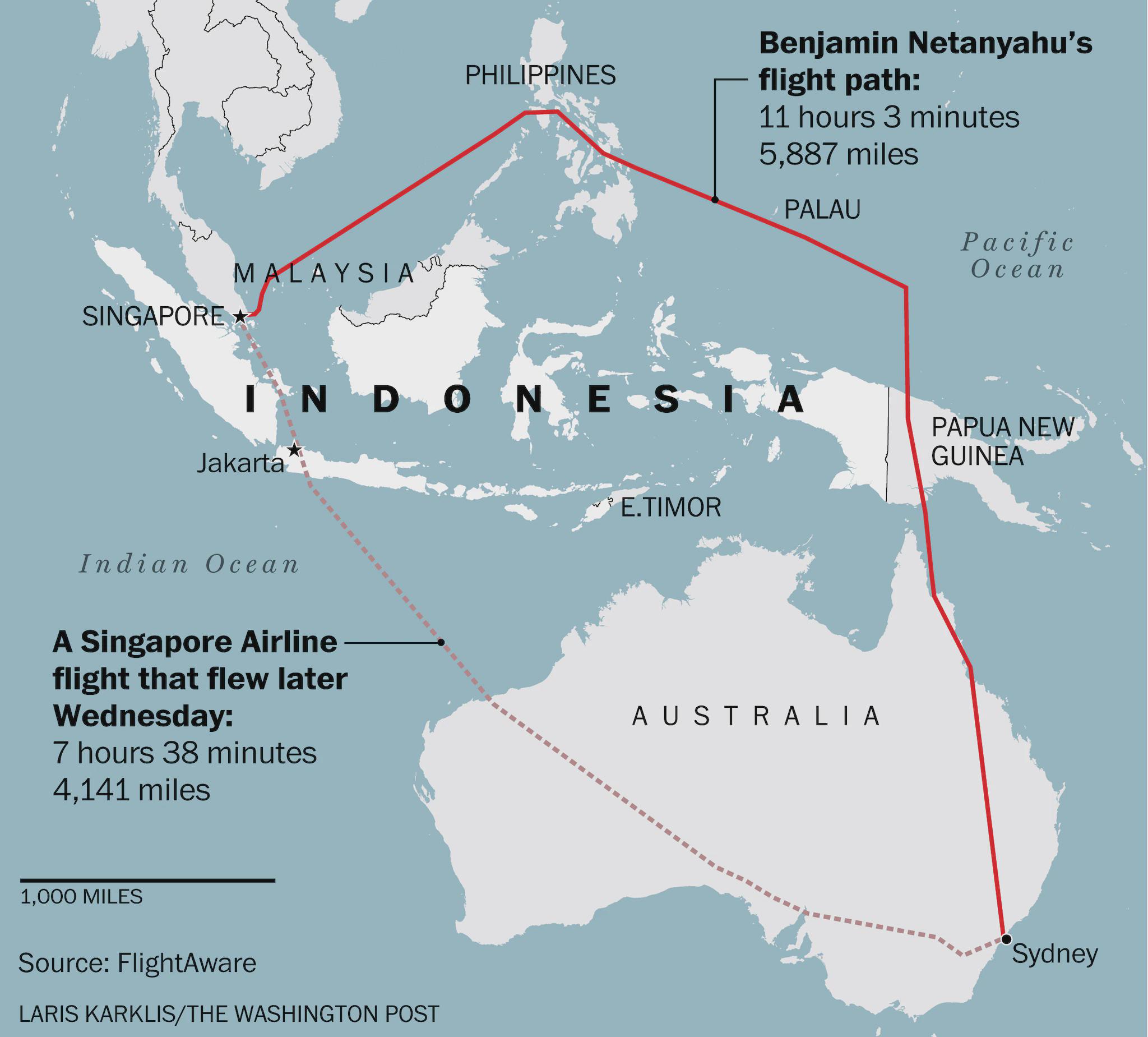
Flight Route Map of Israeli PM Avoiding Indonesia
This map visually represents the flight path taken by Israeli Prime Minister Benjamin Netanyahu during his journey from ...
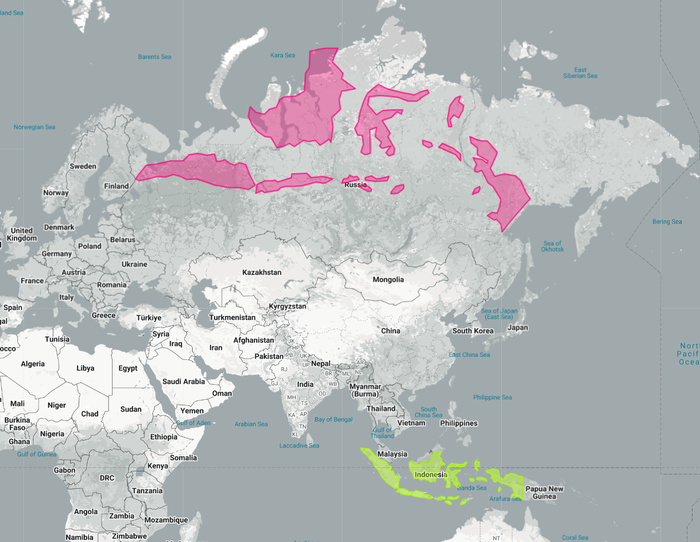
Indonesia Laid Out Over Russia Map
The map titled "Indonesia Laid Out Over Russia" provides a striking visual representation by superimposing the vast arch...
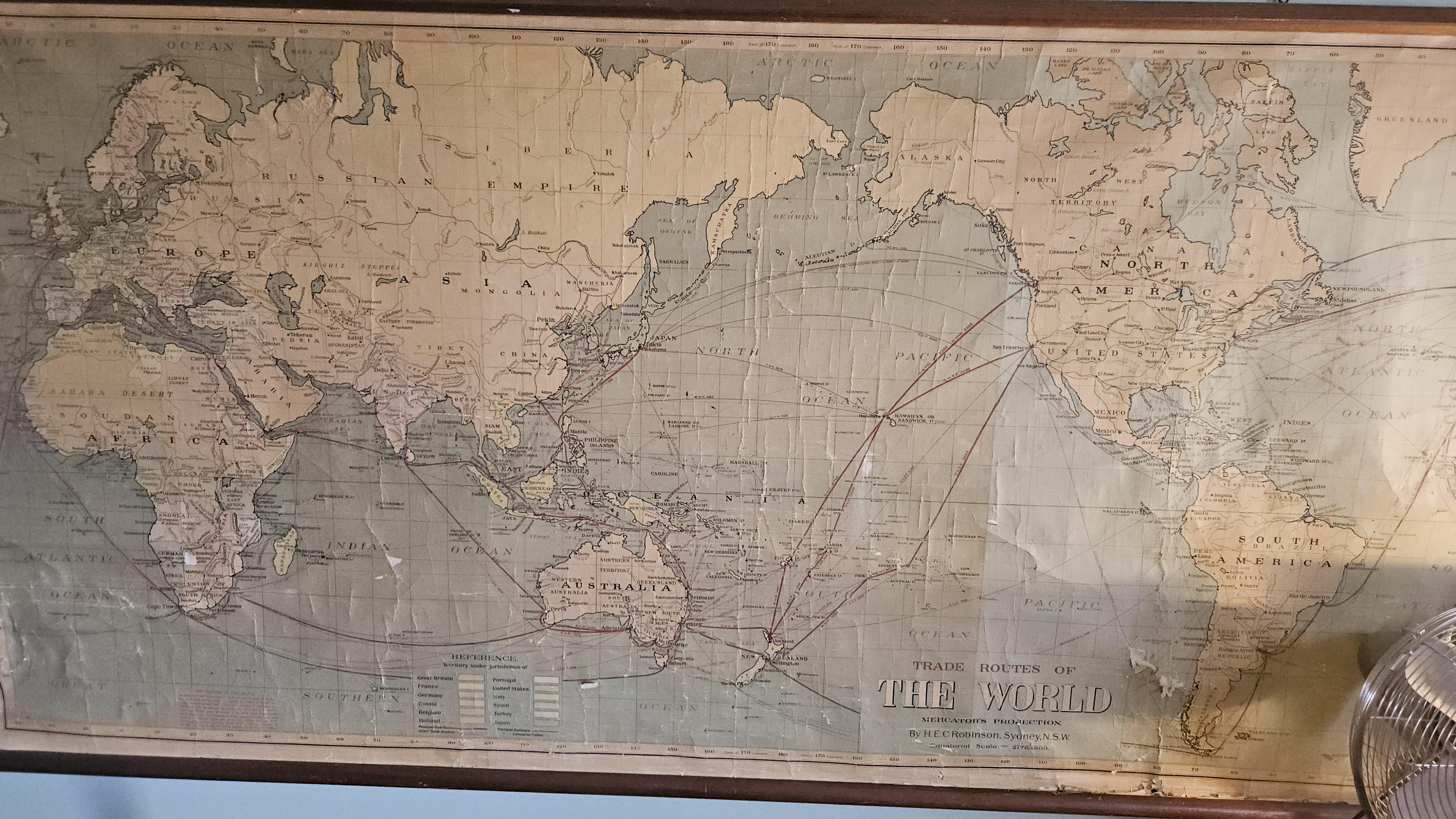
Historical Map of Southeast Asia
This historical map, featuring the terms "Siam," "Burma," "Russian Empire," and "Holland," provides a glimpse into the g...
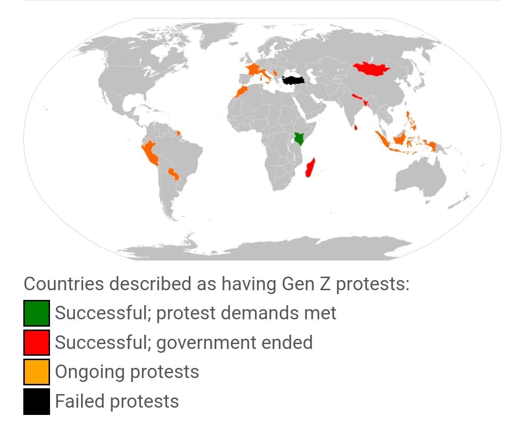
2025 Zoomer One Piece Pirate Flag Revolutions Map
...