nmapa.org logo
nmapa.org
HomeGalleryTagsAboutPrivacyDisclaimer
Home›Tags›iceland

iceland Maps

3 geographic visualizations tagged with "iceland"

Iceland Population Distribution Map

Iceland Population Distribution Map

This map illustrates a striking aspect of Iceland's population distribution: the red area represents only 1% of the coun...

👁 20📅 9/12/2025
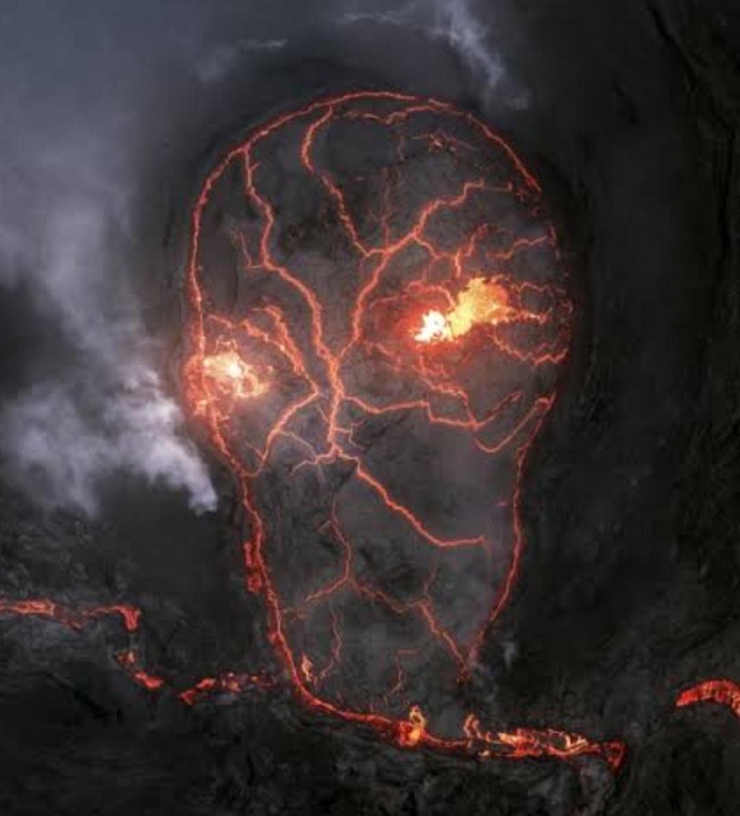
Erupting Volcano Map of Iceland

Erupting Volcano Map of Iceland

This visualization presents a detailed aerial view of an erupting volcano in Iceland, capturing the dynamic and ever-cha...

👁 28📅 9/10/2025
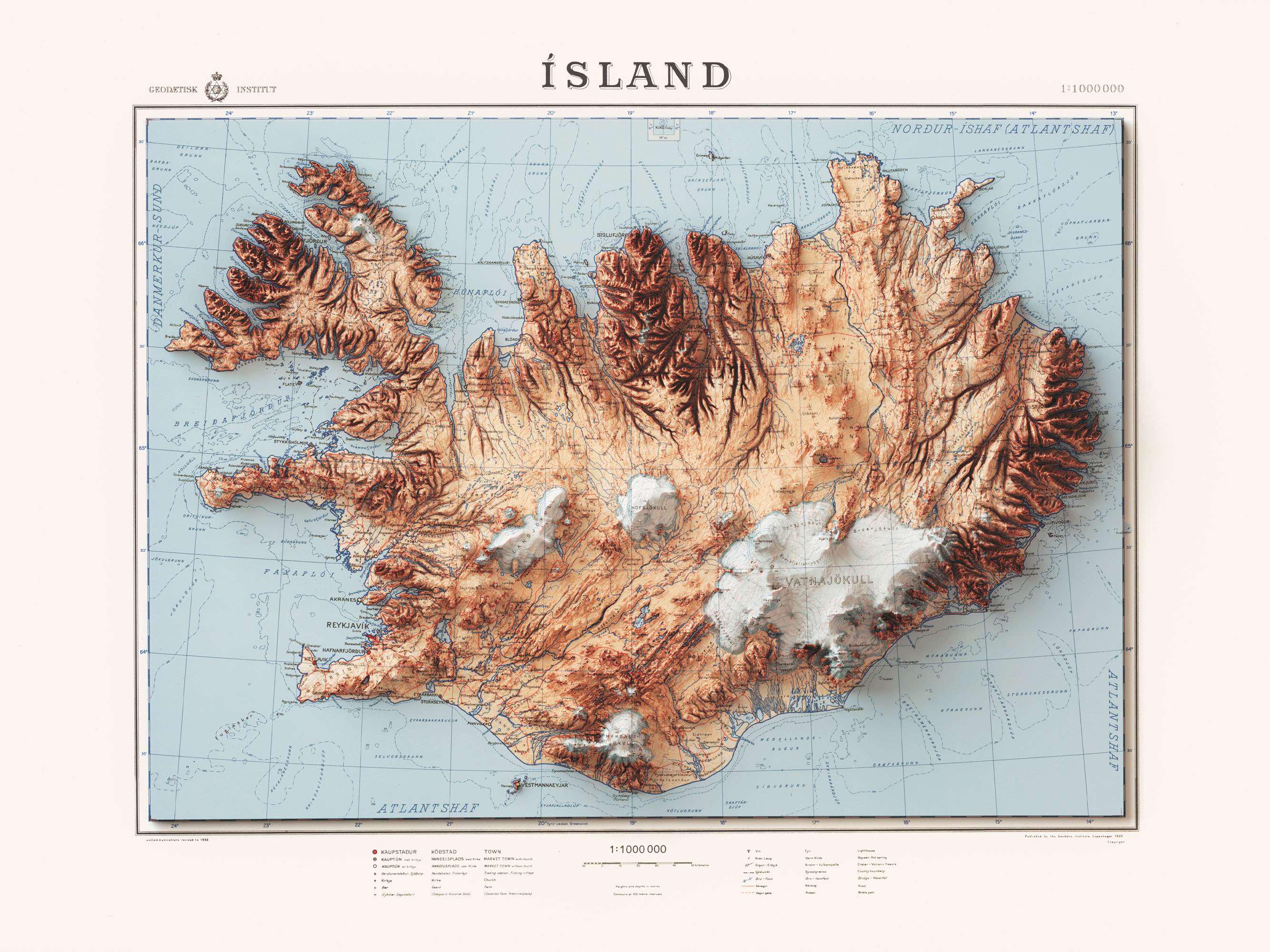
Iceland 1963 Map with Shaded Relief

Iceland 1963 Map with Shaded Relief

The shaded relief on this map highlights the elevation changes across the island. For instance, the central highlands, w...

👁 62📅 8/11/2025
← Browse All TagsBrowse All Maps
nmapa.org logo

nmapa.org

Your premium gateway to the world's most fascinating maps and geographical visualizations. Explore, discover, and understand our planet through the art of cartography.

Explore

  • Home
  • About
  • Gallery

Legal

  • Privacy Policy
  • Disclaimer
  • Terms of Service

© 2025 nmapa.org. All rights reserved. Made with ❤️ for geography enthusiasts worldwide.