hispania Maps
2 geographic visualizations tagged with "hispania"

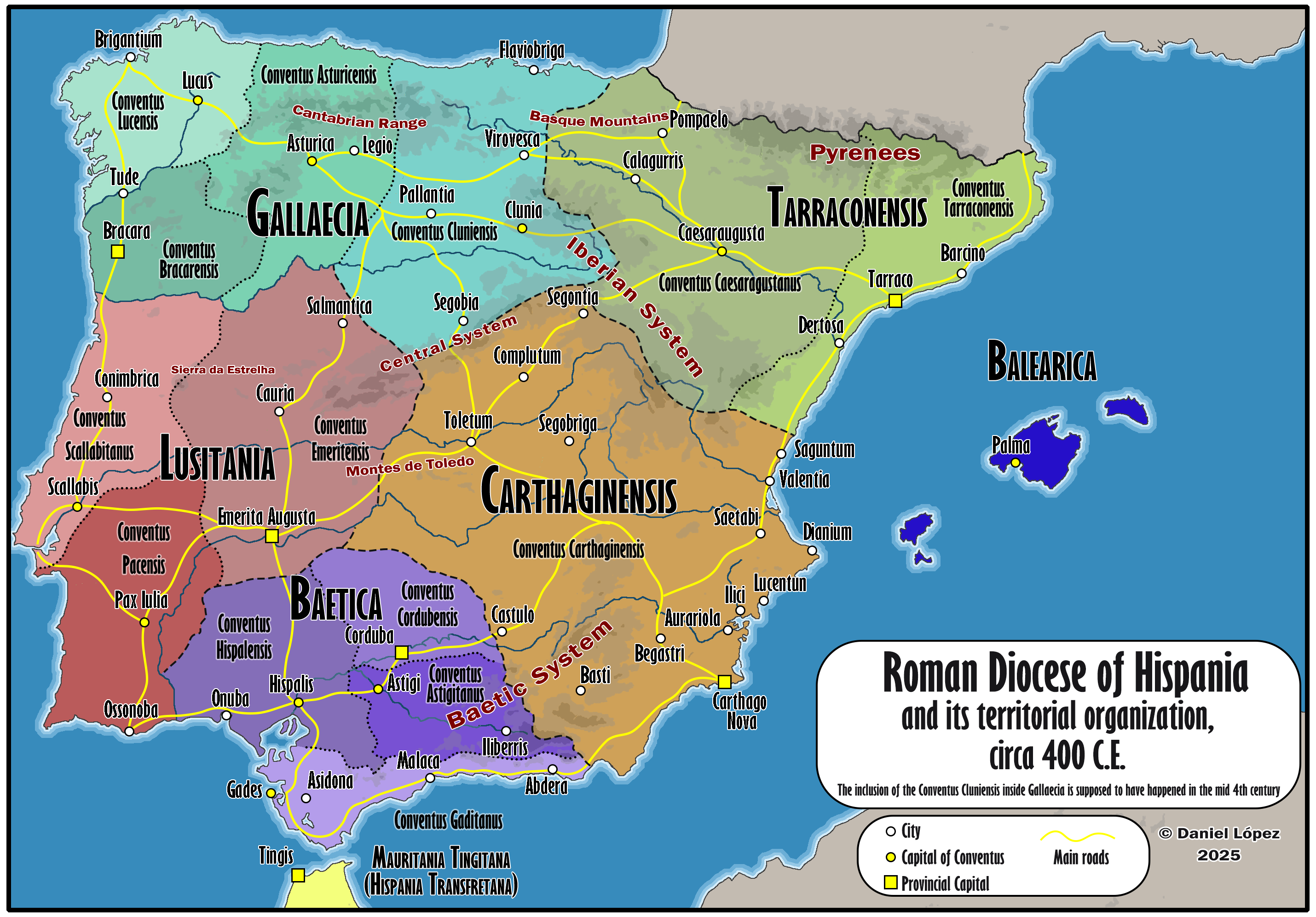
Map of Roman Hispania Circa 400
The 'Detailed Map of Roman Hispania (c. 400)' provides a rich visual representation of the Iberian Peninsula during a cr...
👁 218📅 8/18/2025

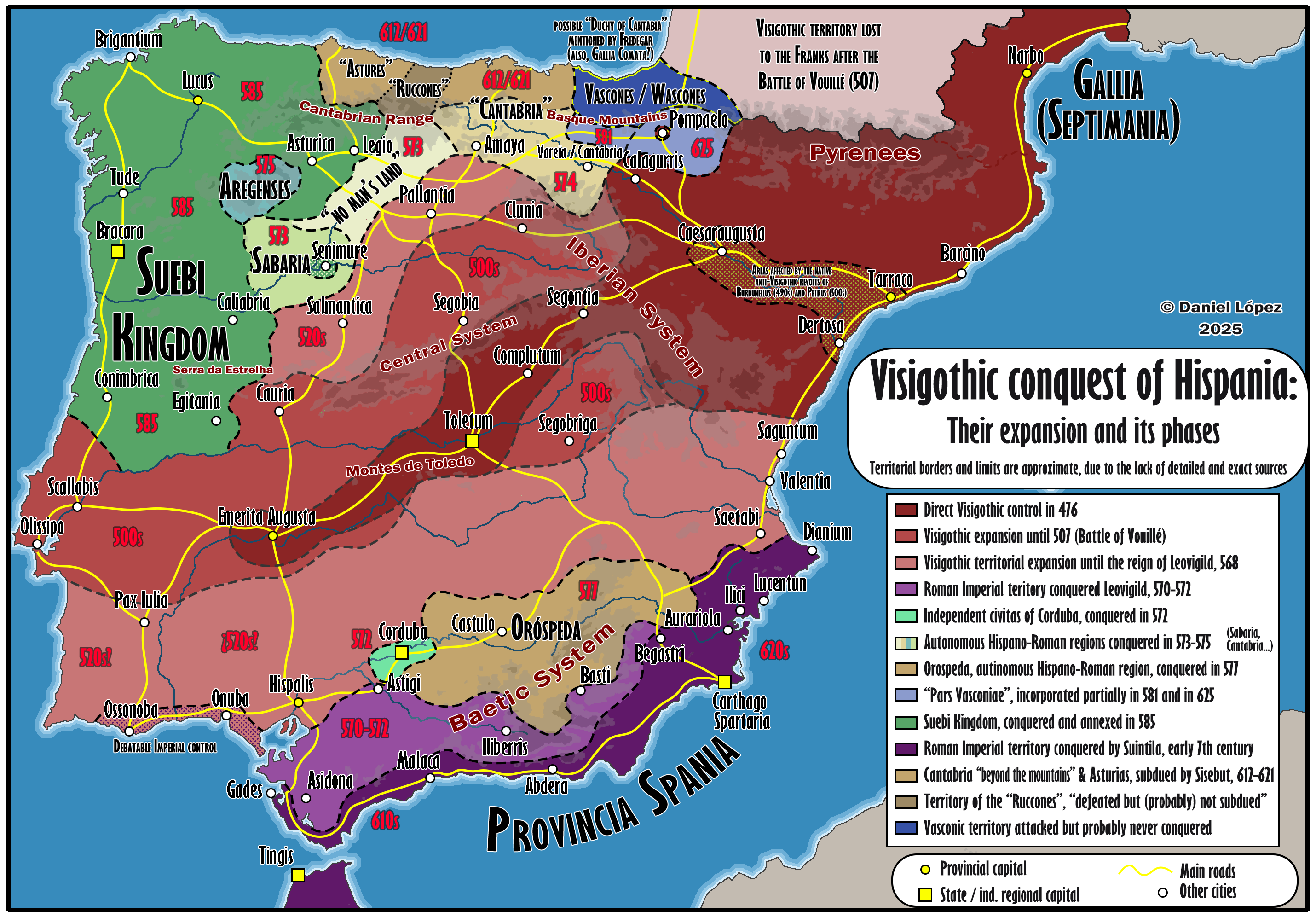
Visigothic Conquest of Hispania Map
This visualization illustrates the phases of the Visigothic conquest of Hispania, highlighting the territorial expansion...
👁 74📅 9/23/2025