food accessibility Maps
4 geographic visualizations tagged with "food accessibility"

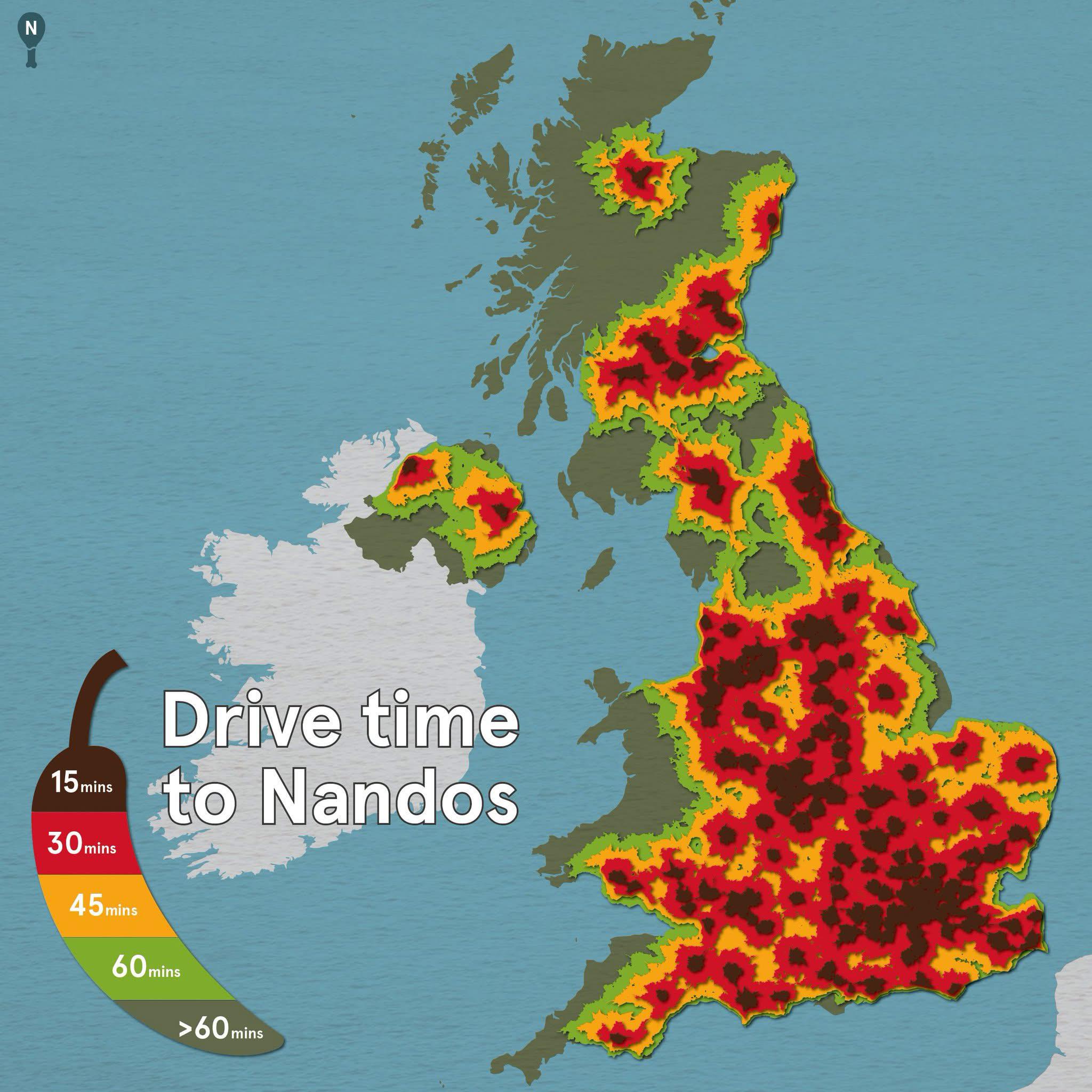
Drive Time to Nando’s in the UK Map
The "Drive Time to Nando’s in the UK" map provides a visual representation of how long it takes to reach various Nando’s...
👁 46📅 9/26/2025

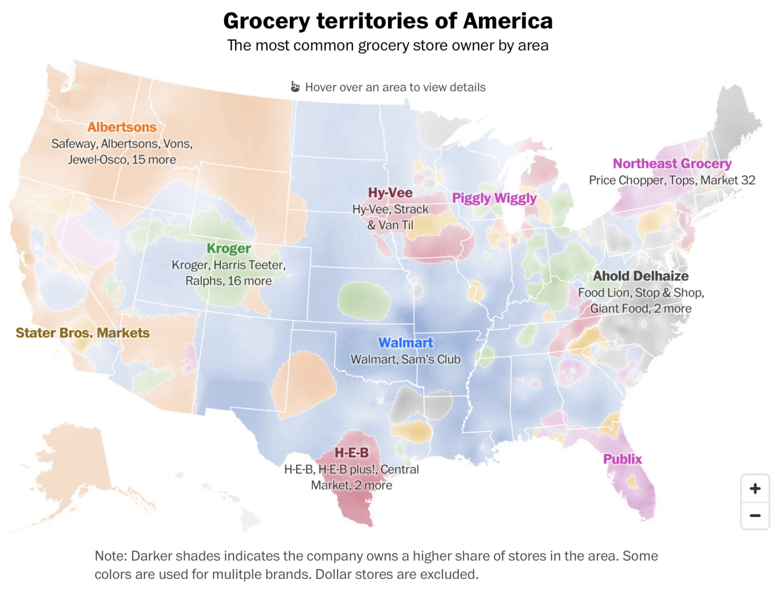
Grocery Store Dominance in the US Map
This visualization provides an insightful look into grocery store dominance across the United States. By illustrating th...
👁 46📅 9/25/2025

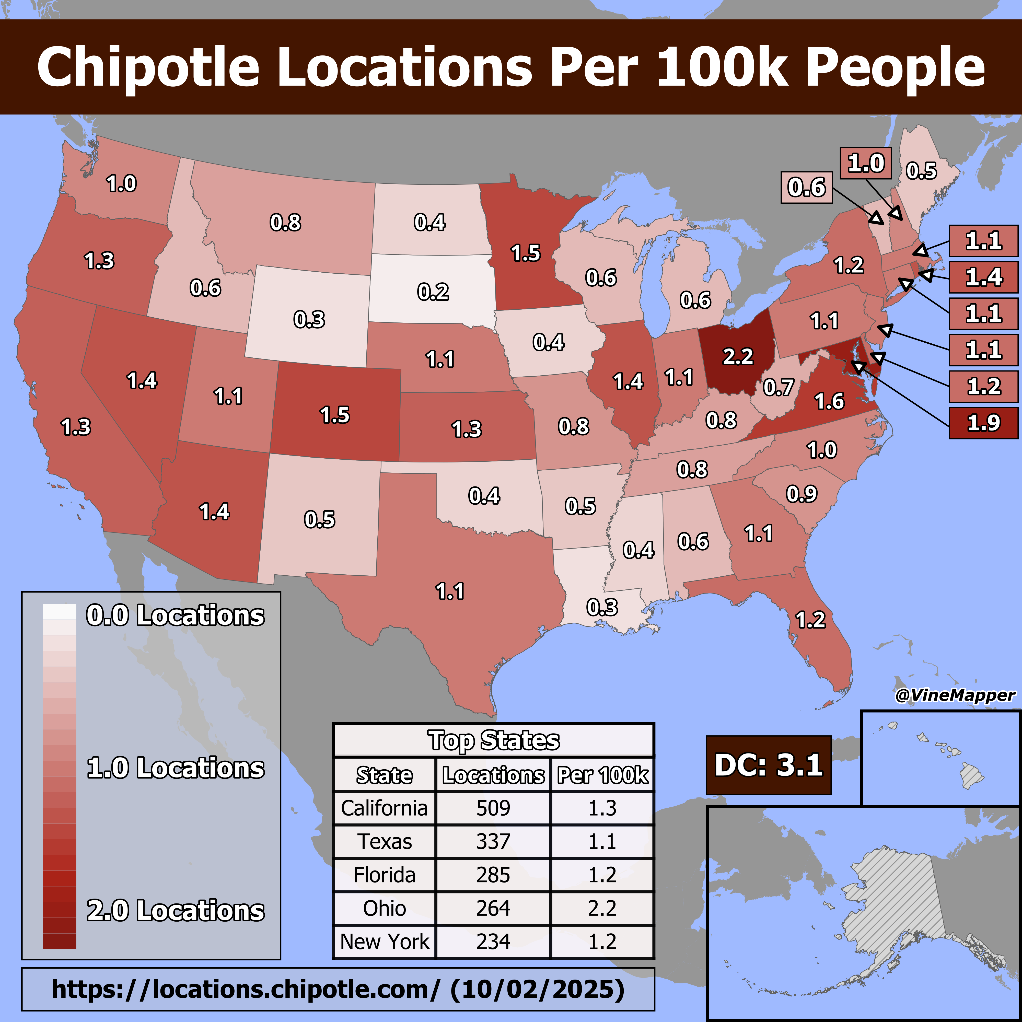
Chipotle Locations Per 100k People Map
The "Chipotle Locations Per 100k People" map provides a visual representation of how many Chipotle restaurants are avail...
👁 18📅 10/9/2025

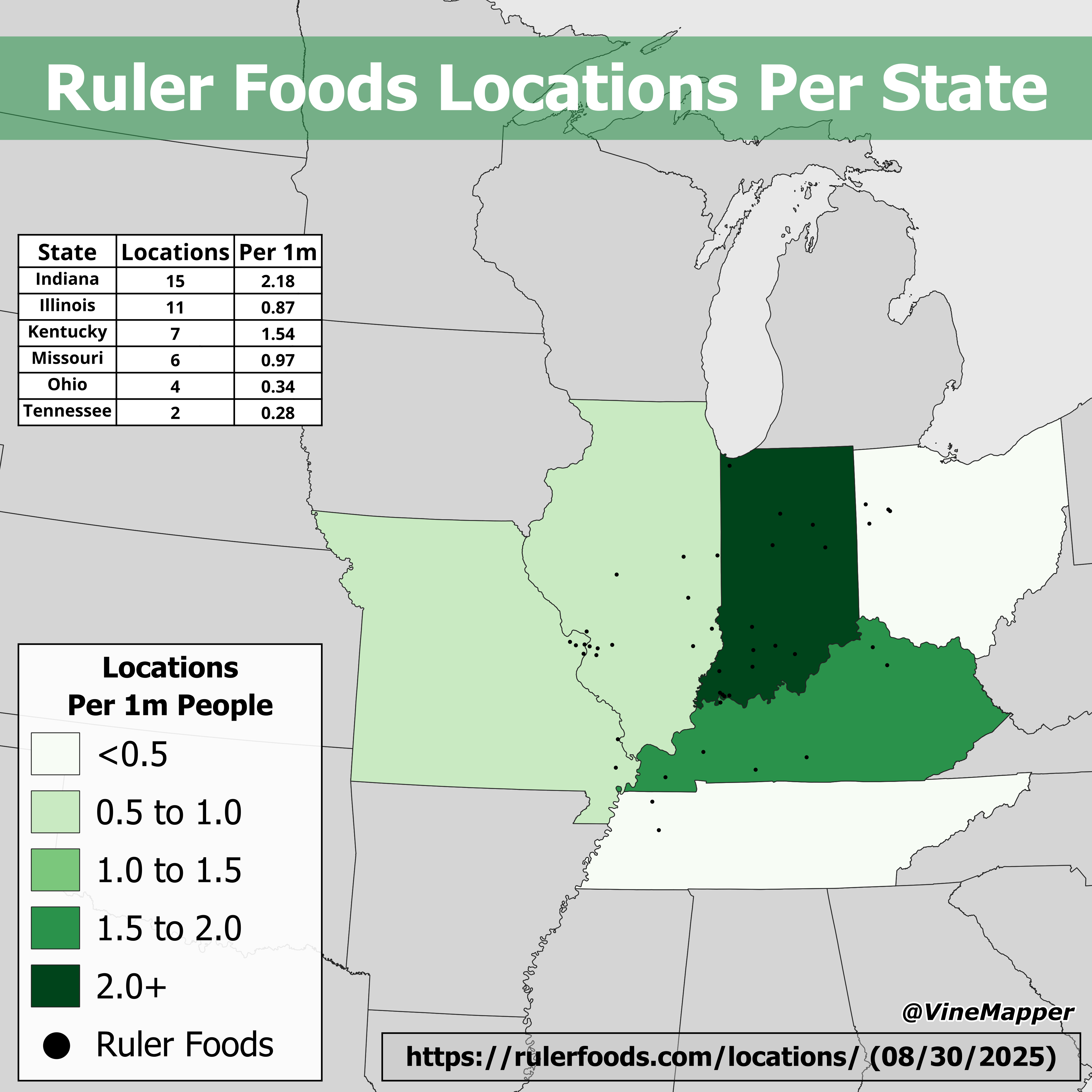
Ruler Foods Locations Per State Map
The 'Ruler Foods Locations Per State' map provides a clear visual representation of where Ruler Foods grocery stores are...
👁 66📅 9/11/2025