edo period Maps
3 geographic visualizations tagged with "edo period"

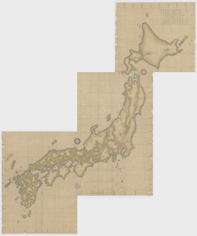
Japanese Topographical Map by Inō Tadataka
The map created by Inō Tadataka in 1821 represents a detailed topographical outline of Japan, showcasing the country's m...
👁 38📅 9/27/2025

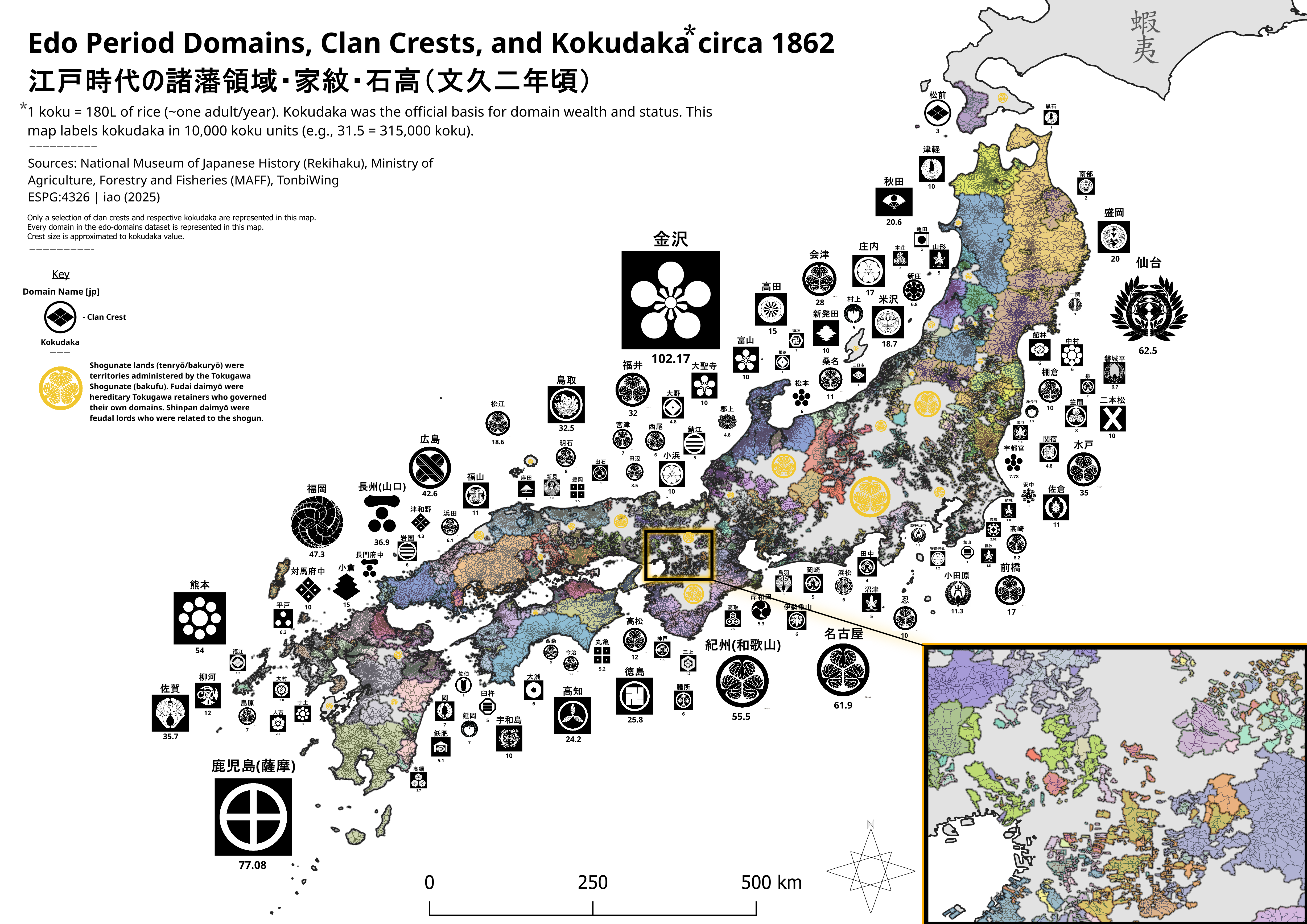
Edo Domains and Clan Crests Map of Japan 1862
The visualization titled "Edo Domains, Clan Crests, and Kokudaka ~1862 Japan" presents a fascinating snapshot of Japan's...
👁 42📅 9/17/2025

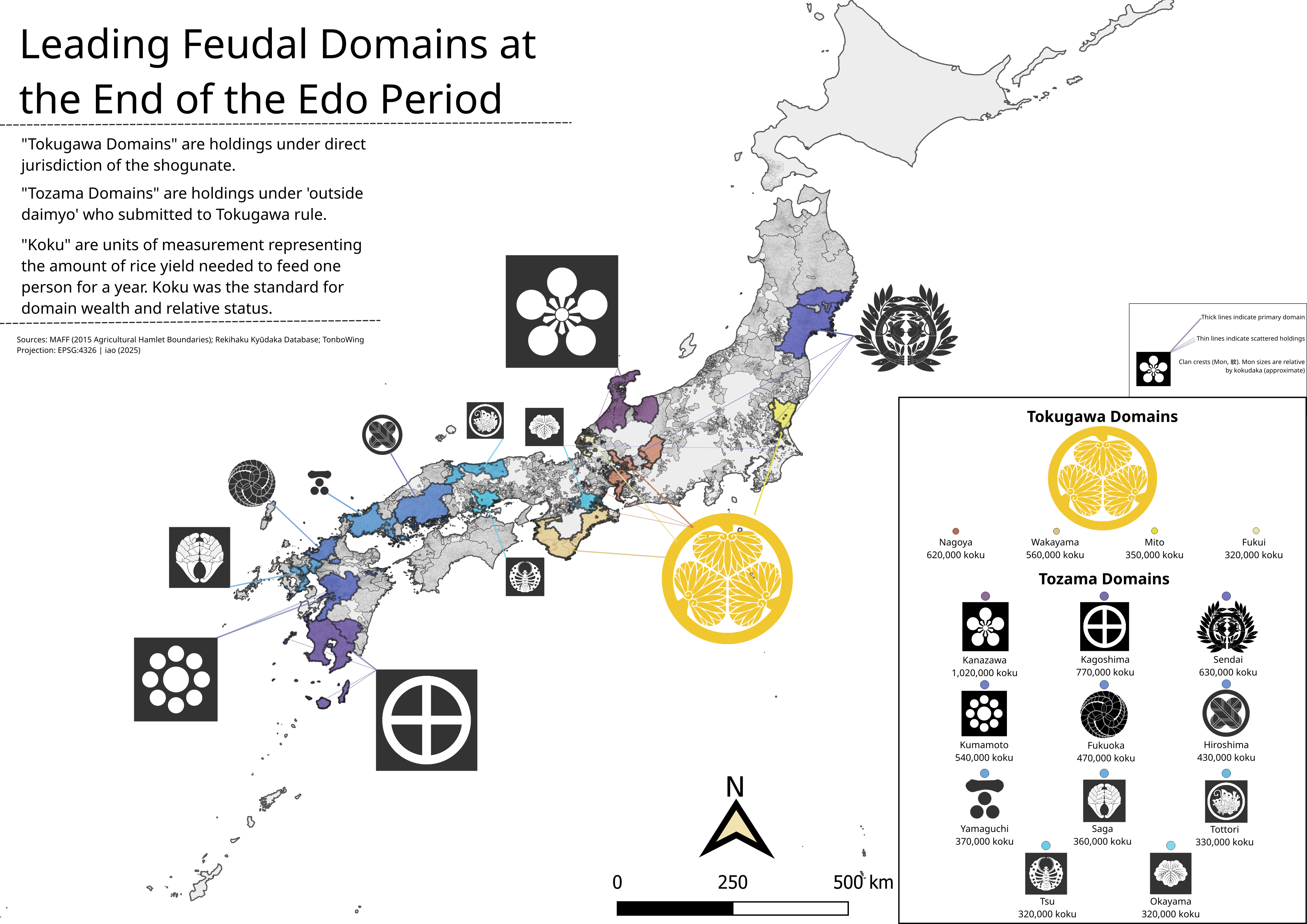
Rice Yield by Edo Domain Map, 1862 Japan
The map titled "Edo Domains with Highest Rice Yield, ~1862 Japan" provides a detailed visualization of rice production a...
👁 58📅 9/8/2025