census data Maps
8 geographic visualizations tagged with "census data"
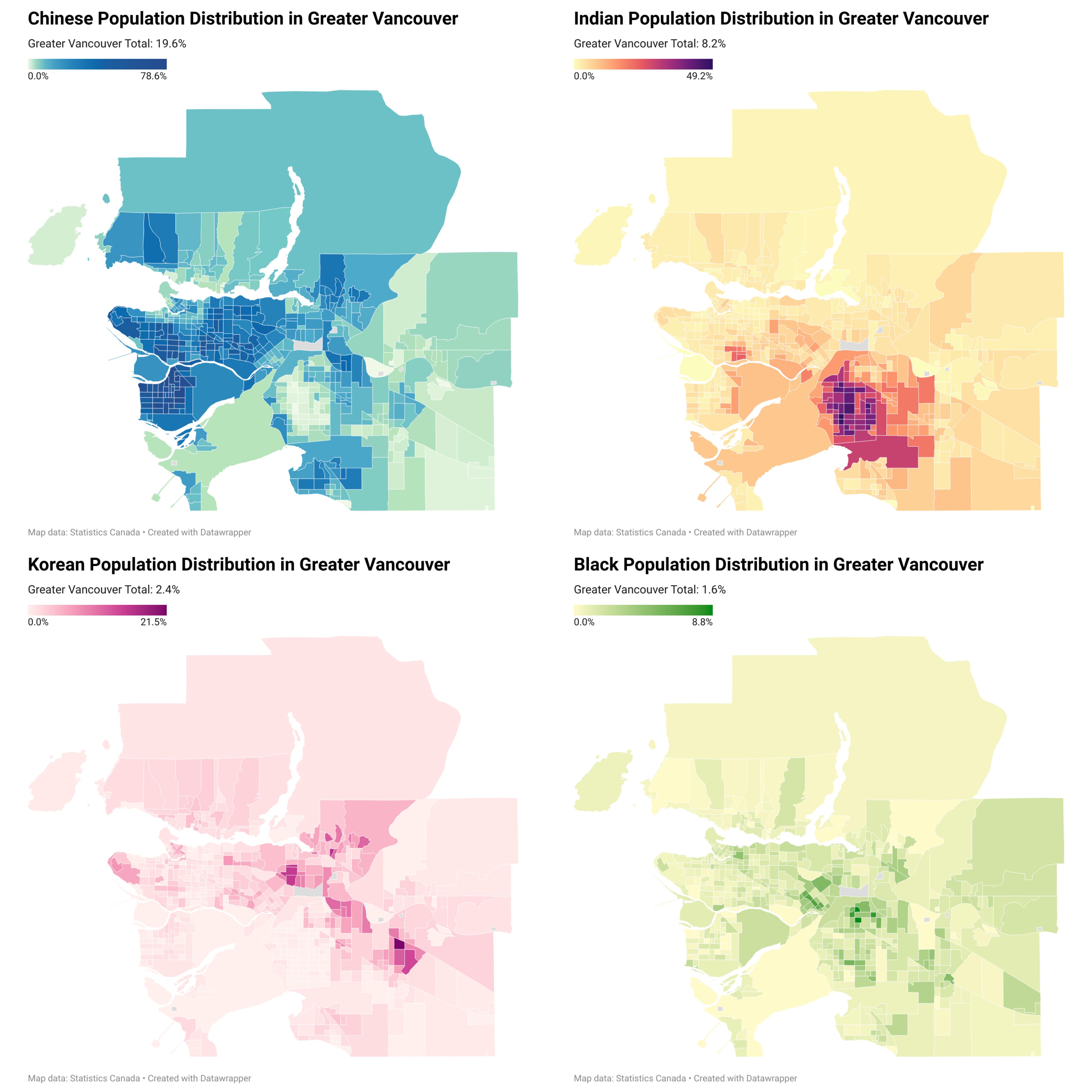
Ethnic Minority Population Distribution Map Greater Vancouver
...
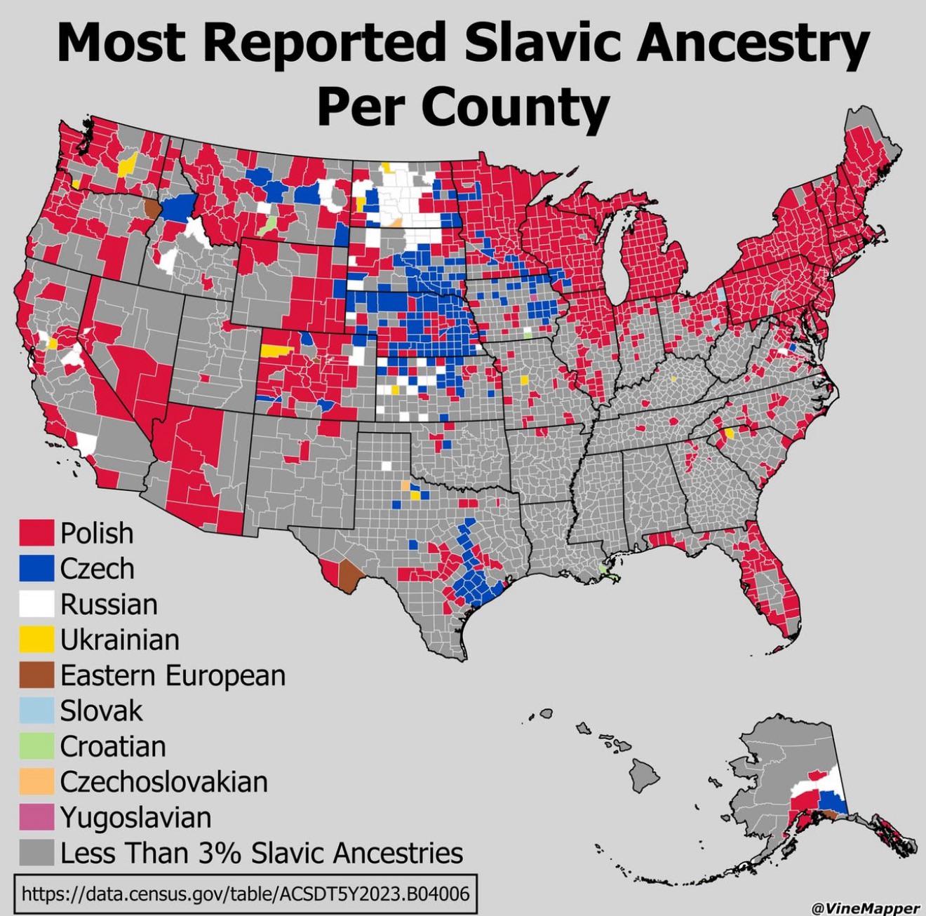
Most Reported Slavic Ancestry Per US County Map
...
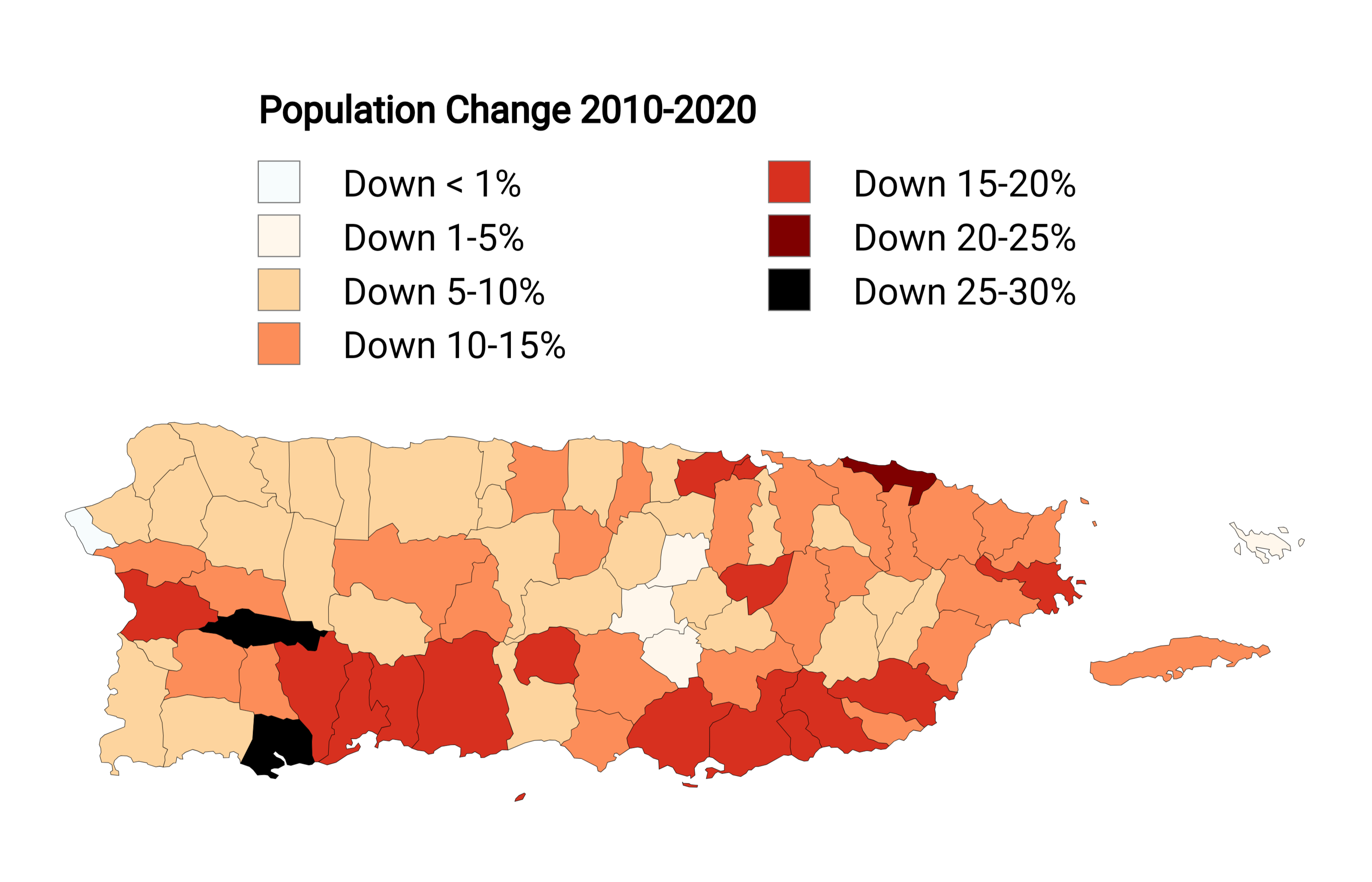
Puerto Rico Population Decline Map 2010-2020
The visualization titled "Puerto Rico's Population Decline (2010-2020)" offers a stark representation of demographic shi...
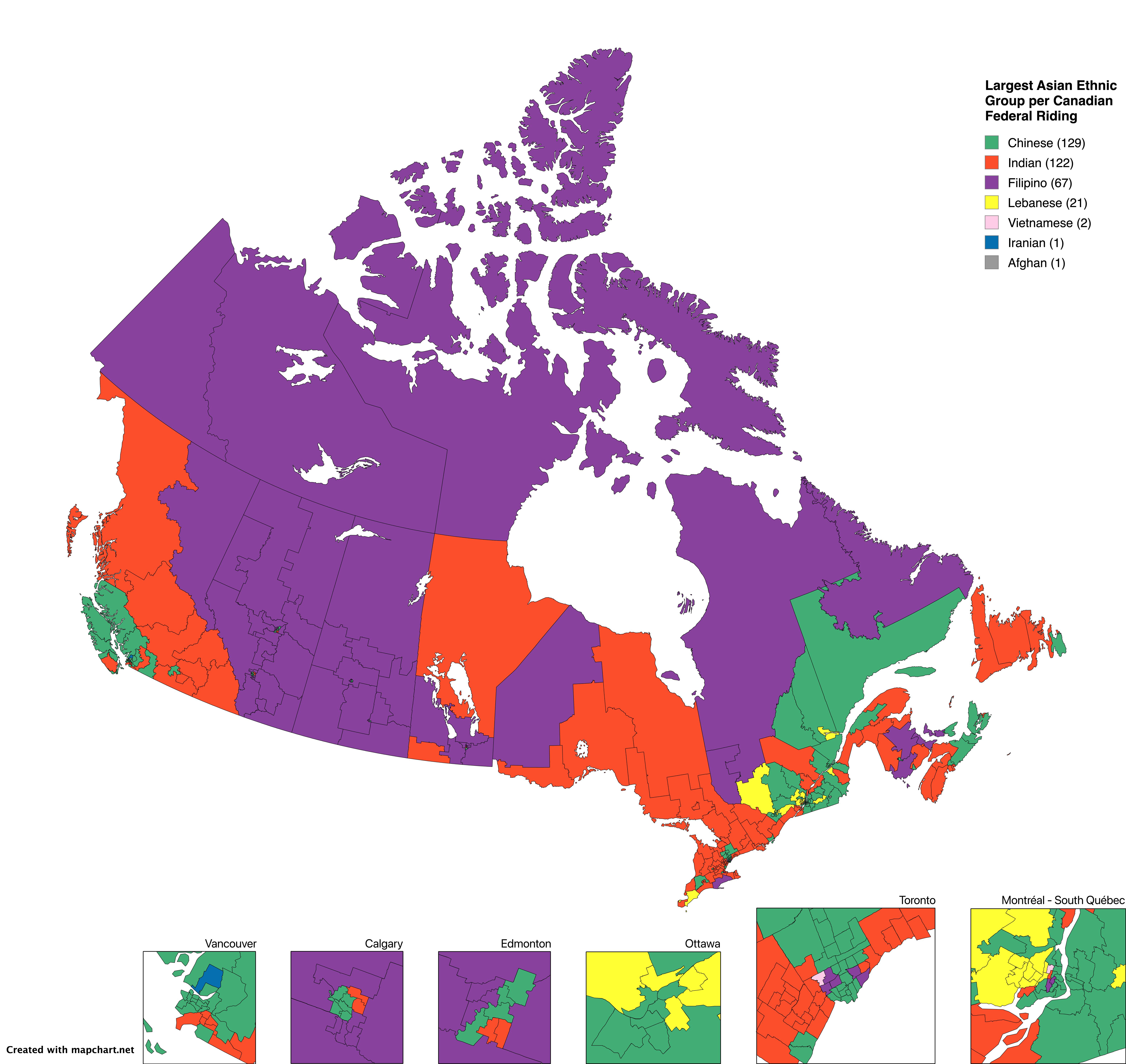
Largest Asian Ethnic Group per Canadian Federal Riding Map
The "Largest Asian Ethnic Group per Canadian Federal Riding" map provides a detailed visualization of the predominant As...
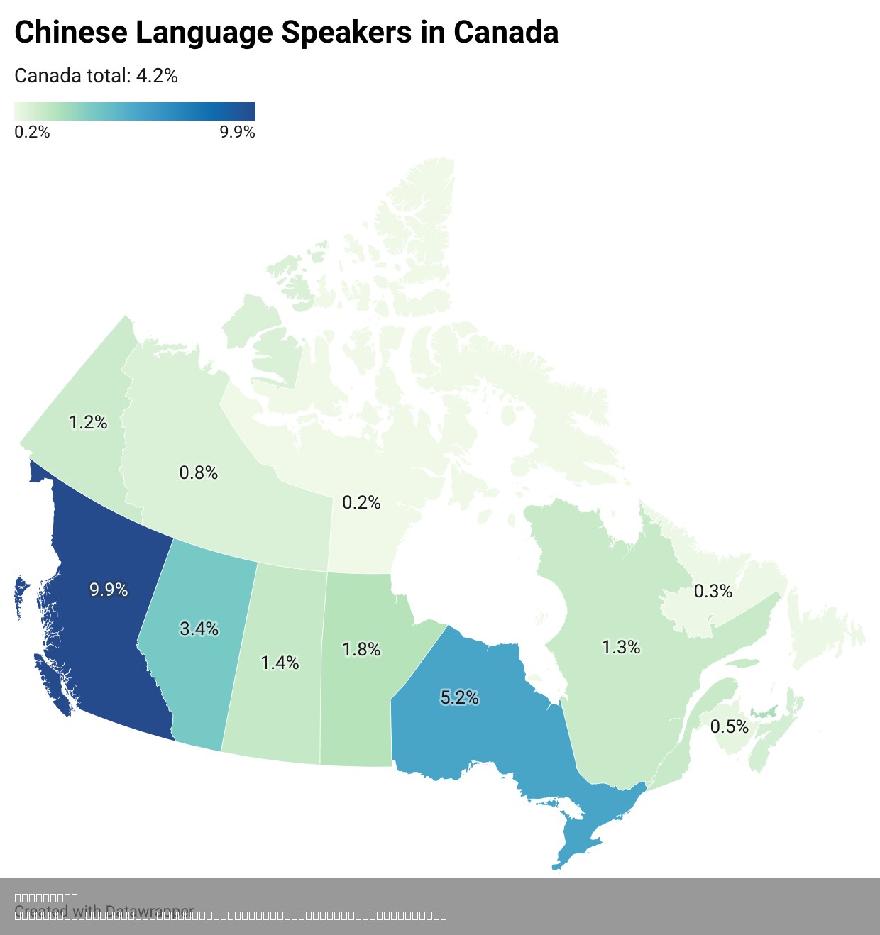
Chinese Language Speakers per Canadian Province and Territory Map
Interestingly, the Chinese language’s prominence is not just a reflection of population numbers but also of cultural int...
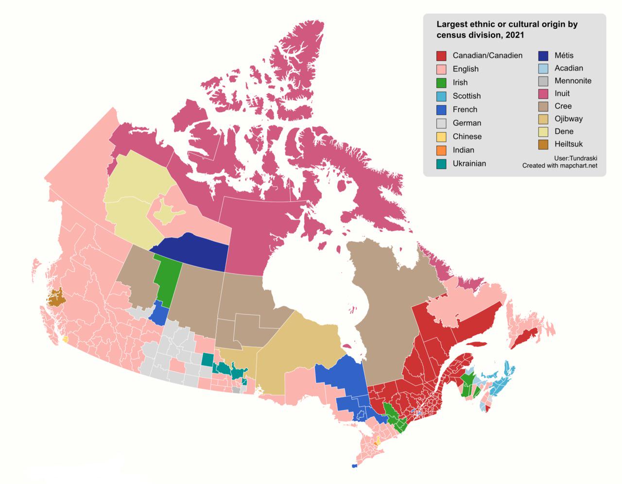
Largest Ethnic Origins in Canada by Census Division Map
This map visualizes the largest ethnic or cultural origins across Canada based on the 2021 census data. By breaking down...
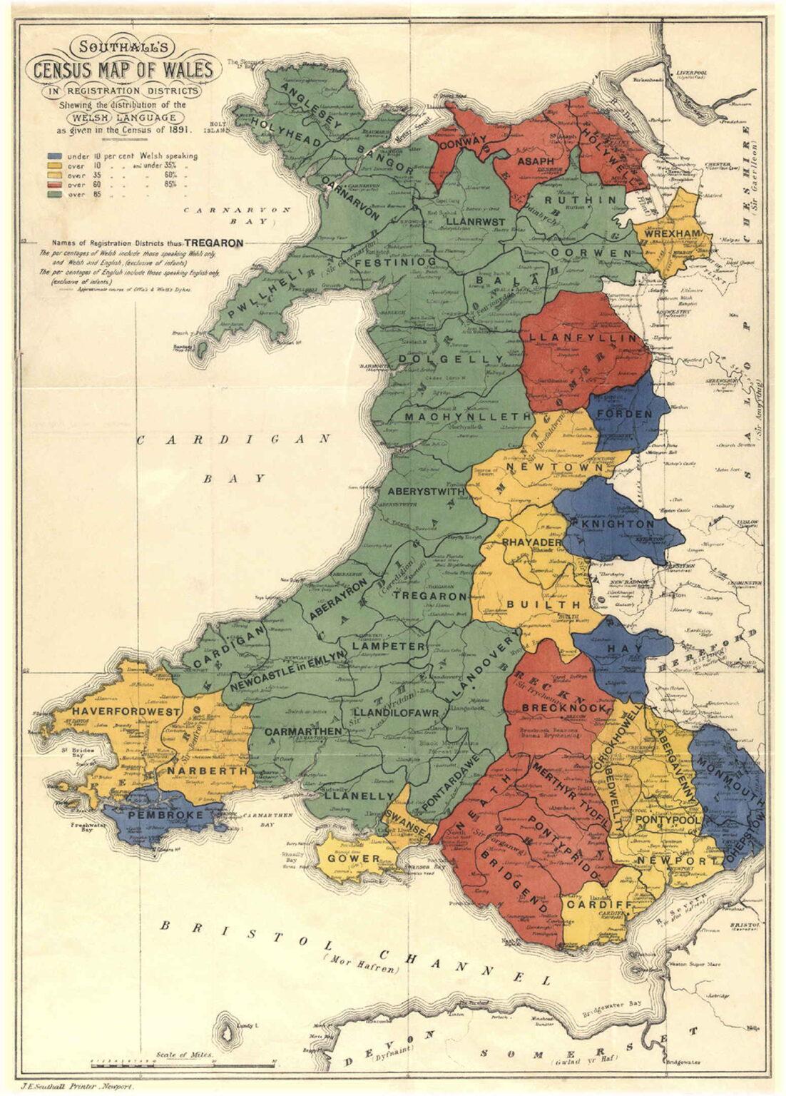
Welsh Language Distribution Map by Census Districts 1891
This map illustrates the distribution of the Welsh language across various census districts in Wales, as recorded in the...
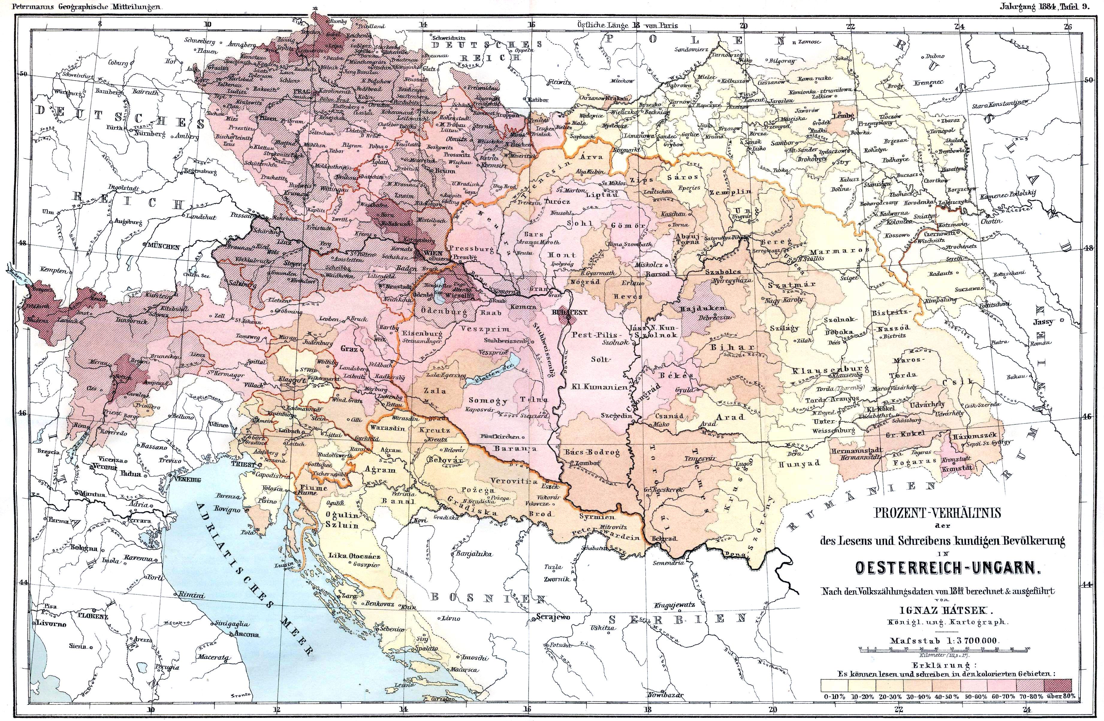
Literacy Rates Map of Austro-Hungarian Empire 1880
The map titled "Literacy Rates in Austro-Hungarian Empire (Census 1880)" visually represents the literacy levels across ...