nmapa.org logo
nmapa.org
HomeGalleryTagsAboutPrivacyDisclaimer
Homeβ€ΊTagsβ€Ίbritain

britain Maps

3 geographic visualizations tagged with "britain"
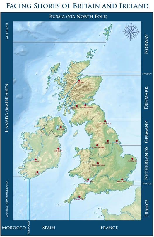
Map of Countries Across From Beaches in Britain and Ireland

Map of Countries Across From Beaches in Britain and Ireland

This map visually represents which countries you would face if you were standing on a beach in Britain or Ireland, gazin...

πŸ‘ 58πŸ“… 9/15/2025
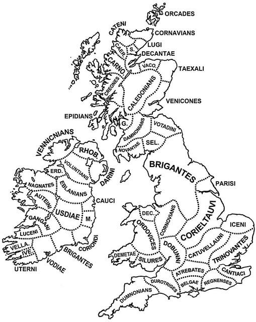
Tribes of Britain and Ireland Map

Tribes of Britain and Ireland Map

The "Tribes of Britain and Ireland around the time of Julius Caesar’s invasion" map visually represents the various trib...

πŸ‘ 6πŸ“… 10/6/2025
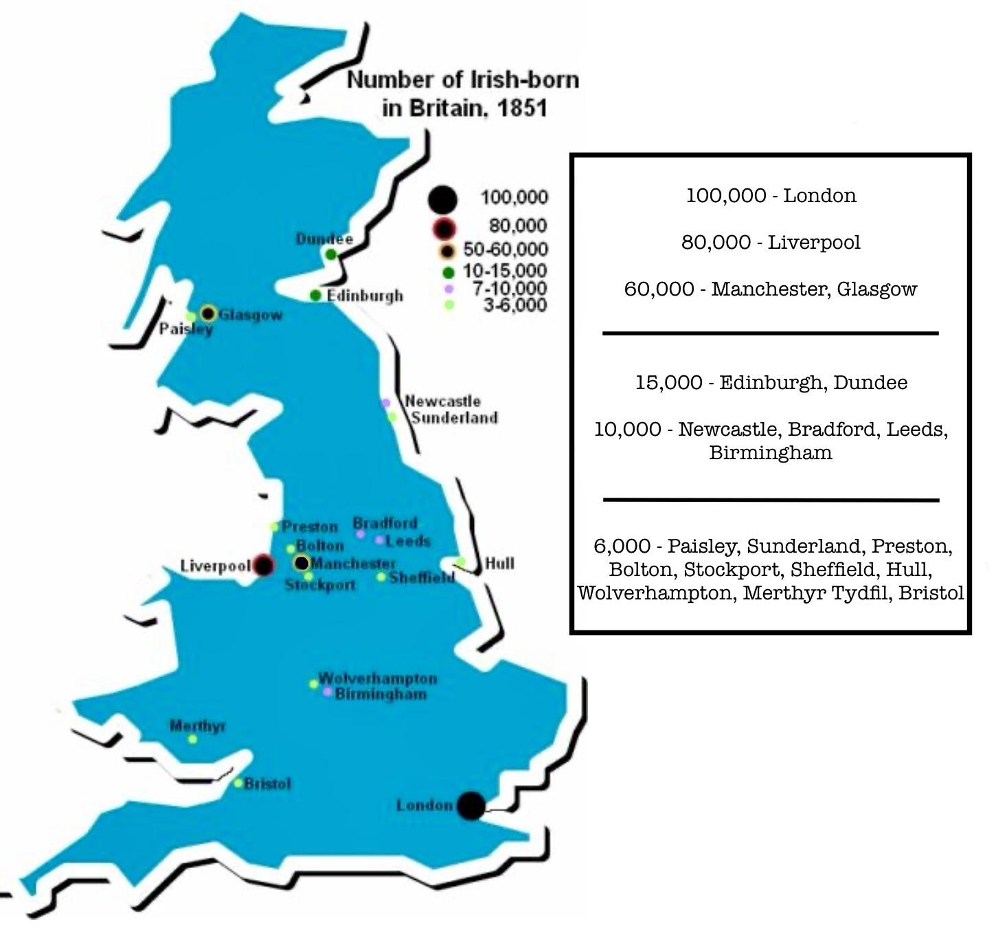
Map of Irish-born Population in Britain in 1851

Map of Irish-born Population in Britain in 1851

The visualization titled "Number of Irish-born living in Britain in 1851" illustrates the demographic impact of the Grea...

πŸ‘ 106πŸ“… 8/14/2025
← Browse All TagsBrowse All Maps
nmapa.org logo

nmapa.org

Your premium gateway to the world's most fascinating maps and geographical visualizations. Explore, discover, and understand our planet through the art of cartography.

Explore

  • Home
  • About
  • Gallery

Legal

  • Privacy Policy
  • Disclaimer
  • Terms of Service

© 2025 nmapa.org. All rights reserved. Made with ❀️ for geography enthusiasts worldwide.