air travel Maps
8 geographic visualizations tagged with "air travel"
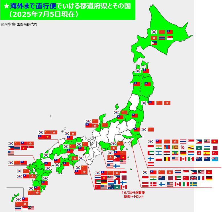
Map of International Direct Flights to Japan Prefecture
This map provides a comprehensive overview of international direct flight routes to various prefectures in Japan, displa...
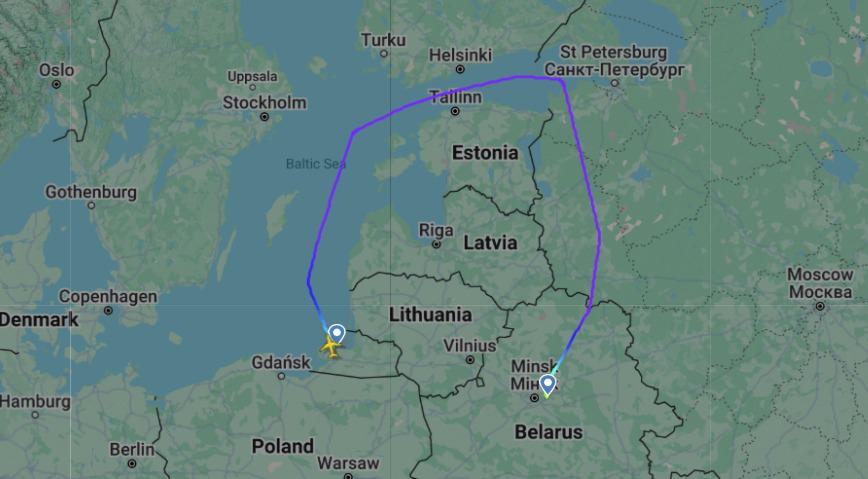
Flight Route Map Between Kaliningrad and Minsk Airports
This map illustrates the flight route between Kaliningrad (KGD) and Minsk (MSQ) airports, providing a clear visual repre...
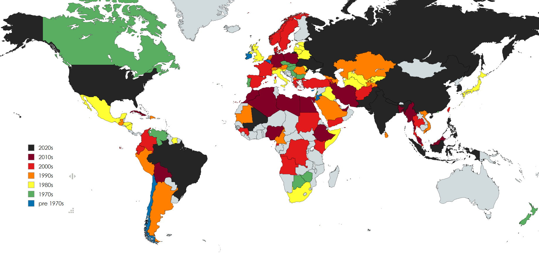
Plane Crash Fatalities by Country Map
The aviation industry has seen significant advancements in technology, pilot training, and air traffic control systems, ...
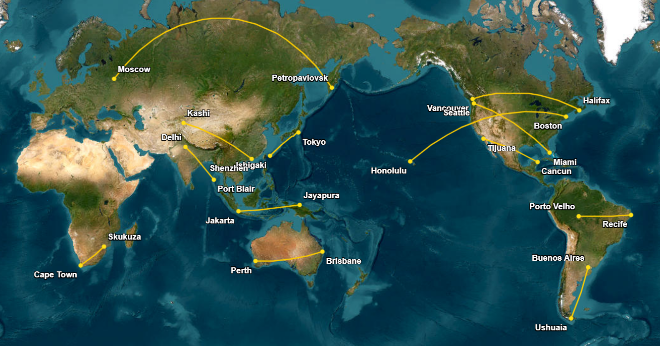
Longest Domestic Flights Map
In Russia, the flight from Moscow to Petropavlovsk on the Kamchatka Peninsula lasts about 8 hours and 40 minutes. This j...
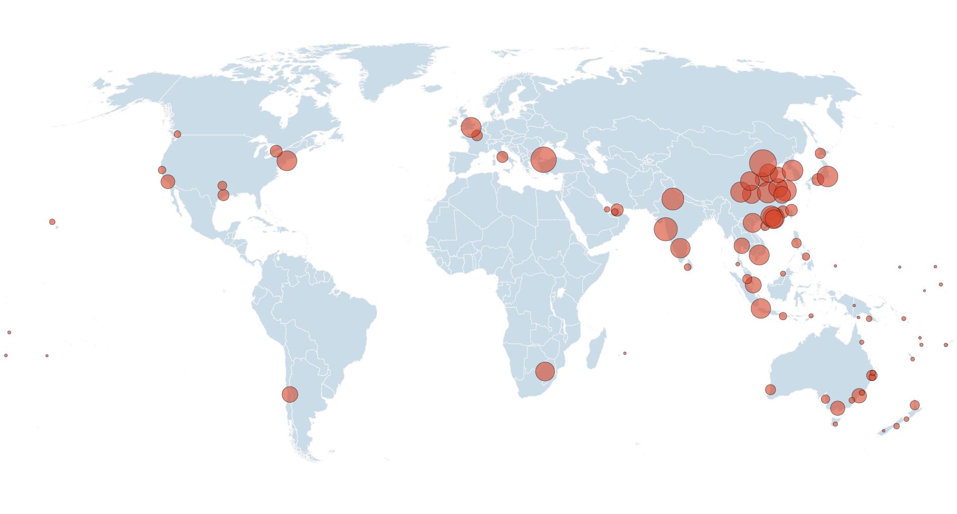
Direct Flights to/from Australia Map
This visualization presents a comprehensive overview of airports that offer direct flights to and from Australia. Each a...
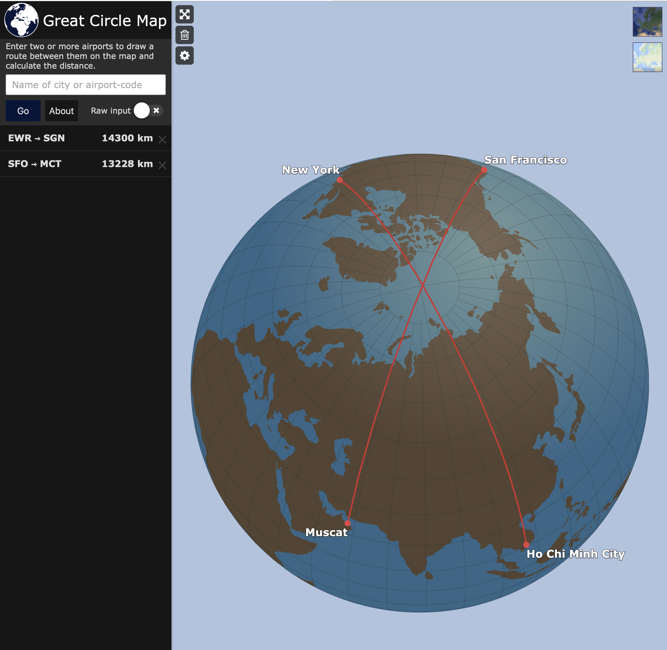
Map of City Pairs Flying Over North Pole
This map visualizes the city pairs that, for the shortest flying route, require aircraft to traverse the North Pole. It ...
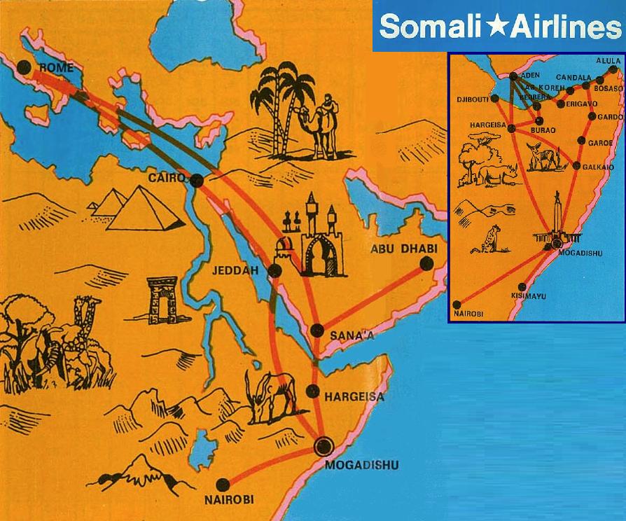
Somali Airlines Route Map
The Somali Airlines route map provides a comprehensive overview of the various domestic and international destinations s...
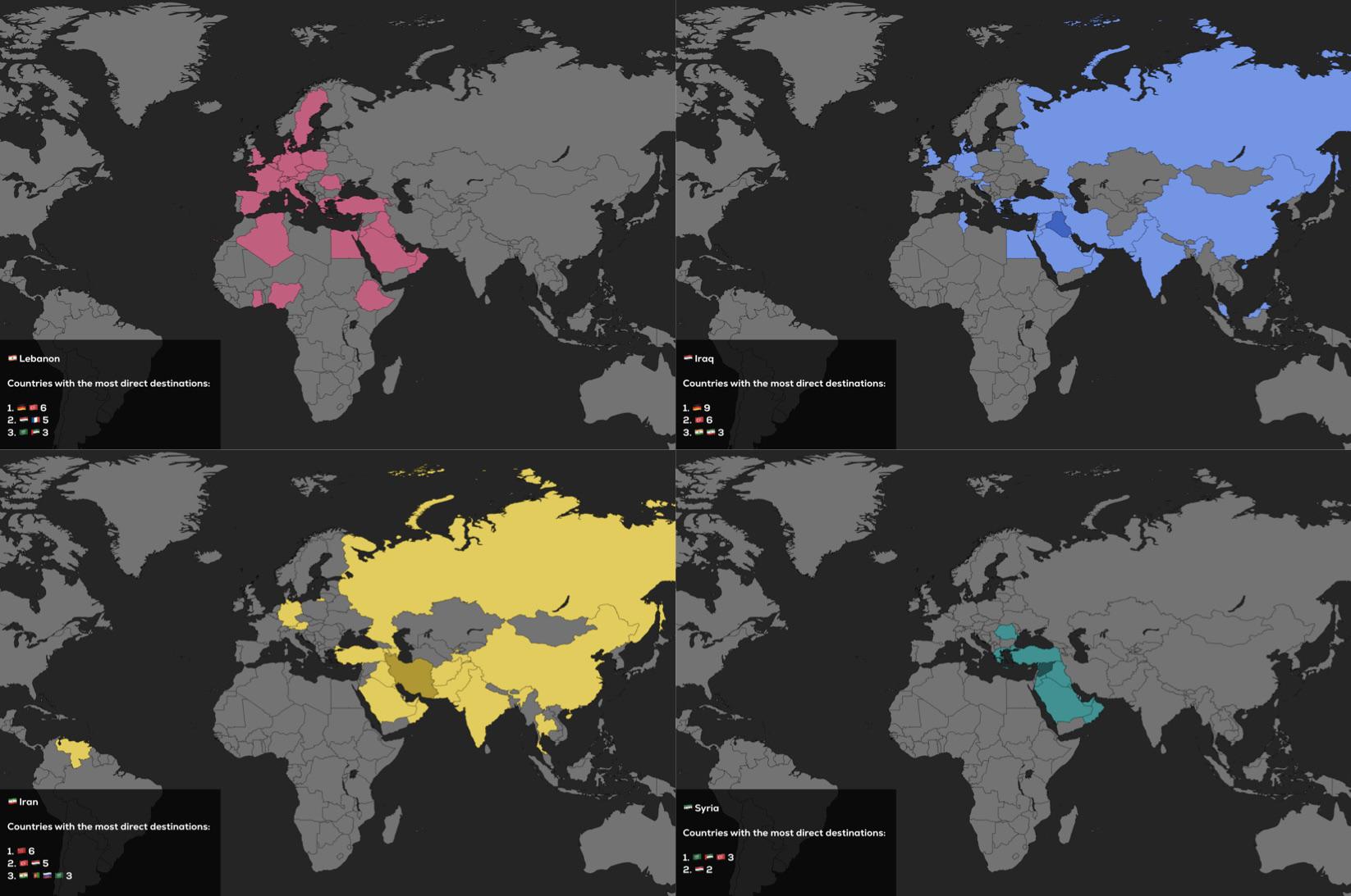
Direct Flights Map of Lebanon, Iraq, Iran and Syria
The visualization titled "Direct Flights of Lebanon, Iraq, Iran and Syria as of 2025" presents a comprehensive overview ...