2024 election Maps
10 geographic visualizations tagged with "2024 election"
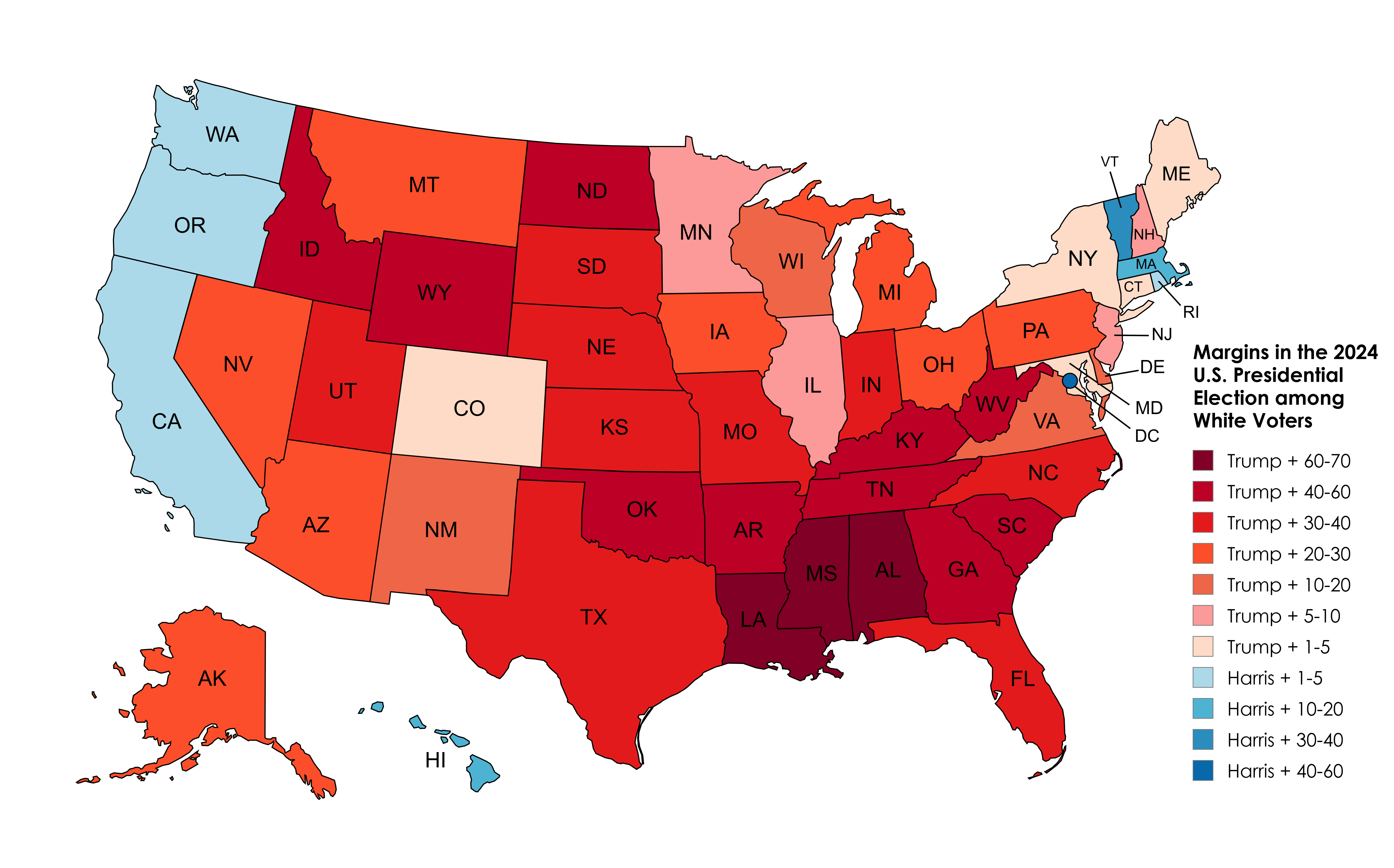
2024 Election Results Map Amongst White Voters
The 2024 Election Results Map Amongst White Voters offers a detailed representation of how this demographic voted across...
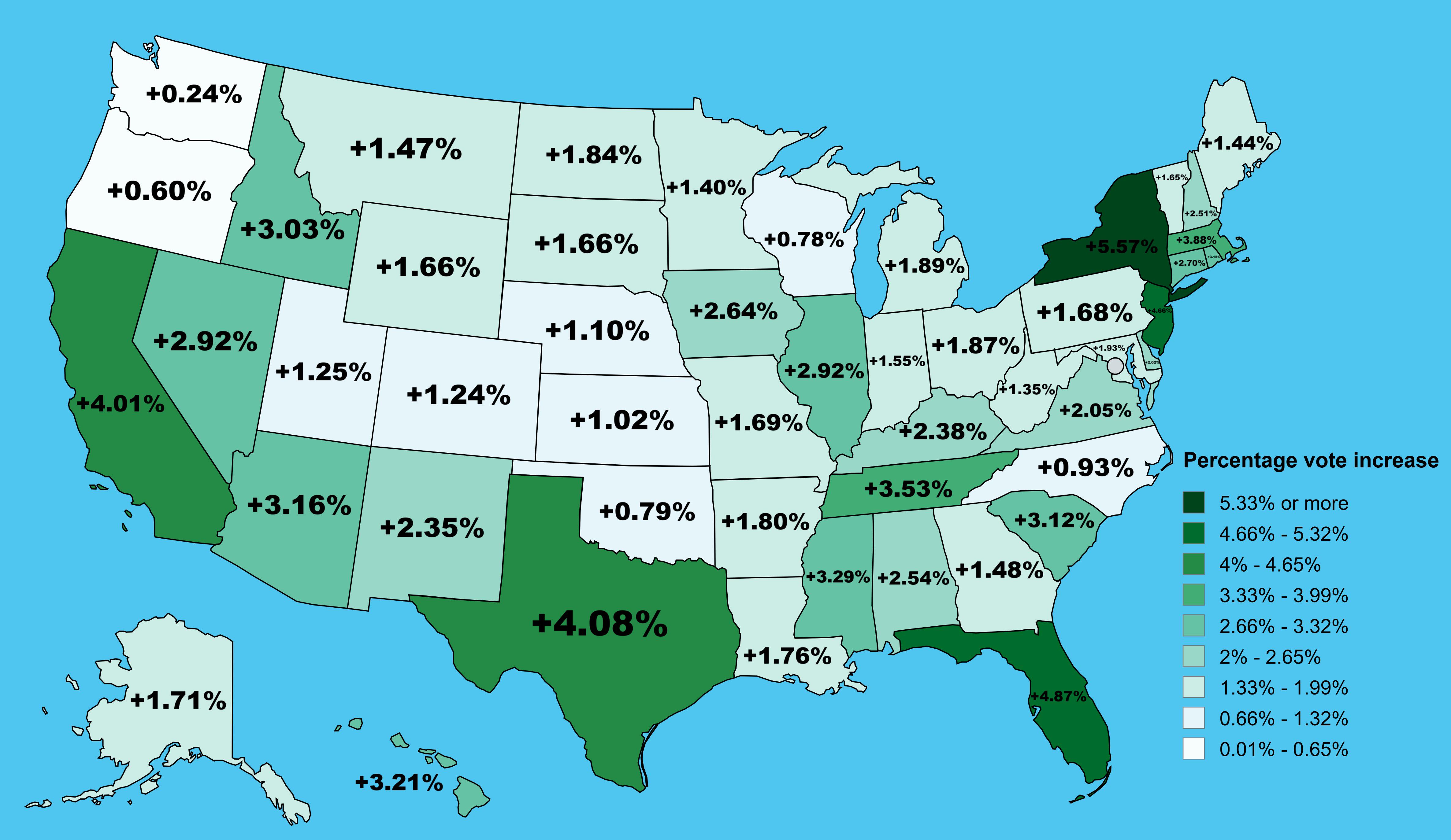
Trump Vote Percentage Increase by State Map
This map illustrates the percentage increase in vote percentage for Donald Trump from the 2020 to the 2024 presidential ...
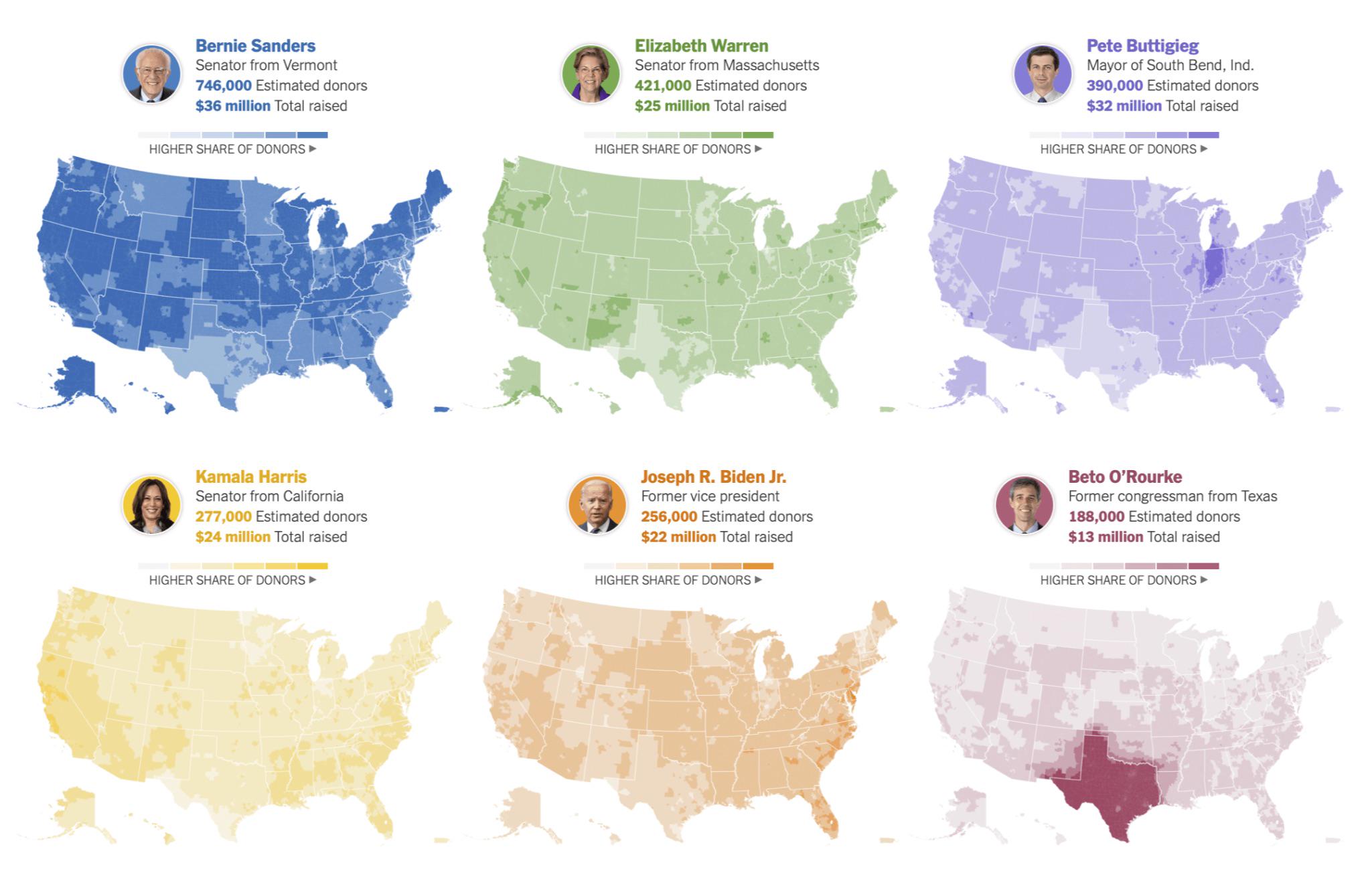
Map of Donations to Democrat Candidates 2024
...
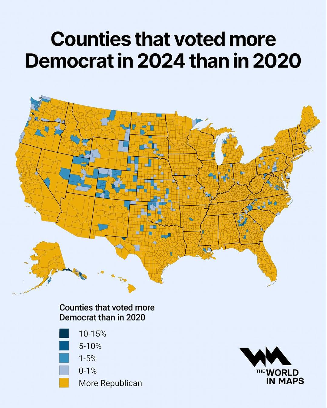
Map of Counties Voting More Democrat in 2024 vs 2020
This map illustrates the counties across the United States that exhibited a higher percentage of votes for the Democrati...
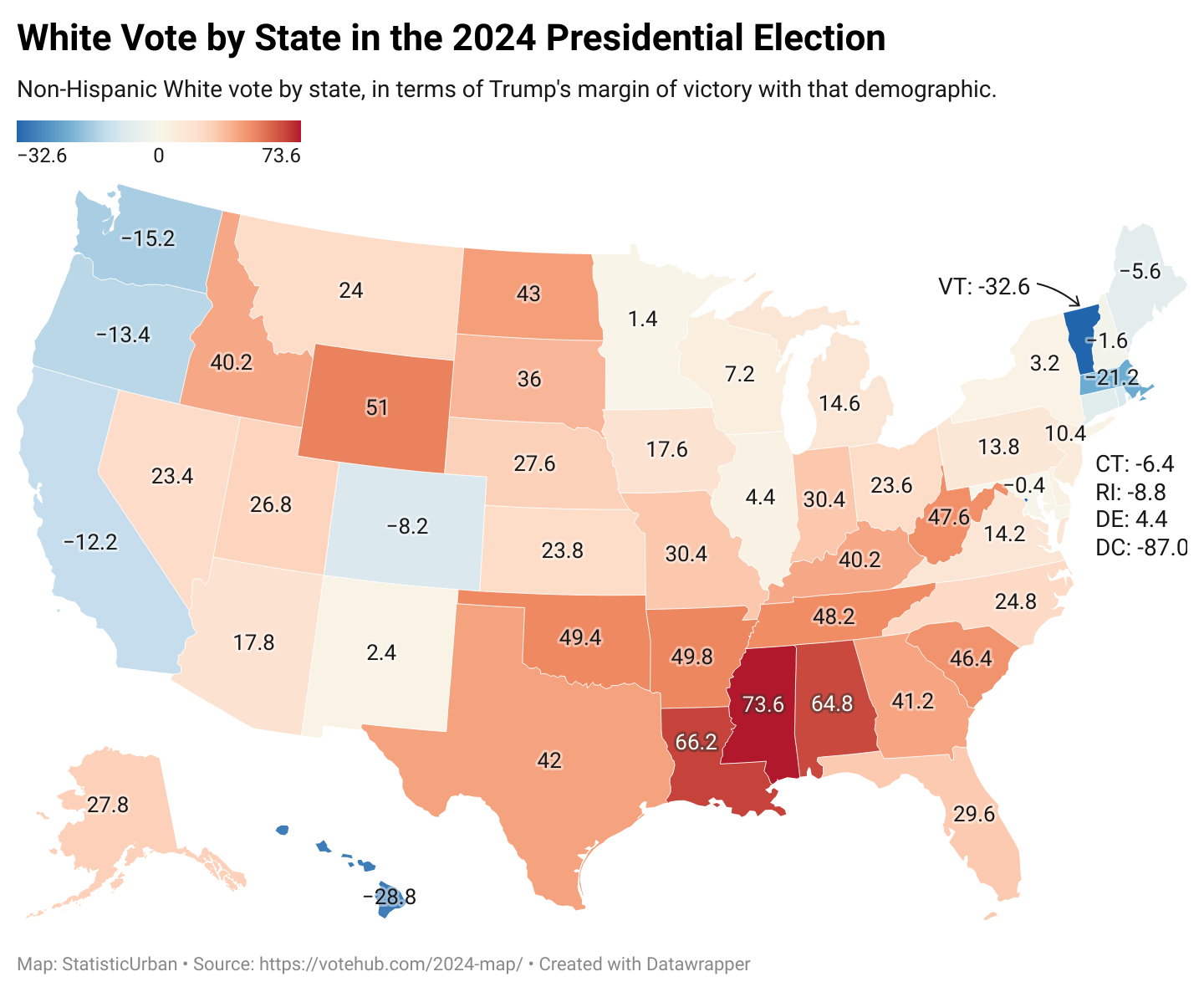
Voting Patterns Map of White Americans 2024
The map titled "How White Americans Voted in 2024" provides a detailed visual representation of voting behaviors among W...
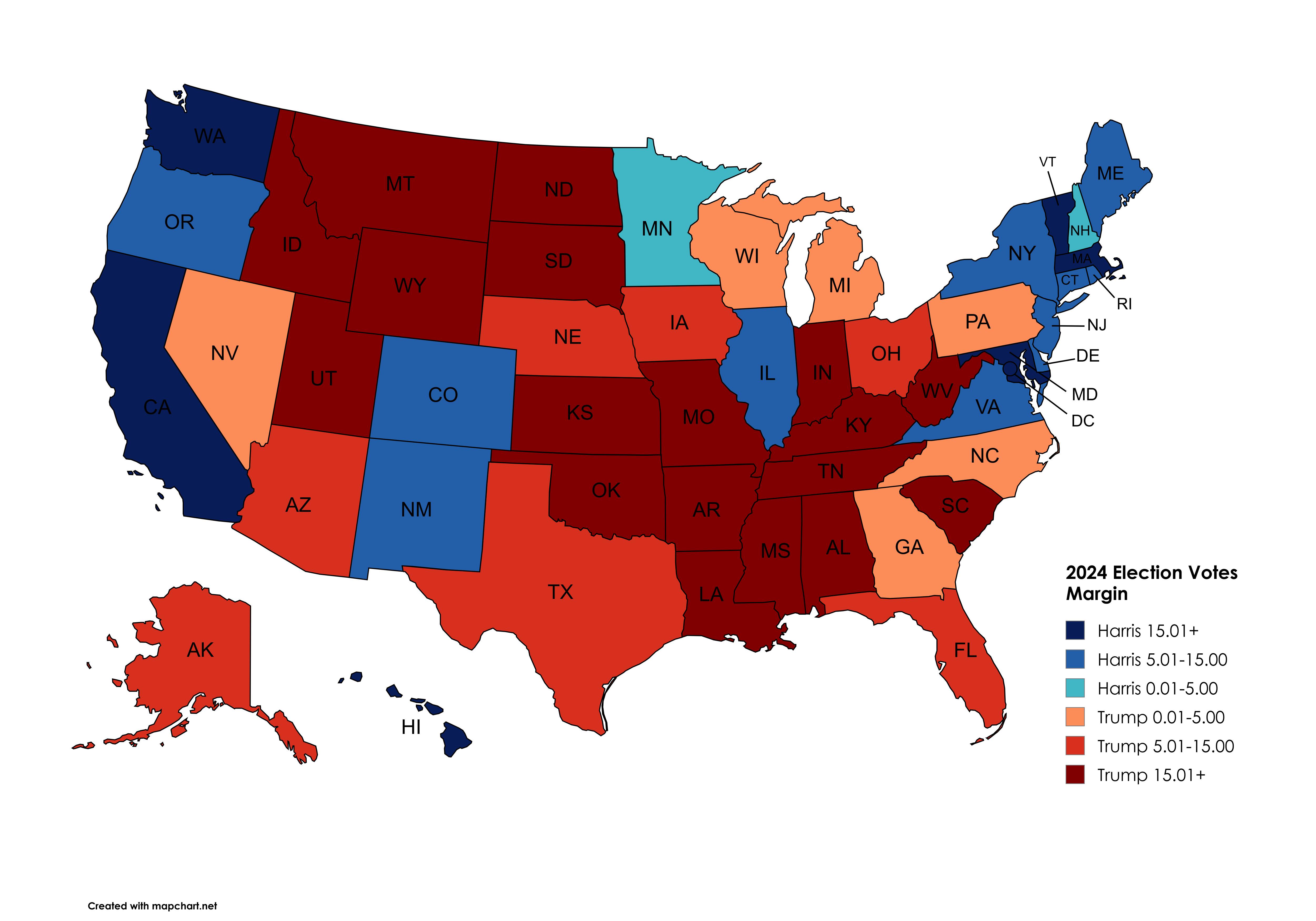
2024 Presidential Election States Margin of Votes Map
The "2024 Presidential Election States Margin of Votes Map" provides a visual representation of the vote margins across ...
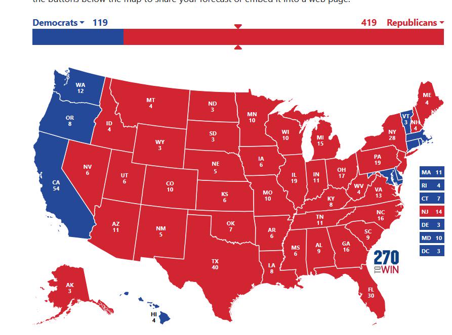
2024 US Election Internal Polling Map
This map visualizes the internal polling data from President Biden's campaign shortly before he announced his decision t...
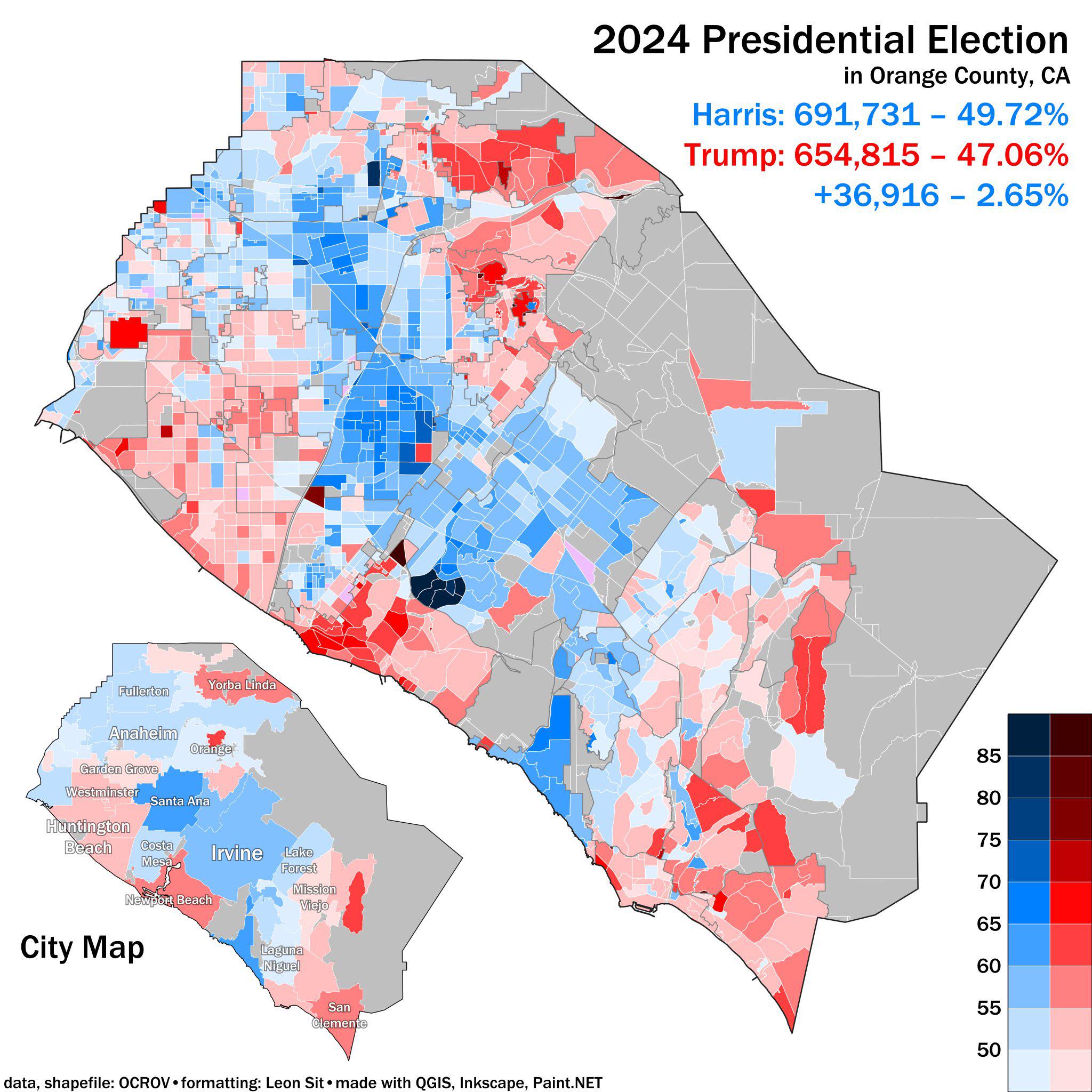
2024 Presidential Election Results Map Orange County CA
The 2024 Presidential Election Results Map for Orange County, CA, provides a detailed visualization of how residents in ...
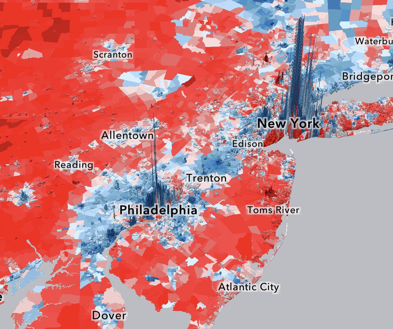
2024 Presidential Election Demographics Map
Race also plays a pivotal role in electoral dynamics. The map indicates that neighborhoods with significant populations ...
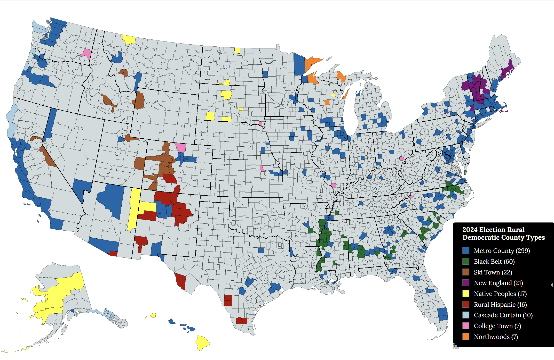
Rural Democratic Voting County Types Map
The "Rural Democratic Voting County Types of the 2024 U.S. Presidential Election" map provides a visual representation o...