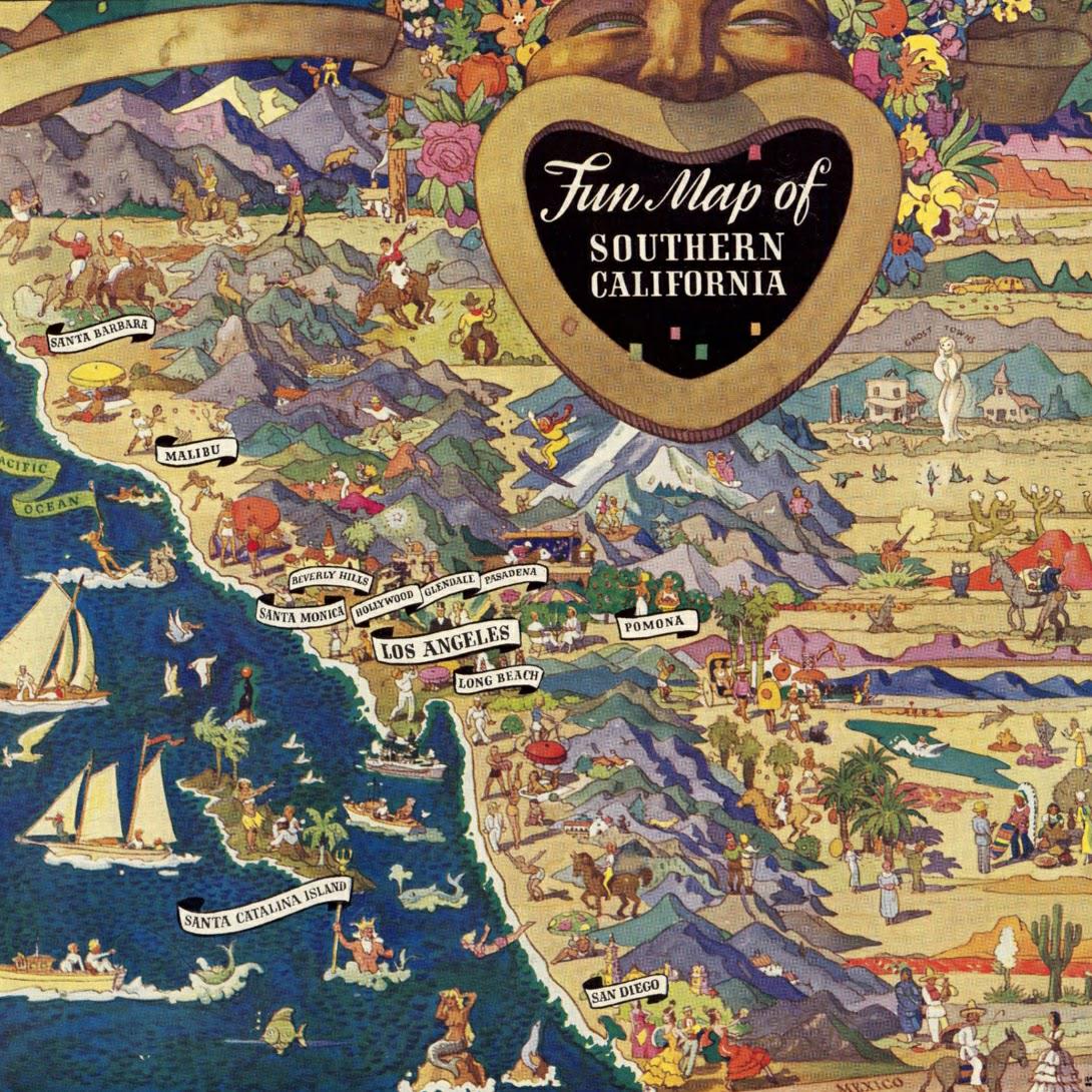
Fun Map of Southern California in 1935

David Chen
Data Visualization Specialist
David Chen is an expert in transforming complex geographic datasets into compelling visual narratives. He combines his background in computer science ...
Geographic Analysis
What This Map Shows
The "Fun Map of Southern California (1935)" provides a unique glimpse into the cultural and geographical landscape of Southern California during the mid-20th century. This colorful and whimsical map highlights various attractions, landmarks, and notable features of the region, making it a delightful artifact for both geography enthusiasts and history buffs. It showcases a time when the automobile culture was burgeoning, and the allure of the California coast was starting to become an irresistible destination for many.
Deep Dive into Southern California's Attractions and Landmarks
Southern California in 1935 was a vibrant tapestry of natural beauty, burgeoning cities, and cultural landmarks. The map encapsulates the essence of the region's appeal during this period, revealing a blend of outdoor attractions and urban developments.
One of the most striking features of this map is its emphasis on leisure activities. At this time, Southern California was becoming synonymous with sun-soaked beaches and outdoor adventures. The coastline, stretching from San Diego to Santa Barbara, offered a range of recreational opportunities. The beaches were not just places for relaxation; they were burgeoning social hubs where families gathered, surfers rode the waves, and beach volleyball began to gain popularity. Interestingly, the map marks famous beaches such as Santa Monica and Venice Beach, which continue to be iconic destinations today.
Inland, the map highlights the majestic San Gabriel Mountains, which provide a stunning contrast to the coastal scenery. These mountains not only serve as a backdrop for Los Angeles but also attract outdoor enthusiasts eager to explore hiking trails and enjoy the natural landscape. The map captures the spirit of adventure that was palpable in the air, reflecting a growing fascination with nature as a respite from urban life.
Furthermore, the map illustrates the burgeoning cities of the time. Los Angeles, already a significant urban center, is depicted with its expanding neighborhoods and attractions. The Hollywood sign, though not yet the global icon it is today, was already an emerging symbol of the film industry’s golden age. The map hints at the cultural revolution that was brewing, as movie studios flourished and the entertainment industry began to shape the identity of Southern California.
Regional Analysis
When examining the map, one can see distinct regional characteristics that define Southern California’s landscape. For instance, San Diego, known for its mild climate and beautiful coastline, is marked by its proximity to the Mexican border, highlighting its multicultural influences. In contrast, Los Angeles, often referred to as the heart of the entertainment industry, features numerous landmarks such as Griffith Park and the famous Dodger Stadium, which was in its infancy at that time.
The Central Coast, including Santa Barbara, is portrayed with its picturesque landscapes and vineyards. This region reflects the agricultural richness of Southern California, which was crucial to its economy. Interestingly, while Los Angeles was known for its rapid urbanization, areas like Santa Barbara maintained a more relaxed, small-town vibe, which can still be felt today.
Then there’s the desert region of Palm Springs, which, in the 1930s, was just beginning to emerge as a glamorous getaway for the wealthy. The map points to its potential as a resort destination, foreshadowing the development that would follow in the coming decades. This contrast between urban sprawl and natural beauty speaks volumes about the diverse land uses and cultural shifts occurring in Southern California.
Significance and Impact
Understanding the significance of the "Fun Map of Southern California (1935)" is crucial as it reflects a pivotal moment in the region's history. The mid-1930s were a time of transformation, as the Great Depression was beginning to wane, and the allure of California was irresistible to many Americans. The map not only serves as a historical reference but also illustrates the growth of tourism and leisure culture that would shape the region for decades to come.
Fast forward to today, and Southern California remains a global hub for culture, entertainment, and outdoor activities. The trends seen in the 1935 map are echoed in current demographics and urban planning, with a focus on sustainability and maintaining the balance between urban development and natural landscapes. Have you noticed how the same beaches and mountains that drew visitors in the 1930s are still attracting millions today? This enduring appeal is a testament to the region's rich history and its ability to adapt and thrive.
In conclusion, the "Fun Map of Southern California (1935)" is more than just a geographical representation; it’s a snapshot of a time when Southern California was beginning to realize its potential as a cultural and recreational powerhouse. It invites us to reflect on how far the region has come and the ways it continues to evolve, while still holding onto the charm and allure that has captivated generations.
Visualization Details
- Published
- October 18, 2025
- Views
- 38
Comments
Loading comments...