
Marcus Rodriguez
Historical Geography Expert
Marcus Rodriguez specializes in historical cartography and geographic data analysis. With a background in both history and geography, he brings unique...
Geographic Analysis
What This Map Shows
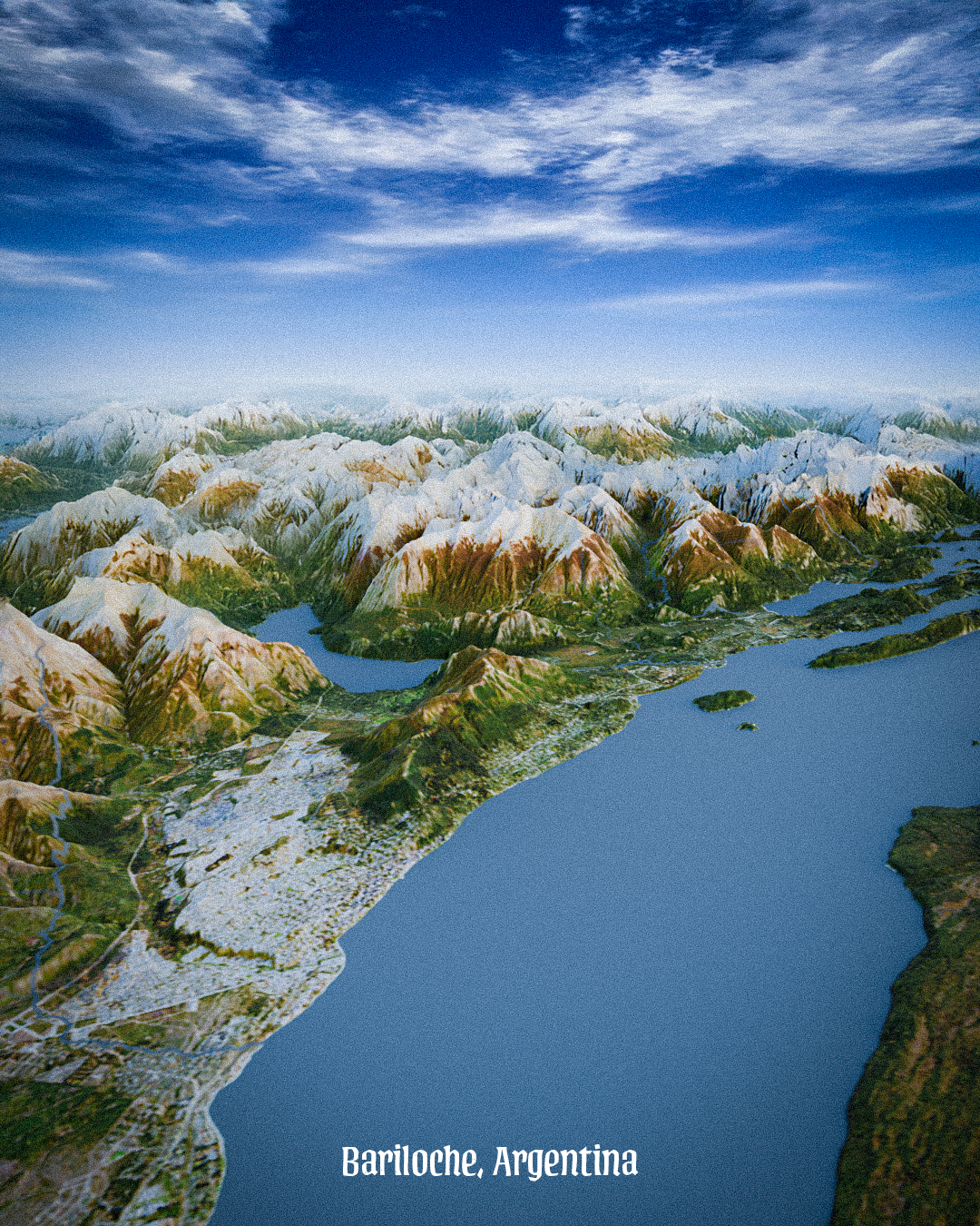
This oblique view map of Bariloche, Argentina, presents a unique combination of satellite images layered with elevation models, offering a striking perspective of this picturesque city. While the map may lack traditional cartographic references, the visual richness captures the essence of Bariloche’s stunning topography, nestled between the Andean mountains and the pristine shores of Lake Nahuel Huapi. The elevation contours and varied color palettes highlight the dramatic landscapes that define this region, making it an inviting visual exploration of one of Argentina's most beloved destinations.
Deep Dive into Bariloche’s Geography
Bariloche, officially known as San Carlos de Bariloche, is situated in the northern part of the Patagonia region of Argentina. It is renowned for its breathtaking landscapes, which are characterized by an intricate blend of mountains, lakes, and forests. The city lies at an altitude of approximately 770 meters (2,530 feet) above sea level, providing it with a unique microclimate that contributes to its appeal as a year-round tourist destination.
Interestingly, the geography surrounding Bariloche plays a critical role in its climate and ecology. The city is located on the shores of Lake Nahuel Huapi, the largest lake in the region, which is a remnant of glacial activity. The lake's presence moderates temperatures, contributing to the area's relatively mild summers and cold, snowy winters. This makes Bariloche a popular spot not just for summer hiking and water sports, but also for winter sports, particularly skiing at the nearby Cerro Catedral ski resort, one of the largest and most developed in South America.
The surrounding mountains, particularly the Andes, create a rain shadow effect, which leads to diverse weather patterns. The eastern side of the mountains typically experiences drier conditions, while the western slopes receive significant precipitation, supporting dense forests of coihue and lenga trees. This ecological diversity is home to various wildlife species, including the elusive Andean condor and the Patagonian fox.
In terms of urban development, Bariloche has evolved from a small settlement established in the late 19th century into a bustling city. Its growth was spurred by the Argentinian tourism boom in the 20th century, and today, it boasts a population of around 130,000 residents. The city serves as a hub for adventurers and nature enthusiasts, providing access to numerous national parks, including the Nahuel Huapi National Park, which encompasses more than 7,500 square kilometers of protected wilderness.
Regional Analysis
Bariloche’s geographical context presents a fascinating blend of urban and natural environments. The city is bordered by several prominent landmarks, including the Cerro Otto mountain to the north and the Andes range to the west. The map effectively illustrates how these features influence not just the physical landscape but also the social and economic dynamics of the area.
For example, the proximity to Lake Nahuel Huapi has facilitated the development of a robust tourism sector, with many businesses catering to visitors seeking outdoor activities. In contrast, the areas to the east of the city, which are more arid, are primarily agricultural, focusing on fruit and vegetable production, which contrasts sharply with the tourism-driven economy of the western side.
Interestingly, the elevation changes depicted in the map also highlight disparities in land use. Higher elevations are often designated for conservation, while lower regions have been developed for housing and commercial enterprises. This distinction is essential for urban planners and policymakers as they navigate growth and sustainability challenges in this breathtaking region.
Significance and Impact
Understanding Bariloche’s geography is critical for several reasons. First, it underscores the importance of environmental conservation in a region that attracts millions of tourists each year. As tourism continues to grow, so do the pressures on local ecosystems. The balance between economic development and environmental sustainability is a pressing concern for local authorities and residents alike.
Moreover, the unique geography of Bariloche has implications for climate change. As temperatures rise and weather patterns shift, regions like Bariloche may face altered precipitation levels and increased wildfire risks. This highlights the need for proactive environmental management strategies to ensure that both the natural beauty and the economic viability of Bariloche are preserved for future generations.
In conclusion, this oblique view map of Bariloche not only showcases its stunning landscapes but also invites us to consider the intricate relationship between geography, ecology, and human activity in this remarkable region of Argentina. As we reflect on Bariloche's beauty, we must also remember the importance of preserving its natural resources and the delicate balance between development and conservation.
Visualization Details
- Published
- September 20, 2025
- Views
- 66
Comments
Loading comments...