social media Maps
6 geographic visualizations tagged with "social media"
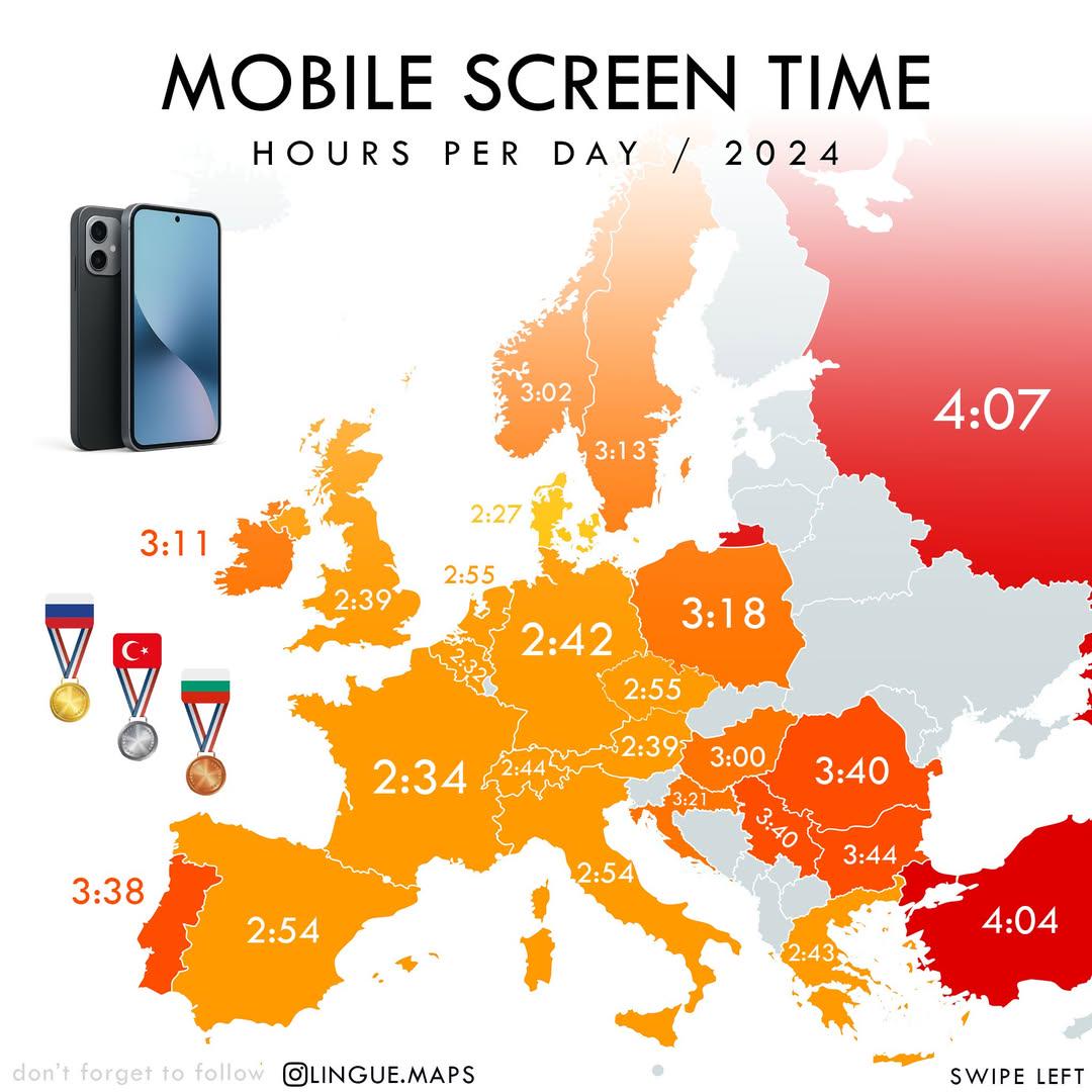
Mobile Screen Time in Hours per Day Map
The "Mobile Screen Time in Hours per Day (2024)" map visually represents the average daily hours individuals spend on th...
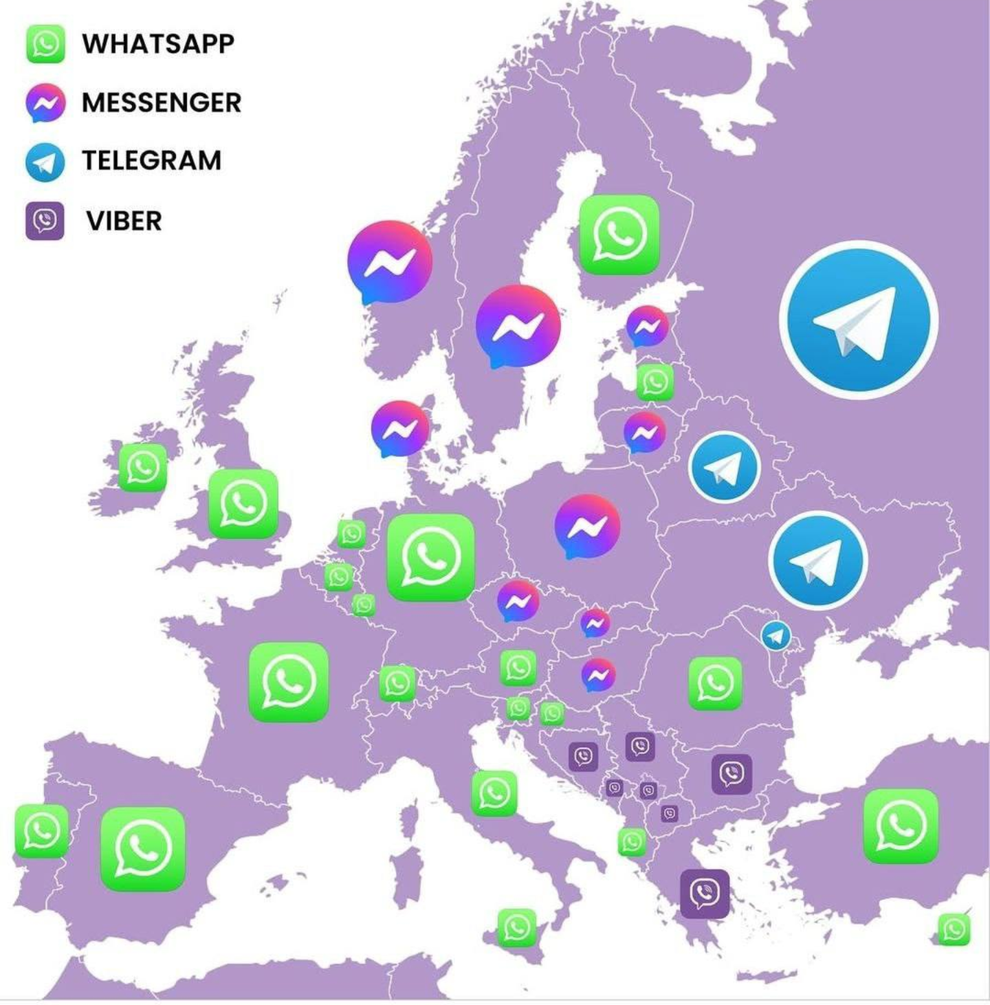
Most Popular Messenger Apps in European Countries Map
This map visualizes the most popular messaging applications used in various countries across Europe. By highlighting the...
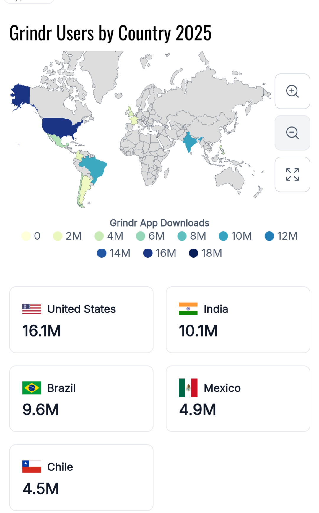
Countries with Highest Number of Grindr Users Map
This map displays the countries with the highest number of active Grindr users, highlighting the varying levels of engag...
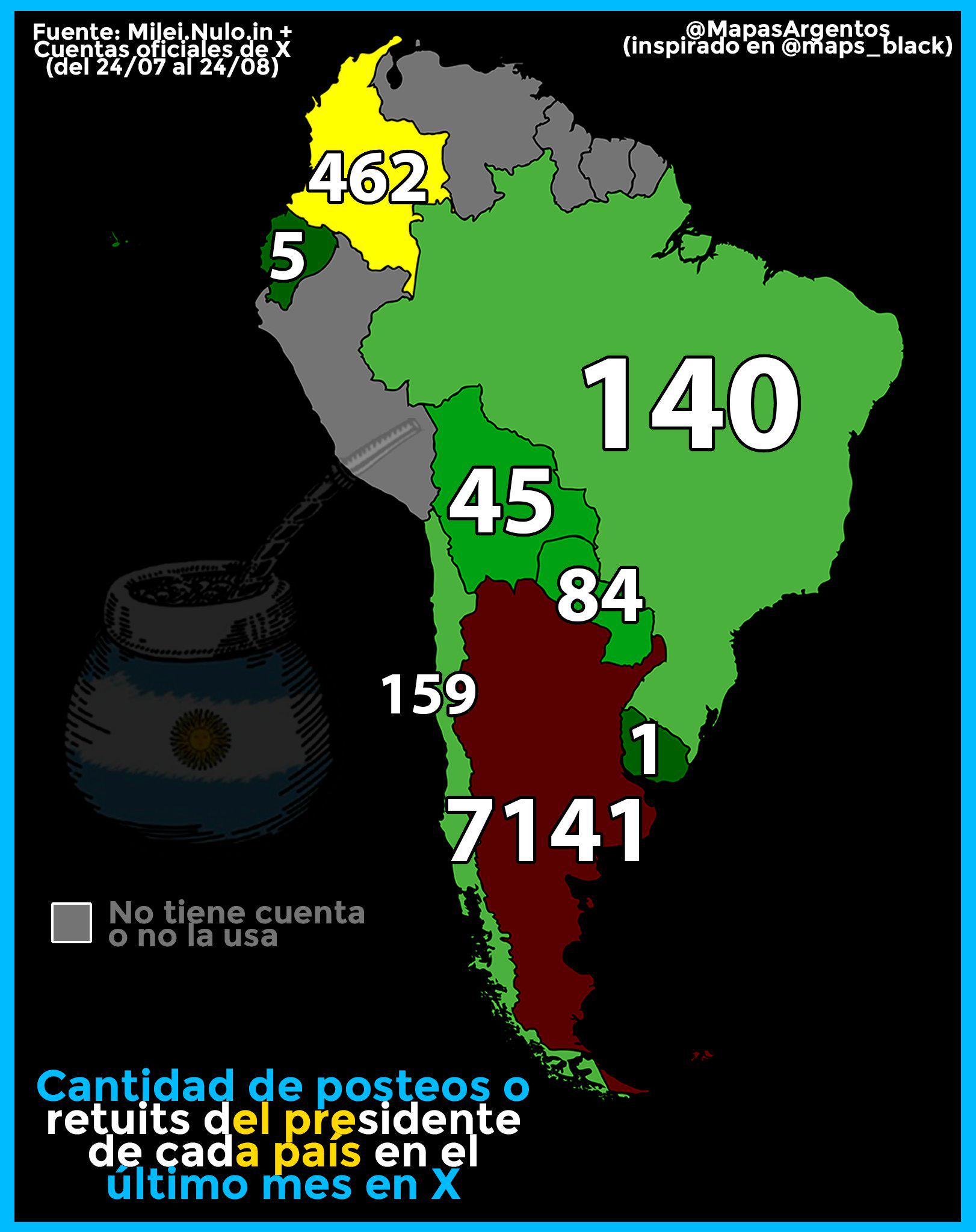
Map of Tweets and Retweets by South American Presidents
The visualization titled "Amount of tweets and retweets last month by the President of each South American country" prov...
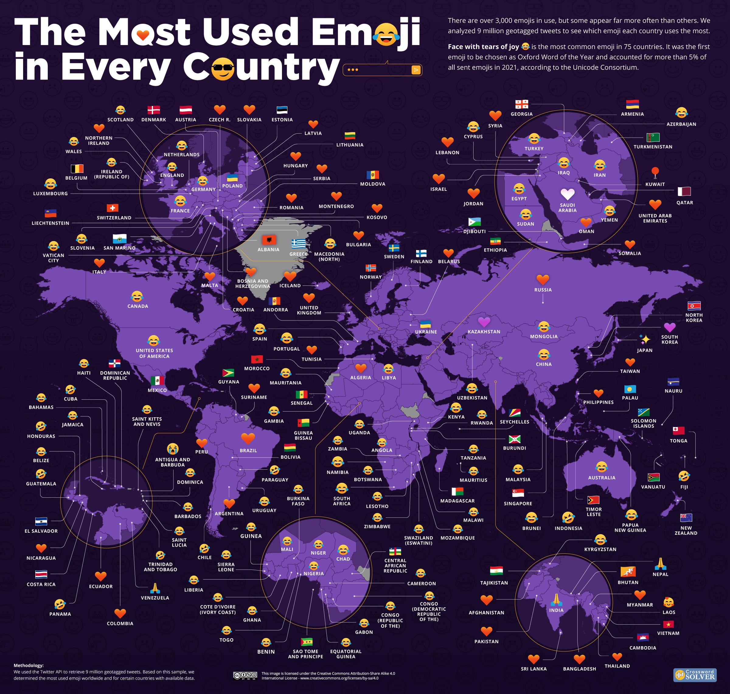
Most Used Emojis by Country Map
The visualization titled "Most Used Emojis by Country Map" presents a fascinating look into the digital expressions that...
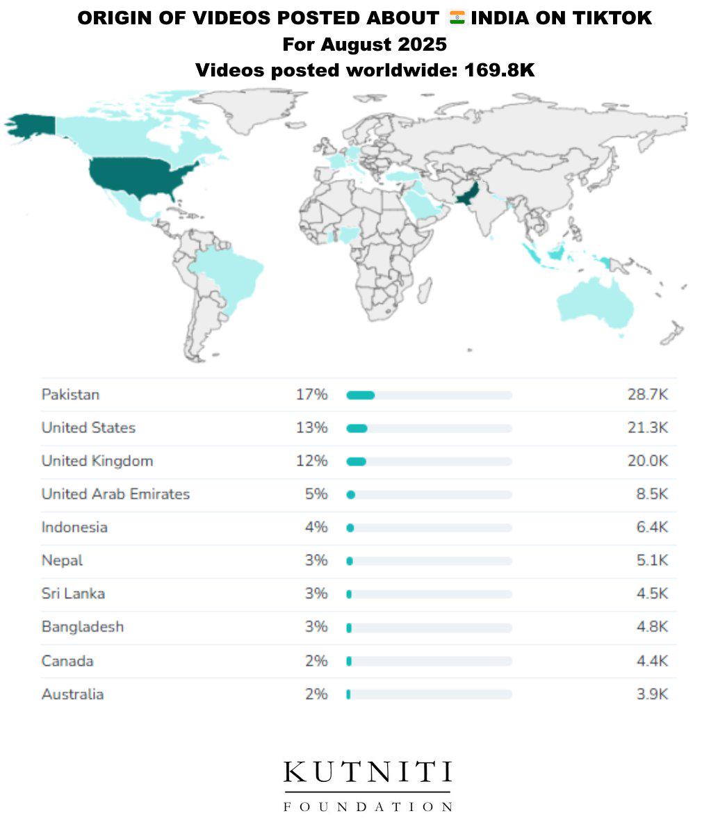
Origin of TikTok Videos About India Map
This visualization provides a clear geographical representation of the origins of videos posted about India on TikTok. B...