political parties Maps
6 geographic visualizations tagged with "political parties"
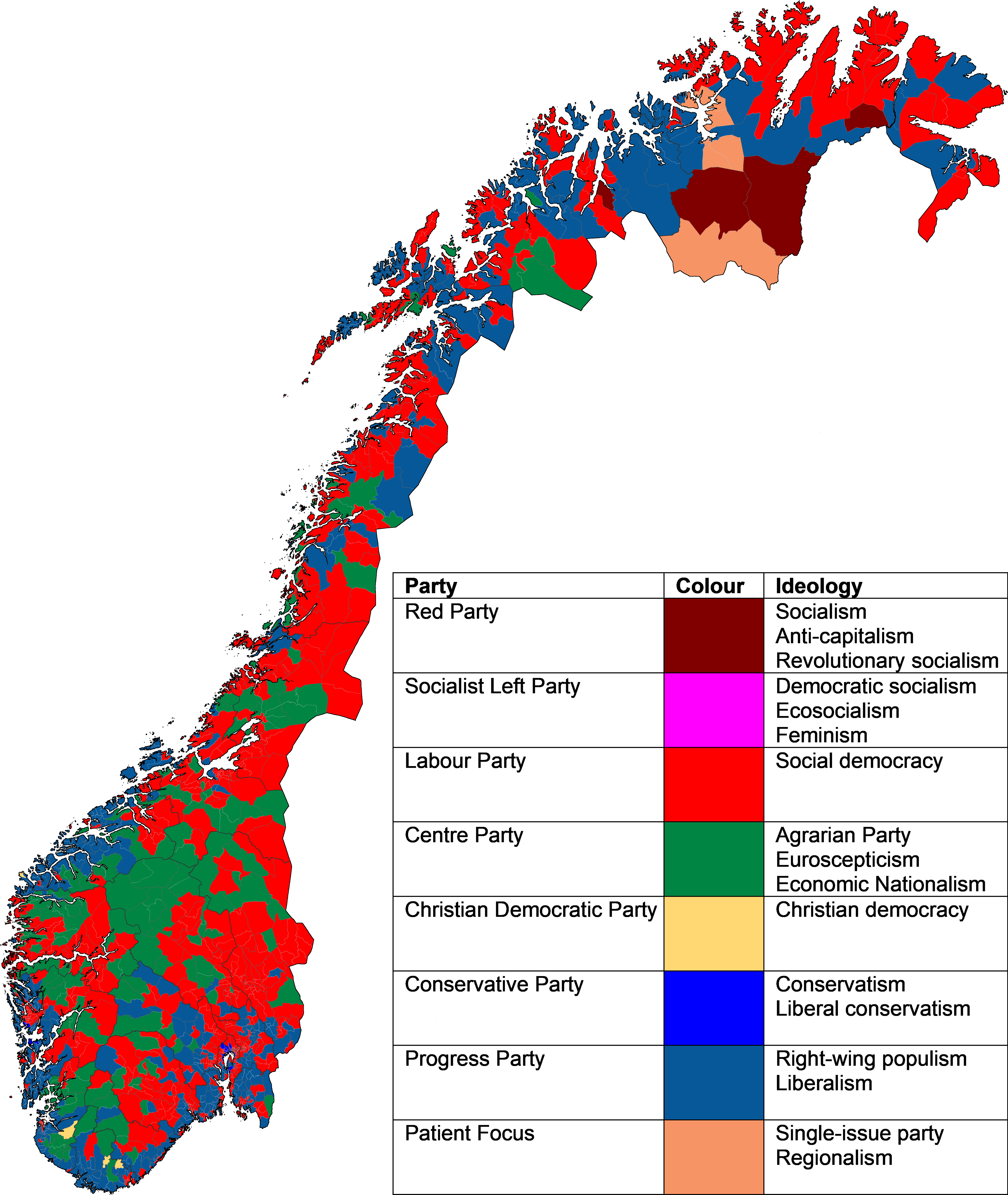
Largest Political Party by Constituency Map Norway 2025
The "Largest Political Party in Each Constituency in the 2025 Norwegian Parliamentary Election" map visually represents ...
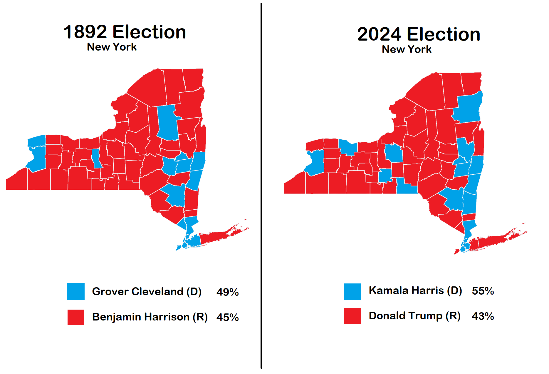
New York Election Map 1892 vs 2024
The visualization titled "Election in New York 1892 vs 2024" provides a compelling comparison of political landscapes ac...
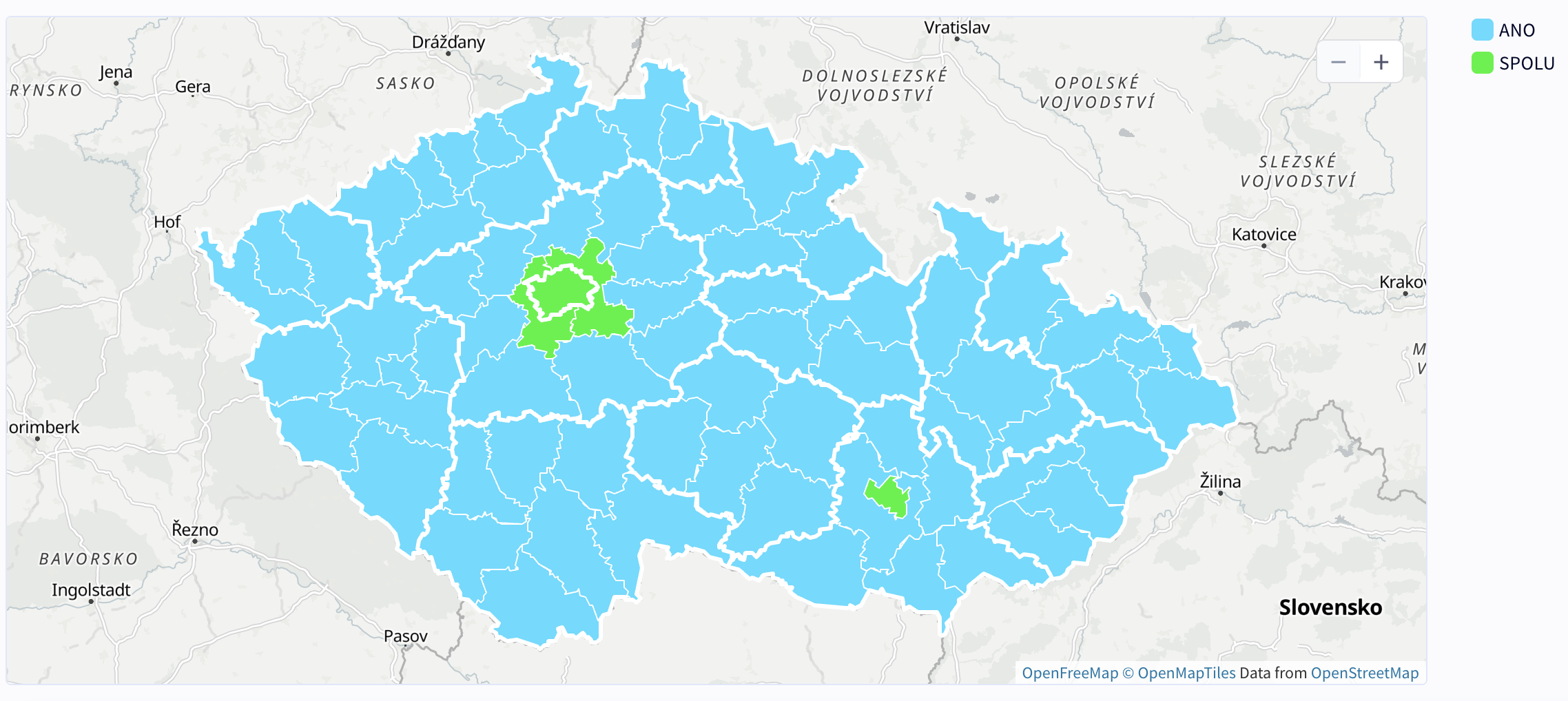
Winning Party by District Map – 2025 Czech Parliamentary Elections
The "Winning Party by District – 2025 Czech Parliamentary Elections" map offers a detailed visualization of the politica...
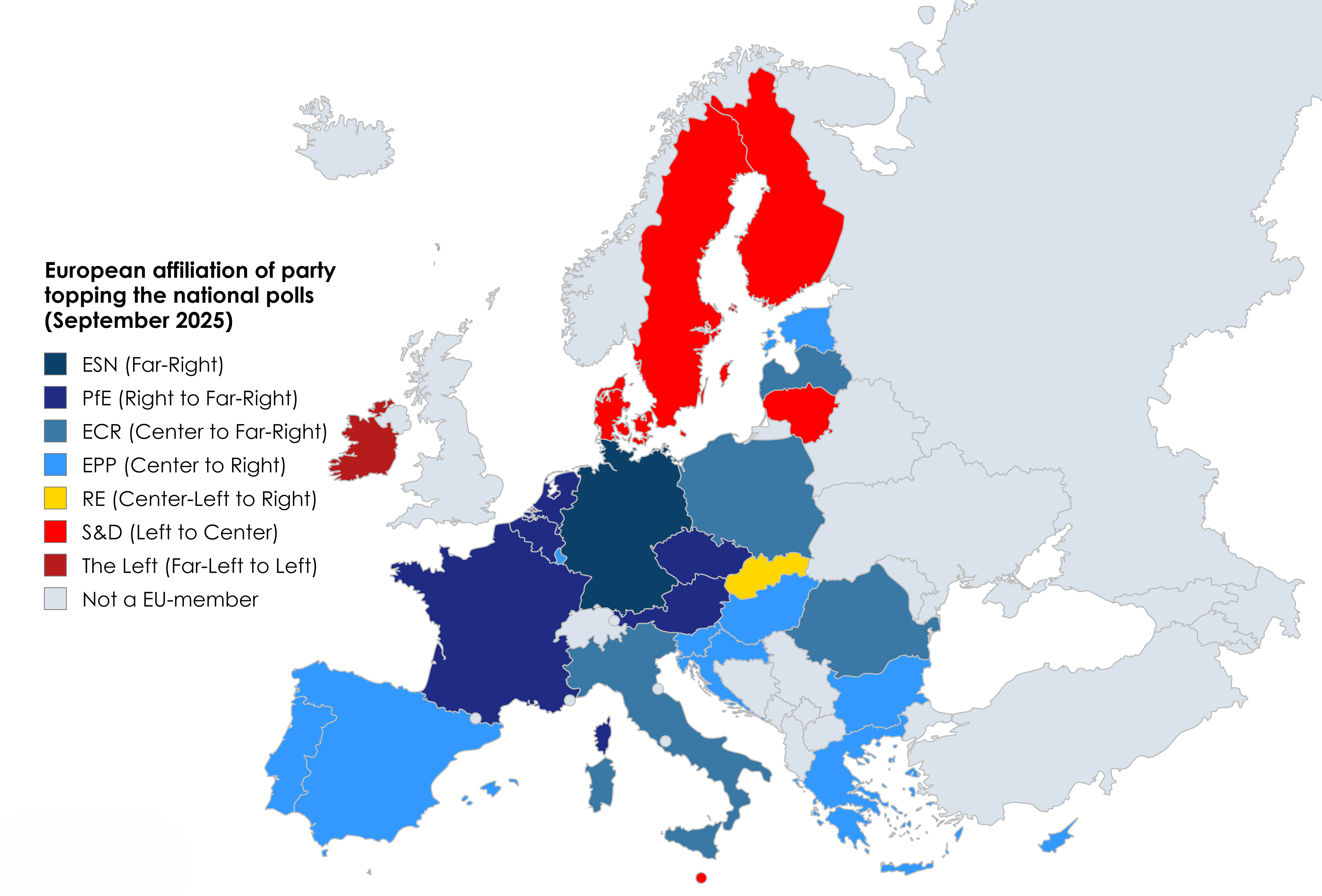
EU National Polls by Party Map
This map provides a clear visualization of the current political landscape in the European Union by displaying which pol...
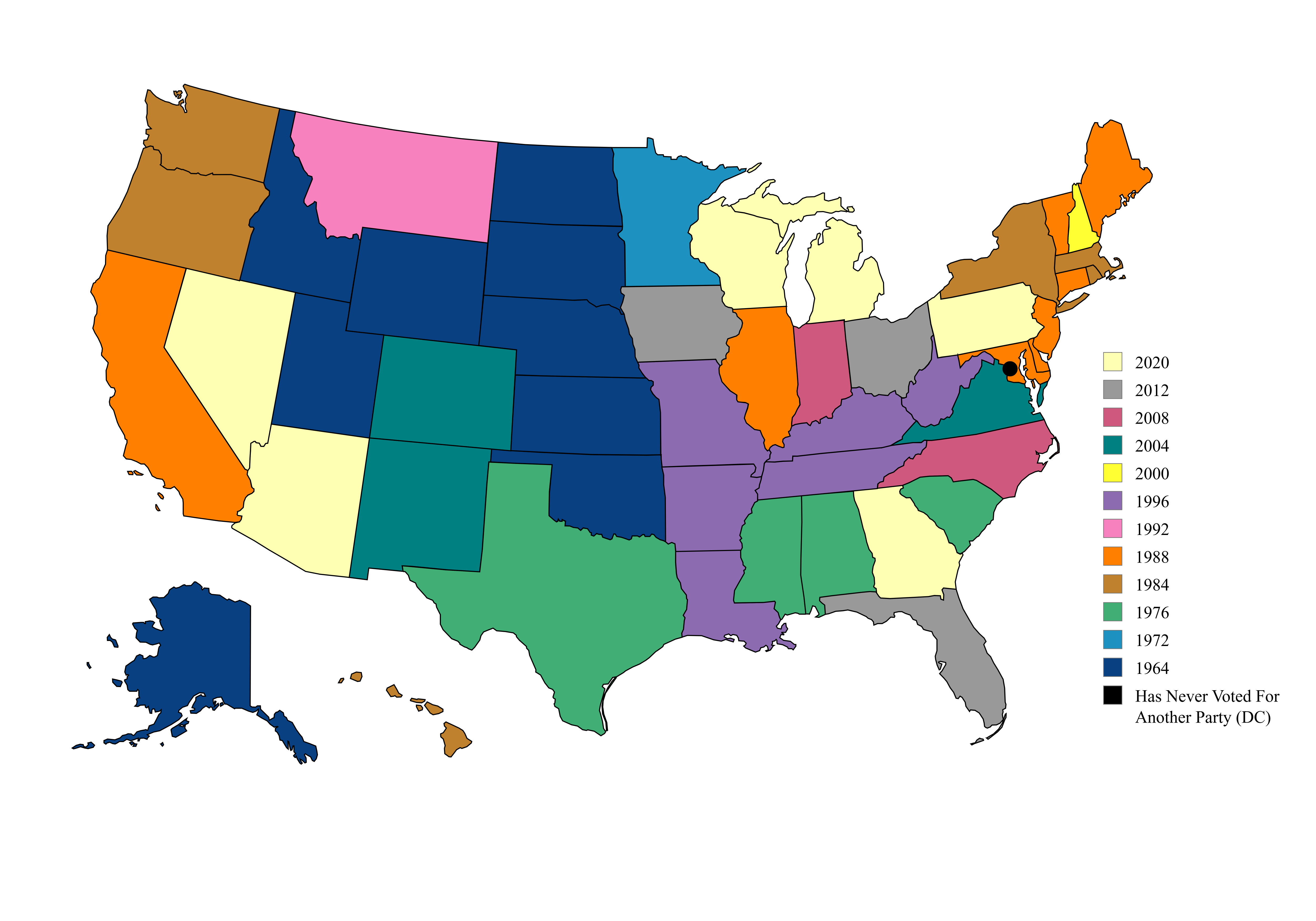
Map of US Presidential Election Party Switches
This map illustrates a fascinating political phenomenon in the United States: the last presidential election in which ea...
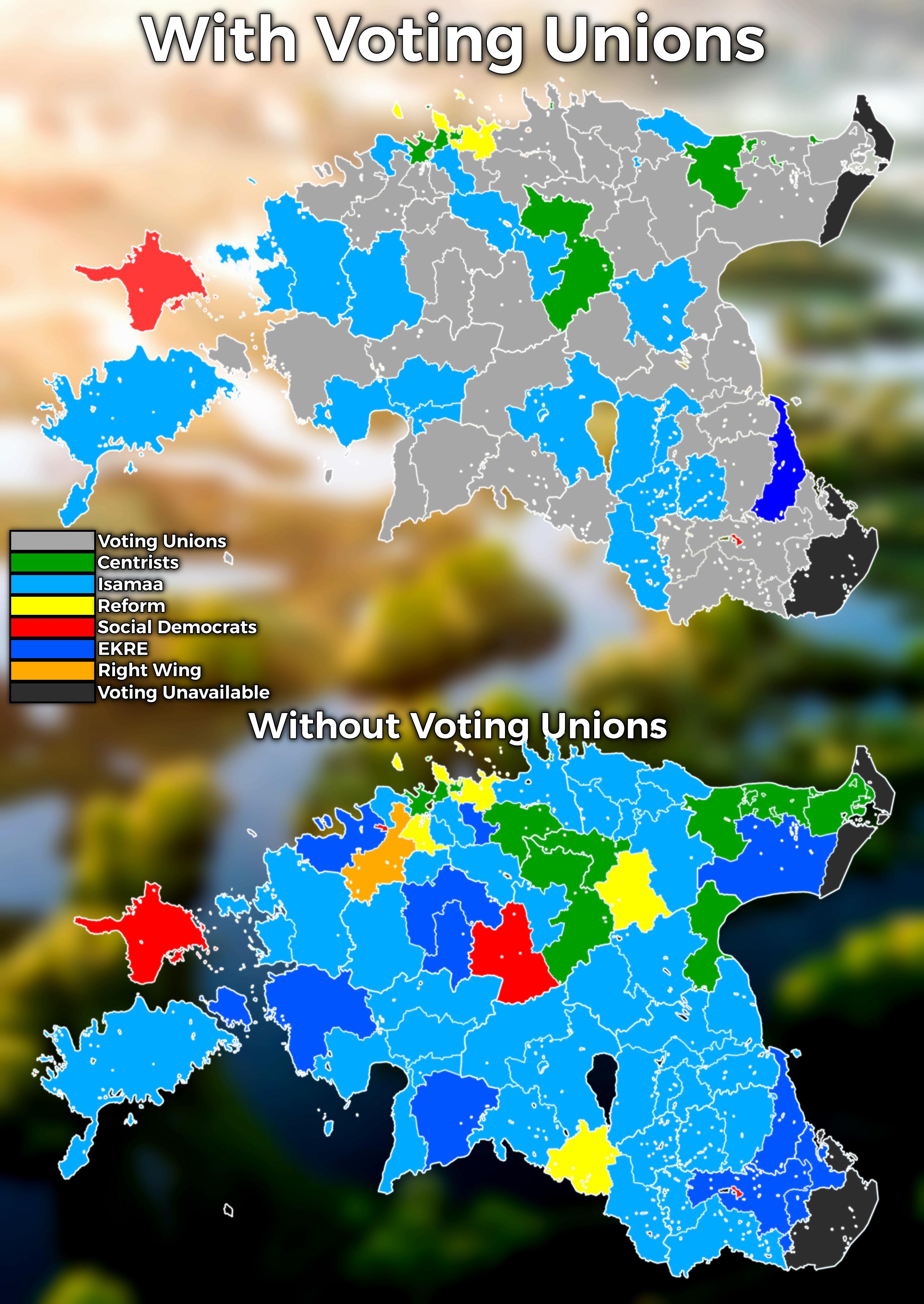
Estonian 2025 Municipal Election Results Map
The Estonian 2025 municipal election results map vividly illustrates the political landscape of Estonia by showcasing th...