islam Maps
14 geographic visualizations tagged with "islam"
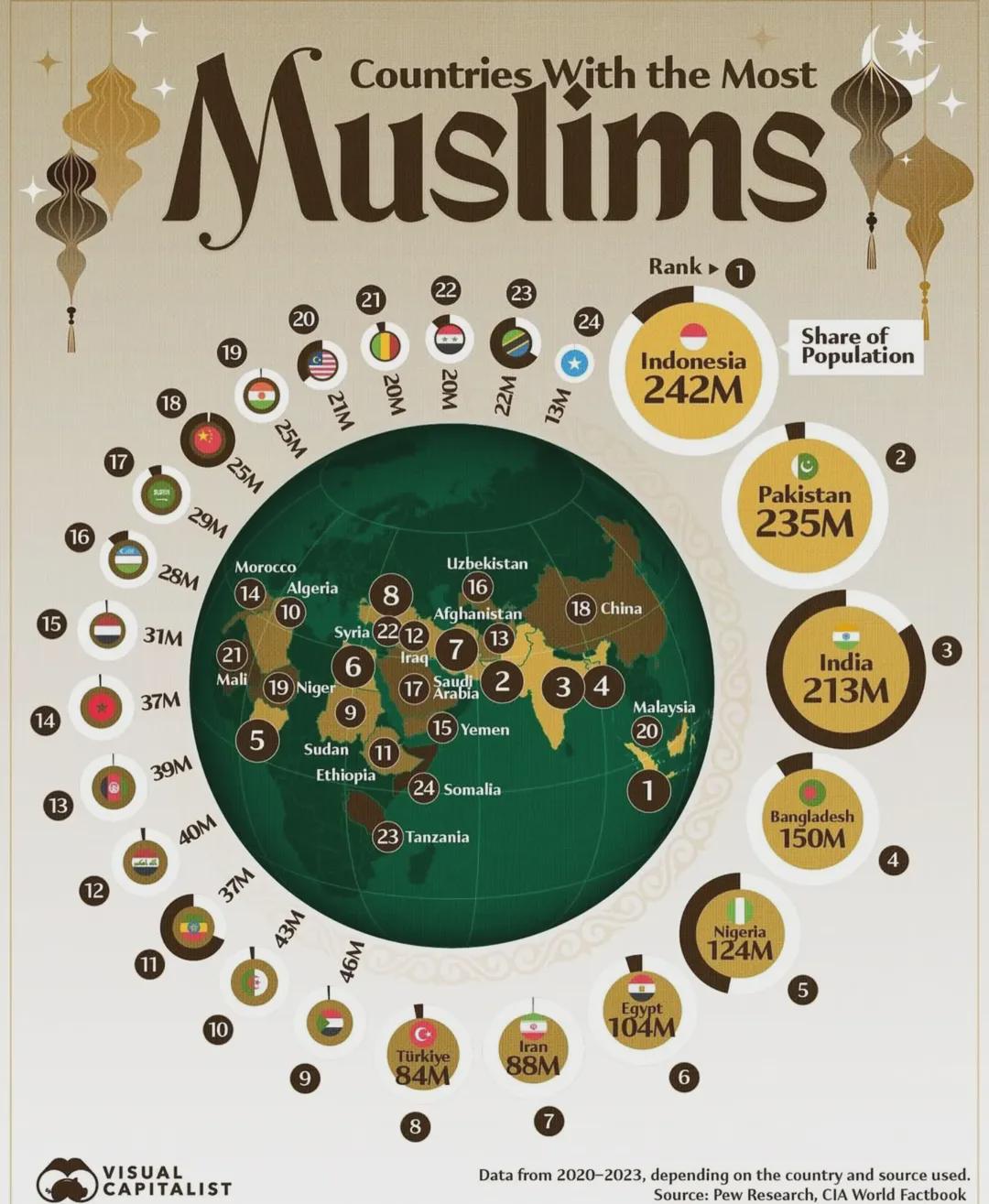
Countries With The Most Muslims Map
This map illustrates the distribution of Muslim populations across the globe, highlighting the countries with the larges...
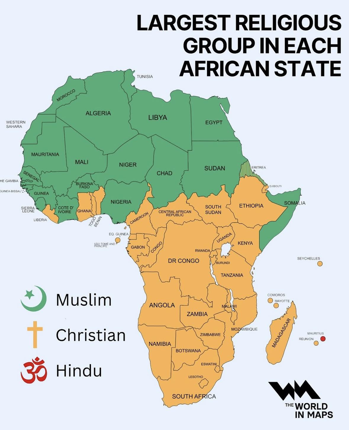
Map of Largest Religious Group in Each African State
The map titled "Largest Religious Group in Each African State" provides a clear visual representation of the predominant...
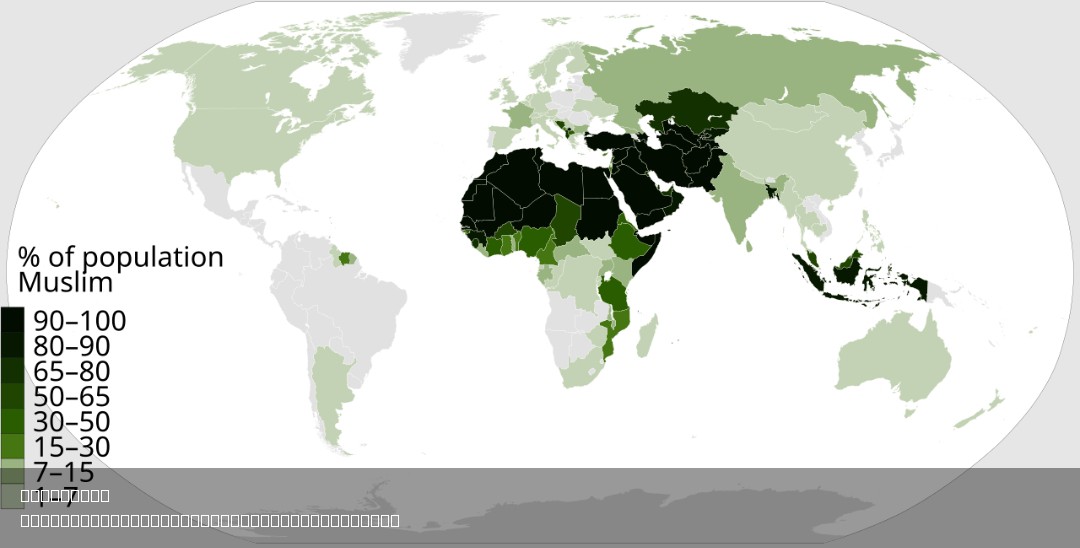
% of Muslim Population by Country Map
This map visually represents the percentage of the Muslim population in each country around the world. By highlighting t...
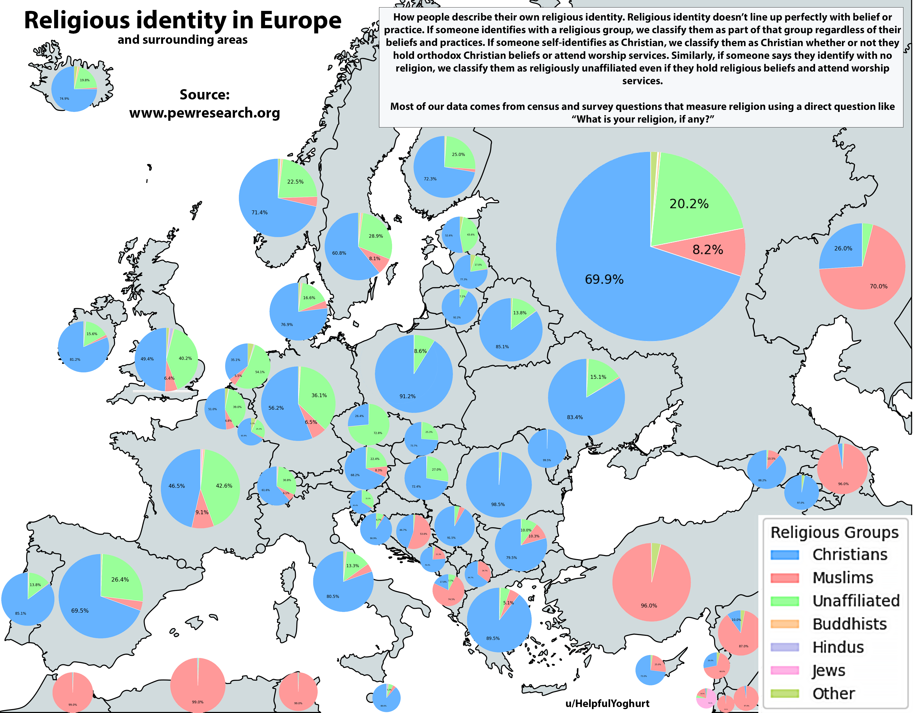
Religious Identity in Europe Map
The "Religious Identity in Europe Map" provides a comprehensive visualization of the religious landscape across the cont...
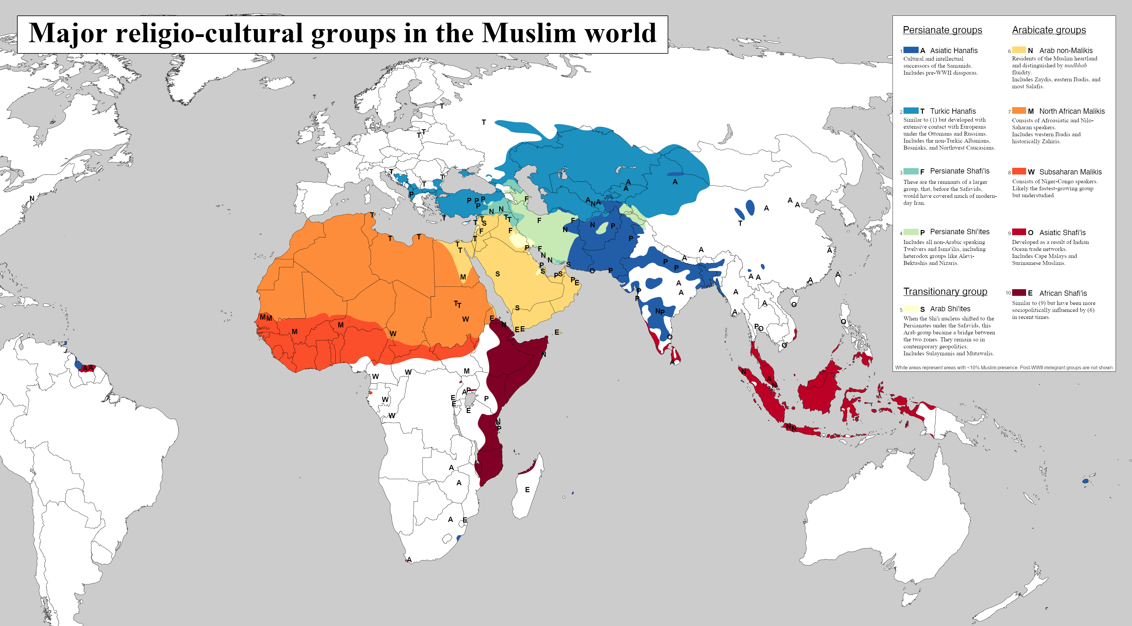
Major Religio-Cultural Groups in the Muslim World Map
This map titled 'Major Religio-Cultural Groups in the Muslim World' illustrates the diverse landscape of religious and c...
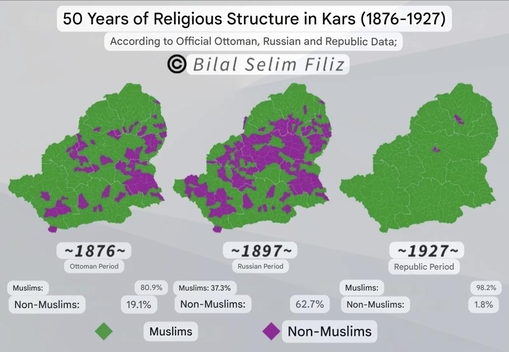
Religious Structure Map of Kars History
The map titled "The Religious Structure of Kars during the Ottoman, Russian and Turkey Republic periods" provides a deta...
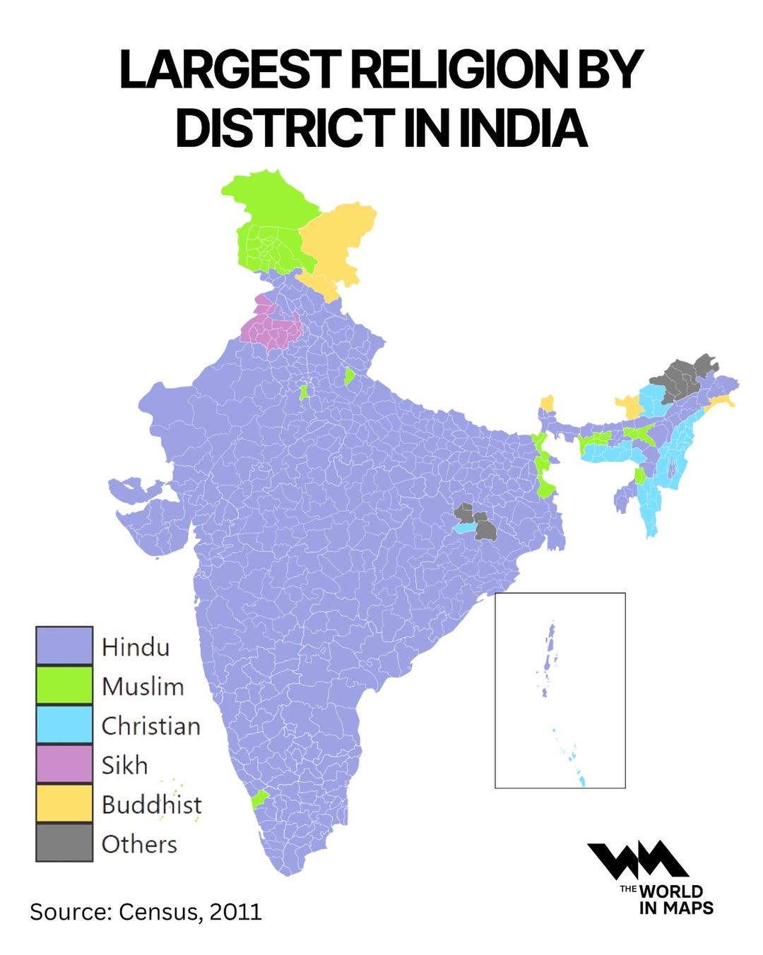
Largest Religion by District in India Map
The "Largest Religion by District in India Map" offers a fascinating look at the religious landscape of India, highlight...
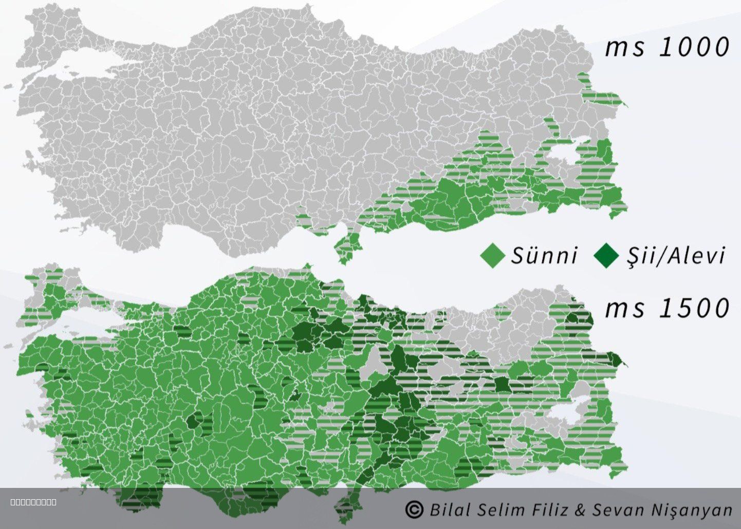
Islam in Turkey 1000 and 1500 Map
The "Islam in Turkey 1000 and 1500 Map" visually represents the spread and influence of Islam across the region of Turke...
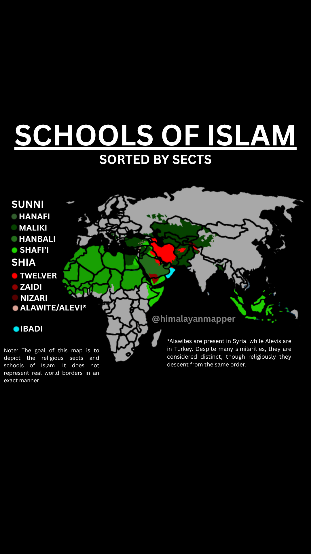
Schools of Islam by Sects Map
The "Schools of Islam by Sects Map" provides a visual representation of the various sects within Islam, illustrating how...
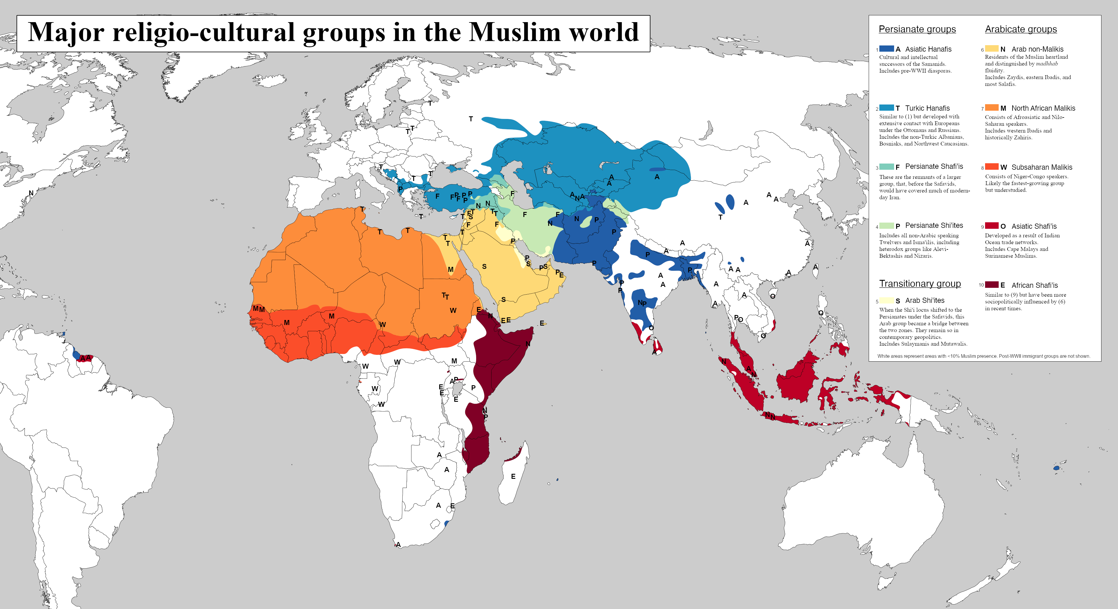
Major Religio-Cultural Groups in the Muslim World Map
The visualization titled \...
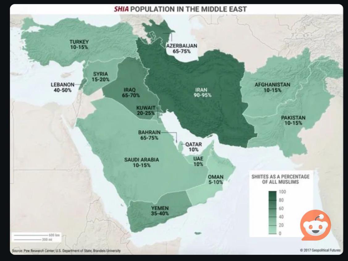
% of Shia Muslims in Middle East Countries Map
The visual representation titled \...
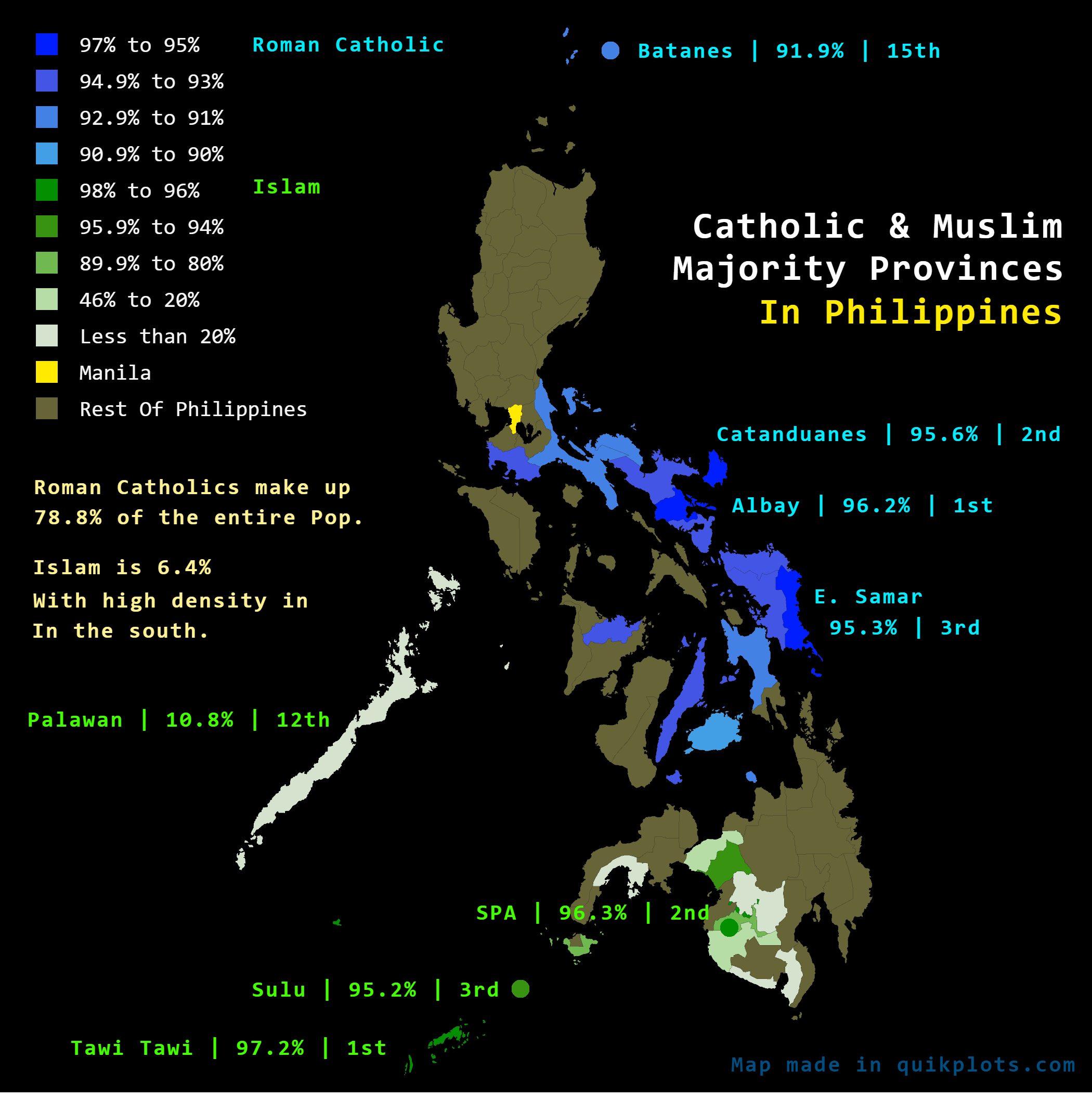
Catholic and Muslim Majority Provinces Map in the Philippines
The "Catholic & Muslim Majority Provinces In The Philippines" map visually delineates the religious demographics of the ...
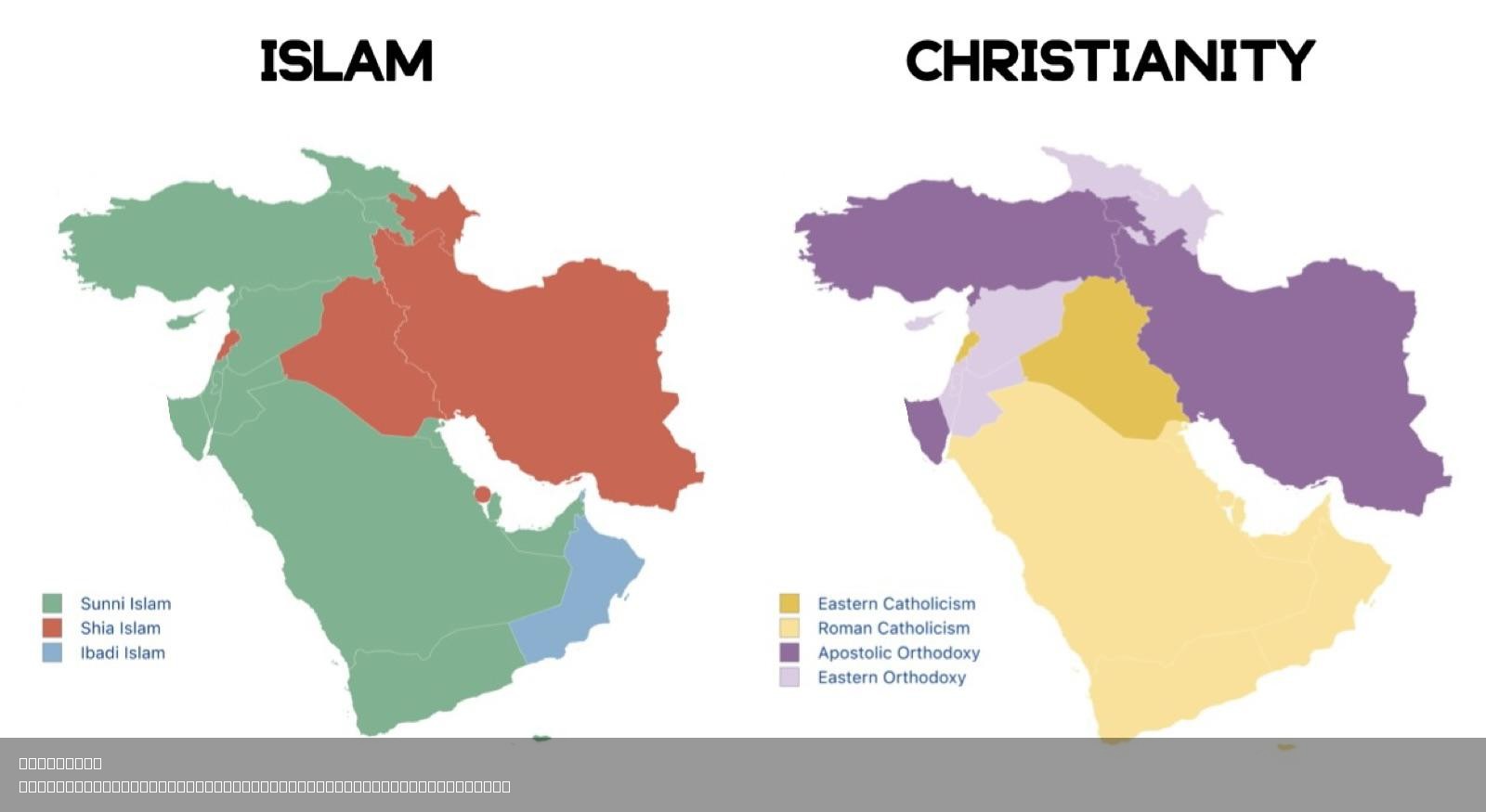
Largest Sect of Islam and Christianity in West Asia Map
This map provides a visual representation of the largest sects of Islam and Christianity in West Asia, highlighting the ...
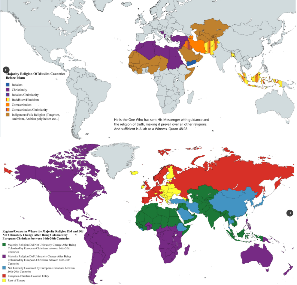
Religion Change Map Due to Islamic and Christian Imperialism
Islamic imperialism began with the rapid expansion of the Arab Caliphates after the death of Prophet Muhammad. As these ...