health Maps
9 geographic visualizations tagged with "health"
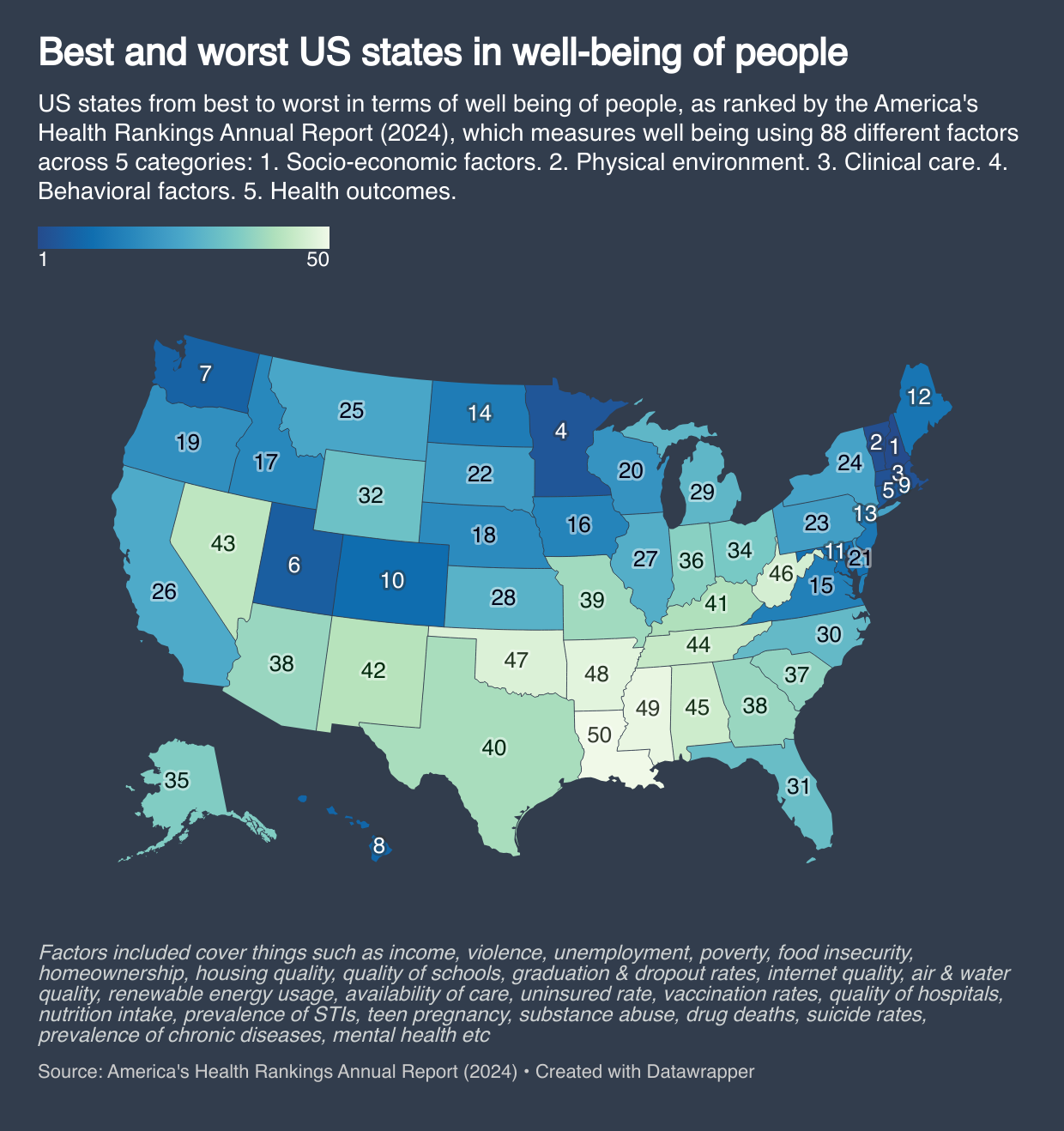
Best and Worst US States by Overall Well-Being Map
This map provides a comprehensive overview of the overall well-being of each U.S. state, ranking them based on various f...
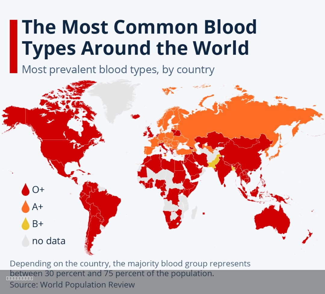
Most Common Blood Types Around the World Map
The "Most Common Blood Types Around the World Map" provides a visual representation of the distribution of blood types a...
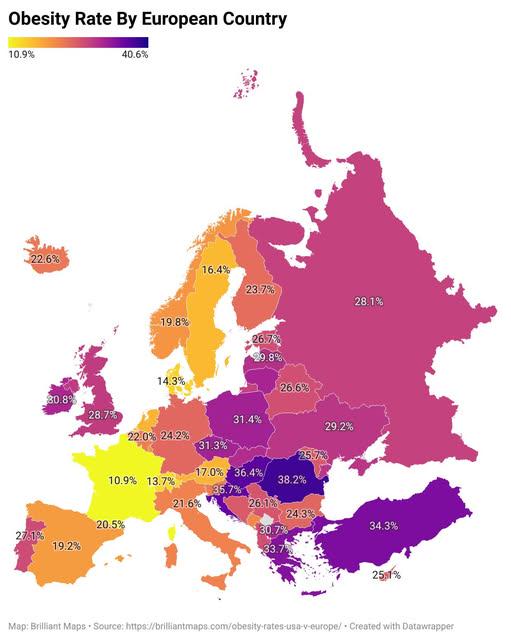
European Obesity Rate by Country Map
The "European Obesity Rate by Country Map" for 2024 offers a vivid depiction of the prevalence of obesity across various...
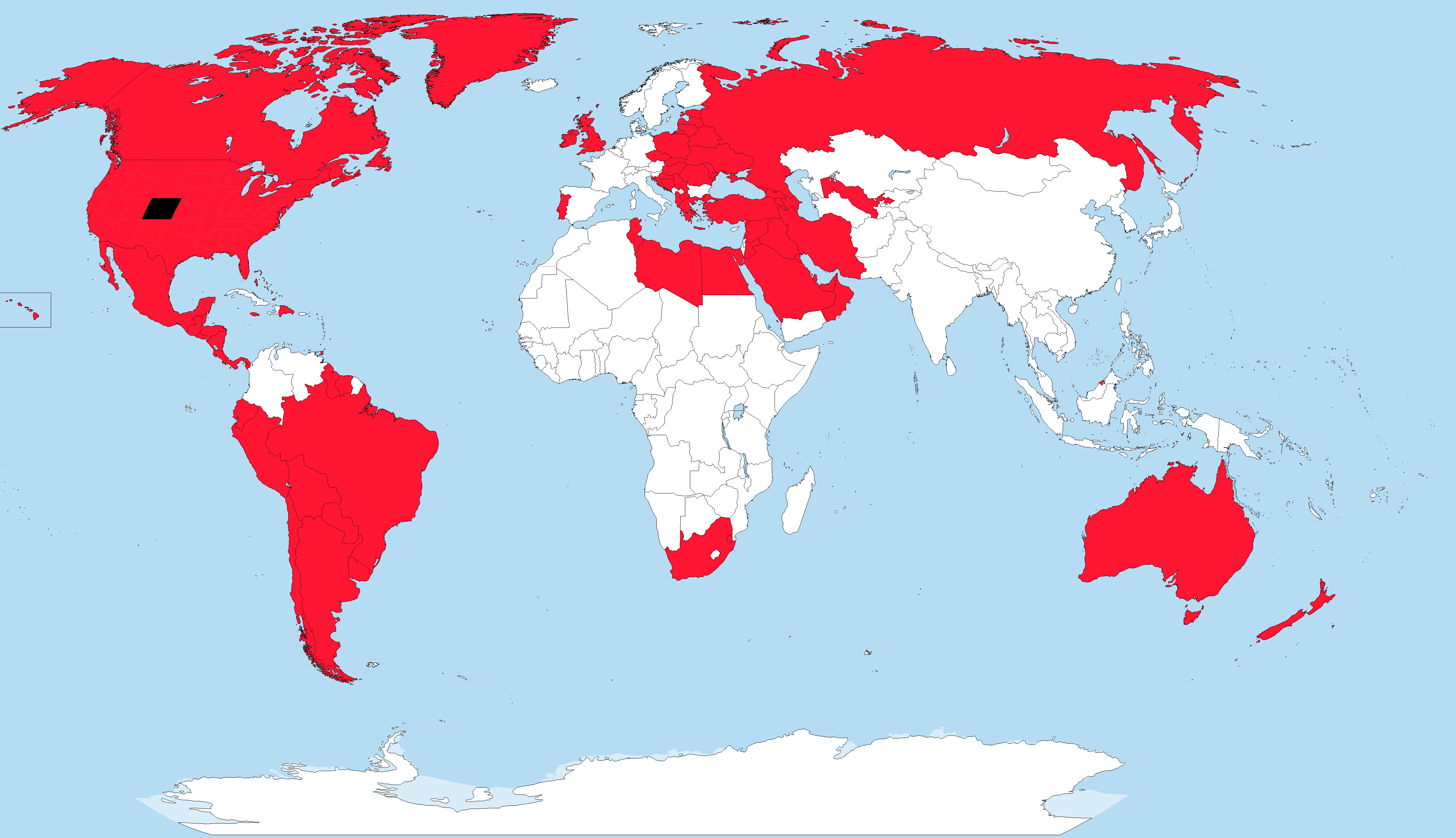
Obesity Rates Compared to Colorado Map
The visualization illustrates the obesity rates across various countries and states, highlighting those with a higher pr...
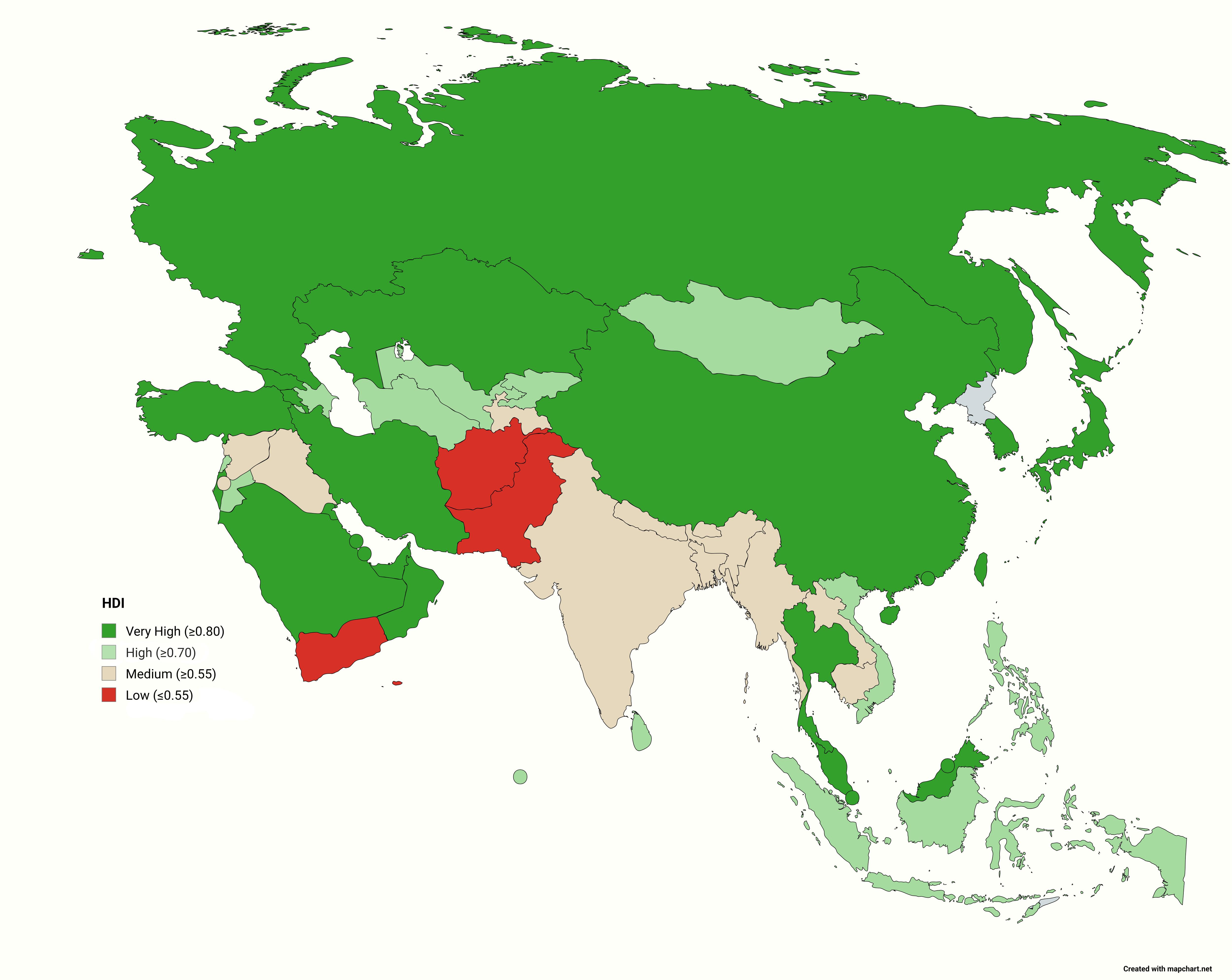
Asian Countries by HDI Class Map
Interestingly, the HDI is calculated using three essential dimensions: health (life expectancy at birth), education (mea...
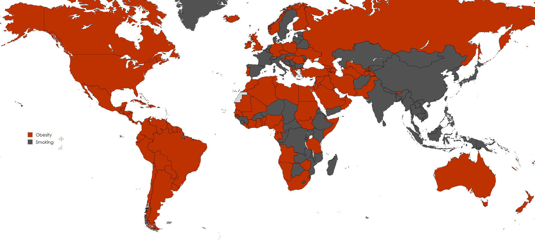
Smoking vs Obesity Prevalence Map
This visualization highlights the prevalence of smoking and obesity among adult populations across various countries. It...
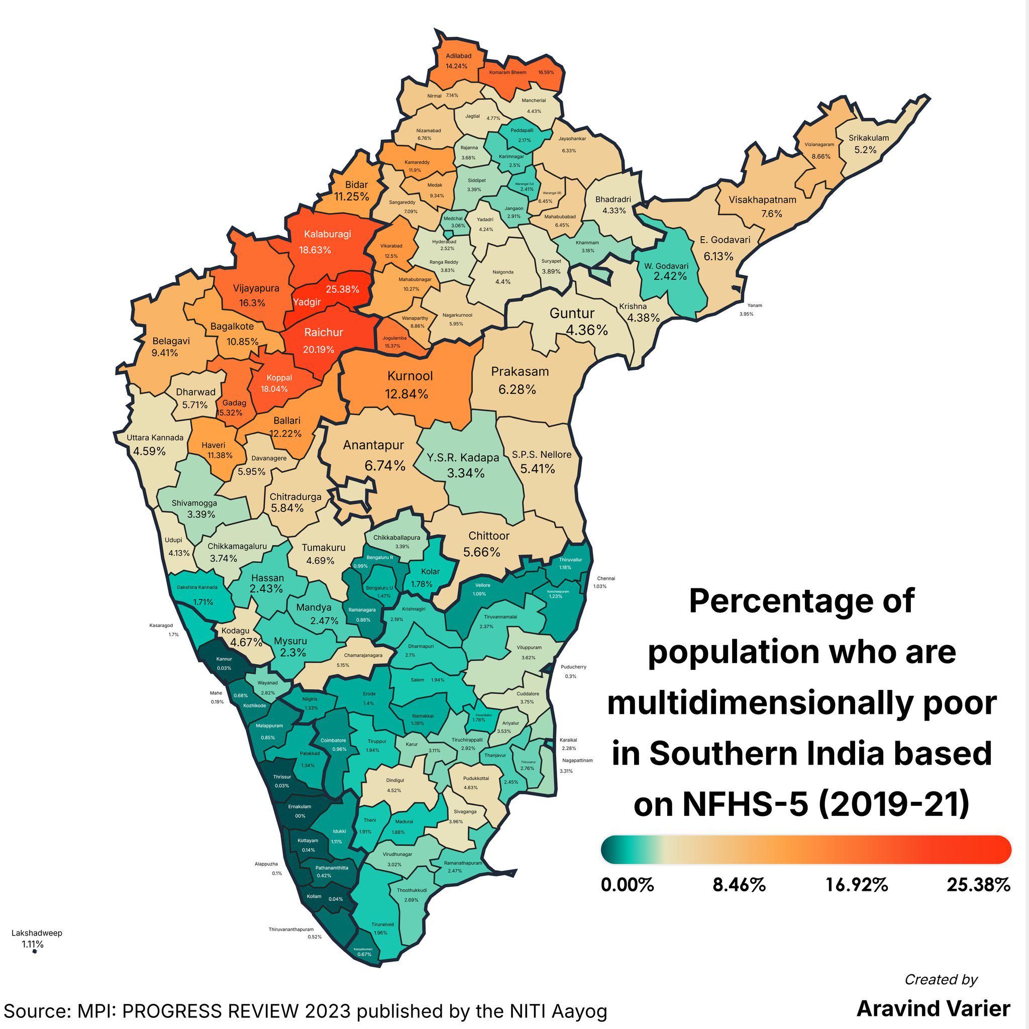
Multidimensional Poverty Percentage Map by District
The "Percentage of People Who Are Multidimensionally Poor (District Wise) Map" provides a detailed breakdown of multidim...
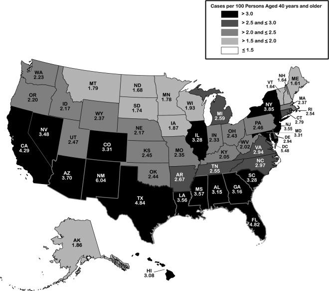
Glaucoma Prevalence Map in the USA
...
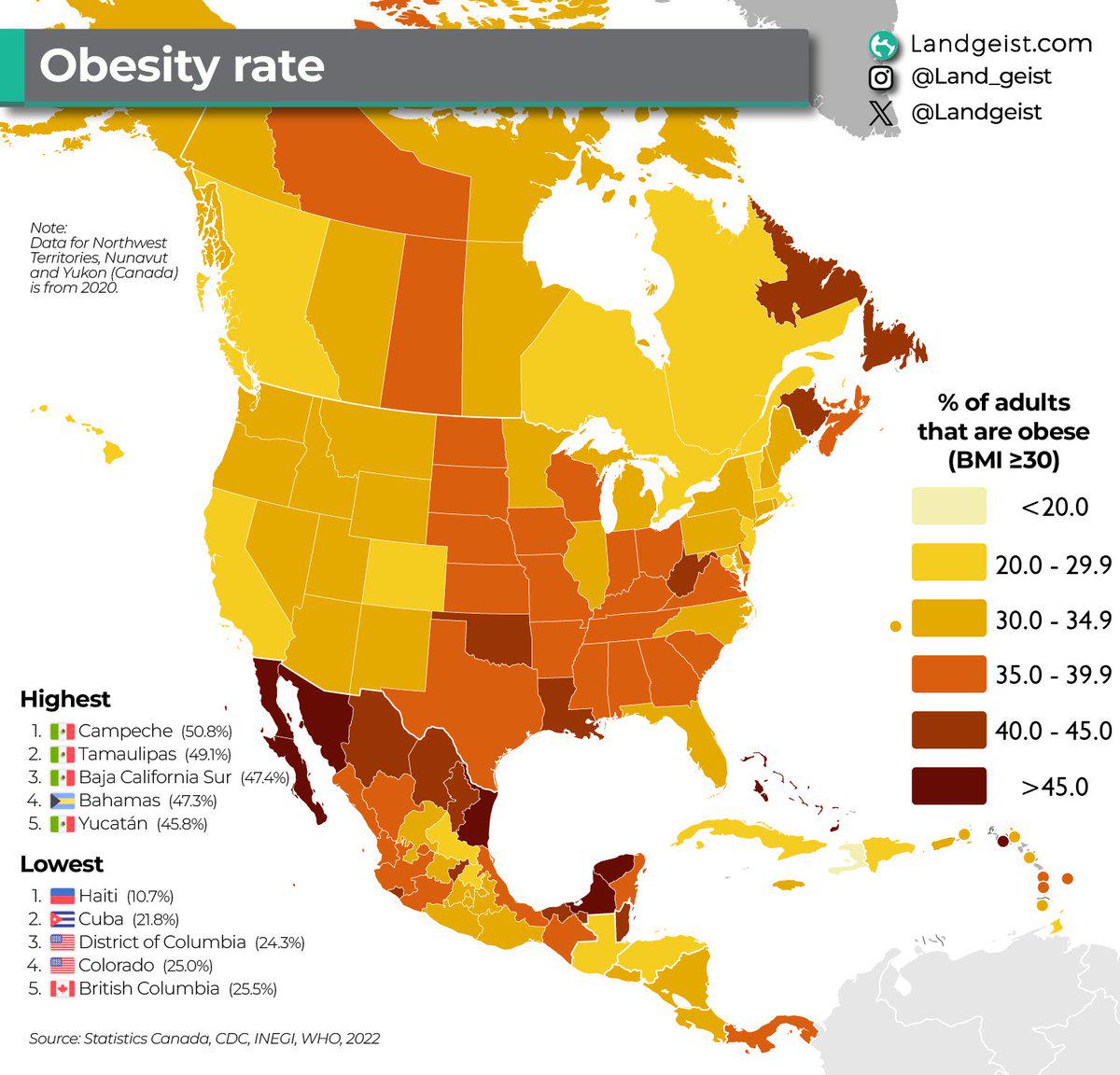
Obesity Rate Map in Northern & Central America
The "Obesity Rate in Northern & Central America [2022 data]" map provides a comprehensive visual representation of the o...