gun control Maps
9 geographic visualizations tagged with "gun control"
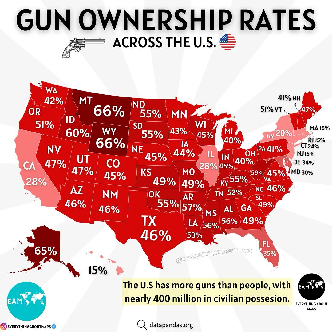
Gun Ownership in the U.S. Map
The "Gun Ownership in the U.S. Map" provides a compelling visual representation of firearm ownership across the United S...
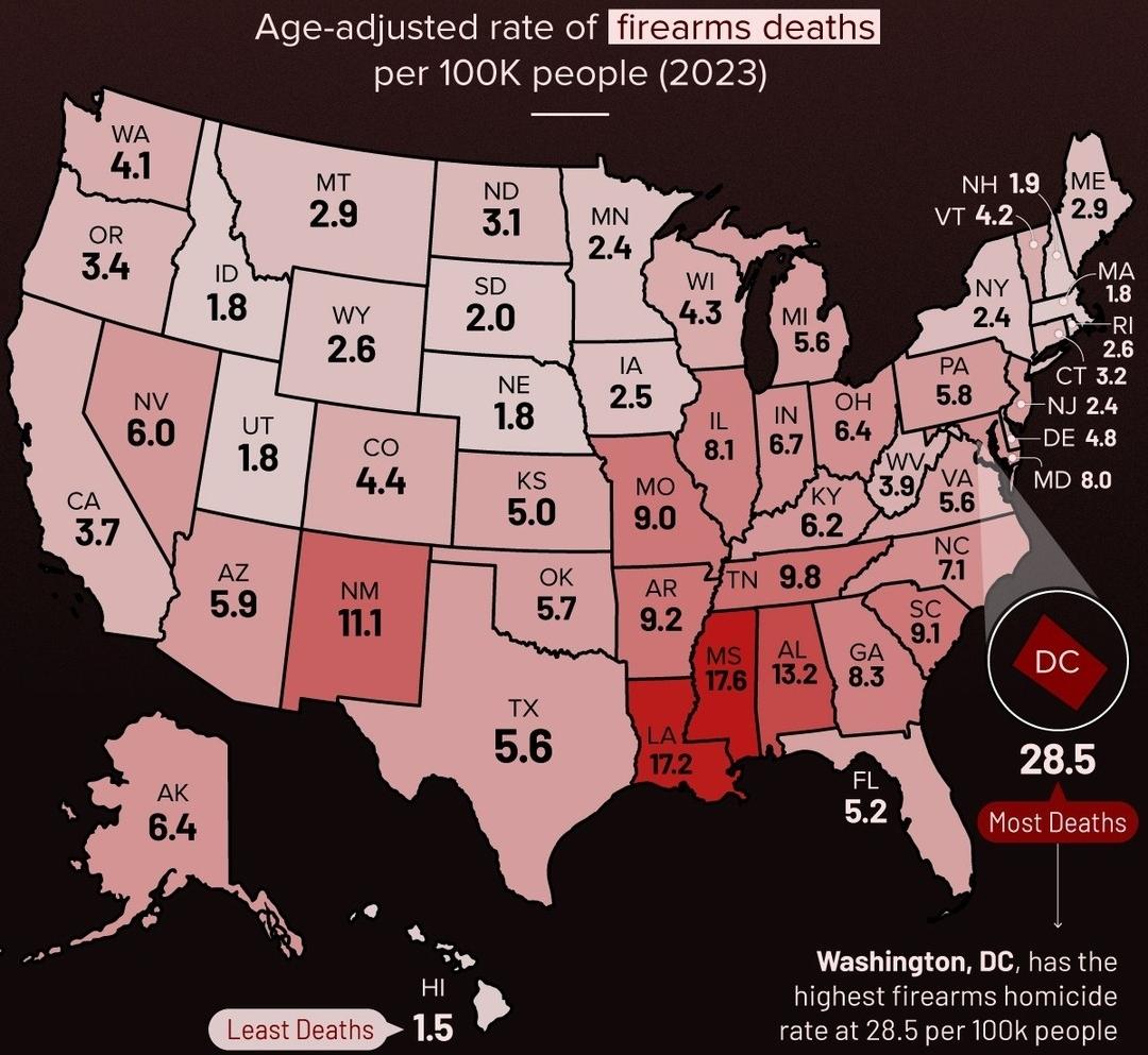
Gun Related Deaths in the USA Map
The "Gun Related Deaths in the USA Map" provides a stark visual representation of the incidence of firearm-related fatal...
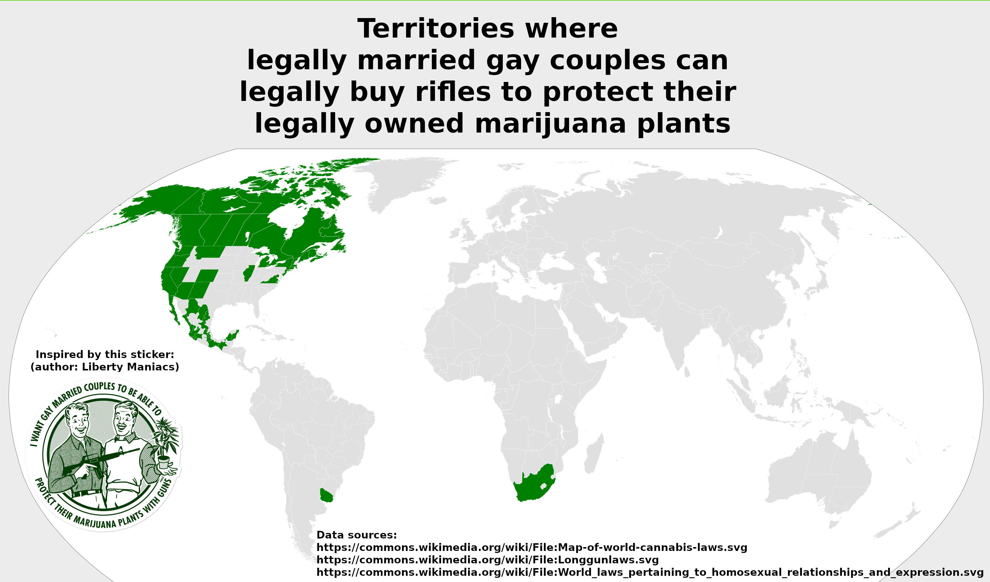
Map of States Allowing Gay Couples to Buy Rifles for Marijuana Protection
This map illustrates the territories in the United States where legally married gay couples have the right to purchase r...
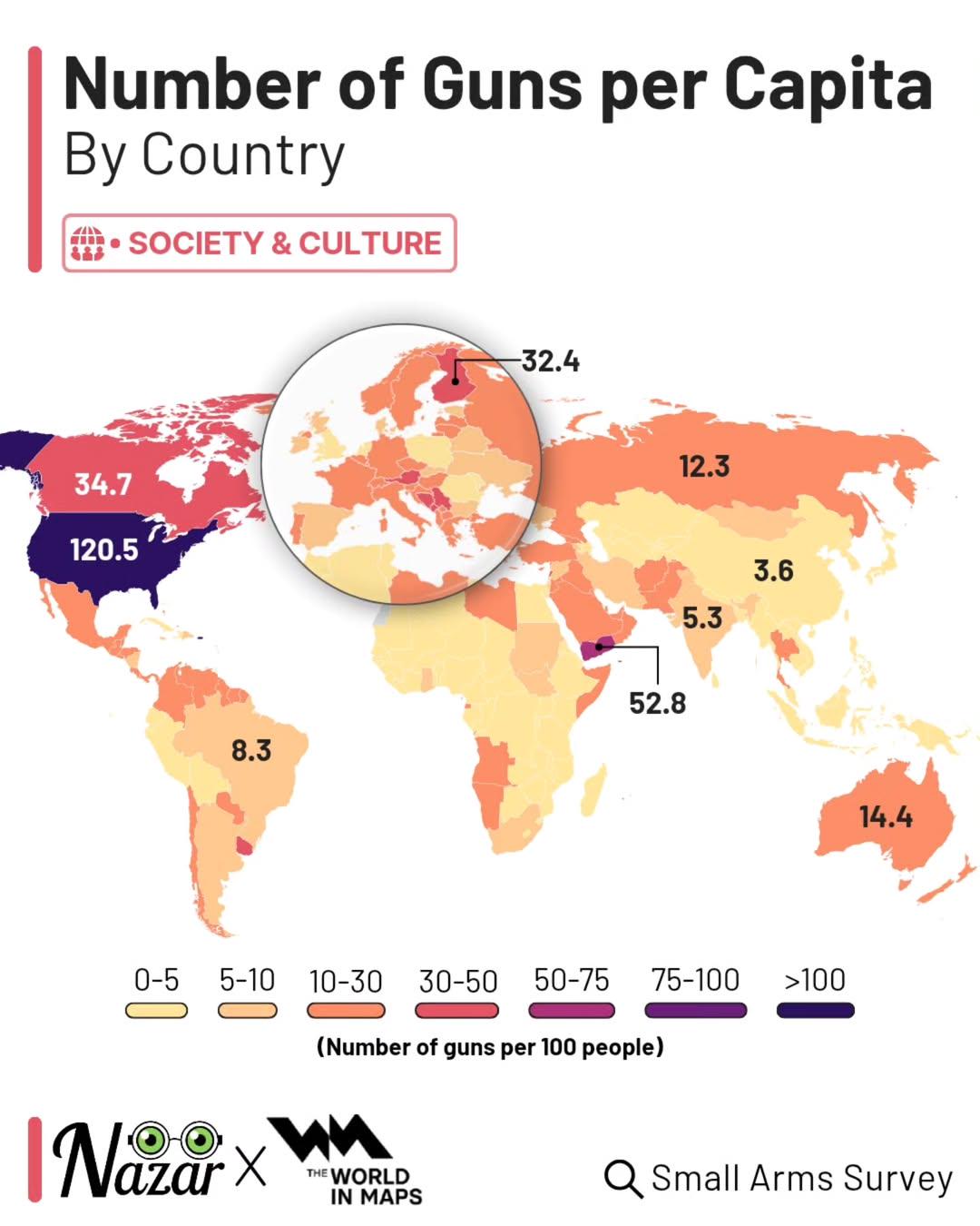
Guns Per Capita by Country Map
This map provides a clear visualization of the number of guns per capita by country, showcasing the stark differences in...
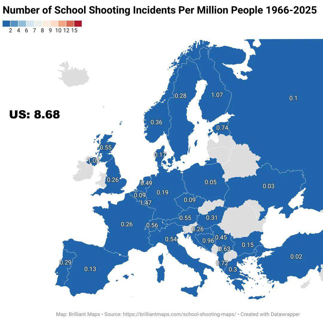
School Shooting Incidents Per Million People Map
The map titled "Number of School Shooting Incidents per Million People 1966-2025" provides a stark visual representation...
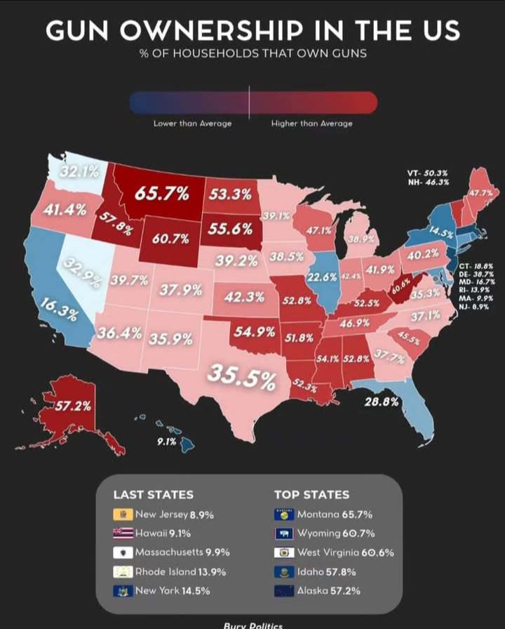
Gun Ownership Per Household in the US Map
The visualization titled 'Rate of Gun Ownership per Household in the US' provides a clear representation of the percenta...
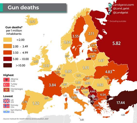
Gun Deaths by Country in Europe Map
The visualization titled "Gun Deaths by Country in Europe Map" presents a stark representation of firearm-related fatali...
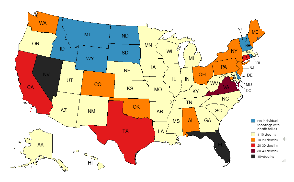
Deadliest Mass Shooting by US State Map
The "Deadliest Mass Shooting by US State Map" presents a stark and sobering visualization of the most tragic mass shooti...
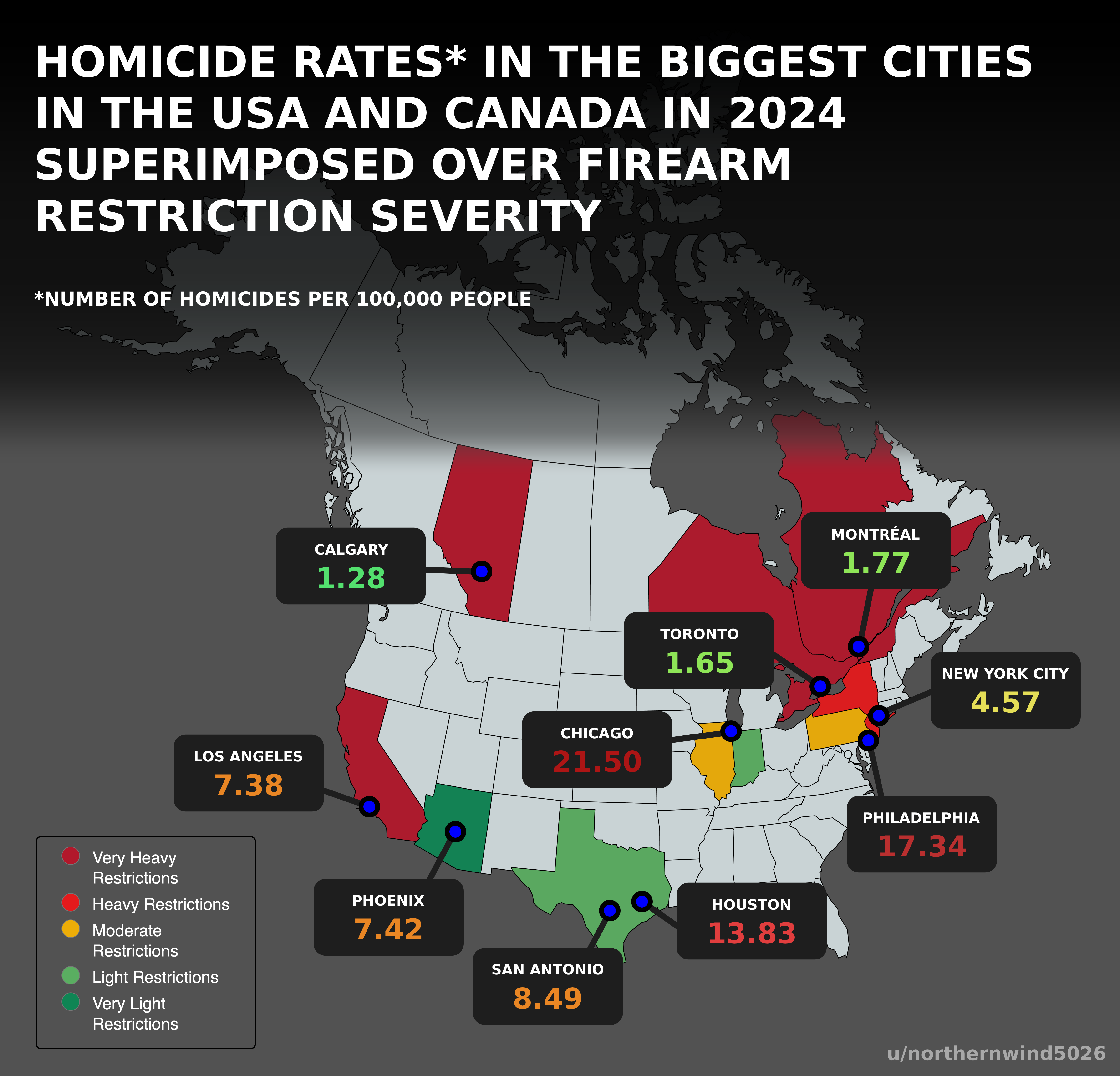
Homicide Rates and Firearm Restrictions Map USA Canada 2024
Interestingly, U.S. cities such as St. Louis and Baltimore are notorious for high homicide rates, while cities like New ...