european countries Maps
12 geographic visualizations tagged with "european countries"
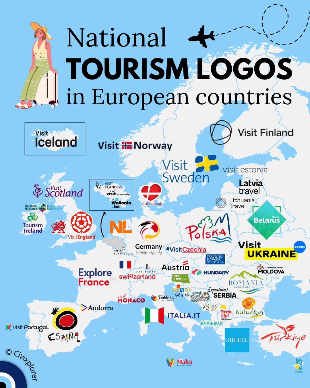
National Tourism Logos in European Countries Map
The "National Tourism Logos in European Countries Map" provides a visual representation of the distinct logos that repre...
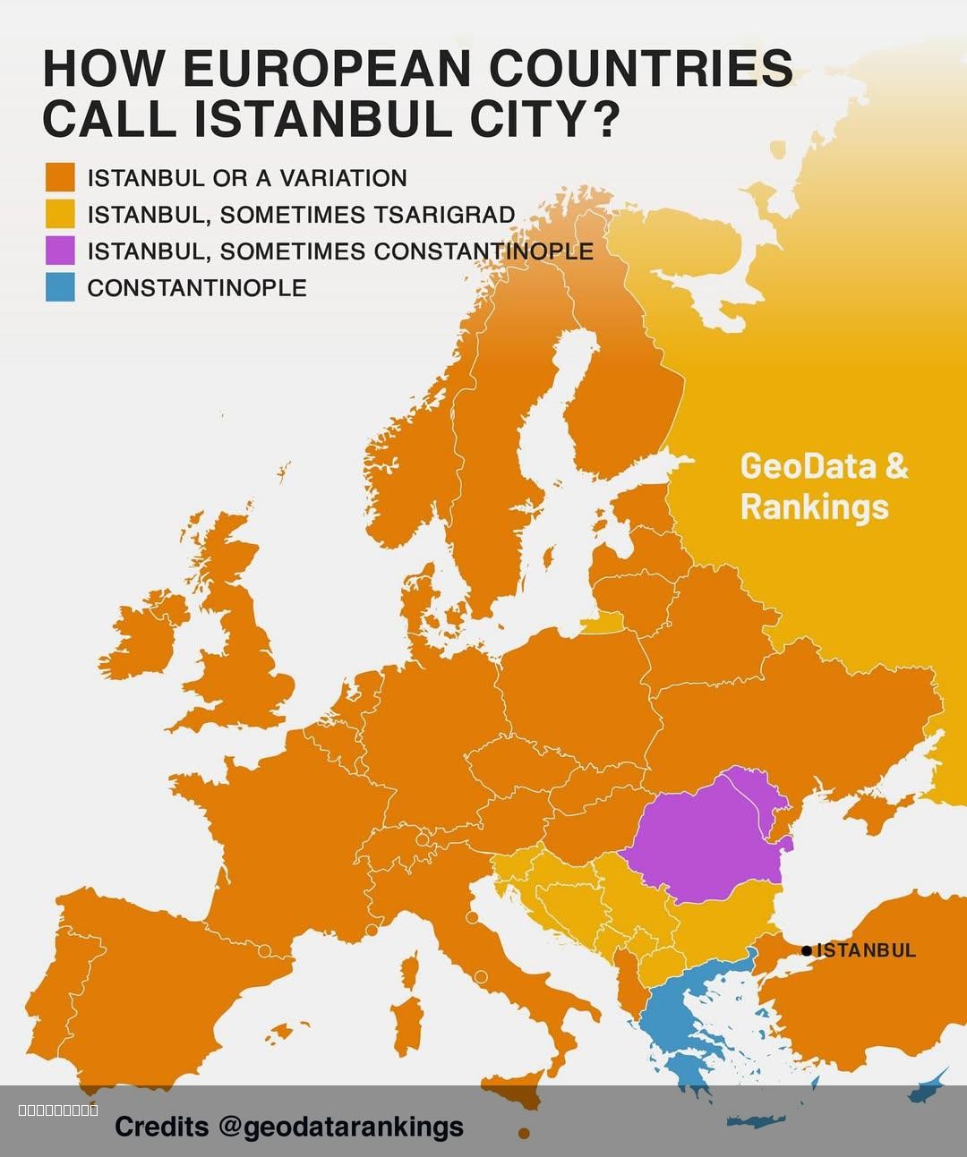
Map of How European Countries Call Istanbul
This map illustrates the various names that different European countries use to refer to the city of Istanbul, Turkey. W...
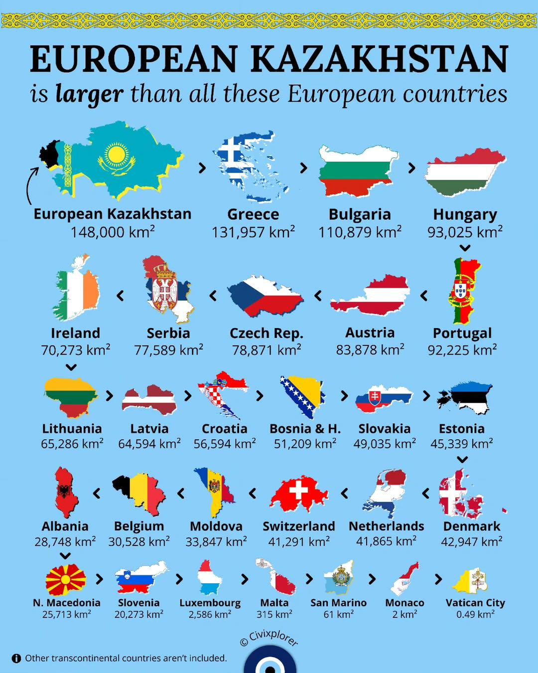
European Kazakhstan Size Comparison Map
The visualization titled 'European Kazakhstan is larger than all these European countries' provides a striking compariso...

Map of European Countries Smaller than Kazakhstan
This map provides a visual representation of European countries that are smaller in land area than Kazakhstan. Kazakhsta...
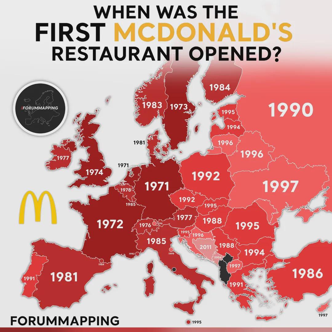
First McDonald's Restaurant Opening Dates Map in Europe
This visualization provides a comprehensive overview of when the first McDonald's restaurants opened in various European...
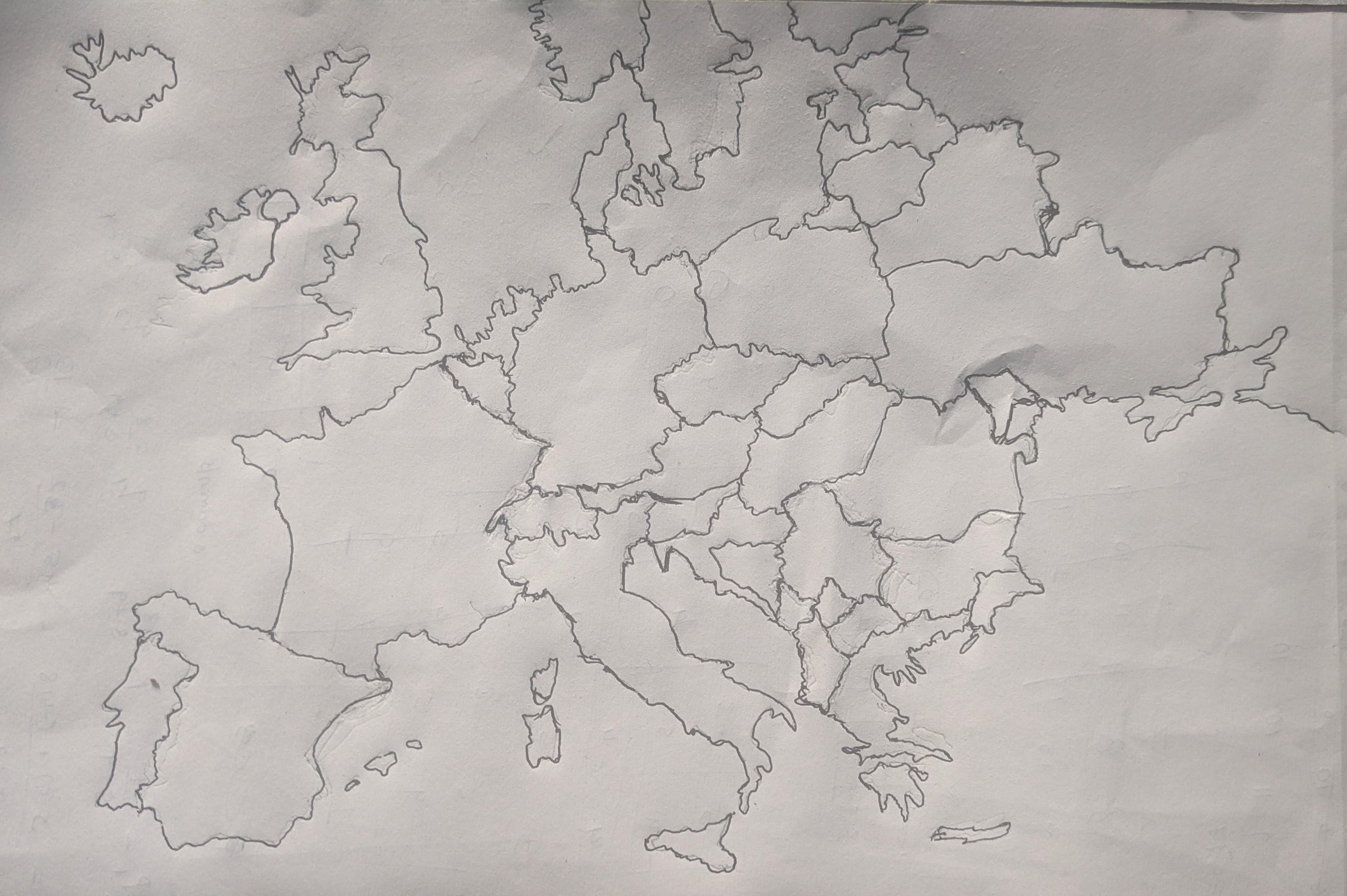
Hand Drawn Map of Europe Overview
Interestingly, Europe’s diverse geography is shaped by its historical context. The Alps, for instance, are not just a st...
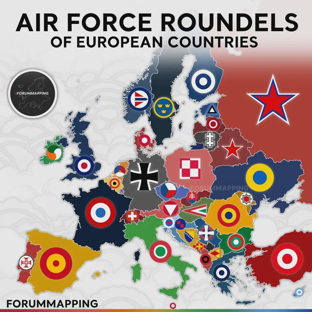
Air Force Roundels of European Countries Map
...
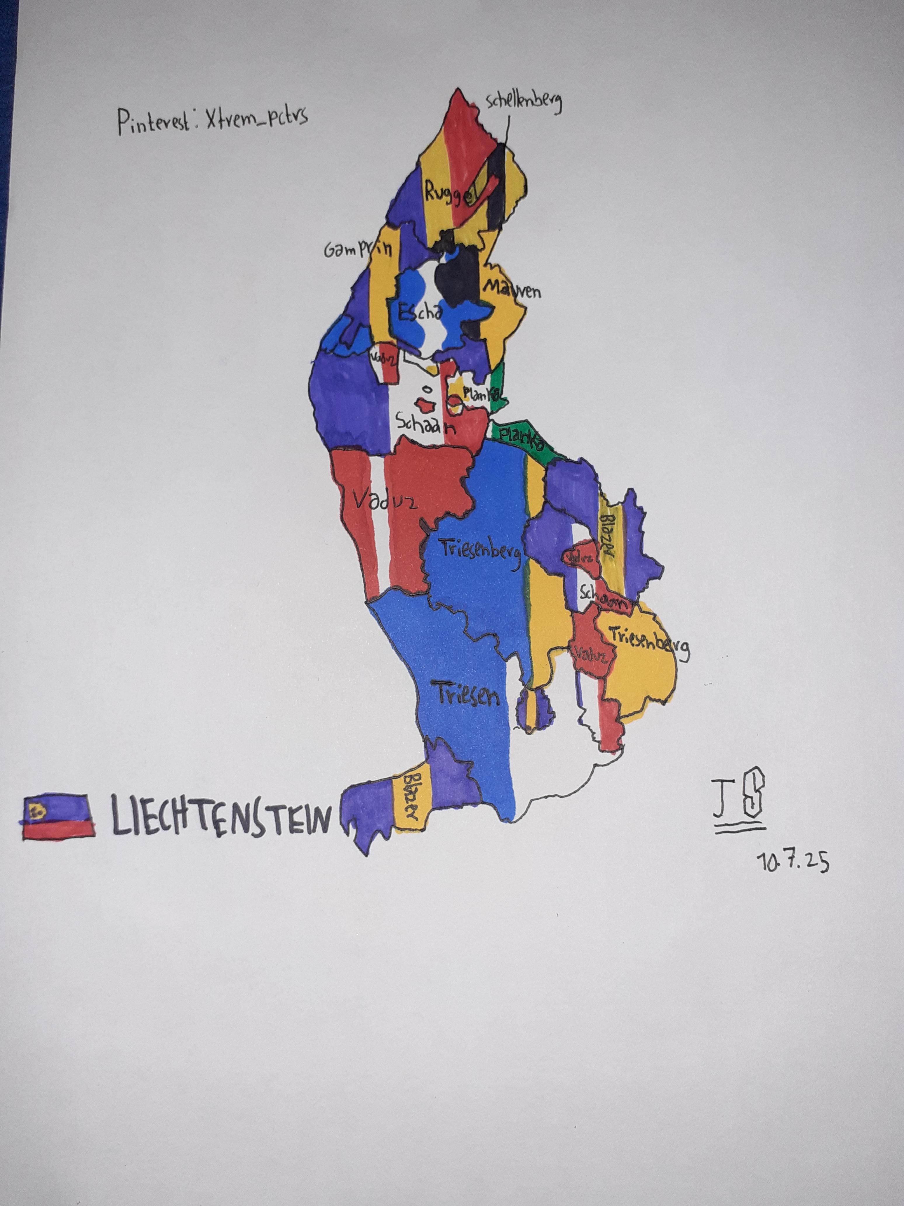
Self-Drawn Flag Map of Liechtenstein States
The visualization titled "Self-Drawn Flag Map of Liechtenstein States" presents a unique and artistic representation of ...
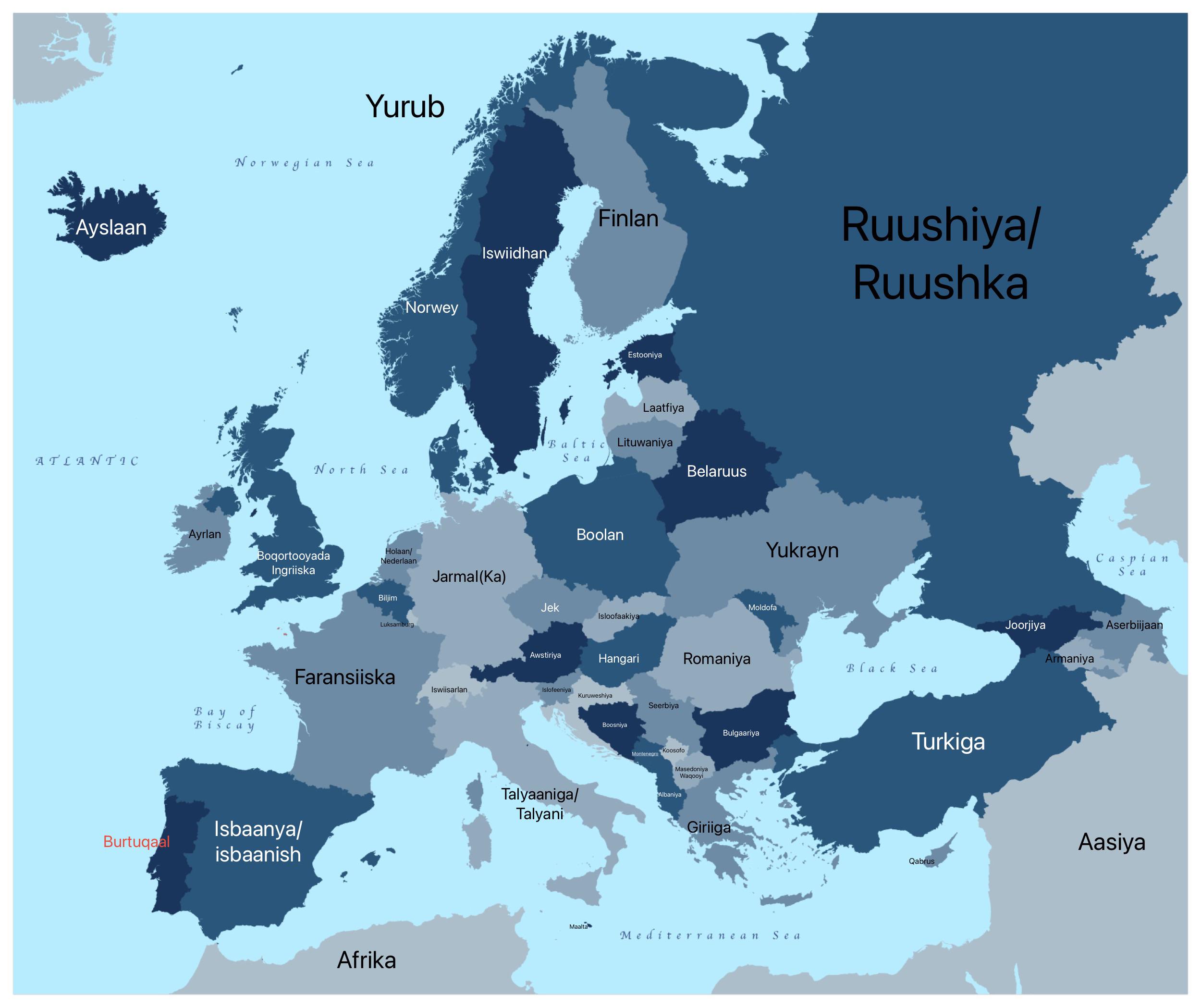
European Countries in AfSomali Map
The "European Countries in AfSomali Map" is an intriguing visualization that presents the names of European nations tran...
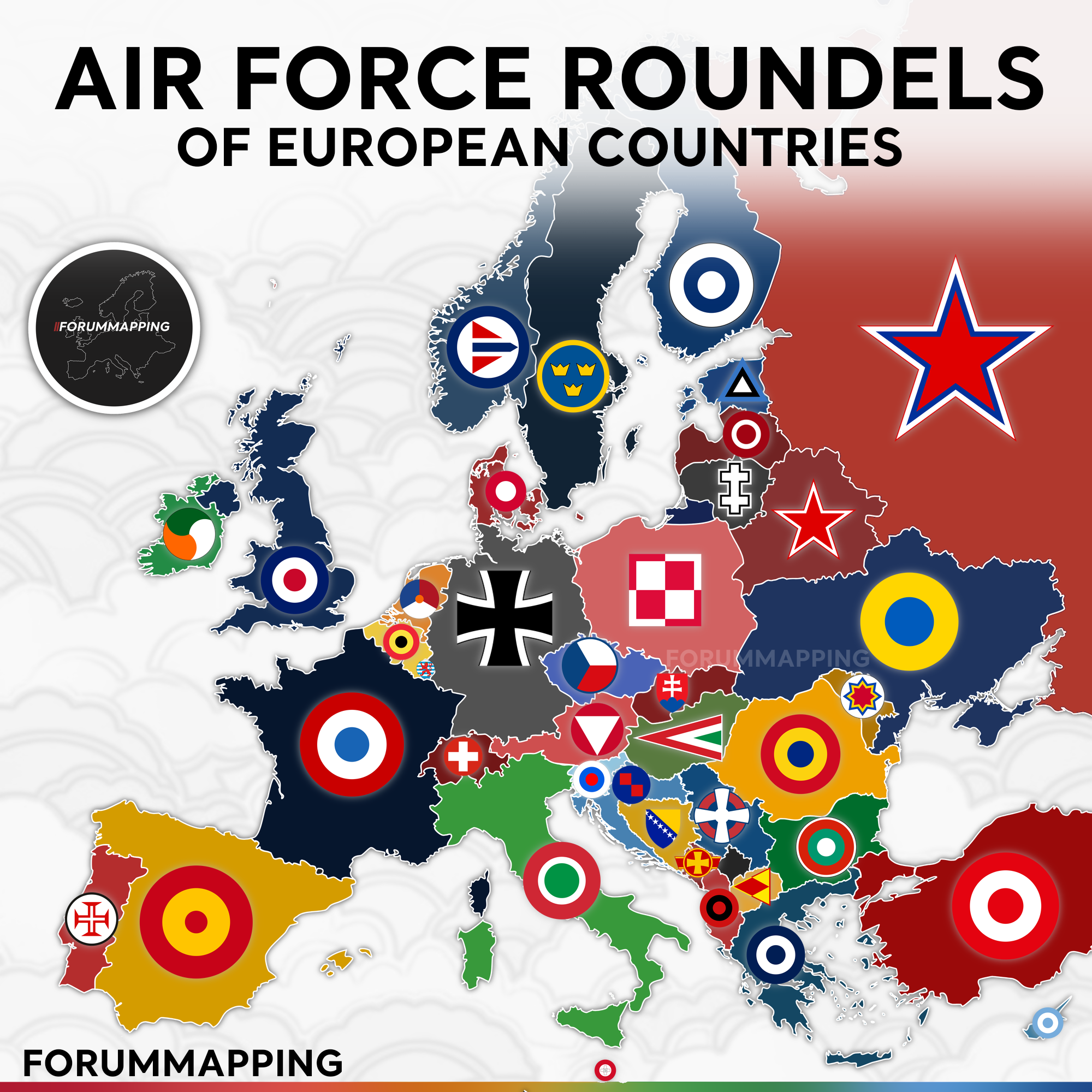
Air Force Roundels of European Countries Map
This map presents a visual representation of the air force roundels used by various European countries. Roundels are dis...
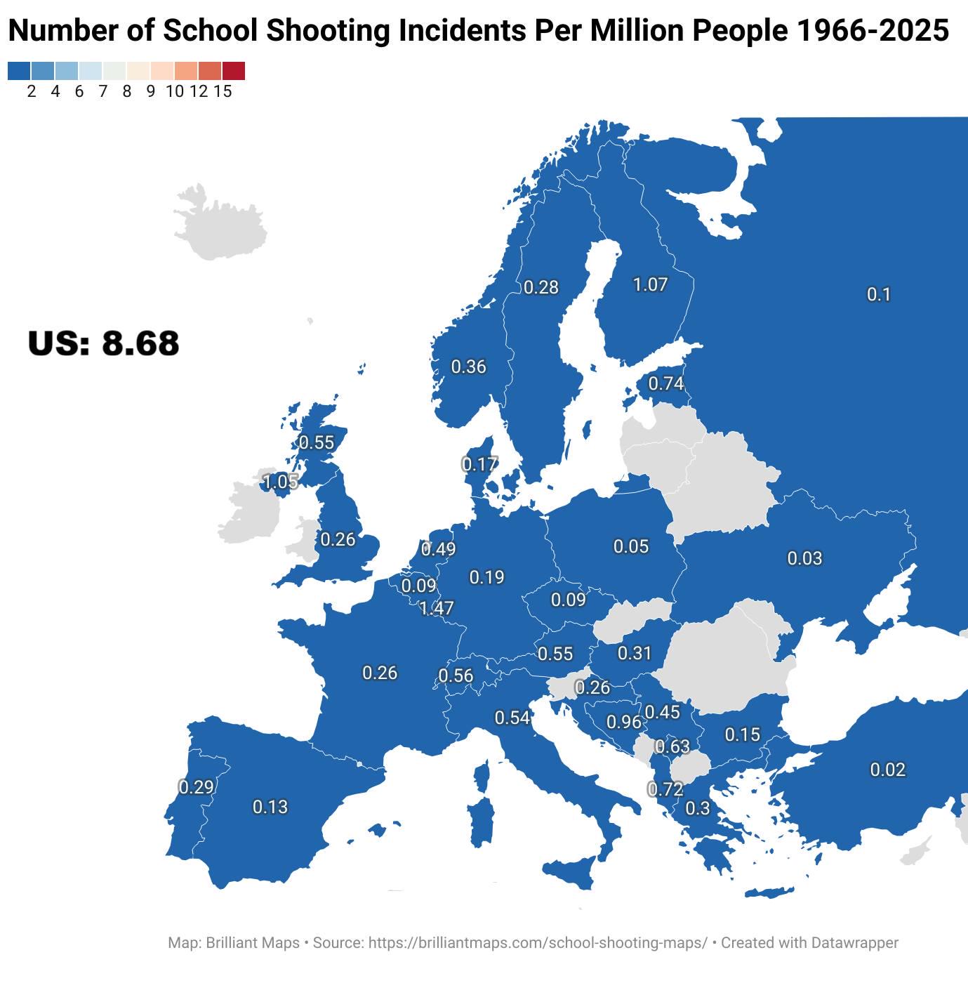
School Shootings Per Million People Map in Europe
The map titled "Number of School Shootings Per Million People By European Country Between 1966 and 2025" provides a star...
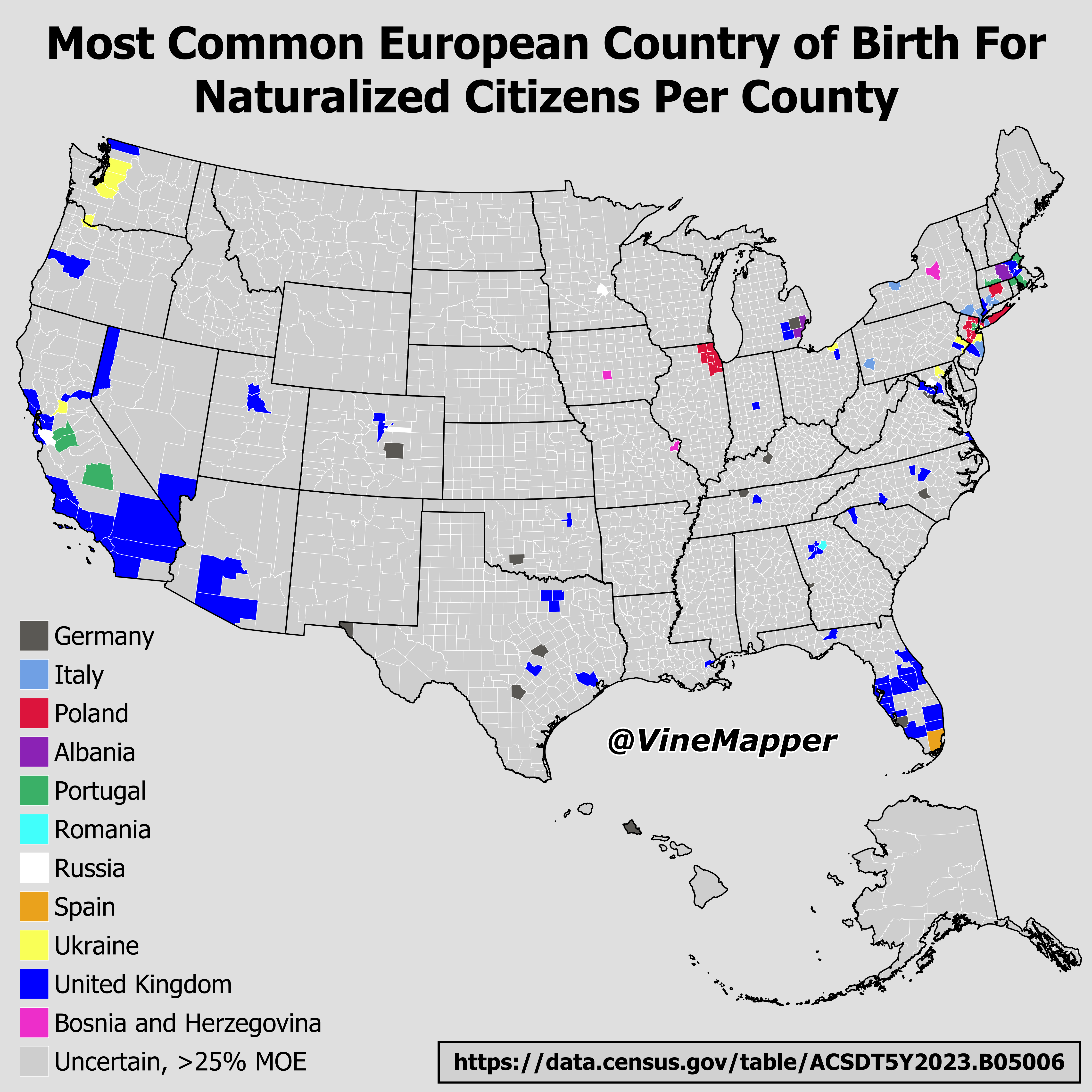
Most Common European Country of Birth for Naturalized Citizens Map
This map visualizes the most common European countries of birth for naturalized citizens across various counties. It hig...