european cities Maps
5 geographic visualizations tagged with "european cities"
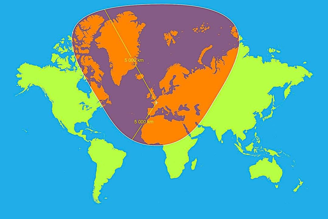
Map of 5,000km Radius from Paris
This map visualizes a circle with a 5,000 km radius centered on Paris, France. It highlights an extensive area that span...
👁 56📅 9/30/2025
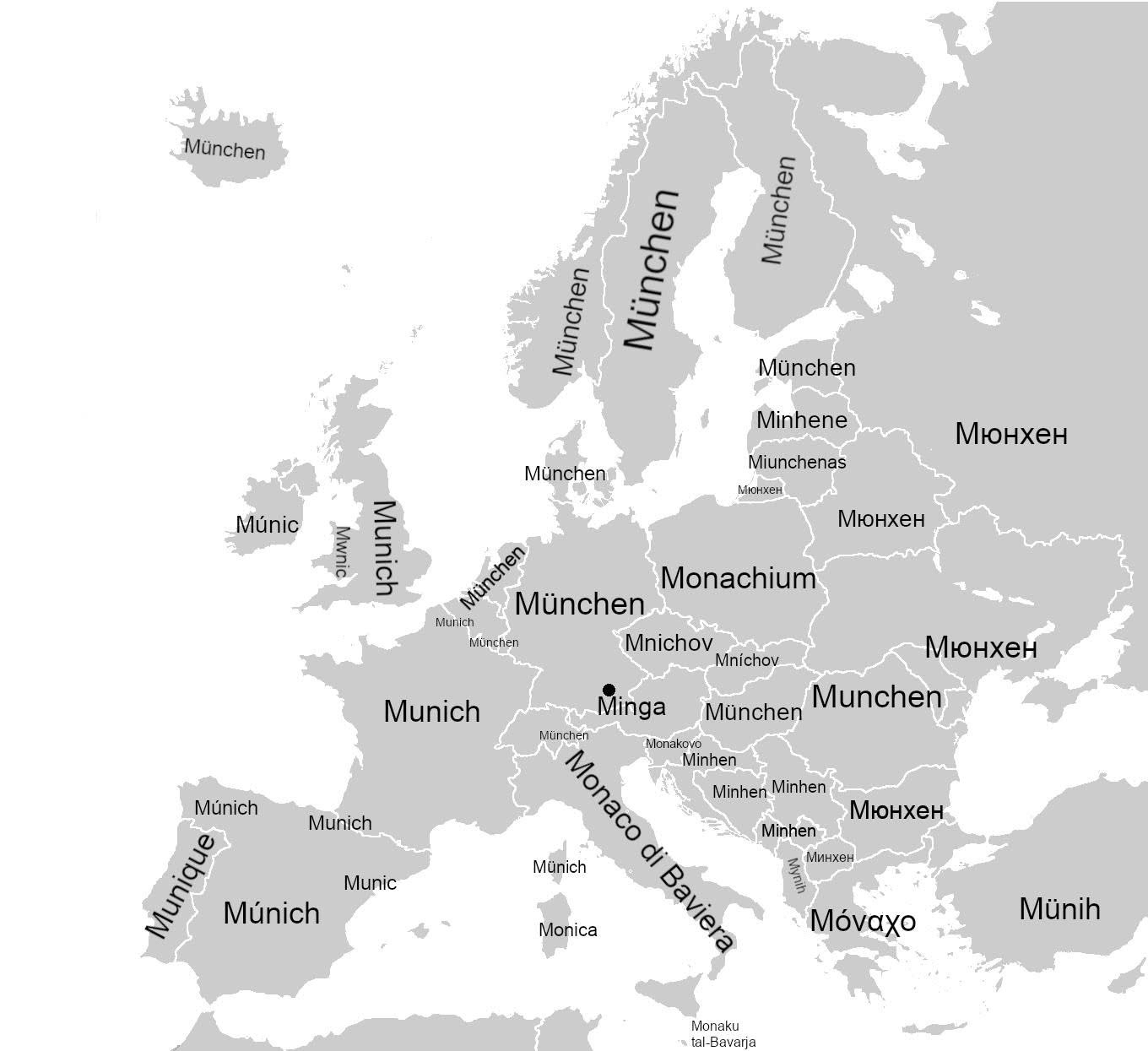
Map of How Munich is Called Across Europe
The visualization titled "How Munich is Called Across Europe" showcases the diverse names that the city of Munich is kno...
👁 20📅 10/24/2025
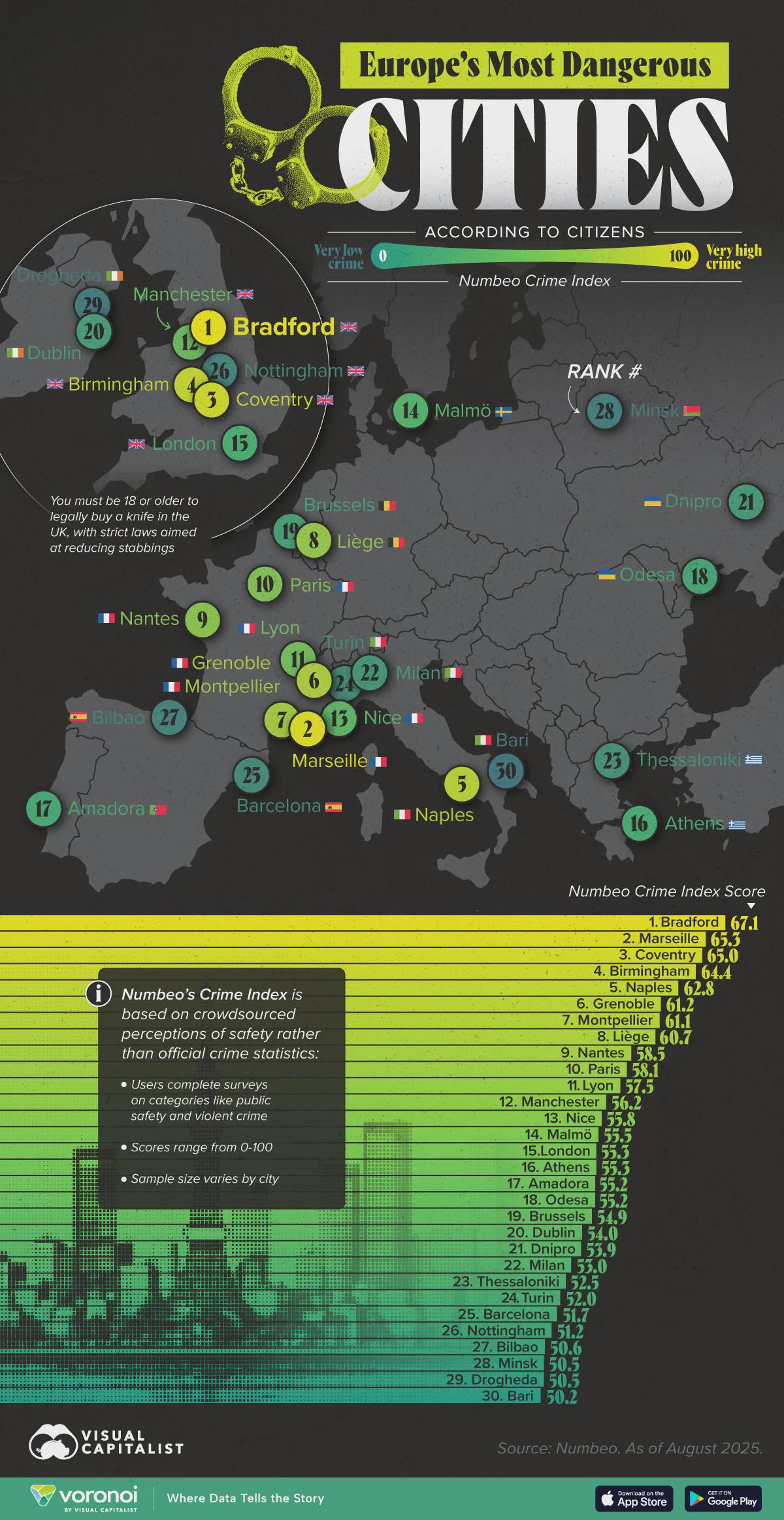
Most Dangerous European Cities Map
The \...
👁 30📅 10/14/2025
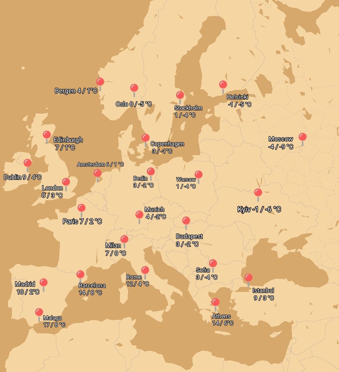
Average January High Low Temperature Map of European Cities
The visualization presents the average high and low temperatures in January across various European cities, providing a ...
👁 64📅 9/30/2025
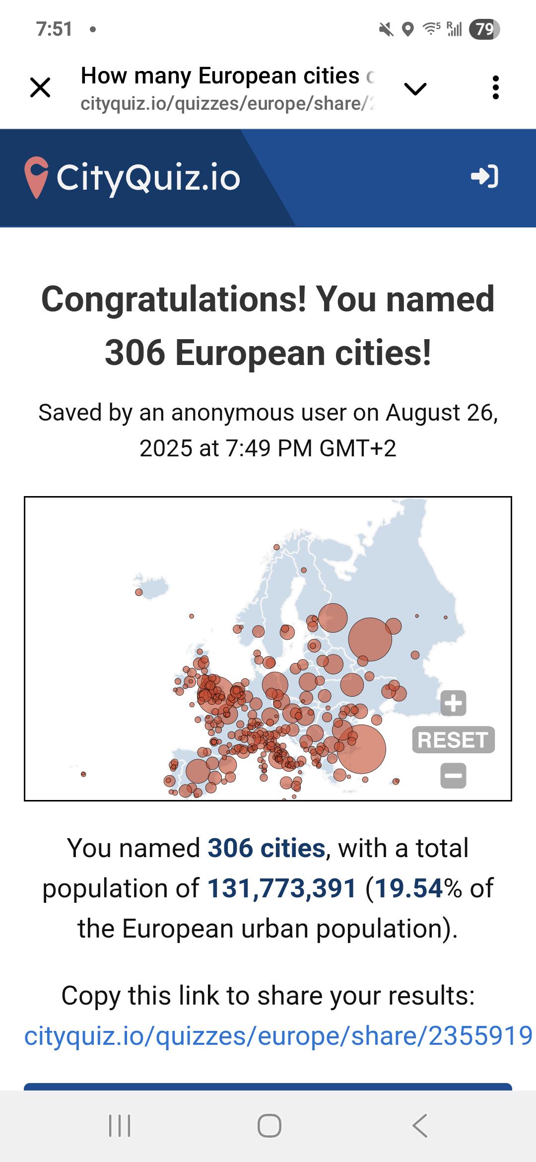
Travel Experience Map of Americans in Europe
This unique map illustrates the travel experiences of Americans living in Europe, shedding light on how these expatriate...
👁 96📅 8/26/2025